External links
- Rowlett, Russ. "The Lighthouse Directory". University of North Carolina at Chapel Hill.
| Types |
|  | ||||
|---|---|---|---|---|---|---|
| Fixtures | ||||||
| Maintenance | ||||||
| Locations | ||||||
| Categories | ||||||
| Global organizations | ||||||
This is a list of lighthouses in El Salvador . [1] [2]
| Name | Image | Year built | Location & coordinates | Class of light [2] | Focal height [2] | NGA number [2] | Admiralty number [2] | Range nml [2] |
|---|---|---|---|---|---|---|---|---|
| Acajutla Lighthouse | Image | 1872 est. | Acajutla 13°34′52.8″N89°50′04.0″W / 13.581333°N 89.834444°W | Iso W 12s. | 25 metres (82 ft) | 15364 | G3380 | 8 |
| Isla Zacatillo Lighthouse | n/a | La Unión 13°18′42.9″N87°46′09.7″W / 13.311917°N 87.769361°W | L Fl W 14s. | 18 metres (59 ft) | 15388 | G3367 | 5 | |
| Punta Ampala Lighthouse | n/a | La Unión Department 13°09′16.9″N87°53′58.7″W / 13.154694°N 87.899639°W | Fl W 15s. | 27 metres (89 ft) | 15394 | G3362 | 12 | |
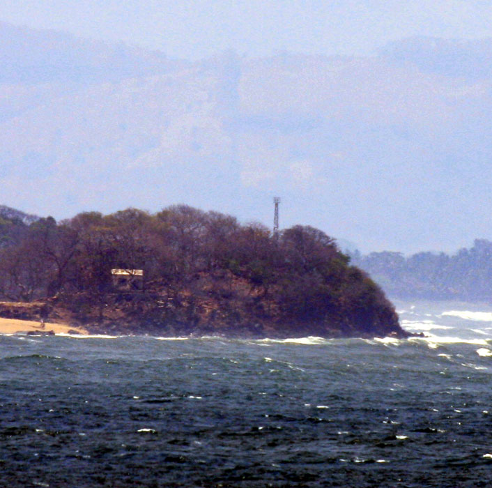
| Punta Chiquirin Lighthouse | Image | n/a | La Unión Department 13°17′30.3″N87°46′46.1″W / 13.291750°N 87.779472°W | L Fl W 13s. | 18 metres (59 ft) | 15384 | G3366 | 10 |
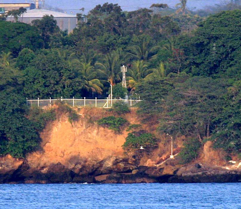
| Punta Remedios Lighthouse | Image | 1905 est. | Acajutla 13°31′25.2″N89°48′19.5″W / 13.523667°N 89.805417°W | L Fl W 20s. | 25 metres (82 ft) | 15372 | G3378 | 14 |
| Types |
| | ||||
|---|---|---|---|---|---|---|
| Fixtures | ||||||
| Maintenance | ||||||
| Locations | ||||||
| Categories | ||||||
| Global organizations | ||||||