Lighthouses
| Name | Image | Year built | Location & coordinates | Class of Light | Focal height | NGA number | Admiralty number | Range nml |
|---|---|---|---|---|---|---|---|---|
| Atlantic Entrance Range Middle Lighthouse | | 1914 | Gatún 9°16′55.6″N79°55′09.9″W / 9.282111°N 79.919417°W | F G | 30 metres (98 ft) | 16616 | J6132.1 | 15 |
| Atlantic Entrance Range Rear Lighthouse | Image | 1914 | Gatún 9°16′17.7″N79°55′10.1″W / 9.271583°N 79.919472°W | Oc G | 30 metres (98 ft) | 16620 | J6132.2 | 15 |
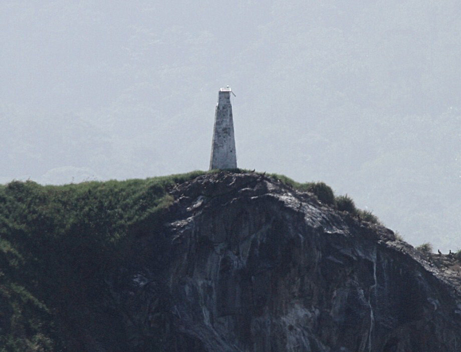
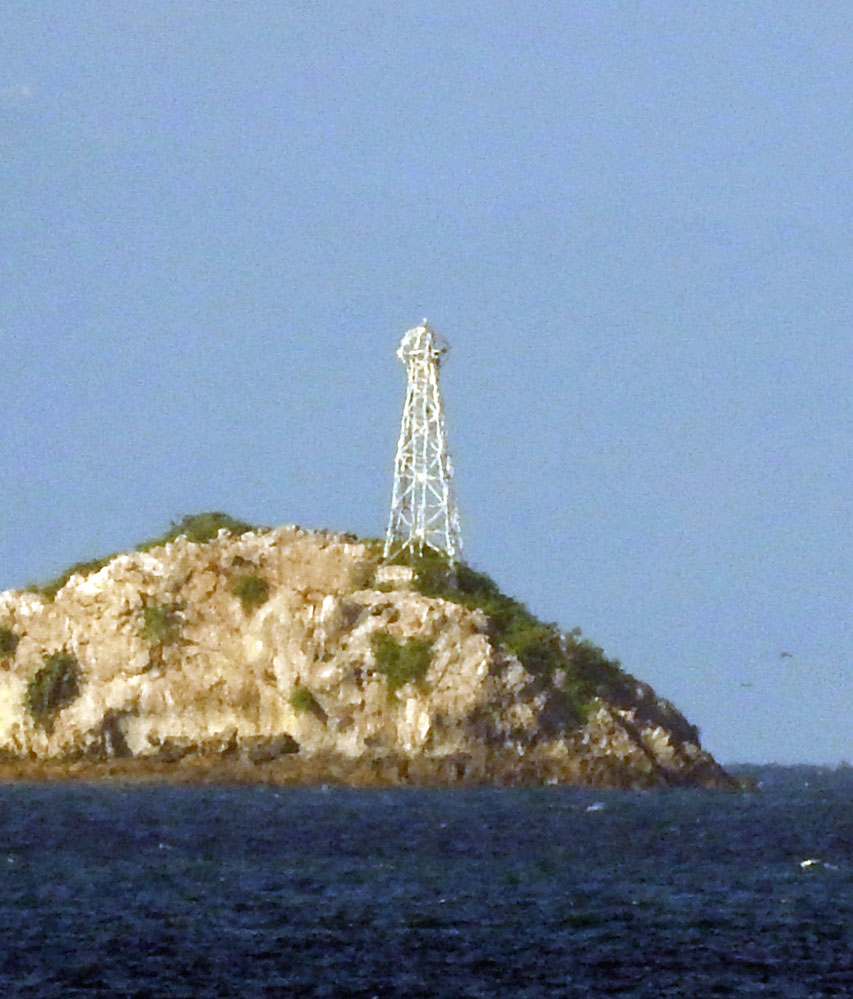
| Farallon Sucio Lighthouse | Image | 1925 est. | Portobelo District 9°38′31.0″N79°38′09.6″W / 9.641944°N 79.636000°W | Fl R 5s. | 33 metres (108 ft) | 16624 | J6136 | 12 |
| Flamenco Island Lighthouse | Image | 1920s | El Chorrillo 8°54′26.6″N79°31′15.0″W / 8.907389°N 79.520833°W | Oc (2) WR 5s. | 47 metres (154 ft) | 0096 | G3198 | 19 |
| Frailes del Sur Lighthouse | Image | n/a | Los Santos Province 7°20′20.4″N80°08′26.1″W / 7.339000°N 80.140583°W | Fl R 4s. | 20 metres (66 ft) | 0044 | G3246 | 9 |
| Gatún Northbound Rear Lighthouse |  | 1914 | Gatún 9°16′19.7″N79°55′25.5″W / 9.272139°N 79.923750°W | Oc G | 30 metres (98 ft) | 16608 | J6141 | 15 |
| Isla Boná Lighthouse | Image | n/a | Panamá Oeste Province 8°34′06.4″N79°35′24.2″W / 8.568444°N 79.590056°W | L Fl W 13s. | 53 metres (174 ft) | 0052 | G3222 | 22 |
| Isla Burica Lighthouse | n/a | Chiriquí Province 8°01′03.6″N82°52′38.4″W / 8.017667°N 82.877333°W | Fl W 10s. | 34 metres (112 ft) | 0004 | G3280 | 12 | |
| Isla Ensillada Lighthouse | n/a | Chiriquí Province 8°09′06.4″N82°09′43.4″W / 8.151778°N 82.162056°W | Fl W 5s. | 62 metres (203 ft) | 0022 | G3269 | 14 | |
| Isla Escudo de Vargas Lighthouse | n/a | Kusapin 9°05′24.0″N81°32′42.0″W / 9.090000°N 81.545000°W | Fl W 7s. | 37 metres (121 ft) | 16588 | J6091 | 6 | |
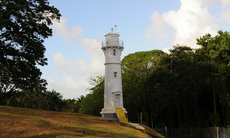
| Isla Grande Lighthouse | Image Archived 2016-10-09 at the Wayback Machine | 1894 | Isla Grande 9°38′16.7″N79°33′27.4″W / 9.637972°N 79.557611°W | Fl W 5s. | 93 metres (305 ft) | 16628 | J6138 | 12 |
| Isla Iguana Lighthouse |  | n/a | Isla Iguana 7°37′42.6″N79°59′52.6″W / 7.628500°N 79.997944°W | Fl W 13s. | 25 metres (82 ft) | 0047 | G3243 | 10 |
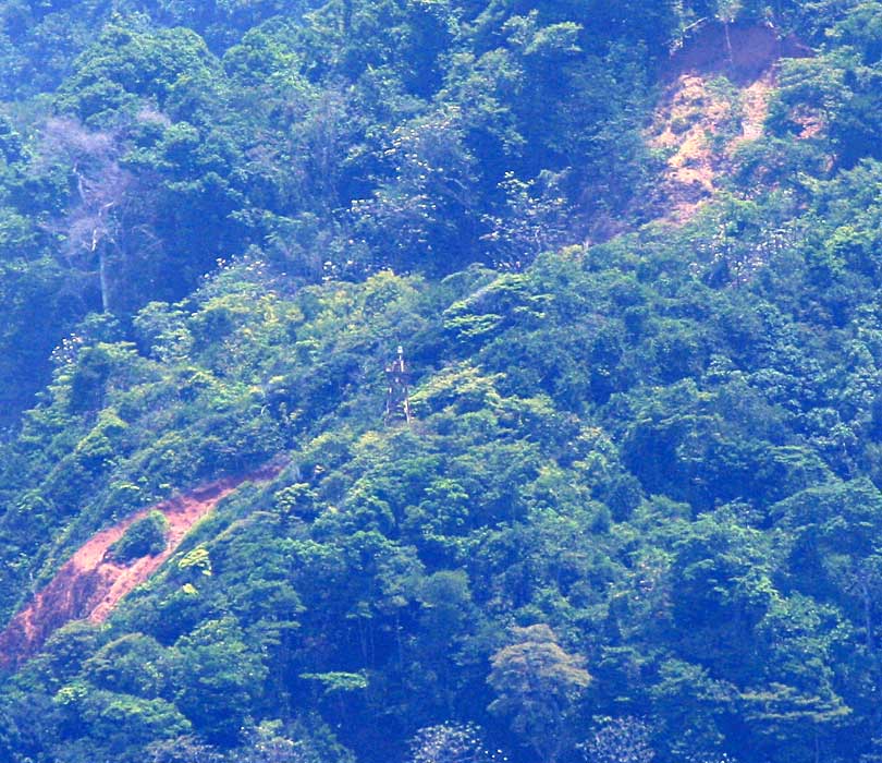
| Isla Jicarita Lighthouse | Image | n/a | Jicarita 7°12′19.4″N81°47′56.6″W / 7.205389°N 81.799056°W | Fl W 15s. | 102 metres (335 ft) | 0028 | G3562 | 20 |
| Isla Ladrones Lighthouse | n/a | Chiriquí Province 7°51′54.0″N82°26′30.0″W / 7.865000°N 82.441667°W | L Fl W 9s. | 65 metres (213 ft) | 0012 | G3266 | 16 | |
| Isla Montuosa Lighthouse | Image | n/a | Chiriquí Province 7°28′14.8″N82°14′20.2″W / 7.470778°N 82.238944°W | L Fl W 7s. | 30 metres (98 ft) | 0020 | G3264 | 11 |
| Islas Secas Lighthouse | n/a | Islas Secas 7°59′39.2″N82°02′05.7″W / 7.994222°N 82.034917°W | L Fl W 9s. | 63 metres (207 ft) | 0024 | G3267 | 15 | |
| Isla Villa Lighthouse | Image Archived 2016-10-13 at the Wayback Machine | n/a | Los Santos Province 7°56′08.7″N80°18′05.2″W / 7.935750°N 80.301444°W | Fl W 18s. | 36 metres (118 ft) | 0046 | G3240 | 12 |
| Limon Bay East Breakwater Lighthouse | n/a | Limon Bay 9°23′17.3″N79°54′56.2″W / 9.388139°N 79.915611°W | Mo (U) G 20s. | 33 metres (108 ft) | 16604 | J6098 | 16 | |
| Limon Bay West Breakwater Lighthouse | n/a | Limon Bay 9°23′18.0″N79°55′20.0″W / 9.388333°N 79.922222°W | V Q (2) R 2s. | 16 metres (52 ft) | 16600 | J6102 | 16 | |
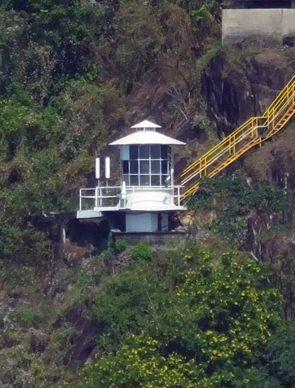
| Morro de Puercos Lighthouse | Image | n/a | Los Santos Province 7°14′39.7″N80°25′52.4″W / 7.244361°N 80.431222°W | Fl W 7.5s. | 84 metres (276 ft) | 0040 | G3250 | 19 |
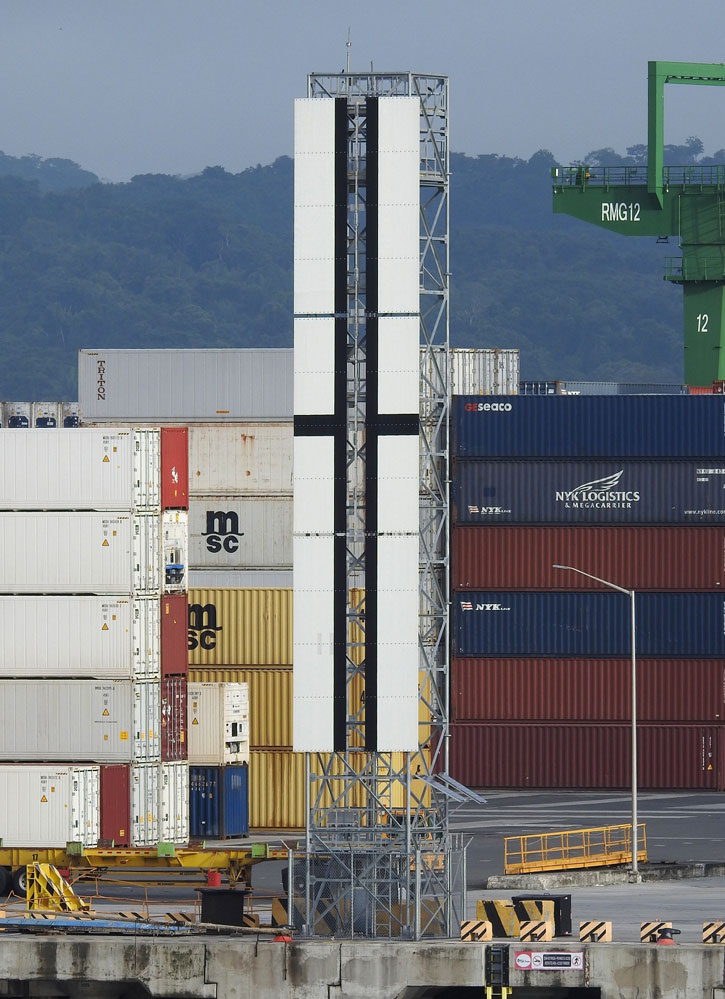
| Pacific Entrance Range Front Lighthouse | Image | 2010 | Balboa 8°57′22.8″N79°34′30.7″W / 8.956333°N 79.575194°W | F G | 20 metres (66 ft) | 0104 | G3200 | 14 |
| Peñon Limoncillo Lighthouse | Image | n/a | Isla Chama Panamá Oeste 8°44′35.5″N79°34′38.7″W / 8.743194°N 79.577417°W | L Fl W 15s. | 23 metres (75 ft) | 0060 | G3216 | 17 |
| Puerto Obaldía Lighthouse | n/a | Puerto Obaldía 8°40′01.7″N77°25′14.3″W / 8.667139°N 77.420639°W | L Fl W 10s. | 12 metres (39 ft) | 16630 | J6143 | 8 | |
| Punta Mala Lighthouse | Image | n/a | Los Santos Province 7°28′13.6″N79°59′57.0″W / 7.470444°N 79.999167°W | L Fl W 20s. | 45 metres (148 ft) | 0048 | G3242 | 13 |
| Punta Mariato Lighthouse | Image | n/a | Punta Mariato 7°12′41.9″N80°53′08.1″W / 7.211639°N 80.885583°W | Fl W 30s. | 102 metres (335 ft) | 0038 | G3252 | 21 |
| Toro Point Lighthouse |  | 1893 | Toro Point Limon Bay 9°22′20.6″N79°56′57.6″W / 9.372389°N 79.949333°W | L Fl W 30s. | 33 metres (108 ft) | 16592 | J6092 | 16 |