Portland Head Light is a historic lighthouse in Cape Elizabeth, Maine. The light station sits on a head of land at the entrance of the primary shipping channel into Portland Harbor, which is within Casco Bay in the Gulf of Maine. Completed in 1791, it is the oldest lighthouse in Maine. The light station is automated, and the tower, beacon, and foghorn are maintained by the United States Coast Guard, while the former lighthouse keepers' house is a maritime museum within Fort Williams Park.

A foghorn or fog signal is a device that uses sound to warn vehicles of navigational hazards such as rocky coastlines, or boats of the presence of other vessels, in foggy conditions. The term is most often used in relation to marine transport. When visual navigation aids such as lighthouses are obscured, foghorns provide an audible warning of rock outcrops, shoals, headlands, or other dangers to shipping.

St Anthony's Lighthouse is the lighthouse at St Anthony Head, on the eastern side of the entrance to Falmouth harbour, Cornwall, UK. The harbour is also known as Carrick Roads and is one of the largest natural harbours in the world.

Cape Wrath Lighthouse at Cape Wrath was built in 1828 by Robert Stevenson and was manned until 1998, when it was converted to automatic operation by the Northern Lighthouse Board. It is located at the most North-Westerly point on the British mainland, in the traditional county of Sutherland within Highland Region. Durness is the closest village, 10 miles (16 km) to the south-east with Inverness around 120 miles (190 km) to the south.

Alcatraz Island Lighthouse is a lighthouse—the first one built on the U.S. West Coast—located on Alcatraz Island in California's San Francisco Bay. It is located at the southern end of the island near the entrance to the prison. The first light house on the island was completed in 1854, and served the bay during its time as a Citadel and military prison. It was replaced by a taller concrete tower built in 1909 to the south of the original one which was demolished after it was damaged due to earthquake in 1906. The automation of the lighthouse with a modern beacon took place in 1963, the year Alcatraz closed as the Alcatraz Federal Penitentiary. It is the oldest light station on the island with a modern beacon and is part of the museum on the island. Although when viewed from afar it easily looks the tallest structure on Alcatraz, it is actually shorter than the Alcatraz Water Tower, but as it lies on higher ground it looks much taller.

Point Arena Light is a lighthouse in Mendocino County, California, United States, two miles (3 km) north of Point Arena, California. It is approximately 130 mi (210 km) north of San Francisco, in the Fort Point Group of lighthouses. The lighthouse features a small museum and gift shop. Guided tours of the light station as well as self-guided tours of the grounds are available daily.

Point Cabrillo Light is a lighthouse in northern California, United States, between Point Arena and Cape Mendocino, just south of the community of Caspar. It has been a federal aid to navigation since 1909. It is part of the California state park system as Point Cabrillo Light Station State Historic Park.

The Cove Point Light is a lighthouse located on the west side of Chesapeake Bay in Calvert County, Maryland.

Sambro Island Lighthouse is a landfall lighthouse located at the entrance to Halifax Harbour, Nova Scotia, on an island near the community of Sambro in the Halifax Regional Municipality. It is the oldest surviving lighthouse in North America and its construction is a National Historic Event.

Point Sur Lighthouse is a lightstation at Point Sur 24.6 miles (39.6 km) south of Monterey, California at the peak of the 361-foot (110 m) rock at the head of the point. It was established in 1889 and is part of Point Sur State Historic Park. The light house is 40 feet (12 m) tall and 270 feet (82 m) above sea level. As of 2016, and for the foreseeable future the light is still in operation as an essential aid to navigation. Point Sur is the only complete turn-of-the-20th-century lightstation open to the public in California. Three-hour walking tours guided by volunteers are available on Wednesdays and weekends throughout the year.

Start Point lighthouse was built in 1836 to protect shipping off Start Point, Devon, England. Open to the public in summer months, it is owned and operated by Trinity House. It has been designated by English Heritage as a grade II listed building.
Neyaashiinigmiing, formerly Cape Croker, is a reserve within Bruce County, Ontario. It is one of the parcels of land administered by the Chippewas of Nawash Unceded First Nation.

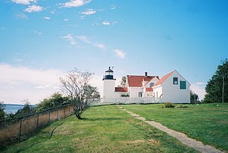
The Fort Point Light, or Fort Point Light Station, is located in Fort Point State Park, in Stockton Springs, Maine. A lighthouse at this point has served as an active aid to navigation since 1835; the present lighthouse dates to 1857, and is listed on the National Register of Historic Places.

Long Point Light Station is a historic lighthouse at the northeast tip of Long Point in Provincetown, Massachusetts. As a navigational aid, it marks the southwest edge of the entrance to Provincetown Harbor. The United States Coast Guard Light List describes it simply as a "white square tower". The light it casts is green, occulting every 4 seconds, and, at a focal height of 35.5 feet (10.8 m) above mean sea level, has a visible range of 8 nautical miles. When the weather affords low-visibility, one can hear the station's fog horn – sounding a single blast for two seconds, and repeating every 15 seconds – as it seems to call out for its nearly-identical closest neighbor, the Wood End Light.

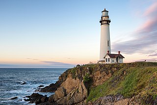
Pigeon Point Light Station or Pigeon Point Lighthouse is a lighthouse built in 1871 to guide ships on the Pacific coast of California. It is the tallest lighthouse on the West Coast of the United States. It is still an active Coast Guard aid to navigation. Pigeon Point Light Station is located on the coastal highway, 5 miles (8 km) south of Pescadero, California, between Santa Cruz and San Francisco. The 115-foot (35 m), white masonry tower, resembles the typical New England structure.

Roche's Point Lighthouse is situated at the entrance to Cork Harbour, Ireland. A lighthouse was first established on 4 June 1817 to guide ships into Cork Harbour. The original tower was deemed too small and in 1835 was replaced by the larger present tower which is 49 feet high with a diameter of 12 feet. Roche's Point Lighthouse, and a number of other structures, are located on a headland of the same name.

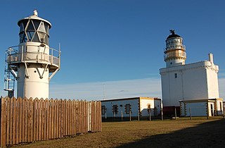
There are two lighthouses located on Kinnaird Head, in Fraserburgh, Scotland: an historical one built in a converted castle; and its modern replacement, built in 1991.

Cape Race Lighthouse is an active lighthouse located at Cape Race on the Avalon Peninsula, Newfoundland. The light's characteristic is a single white flash every 7.5 seconds; additionally, a foghorn may sound a signal of two blasts every 60 seconds. It is located on one of Canada's busiest shipping lanes. The lighthouse is also a tourist attraction.

The Point Abino Light Tower is a lighthouse on the rocky north shore of Lake Erie at the southern tip of Point Abino peninsula west of Crystal Beach, Ontario, Canada. The Greek Revival white square tower with red accents is attached to the fog alarm building, and a lighthouse keeper's residence is located on the shore to the north.

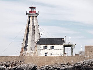
The Gannet Rock Lighthouse is a Canadian lighthouse located on a rocky islet 8 miles (13 km) south of Grand Manan in the Bay of Fundy. It was first lit in 1831 and was staffed until 1996. It was solarized in 2002 and remains operational in 2023. It was declared "surplus to requirements" by the Canadian Coast Guard in 2010 and is no longer being maintained.


