Mohawk Island

Last updated
Mohawk Island
Mohawk Island Lagoon.JPG
Gull Island Lighthouse
Geography
Location Lake Erie
Coordinates 42°50′2″N79°31′21″W / 42.83389°N 79.52250°W / 42.83389; -79.52250 Coordinates: 42°50′2″N79°31′21″W / 42.83389°N 79.52250°W / 42.83389; -79.52250
Area0.04 km2 (0.015 sq mi)
Administration
Canada
Province Ontario
County Haldimand County
Demographics
PopulationUninhabited

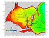
Mohawk Island is a small (4 hectares (9.9 acres) [1] ) island in the northeast of Lake Erie, in Haldimand County, Ontario, Canada. It is composed of limestone with almost no vegetation, and is close to the water level. It was formerly known as Gull Island and contains the ruins of the Gull Island Lighthouse which was built in 1848 to guide ships into the Welland Canal at Port Maitland. In 1933, the lighthouse was automated to no longer require a human keeper and lost significance in 1934 due to the realignment of the canal at Port Colborne. It was decommissioned in 1969 when the mechanism was destroyed by a fire. [2] The lighthouse is located close to the shore of Rock Point Provincial Park. [3]

Contents

Currently, no humans live on the island, and it is mostly inhabited by birds. It is an important nesting and loafing area for gulls, terns and cormorants. The island is also used by migratory birds such as Canada geese as a stopover point. Management of the island was transferred to the Canadian Wildlife Service in 1976 and it was designated as the Mohawk Island National Wildlife Area in 1978. The lighthouse ruin was protected as a heritage lighthouse in 2015.

Geography

Mohawk Island is located in the eastern basin of Lake Erie in Ontario, 20 kilometres (12 mi) southeast of Port Colborne, near the mouth of the Grand River. The island is a limestone outcrop barely above Lake Erie. The island's bedrock is composed of Dundee Limestone, an Eifelian geological formation (397.5 to 391.8 million years old). [4] [5] Because of its low elevation, the proportion of the island's land area varies with lake level. For example, the area of the island was 16,325 square metres (175,720 sq ft) in 1995 and 26,325 square metres (283,360 sq ft) in 2006. [6] The level of Lake Erie can vary by as much as 4 metres (13 ft), but generally fluctuates between 1 and 2 metres (3 ft 3 in and 6 ft 7 in). During November storms waves on the lake can reach 2 to 5 metres (6 ft 7 in to 16 ft 5 in) completely submerging the island. [6]

The island's climate is tempered by the Great Lakes. In the spring, the temperature is cooled by moist air masses from Lake Erie and remains near the freezing point. In the fall and winter, the warmer lake water warms the air and often forms fog. [6]

The island is bare to the rock, although some crevices and the highest area of the island have a thin layer of soil. It has a beach and a sand and gravel mound on its south and east coasts. On the southeast side, there is a mound of zebra and quagga mussel shells. [6]

Natural environment

Flora

The vegetation on Mohawk Island is sparse and not very diverse. There are only a few herbaceous and grassy colonies in the crevices of the island. Species present include common cinquefoil, lady's thumb, dandelion, an unidentified dock species, purple loosestrife and goldenrod species. Lichens and mosses are also found on the rock. Sedges and rushes grow in the submerged crevices. As the island is bare to bedrock and exposed to frequent heavy rainfall it is unlikely that vegetation will recover. [6]

Fauna

The Gull Island lighthouse where comorants and gulls roost. HPIM8229.JPG
The Gull Island lighthouse where comorants and gulls roost.

The main breeding bird species are the herring gull, ring-billed gull, double-crested cormorant and Caspian tern. The Herring Gull and Double-crested Cormorant colonies on the island are the largest recorded in the eastern basin of Lake Erie. The Caspian Tern colony is the only known colony in the lake. Common Tern and Great Black-backed Gull have also nested on the island. [6]

The first record of nesting Herring Gulls was in 1943. The population then slowly increased to 200 nests by 1966. The population then began to vary from year to year between 200 and 250 nests. The 253 nests in 2007 represented 10.1% of the nests recorded around Lake Erie. Ring-billed Gulls were also first reported on the island in 1943. The population there increased much more rapidly than the Hudson's Gull, reaching a peak of 6,300 nests in 1964. The population then varied between 1,500 and 2,400 nests. The 2201 nests recorded in 2010 represented 6.1% of the nests around Lake Erie. [6]

Double-crested cormorants arrived on the island in 1983. The number of nests has steadily increased since then, reaching a peak of 1,586 nests in 2008. This increase is representative of the increase observed around the Great Lakes. In 2009, the 800 nests represent 9% of the number of nests around Lake Erie. [6]

Caspian terns began nesting on the island in 1996. They nest exclusively on deposits of zebra and quagga mussel shells, both of which are invasive species in the Great Lakes. Although variable, the breeding population is steadily increasing. In 2007, the colony consisted of 300 nests, or 10.3% of the Great Lakes population. [6] [7] In 1946, the common tern was the main species nesting on the island with between 1,400 and 1,800 pairs. Beginning in 1960, the gull population increased, resulting in a decrease in vegetation on the island as well as a decrease in pairs. No more nests have been observed since 2004. The Great Black-backed Gull, first observed on the island in 1991, nests on the island intermittently. [6]

The low level of the island makes the colonies particularly vulnerable to waves. For example, the Caspian tern colony was completely destroyed in June 2010 by a large seiche that raised the water level by more than a meter in the eastern basin of Lake Erie. [6]

Since 1970, at least twenty species of waterfowl have been observed within 1.5 kilometres (0.93 mi) of the island's shoreline. During migration periods, mallards, Canada geese, goldeneyes, scaups and sandpipers frequent the Mohawk Island area as they cross Lake Erie. The population of mallards and American black ducks using the area more than doubled between the 1970s and 1990s and the Canada goose population increased more than thirteen-fold. The island area is considered of secondary importance compared to other areas of Lake Erie, such as Long Point National Wildlife Area. [6]

Other than birds, only one vertebrate species has been observed on the island, the garter snake, seen in the lighthouse foundation. [6]

History

The lighthouse and lightkeeper's house, originally known as Gull Island, were built between 1846 and 1848 to mark the shoals near the entrance to the Welland Canal at Port Maitland. Standing 18 metres (59 ft) high, the lighthouse has an octagonal iron lantern topped by a dome. Its light beam had a range of 18 kilometres (11 mi). In 1911, the Ontario Department of Lands, Forests and Mines recommended that ownership of the lighthouse island be transferred to the federal Department of Marine and Fisheries to facilitate maintenance. The lighthouse was automated in 1933. In 1934, the entrance to the Welland Canal was transferred to Port Colborne, reducing the importance of the lighthouse. In 1969, a fire destroyed the mechanisms. It was replaced the same year by a simple navigation buoy. [6]

In 1970, the Canadian Wildlife Service recommended the transfer of the island and its designation as a National Wildlife Area to protect its bird colonies. Ownership of the island was transferred in 1976 and it was designated a National Wildlife Area in 1978. In 1977, Transport Canada issued a demolition notice because it considered the old lighthouse to be a public hazard, though eventually abandoned the idea following public pressure. [6] Only the walls of the lighthouse and the house remain in 2016 and it is forbidden to enter the interior of the structure. [6] It was classified as a heritage lighthouse in 2015 by the Historic Sites and Monuments Board of Canada. [8]

Land protection

Mohawk Island National Wildlife Area
Location Golden Horseshoe
Area4 ha (9.9 acres)
Created1978
Governing body Canadian Wildlife Service
www.canada.ca/en/environment-climate-change/services/national-wildlife-areas/locations/mohawk-island.html

The island is located entirely within the Mohawk Island National Wildlife Area, a national wildlife area administered by the Canadian Wildlife Service of Environment and Climate Change Canada. It is one of the few protected areas in the vicinity, along with Byng Island Conservation Area, James N. Allan Provincial Park, and Rock Point Provincial Park which is a banding station for the Canadian Migration Monitoring Network. Access to Mohawk Island is prohibited except by permit between April 1 and August 30 to avoid disturbance of breeding birds. [6] From September 1 to March 31, access is permitted during daylight hours, including by motorboat. Permitted activities include "wildlife viewing, picnicking, recreational fishing from shore ... [and] swimming". [6] Entering the stone lighthouse structures is not permitted. [1]

Panoramic view of the island. Panorama of Mohawk Island.jpg
Panoramic view of the island.

Related Research Articles

Lake Winnipeg Large glacial lake in Manitoba, Canada

Lake Winnipeg is a very large, relatively shallow 24,514-square-kilometre (9,465 sq mi) lake in North America, in the province of Manitoba, Canada. Its southern end is about 55 kilometres (34 mi) north of the city of Winnipeg. Lake Winnipeg is Canada's sixth-largest freshwater lake and the third-largest freshwater lake contained entirely within Canada, but it is relatively shallow excluding a narrow 36 m (118 ft) deep channel between the northern and southern basins. It is the eleventh-largest freshwater lake on Earth. The lake's east side has pristine boreal forests and rivers that were in 2018 inscribed as Pimachiowin Aki, a UNESCO World Heritage Site. The lake is 416 km (258 mi) from north to south, with remote sandy beaches, large limestone cliffs, and many bat caves in some areas. Manitoba Hydro uses the lake as one of the largest reservoirs in the world. There are many islands, most of them undeveloped.

Tern Family of seabirds

Terns are seabirds in the family Laridae that have a worldwide distribution and are normally found near the sea, rivers, or wetlands. Terns are treated as a subgroup of the family Laridae which includes gulls and skimmers and consists of eleven genera. They are slender, lightly built birds with long, forked tails, narrow wings, long bills, and relatively short legs. Most species are pale grey above and white below, with a contrasting black cap to the head, but the marsh terns, the Inca tern, and some noddies have dark plumage for at least part of the year. The sexes are identical in appearance, but young birds are readily distinguishable from adults. Terns have a non-breeding plumage, which usually involves a white forehead and much-reduced black cap.

Double-crested cormorant Species of bird

The double-crested cormorant is a member of the cormorant family of water birds. Its is found near rivers and lakes, and in coastal areas, and is widely distributed across North America, from the Aleutian Islands in Alaska down to Florida and Mexico. Measuring 70–90 cm (28–35 in) in length, it is entirely black except for a bare patch of orange-yellow facial skin and some extra plumage that it exhibits in the breeding season, when it grows a double crest in which black feathers are mingled with white. Five subspecies are recognized. It mainly eats fish and hunts by swimming and diving. Its feathers, like those of all cormorants, are not waterproof and it must spend time drying them out after spending time in the water. Once threatened by the use of DDT, the numbers of this bird have increased markedly in recent years.

Roseate tern Bird in the family Laridae

The roseate tern is a species of tern in the family Laridae. The genus name Sterna is derived from Old English "stearn", "tern", and the specific dougallii refers to Scottish physician and collector Dr Peter McDougall (1777–1814). "Roseate" refers to the bird's pink breast in breeding plumage.

Forsters tern Species of bird

Forster's tern is a tern in the family Laridae. The genus name Sterna is derived from Old English "stearn", "tern", and forsteri commemorates the naturalist Johann Reinhold Forster.

The Mud Islands reserve is located within Port Phillip, about 90 km (56 mi) south-west of Melbourne, Australia, lying 10 km (6.2 mi) inside Port Phillip Heads, 7 km (4.3 mi) north of Portsea and 9 km (5.6 mi) east of Queenscliff. The land area of about 50 hectares is made up of three low-lying islands surrounding a shallow tidal 35-hectare (86-acre) lagoon connected to the sea by three narrow channels. The shapes and configuration of the islands change over the years due to movement of sand by tidal currents.

Presquile Provincial Park Ontario park

Presqu'ile Provincial Park is a park in southeastern Northumberland County on the north shore of Lake Ontario near the town of Brighton in Ontario, Canada. The park occupies an area of 9.37 km2 (3.62 sq mi). The name of the park is the French word for peninsula, or literally "almost island", and was believed to be named by Samuel De Champlain on his second expedition. The peninsula was formed when a limestone island was connected to the mainland by a sand spit; this kind of formation is referred to as a tombolo.

Anaho Island National Wildlife Refuge National Wildlife Refuge in Nevada

The Anaho Island National Wildlife Refuge is a wildlife refuge on Anaho Island in Pyramid Lake, Nevada. The refuge was established by President Woodrow Wilson in 1913 as a sanctuary for colonial nesting birds. It is home to one of the two largest colonies of pelicans—American white pelicans—in the western U.S. Other birds found on the island include California gulls, Caspian terns, double-crested cormorants, great blue herons, black-crowned night herons, and snowy egrets.

Hog Island (Wisconsin) Island in Lake Michigan, United States

Hog Island is an uninhabited island located off the eastern shore of Washington Island in the town of Washington, Door County, Wisconsin, United States. The island has a land area of 2.14 acres (8,656 m2) and an elevation of 10 feet or 20 feet above Lake Michigan.

Chantry Island (Ontario)

Chantry Island is a small island in Lake Huron, south of the mouth of the Saugeen River and approximately a kilometre off the shores of the town of Southampton, Ontario. It is approximately 19 hectares in size and is a migratory bird sanctuary. Since the sanctuary territory extends 183 metres into the water surrounding the island, the total official area is listed as 63 hectares.

Bird colony Large congregation of birds at a particular location

A bird colony is a large congregation of individuals of one or more species of bird that nest or roost in proximity at a particular location. Many kinds of birds are known to congregate in groups of varying size; a congregation of nesting birds is called a breeding colony. Colonial nesting birds include seabirds such as auks and albatrosses; wetland species such as herons; and a few passerines such as weaverbirds, certain blackbirds, and some swallows. A group of birds congregating for rest is called a communal roost. Evidence of colonial nesting has been found in non-neornithine birds (Enantiornithes), in sediments from the Late Cretaceous (Maastrichtian) of Romania.

Little Galloo Island is located in eastern Lake Ontario near the entrance to Sackets Harbor in Jefferson County, New York, within the jurisdiction of the Town of Hounsfield.

Breton National Wildlife Refuge

Breton National Wildlife Refuge is located in southeastern Louisiana in the offshore Breton Islands and Chandeleur Islands. It is located in the Gulf of Mexico and is accessible only by boat. The refuge was established in 1904 through executive order of President Theodore Roosevelt and is the second-oldest refuge in the National Wildlife Refuge System.

Gravel Island National Wildlife Refuge

Gravel Island National Wildlife Refuge is a National Wildlife Refuge located off the Door Peninsula in Wisconsin. Founded in 1913, the refuge consists of two Lake Michigan islands that act as nesting grounds for native bird species. It is inhabited by large colonies of shore birds and waterfowl in addition to hosting a pair of great black-backed gulls, one of farthest westward breeding sites of the species.

Maine Coastal Islands National Wildlife Refuge contains more than 50 offshore islands and four coastal parcels, totaling more than 8,100 acres. The complex spans more than 250 miles of Maine coastline and includes five national wildlife refuges — Petit Manan, Cross Island, Franklin Island, Seal Island, and Pond Island. The U.S. Fish and Wildlife Service manages the refuge complex as part of the National Wildlife Refuge System.

Glenn Martin National Wildlife Refuge Nature preserve in Maryland and Virginia

Glenn Martin National Wildlife Refuge includes the northern half of Smith Island, which lies 11 miles (18 km) west of Crisfield, Maryland, and Watts Island, which is located between the eastern shore of Virginia and Tangier Island. Both islands are situated in the lower Chesapeake Bay.

Three Sisters Island (Tasmania) Three small islands in Bass Strait, Tasmania

The Three Sisters Island or Three Sisters Islands are three small and rocky granite islands, with a collective land area of 2 hectares, located in the Bass Strait, lying 500 metres (1,600 ft) off the north coast of Tasmania, Australia, between the towns of Penguin and Ulverstone.

<span class="mw-page-title-main">Bird Island Nature Reserve</span> Protected area in New South Wales, Australia

The Bird Island Nature Reserve is a protected nature reserve located near Lake Munmorah on the Central Coast region of New South Wales, Australia. The island is situated 1.4 kilometres (0.87 mi) off the east coast of New South Wales, within the Tasman Sea. The reserve may be seen from the lighthouse at Norah Head.

The Wisconsin Islands Wilderness is a 29-acre (12 ha) wilderness area located in Door County in northeastern Wisconsin. It is one of the smallest wilderness areas in the United States. Managed by the U.S. Fish & Wildlife Service, the wilderness area is composed of three islands in Lake Michigan.

Scotch Bonnet Island

Scotch Bonnet Island is a small island in Lake Ontario. It is part of Prince Edward County, Ontario, Canada.

References

  1. 1 2 "Mohawk Island National Wildlife Area." Environment Canada, 20 August 2012. Retrieved 31 August 2012.
  2. "Mohawk Island Lighthouse." Archived 2012-03-16 at the Wayback Machine Rudy and Alice's Lighthouse Page. Posted September 2006. Retrieved 31 August 2012.
  3. Penberthy, Bryan. "Mohawk Island Lighthouse." US Lighthouses, 2009. Retrieved 31 August 2012.
  4. "Dundee Formation". Lexique des unités géologiques canadiennes. Ressources naturelles Canada. Retrieved 15 February 2022.
  5. "Bedrock geology of Ontario, southern sheet" (PDF). Ontario Geological Survey. 1991. Retrieved 19 November 2016..
  6. 1 2 3 4 5 6 7 8 9 10 11 12 13 14 15 16 17 18 "Scotch Bonnet Island and Mohawk Island National Wildlife Areas Management Plan" (PDF). Environment and Climate Change Canada. 2016. pp. v., 7–8, 10–11, 15–17, 20–23, 42. Archived from the original (PDF) on 16 September 2020. Retrieved 15 February 2022.
  7. "Réserve nationale de faune de l'île Mohawk" (in French). Environnement et Changement Climatique Canada. Archived from the original on 4 October 2017. Retrieved 15 February 2022..
  8. "Phare de Mohawk Island". Annuaire des désignations patrimoniales fédérales (in French). Parcs Canada. Archived from the original on 2 January 2022. Retrieved 15 February 2022.
  9. "Mohawk Island National Wildlife Area". Environment and Climate Change Canada - Ontario Region. 19 August 2020. Retrieved 15 February 2022..