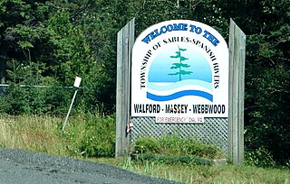
Sables-Spanish Rivers is a township in Ontario, Canada, on the north shore of Georgian Bay. It is located in the Sudbury District, approximately 70 kilometres (43 mi) west of Sudbury.

The French River is a river in Central Ontario, Canada. It flows 110 kilometres (68 mi) from Lake Nipissing southwest to Georgian Bay. The river largely follows the boundary between the Parry Sound District and the Sudbury District, and in most contexts is considered the dividing line between Northern and Southern Ontario. The French River was designated a Canadian Heritage River in 1986.

The Mattawa River is a river in central Ontario, Canada. It flows east from Trout Lake east of North Bay and enters the Ottawa River at the town of Mattawa. Counting from the head of Trout Lake, it is 76 kilometres (47 mi) long. The river's name comes from the Algonquin word for "meeting of waterways".

The River aux Sables, also known as the Aux Sables River and the Rivière aux Sables, is a river in Algoma and Sudbury Districts, Ontario, Canada, which flows from Lac aux Sables in Algoma District and empties into the Spanish River near the community of Massey.

The Spanish River is a river in Algoma District, Sudbury District and Greater Sudbury in Northeastern Ontario, Canada. It flows 338 kilometres (210 mi) in a southerly direction from its headwaters at Spanish Lake and Duke Lake to its mouth at the North Channel of Lake Huron just outside the community of Spanish.

The Bonnechere River is a river in the Saint Lawrence River drainage basin in Nipissing District and Renfrew County in eastern and northeastern Ontario, Canada. The river flows from Algonquin Provincial Park to the Ottawa River east and north of the town of Renfrew. The river's name is thought to come from the French "bonne chère" meaning "plentiful good food".

The Barron River is a river in the Saint Lawrence River drainage basin in Nipissing District and Renfrew County, Ontario, Canada. It flows from Clemow Lake in northern Algonquin Provincial Park and joins the Petawawa River, whose southern branch it forms, in the municipality of Laurentian Hills, near the municipality of Petawawa.

The Amable du Fond River is a river in Nipissing District, in Northern Ontario, Canada.
The Pukaskwa River is a river in Thunder Bay District and Algoma District in Northern Ontario, Canada. It is in the Great Lakes Basin and is a tributary of Lake Superior, which it enters at the south end of Pukaskwa National Park. It is a remote, pristine, free-flowing, medium-sized Shield river, with lots of whitewater, best travelled in spring.
The Obabika River Provincial Park is a provincial park in Ontario, Canada, straddling across the boundaries of the Sudbury, Nipissing, and Timiskaming Districts. While it is named after and includes the Obabika River, the bulk of the park extends north of Obabika Lake to the eastern boundary of Lady Evelyn-Smoothwater Provincial Park.
White Lake Provincial Park is a park in the Thunder Bay District of Northern Ontario, Canada, along Highway 17, north of Lake Superior.
The Temagami River, formerly spelled as Timagami River, is a river in the Nipissing District of Ontario, Canada, in the Temagami region. Its source is Lake Temagami and flows through Cross Lake and Red Cedar Lake. It flows into the Sturgeon River at the community of River Valley.

Batiscan River has its source in the region of Lac Édouard, in the Laurentians Mountains, the Batiscan River flows over a length of 177 km. It receives water from numerous tributaries, including, in its upper reach, the Rivière aux Éclairs and the Jeannotte river. In its downstream part, it waters Saint-Narcisse and Sainte-Geneviève-de-Batiscan before flowing into the St. Lawrence River at Batiscan.

The Gull River is a river in Thunder Bay District in Northwestern Ontario, Canada. The river is in the Great Lakes Basin and is a tributary of Lake Nipigon.

Tertiary Highway 810, commonly referred to as Highway 810, is a provincially maintained access road, extending from Bull Lake to Richie Falls alongside the River aux Sables north of Massey. A northerly extension of Highway 553, the road was established in 1974 and has remained unchanged since then.

The Chiniguchi Waterway Provincial Park consists of 9,368 ha (36.17 sq mi) of protected wilderness along the Chiniguchi River, Maskinonge Lake, Kukagami Lake, Wolf Lake and Matagamasi Lake in the Sudbury District of Ontario, that includes 336 hectares of Forest Reserve. The park is one of the several provincial parks located in the Sudbury area. It is managed by Ontario Parks. It contains the largest stand of old growth Red Pines.
The Makobe River is a river in northeastern Ontario, Canada. It is in the Saint Lawrence River drainage basin, and is a left tributary of the Montreal River.

Egan Chutes Provincial Park is located 15 km (9.3 mi) east of Bancroft, Ontario, Canada. It was established as a provincial park in 1989 but is a non-operating park. Egan chutes is classified as a nature reserve, protecting a section of the York River.
The East English River Provincial Park is a linear waterway park in Kenora District, Ontario, Canada. It includes a 200 metres (660 ft) wide strip of land on both sides of the English River and its lakes, from the intersection of Highway 599 to Minnitaki Lake. It was established in 2003 to protect natural features, that are representative of the area, and high quality recreational canoe routes with over 30 sets of rapids. The park's notable features include white pine forest at the northern extent of its range, white elm and burr oak, caribou habitat and calving locations, fisheries, and archaeological sites.

The Oxtongue River is a river in Nipissing and Muskoka Districts, Ontario, Canada. It is a tributary of the Muskoka River via Lake of Bays, flowing in a mostly south-westerly direction through undisturbed mixed forest that is home to many native mammal species.


