Related Research Articles

Ishpatina Ridge is the highest point of land in the Canadian province of Ontario, at an estimated 693 m (2,274 ft) above sea level. Ishpatina Ridge rises approximately 300 m (984 ft) above the immediate area. It was only truly recognized as Ontario's highest point after topographical mapping by the Government of Canada revealed this fact in the 1970s. Before then, the more popular Maple Mountain was thought to be higher.

The Boundary Waters Canoe Area Wilderness comprises 1,090,000 acres (440,000 ha) of pristine forests, glacial lakes, and streams in the Superior National Forest. Located entirely within the U.S. state of Minnesota at the Boundary Waters, the wilderness area is under the administration of the United States Forest Service. Efforts to preserve the primitive landscape began in the 1900s and culminated in the Boundary Waters Canoe Area Wilderness Act of 1978. The area is a popular destination for canoeing, hiking, and fishing, and is the most visited wilderness in the United States.

The White Mountain National Forest (WMNF) is a federally managed forest contained within the White Mountains in the northeastern United States. It was established in 1918 as a result of the Weeks Act of 1911; federal acquisition of land had already begun in 1914. It has a total area of 750,852 acres (303,859 ha). Most of the WMNF is in New Hampshire; a small part is in the neighboring state of Maine. Conservationist and community activist Katherine Sleeper Walden was instrumental in securing at-risk land for the forest, including thousands of acres in the region surrounding the locally famous Bowl near Wonalancet.
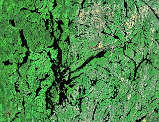
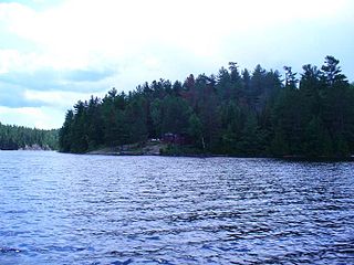
Lake Temagami, formerly spelled as Lake Timagami, is a lake in Nipissing District in northeastern Ontario, Canada, situated approximately 80 km north of North Bay. The lake's name comes from dimii-agamiing "tih-MEE-uh-guh-MEENG", which means "it is deep water by the shore" in the Ojibwa language.

The Laurentian Mixed Forest Province, also known as the North Woods, is a forested ecoregion in eastern North America. Among others, this terminology has been adopted by the Minnesota Department of Natural Resources. Similar, though not necessarily entirely identical regions, are identified by the United States Environmental Protection Agency as Northern Lakes and Forests, and by the World Wildlife Fund by regions such as the Western Great Lakes forests and Eastern forest-boreal transition.

The Porcupine Mountains, or Porkies, are a group of small mountains spanning the northwestern Upper Peninsula of Michigan in Ontonagon and Gogebic counties, near the shore of Lake Superior. The Porcupine Mountains were named by the native Ojibwa people, supposedly because their silhouette had the shape of a crouching porcupine. They are home to the most extensive stand of old growth northern hardwood forest in North America west of the Adirondack Mountains, spanning at least 31,000 acres (13,000 ha). The area is popular among tourists, especially Lake of the Clouds in the heart of the mountains, and is part of Porcupine Mountains Wilderness State Park.

The Slate Islands are a small archipelago in Lake Superior, Ontario, Canada, about 12 kilometres (7.5 mi) south of the town of Terrace Bay. The island group, consisting of 15 islands in total, was created by a meteorite impact which formed a crater about 32 km (20 mi) wide. In 1985, the Ontario government established the Slate Islands as a natural environment provincial park. The islands are notable for having Ontario's largest herd of boreal woodland caribou.

Pukaskwa National Park is a national park located south of the town of Marathon, Ontario in the Thunder Bay District of northern Ontario, Canada. Established in 1978, Pukaskwa is known for its vistas of Lake Superior and boreal forests. The park covers an area of 1,878 square kilometres (725 sq mi), and protects part of the longest undeveloped shoreline anywhere on the Great Lakes.
The Colville National Forest is a U.S. National Forest located in northeastern Washington state. It is bordered on the west by the Okanogan–Wenatchee National Forest and the Kaniksu National Forest to the east. The forest also borders Little Pend Oreille National Wildlife Refuge and the Lake Roosevelt National Recreation Area.
Jumping Cariboo Lake, sometimes incorrectly spelled Jumping Caribou Lake, is a lake located within the Municipality of Temagami, in the Nipissing District, Ontario, Canada. It contains small islands and hidden bays. Ojibwa natives of the area have given the lake its name.
The Obabika River Provincial Park is a provincial park in Ontario, Canada, straddling across the boundaries of the Sudbury, Nipissing, and Timiskaming Districts. While it is named after and includes the Obabika River, the bulk of the park extends north of Obabika Lake to the eastern boundary of Lady Evelyn-Smoothwater Provincial Park.

Lady Evelyn-Smoothwater Provincial Park is a remote wilderness park in northeastern Ontario, Canada, north of Lake Temagami. This operating park, requiring permits for all visitors, encompasses "rugged topography, clear lakes, stunning waterfalls, and rushing rivers".

Neys Provincial Park is a natural environment-class provincial park on the north shore of Lake Superior, just west of Marathon, Ontario, Canada. This 5,383-hectare (13,300-acre) park includes the historic Coldwell Peninsula and the surrounding island system, consisting of Pic Island, Detention Island, and the Sullivan Islands.

Temagami, formerly spelled Timagami, is a municipality in northeastern Ontario, Canada, in the Nipissing District with Lake Temagami at its heart.

The La Cloche Silhouette Trail is a 78-kilometre (48 mi) backpacking loop across the white quartzite peaks of the La Cloche mountain range. The trail is situated in Killarney Provincial Park, Ontario, Canada. The trail is named for Group of Seven painter Franklin Carmichael's painting "La Cloche Silhouette." Wildlife can be seen throughout the trail - black bears, moose, wolverines, mountain lions, lynx, fishers, snakes, porcupines, beavers, river otters, among other animals, can be encountered at various points along the way.
Cassels Lake is a lake located within the Municipality of Temagami, in the Nipissing District, Ontario, Canada. It contains numerous portages, campsites and is one of three lakes on the eastern edge of the White Bear Forest. The lake is named in honour of Sir Walter Cassels, President of the Exchequer Court of Canada.
The Temagami First Nation is located on Bear Island in the heart of Lake Temagami, the second largest in Lake Temagami after Temagami Island. Its community is known as Bear Island 1. Temagami First Nation (TFN) members are status Indians under the Indian Act that live on and off Bear Island.

Rabbit Lake is a lake in the Temagami region of Northeastern Ontario, Canada, and lies within the townships of Askin, Riddell, and Eldridge. The lake is the largest and southernmost in a chain of lakes including Cassels Lake, Snake Island Lake, and Obashkong Lake.
Poison Pond is a small freshwater lake in the Temagami region of Northeastern Ontario, Canada, located near Pecours Bay of Snake Island Lake. Poison Pond is in the White Bear Forest and is typically approached from the Peregrine Trail, which adjoins the Red Fox Trail to the west. Its eastern portion adjoins the Otter Trail.
Obabika old-growth forest is an Eastern White Pine and Red Pine dominated old-growth forest at the north end of Obabika Lake, just west of the Temagami region of Ontario, Canada. At 2,400 hectares in size, it is commonly considered to be the largest remaining white pine dominated old-growth forest in the world. It is also sometimes called Chee-Skon Lake old-growth forest, or Wakimika Triangle old-growth forest. This area was slated for logging in 1989 and was protected largely as a result of a blockade on Red Squirrel Road in which 344 protestors were arrested, including future Ontario premier Bob Rae. The oldest trees in the Obabika old-growth forest are confirmed to be at least 375 years old, but a diversity of age classes occur in this forest. Another important feature of the area is the spirit rock, a column of rock on the shore of Chee-Skon Lake that is of spiritual significance to the Teme-Augama Anishnabai people.
References
- ↑ White Bear Old Growth Forest Trail Guide Retrieved on 2007-06-27
- 1 2 Henry, Michael (2010). Ontario's old-growth forests. Fitzhenry and Whiteside. p. 131. ISBN 978-1-55041-580-3.
- 1 2 3 4 5 6 7 8 Caribou Mountain/White Bear Forest: An attraction of the Heritage North Tourism Network (Map). Ministry of Natural Resources. 1997.