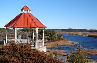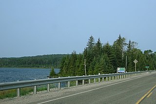
The Spanish River is a river in Algoma District, Sudbury District and Greater Sudbury in Northeastern Ontario, Canada. It flows 338 kilometres (210 mi) in a southerly direction from its headwaters at Spanish Lake and Duke Lake to its mouth at the North Channel of Lake Huron just outside the community of Spanish.

The Ogoki River is a river in the Thunder Bay and Cochrane Districts of Ontario. It springs from the wilderness just east of Savant Lake, flowing north of Lake Nipigon to Ogoki, where it joins the Albany River which empties into James Bay. The river is 480 kilometres (300 mi) long.
The Black Sturgeon River is a river in Thunder Bay District, Northwestern Ontario, Canada, located west of the Nipigon River, that flows to Lake Superior.

White Lake Provincial Park is a park in the Thunder Bay District of Northern Ontario, Canada, along Highway 17, north of Lake Superior.
The Temagami River, formerly spelled as Timagami River, is a river in the Nipissing District of Ontario, Canada, in the Temagami region. Its source is Lake Temagami and flows through Cross Lake and Red Cedar Lake. It flows into the Sturgeon River at the community of River Valley.

The Gull River is a river in Thunder Bay District in Northwestern Ontario, Canada. The river is in the Great Lakes Basin and is a tributary of Lake Nipigon.

Woodland Caribou Provincial Park is a provincial park in Northwestern Ontario, Canada, west of the municipality of Red Lake. It borders Atikaki Provincial Park and Nopiming Provincial Park in eastern Manitoba, and is made up of Canadian Shield and boreal forest. Woodland Caribou Provincial Park is a wilderness park of 450,000 hectares, and it became part of the Pimachiowin Aki UNESCO World Heritage Site in 2018.
Caribou River Provincial Wilderness Park is a provincial park in extreme north-central Manitoba, Canada. It is the northernmost provincial park in Manitoba, and borders the southern Nunavut border. It is known for its remote backcountry camping experience.

Lac la Ronge is a glacial lake in the Canadian province of Saskatchewan. It is the fifth largest lake in the province and is approximately 250 kilometres (160 mi) north of Prince Albert, on the edge of the Canadian Shield. La Ronge, Air Ronge, and the Lac La Ronge First Nation are on the western shore. The lake is a popular vacation spot. Recreational activities include fishing, boating, canoeing, hiking, and camping.

Kesagami Lake is a lake of Cochrane District, in Northeastern Ontario, in Canada. It is a shallow lake that was formed assumedly by glacial erosion and unique for its size in the James Bay area. Entirely protected within Kesagami Provincial Park, it is notable in particular for its trophy pike and walleye fishing.
Caliper Lake Provincial Park is a small provincial park in northwestern Ontario, near the township of Nestor Falls. The park occupies 147 hectares alongside Caliper Lake. The facility is open for day use and overnight camping from mid-May to mid-September. The park features 83 campsites, many with electrical hookups, and some which may be rented for the entire season. The park offers many amenities, including a sandy beach, hiking trails, playground equipment, fish cleaning facilities, boat launches, bathrooms, and showers. Canoes, kayaks, and bicycles are available for rental.

Lac La Ronge Provincial Park is located in the boreal forest of the north central part of the Canadian province of Saskatchewan within the Canadian Shield. Situated in the Churchill River system, this provincial park has close to 100 lakes and more than 30 canoe routes, many of which follow old fur trade routes. Summer activities include camping, hiking, boating, fishing, and swimming. In the winter, there's cross-country skiing, snowmobiling, and ice fishing. Saskatchewan's highest waterfall is in the park. Nistowiak Falls are located north of Lac La Ronge along the Rapid River.
West English River Provincial Park is a provincial park in Kenora District, Ontario, Canada. It spans 65 kilometres (40 mi) along the English River from Barnston Lake to Tide Lake and also includes all the shores and waters of Wegg, Goose, Wilcox, Unexpected, Oak, and Maynard Lakes. The park's notable features include old growth red and white pine stands at the northern extent of their range, and migmatites that are provincially-significant examples of metatexitic and diatexitic metasedimentary rocks. It borders on Tide Lake and Maynard Lake Provincial Nature Reserves.
Upper Fishing Lake is a lake in the east-central part of the Canadian province of Saskatchewan in Narrow Hills Provincial Park. It is situated in a glacier-formed valley in the Cub Hills and the boreal forest ecozone of Canada. It is north-west of the larger Lower Fishing Lake along the course of Caribou Creek and is accessed from the Hanson Lake Road.
Lower Fishing Lake is a lake in the east-central part of the Canadian province of Saskatchewan in Narrow Hills Provincial Park. It is situated in the Cub Hills and the boreal forest ecozone of Canada. The lake is accessed from Highway 920, which connects to Hanson Lake Road and Highway 120. The Fishing Lakes Fire of 1977 burned much of the region upstream and around the lake and now the area is now dominated by jack pine, which is a tree species that is well adapted fire burned forests.
Sturgeon Bay Provincial Park is a provincial park on the western shore of Lake Winnipeg in Manitoba, Canada. The park is considered to be a Class Ib protected area under the IUCN protected area management categories. It is 144.9 km2 (55.9 sq mi) in size.
The East English River Provincial Park is a linear waterway park in Kenora District, Ontario, Canada. It includes a 200 metres (660 ft) wide strip of land on both sides of the English River and its lakes, from the intersection of Highway 599 to Minnitaki Lake. It was established in 2003 to protect natural features, that are representative of the area, and high quality recreational canoe routes with over 30 sets of rapids. The park's notable features include white pine forest at the northern extent of its range, white elm and burr oak, caribou habitat and calving locations, fisheries, and archaeological sites.
St. Raphael Provincial Park is a provincial park in northern Ontario, Canada, roughly halfway between Sioux Lookout and Pickle Lake, straddling the boundary of Kenora and Thunder Bay Districts. It was established on May 22, 2003, and provides backcountry canoeing and camping opportunities.
The Turtle River–White Otter Lake Provincial Park is a large provincial park in Kenora and Rainy River Districts, roughly located between Ignace and Atikokan, Ontario, Canada. It has been recognized as a "natural area with unique biophysical, recreational, and cultural attributes."
Eagle-Dogtooth Provincial Park is a provincial park in Kenora District, Ontario, Canada. It protects a series of lakes and streams between Eagle Lake in the east and Dogtooth Lake in the west. With its irregular terrain of land and water, the park has high fishing, tourism and recreational values.


