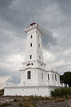
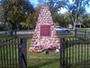
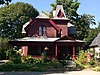
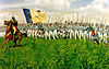
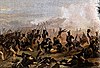
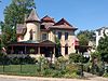
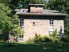
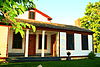
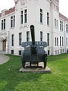
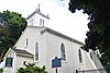
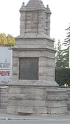
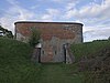
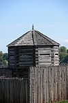
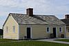
Name Address Coordinates Government recognition (CRHP № ) Image 36 Concession Road Fort Erie ON 42°53′58″N 78°55′31″W / 42.8995°N 78.9252°W / 42.8995; -78.9252 (36 Concession Road ) Fort Erie municipality (16358 ) Upload Photo 202 Dufferin Street Fort Erie ON 42°55′50″N 78°55′09″W / 42.9306°N 78.9193°W / 42.9306; -78.9193 (202 Dufferin Street ) Fort Erie municipality (15922 ) Upload Photo Fort Erie National Historic Site of Canada Fort Erie ON 42°53′36″N 78°55′26″W / 42.8934°N 78.924°W / 42.8934; -78.924 (Fort Erie National Historic Site of Canada ) Federal (12103 ) More images Frenchman's Creek National Historic Site of Canada Fort Erie ON 42°55′35″N 78°56′32″W / 42.9264°N 78.9423°W / 42.9264; -78.9423 (Frenchman's Creek National Historic Site of Canada ) Federal (13036 ) More images The Kraft House Fort Erie ON 42°56′00″N 79°02′33″W / 42.9334°N 79.0424°W / 42.9334; -79.0424 (The Kraft House ) Fort Erie municipality (16344 ) Upload Photo Point Abino Light Tower National Historic Site of Canada Fort Erie (Crystal Beach) ON 42°50′08″N 79°05′43″W / 42.8355°N 79.0953°W / 42.8355; -79.0953 (Point Abino Light Tower National Historic Site of Canada ) Federal (12102 ) More images Ridgeway Battlefield National Historic Site of Canada Fort Erie ON 42°54′14″N 79°02′31″W / 42.904°N 79.042°W / 42.904; -79.042 (Ridgeway Battlefield National Historic Site of Canada ) Federal (16025 ) More images Smith-Geddes House Grimsby ON 43°11′43″N 79°36′04″W / 43.1954°N 79.6012°W / 43.1954; -79.6012 (Smith-Geddes House ) Ontario (10572 ) Upload Photo Alexander-Robinson House Niagara Falls ON 43°08′38″N 79°06′04″W / 43.144°N 79.101°W / 43.144; -79.101 (Alexander-Robinson House ) Niagara Falls municipality (9748 ) More images Bampfield Hall Niagara Falls ON 43°06′18″N 79°03′44″W / 43.1051°N 79.0623°W / 43.1051; -79.0623 (Bampfield Hall ) Niagara Falls municipality (9865 ) More images Battle of Chippawa National Historic Site of Canada Niagara Falls ON 43°03′10″N 79°01′27″W / 43.0527°N 79.0243°W / 43.0527; -79.0243 (Battle of Chippawa National Historic Site of Canada ) Federal (12972 ) More images Battle of Lundy's Lane National Historic Site of Canada Niagara Falls ON 43°05′21″N 79°05′45″W / 43.0893°N 79.0959°W / 43.0893; -79.0959 (Battle of Lundy's Lane National Historic Site of Canada ) Federal (12081 ) More images Buchner House Niagara Falls ON 43°05′19″N 79°05′51″W / 43.0885°N 79.0974°W / 43.0885; -79.0974 (Buchner House ) Niagara Falls municipality (9749 ) More images Chippawa Town Hall Niagara Falls ON 43°03′34″N 79°03′02″W / 43.0595°N 79.0506°W / 43.0595; -79.0506 (Chippawa Town Hall ) Niagara Falls municipality (9750 ) More images Church Residence Niagara Falls ON 43°07′49″N 79°05′51″W / 43.1302°N 79.0974°W / 43.1302; -79.0974 (Church Residence ) Niagara Falls municipality (9752 ) More images Copper Beech Tree Niagara Falls ON 43°05′23″N 79°05′45″W / 43.0896°N 79.0959°W / 43.0896; -79.0959 (Copper Beech Tree ) Niagara Falls municipality (9753 ) More images Cummington Square Niagara Falls ON 43°03′34″N 79°03′02″W / 43.0595°N 79.0506°W / 43.0595; -79.0506 (Cummington Square ) Niagara Falls municipality (9754 ) More images Danner-Sherk House Niagara Falls ON 43°00′01″N 79°01′44″W / 43.0002°N 79.0289°W / 43.0002; -79.0289 (Danner-Sherk House ) Niagara Falls municipality (9755 ) Doran-Marshall Residence Niagara Falls ON 43°06′14″N 79°03′44″W / 43.1039°N 79.0623°W / 43.1039; -79.0623 (Doran-Marshall Residence ) Niagara Falls municipality (9757 ) More images Egerton Morden House Niagara Falls ON 43°05′02″N 79°06′30″W / 43.0839°N 79.1082°W / 43.0839; -79.1082 (Egerton Morden House ) Niagara Falls municipality (9759 ) More images First Bampfield House Niagara Falls ON 43°06′06″N 79°03′51″W / 43.1017°N 79.0641°W / 43.1017; -79.0641 (First Bampfield House ) Niagara Falls municipality (9760 ) More images Fralick's Tavern Niagara Falls ON 43°05′23″N 79°05′47″W / 43.0896°N 79.0964°W / 43.0896; -79.0964 (Fralick's Tavern ) Niagara Falls municipality (9761 ) More images Glenview Mansion Niagara Falls ON 43°06′44″N 79°03′49″W / 43.1123°N 79.0637°W / 43.1123; -79.0637 (Glenview Mansion ) Niagara Falls municipality (9762 ) More images Holy Trinity Church Niagara Falls ON 43°03′45″N 79°03′26″W / 43.0625°N 79.0573°W / 43.0625; -79.0573 (Holy Trinity Church ) Niagara Falls municipality (9763 ) More images J. Ingles House Niagara Falls ON 43°05′10″N 79°05′47″W / 43.086°N 79.0965°W / 43.086; -79.0965 (J. Ingles House ) Niagara Falls municipality (9774 ) More images John Thomson Jr. House Niagara Falls ON 43°06′13″N 79°05′35″W / 43.1037°N 79.0931°W / 43.1037; -79.0931 (John Thomson Jr. House ) Niagara Falls municipality (9775 ) More images Laura Secord House Niagara Falls ON 43°03′31″N 79°03′08″W / 43.0587°N 79.0523°W / 43.0587; -79.0523 (Laura Secord House ) Niagara Falls municipality (9866 ) More images Lyon's Creek Church Niagara Falls ON 43°00′12″N 79°07′39″W / 43.0032°N 79.1275°W / 43.0032; -79.1275 (Lyon's Creek Church ) Niagara Falls municipality (9776 ) Mitchell Cottage Niagara Falls ON 43°07′47″N 79°06′06″W / 43.1296°N 79.1017°W / 43.1296; -79.1017 (Mitchell Cottage ) Niagara Falls municipality (9777 ) More images Nathaniel Dett Chapel Niagara Falls ON 43°05′16″N 79°05′18″W / 43.0878°N 79.0884°W / 43.0878; -79.0884 (Nathaniel Dett Chapel ) Niagara Falls municipality (9778 ) More images Navy Island National Historic Site of Canada Niagara Falls ON 43°03′23″N 79°00′42″W / 43.0564°N 79.0118°W / 43.0564; -79.0118 (Navy Island National Historic Site of Canada ) Federal (16122 ) More images Niagara Falls Armoury Niagara Falls ON 43°06′04″N 79°04′26″W / 43.1011°N 79.0738°W / 43.1011; -79.0738 (Niagara Falls Armoury ) Federal (4347 ), Niagara Falls municipality (9870 ) More images Niagara Falls Carnegie Library Niagara Falls ON 43°06′06″N 79°04′24″W / 43.1016°N 79.0732°W / 43.1016; -79.0732 (Niagara Falls Carnegie Library ) Niagara Falls municipality (9744 ) More images Old Imperial Bank Niagara Falls ON 43°06′31″N 79°03′42″W / 43.1087°N 79.0617°W / 43.1087; -79.0617 (Old Imperial Bank ) Niagara Falls municipality (9782 ) More images Old St. John's Anglican Niagara Falls ON 43°07′25″N 79°05′57″W / 43.1235°N 79.0991°W / 43.1235; -79.0991 (Old St. John's Anglican ) Niagara Falls municipality (9785 ) More images Old St. John's Anglican Church (Stamford) Niagara Falls ON 43°07′25″N 79°05′57″W / 43.1235°N 79.0991°W / 43.1235; -79.0991 (Old St. John's Anglican Church (Stamford) ) Ontario (10543 ) More images Old Stamford Town Hall Niagara Falls ON 43°05′22″N 79°05′28″W / 43.0894°N 79.0912°W / 43.0894; -79.0912 (Old Stamford Town Hall ) Niagara Falls municipality (9787 ) More images Orchard Cadham House Niagara Falls ON 43°05′10″N 79°05′39″W / 43.0862°N 79.0941°W / 43.0862; -79.0941 (Orchard Cadham House ) Niagara Falls municipality (9788 ) More images Oswald House Niagara Falls ON 43°08′42″N 79°06′03″W / 43.1449°N 79.1009°W / 43.1449; -79.1009 (Oswald House ) Niagara Falls municipality (9789 ) More images Post Office and Customs House Niagara Falls ON 43°06′28″N 79°03′42″W / 43.1077°N 79.0618°W / 43.1077; -79.0618 (Post Office and Customs House ) Niagara Falls municipality (9791 ) More images R. Nathaniel Dett British Methodist Episcopal Church National Historic Site of Canada Niagara Falls ON 43°05′16″N 79°05′19″W / 43.0877°N 79.0887°W / 43.0877; -79.0887 (R. Nathaniel Dett British Methodist Episcopal Church National Historic Site of Canada ) Federal (13333 ) More images Russell Cottage Niagara Falls ON 43°07′36″N 79°06′05″W / 43.1266°N 79.1015°W / 43.1266; -79.1015 (Russell Cottage ) Niagara Falls municipality (9790 ) More images Toronto Power Generating Station National Historic Site of Canada Niagara Falls ON 43°04′18″N 79°04′26″W / 43.0718°N 79.074°W / 43.0718; -79.074 (Toronto Power Generating Station National Historic Site of Canada ) Federal (11954 ) More images Via Railway Station Niagara Falls ON 43°06′31″N 79°03′46″W / 43.1087°N 79.0628°W / 43.1087; -79.0628 (Via Railway Station ) Federal (4624 ), Niagara Falls municipality (9792 ) More images Whirlpool House Niagara Falls ON 43°07′48″N 79°05′54″W / 43.1301°N 79.0982°W / 43.1301; -79.0982 (Whirlpool House ) Niagara Falls municipality (9793 ) More images Willoughby Township Hall Niagara Falls ON 43°00′57″N 79°03′32″W / 43.0158°N 79.059°W / 43.0158; -79.059 (Willoughby Township Hall ) Niagara Falls municipality (9794 ) Battlefield of Fort George National Historic Site of Canada Niagara-on-the-Lake ON 43°15′18″N 79°06′29″W / 43.2551°N 79.1081°W / 43.2551; -79.1081 (Battlefield of Fort George National Historic Site of Canada ) Federal (15905 ) More images Fort George National Historic Site of Canada Niagara-on-the-Lake ON 43°14′55″N 79°03′40″W / 43.2486°N 79.0612°W / 43.2486; -79.0612 (Fort George National Historic Site of Canada ) Federal (7613 ) More images Blockhouse 1 Fort George Niagara-on-the-Lake ON 43°14′52″N 79°03′44″W / 43.2479°N 79.0621°W / 43.2479; -79.0621 (Blockhouse 1 ) Federal (4798 ) Upload Photo Blockhouse 2 Fort George Niagara-on-the-Lake ON 43°15′03″N 79°03′40″W / 43.2508°N 79.061°W / 43.2508; -79.061 (Blockhouse 2 ) Federal (4799 ) More images Blockhouse 3 Fort George Niagara-on-the-Lake ON 43°15′03″N 79°03′41″W / 43.2508°N 79.0614°W / 43.2508; -79.0614 (Blockhouse 3 ) Federal (4800 ) More images Brock's Monument Queenston Heights National Historic Site of Canada Niagara-on-the-Lake ON 43°09′36″N 79°03′11″W / 43.16°N 79.053°W / 43.16; -79.053 (Brock's Monument ) Federal (9813 ) More images Butler's Barracks National Historic Site of Canada Niagara-on-the-Lake ON 43°14′51″N 79°04′07″W / 43.2475°N 79.0686°W / 43.2475; -79.0686 (Butler's Barracks National Historic Site of Canada ) Federal (7824 ) Upload Photo Commissariat Storehouse Niagara-on-the-Lake ON 43°14′51″N 79°04′10″W / 43.2474°N 79.0695°W / 43.2474; -79.0695 (Commissariat Storehouse ) Federal (4814 ) Upload Photo Eagleson-Buyers House Niagara-on-the-Lake ON 43°15′01″N 79°04′38″W / 43.2504°N 79.0773°W / 43.2504; -79.0773 (Eagleson-Buyers House ) Niagara-on-the-Lake municipality (16355 ) Field House Niagara-on-the-Lake ON 43°12′07″N 79°03′24″W / 43.201981°N 79.056729°W / 43.201981; -79.056729 (Field House ) Ontario (9635 ) Fort Drummond National Historic Site of Canada Niagara-on-the-Lake ON 43°09′35″N 79°03′11″W / 43.1598°N 79.053°W / 43.1598; -79.053 (Fort Drummond National Historic Site of Canada ) Federal (14547 ) Upload Photo Fort George National Historic Site, Artificer’s and Blacksmith Shop Fort George Niagara-on-the-Lake ON 43°14′52″N 79°03′44″W / 43.2479°N 79.0621°W / 43.2479; -79.0621 (Fort George National Historic Site, Artificer’s and Blacksmith Shop ) Federal (4803 ) Upload Photo Fort Mississauga National Historic Site of Canada Niagara-on-the-Lake ON 43°15′39″N 79°04′43″W / 43.2607°N 79.0787°W / 43.2607; -79.0787 (Fort Mississauga National Historic Site of Canada ) Federal (7616 ) More images Guardhouse / Orderly Room Fort George Niagara-on-the-Lake ON 43°14′52″N 79°03′44″W / 43.2479°N 79.0621°W / 43.2479; -79.0621 (Guardhouse / Orderly Room ) Federal (4810 ) Upload Photo Gunshed Niagara-on-the-Lake ON 43°14′51″N 79°04′10″W / 43.2474°N 79.0695°W / 43.2474; -79.0695 (Gunshed ) Federal (4815 ) Upload Photo Junior Commissariat Officer's Quarters Niagara-on-the-Lake ON 43°14′57″N 79°04′25″W / 43.2493°N 79.0736°W / 43.2493; -79.0736 (Junior Commissariat Officer's Quarters ) Federal (9950 ) Upload Photo Lockhart-Moogk House Niagara-on-the-Lake ON 43°15′21″N 79°04′44″W / 43.2559°N 79.0788°W / 43.2559; -79.0788 (Lockhart-Moogk House ) Niagara-on-the-Lake municipality (15927 ) More images McDougal-Harrison House 100px ON 43°15′27″N 79°04′34″W / 43.2574°N 79.076°W / 43.2574; -79.076 (McDougal-Harrison House ) 100px municipality (14508 ) Upload Photo Men's Two-Storey Barracks Niagara-on-the-Lake ON 43°14′52″N 79°04′28″W / 43.2478°N 79.0744°W / 43.2478; -79.0744 (Men's Two-Storey Barracks ) Federal (9949 ) Upload Photo Mississauga Point Lighthouse National Historic Site of Canada Fort Mississauga Niagara-on-the-Lake ON 43°15′41″N 79°04′37″W / 43.2615°N 79.077°W / 43.2615; -79.077 (Mississauga Point Lighthouse National Historic Site of Canada ) Federal (12012 ) Moore-Bishop-Stokes House Niagara-on-the-Lake ON 43°15′14″N 79°04′18″W / 43.2539°N 79.0717°W / 43.2539; -79.0717 (Moore-Bishop-Stokes House ) Niagara-on-the-Lake municipality (15833 ) Navy Hall Fort George Niagara-on-the-Lake ON 43°14′52″N 79°03′44″W / 43.2479°N 79.0621°W / 43.2479; -79.0621 (Navy Hall ) Federal (4759 ) More images Niagara Apothecary National Historic Site of Canada Niagara-on-the-Lake ON 43°15′18″N 79°04′16″W / 43.255°N 79.0711°W / 43.255; -79.0711 (Niagara Apothecary National Historic Site of Canada ) Federal (9169 ), 10540 ) More images Niagara District Court House Niagara-on-the-Lake ON 43°15′17″N 79°04′17″W / 43.2548°N 79.0714°W / 43.2548; -79.0714 (Niagara District Court House ) Federal (10406 ), 8181 ) More images Niagara Historical Society Museum Niagara-on-the-Lake ON 43°15′07″N 79°04′18″W / 43.2519°N 79.0716°W / 43.2519; -79.0716 (Niagara Historical Society Museum ) Niagara-on-the-Lake municipality (16187 ) Niagara-on-the-Lake National Historic Site of Canada Niagara-on-the-Lake ON 43°15′17″N 79°04′15″W / 43.2548°N 79.0709°W / 43.2548; -79.0709 (Niagara-on-the-Lake National Historic Site of Canada ) Federal (14623 ) Octagonal Blockhouse Fort George Niagara-on-the-Lake ON 43°14′52″N 79°03′44″W / 43.2479°N 79.0621°W / 43.2479; -79.0621 (Octagonal Blockhouse ) Federal (4802 ) More images Officers' Kitchen Fort George Niagara-on-the-Lake ON 43°14′51″N 79°03′44″W / 43.2474°N 79.0621°W / 43.2474; -79.0621 (Officers' Kitchen ) Federal (4806 ) More images Officers' Quarters Fort George Niagara-on-the-Lake ON 43°14′52″N 79°03′44″W / 43.2479°N 79.0621°W / 43.2479; -79.0621 (Officers' Quarters ) Federal (4808 ) Upload Photo Powder Magazine Niagara-on-the-Lake ON 43°15′03″N 79°03′41″W / 43.2509°N 79.0615°W / 43.2509; -79.0615 (Powder Magazine (Fort George) ) Federal (10730 ) Upload Photo Powder Magazines Fort Mississauga Niagara-on-the-Lake ON 43°15′41″N 79°04′37″W / 43.2615°N 79.077°W / 43.2615; -79.077 (Powder Magazines (Fort Mississauga) ) Federal (10134 ) More images Powell-Wisch House Niagara-on-the-Lake ON 43°15′00″N 79°04′32″W / 43.2499°N 79.0756°W / 43.2499; -79.0756 (Powell-Wisch House ) Niagara-on-the-Lake municipality (16186 ) Upload Photo Queenston-Chippawa Hydro-Electric Development National Historic Site of Canada Niagara-on-the-Lake (Queenston) ON 43°08′47″N 79°02′41″W / 43.1464°N 79.0446°W / 43.1464; -79.0446 (Queenston-Chippawa Hydro-Electric Development National Historic Site of Canada ) Federal (17706 ) More images Queenston Heights National Historic Site of Canada Niagara-on-the-Lake (Queenston) ON 43°09′36″N 79°03′10″W / 43.1601°N 79.0529°W / 43.1601; -79.0529 (Queenston Heights National Historic Site of Canada ) Federal (7677 ) More images Secord Mill Niagara-on-the-Lake ON 43°09′09″N 79°06′15″W / 43.1526°N 79.1043°W / 43.1526; -79.1043 (Secord Mill ) Niagara-on-the-Lake municipality (16359 ) More images Tower Fort Mississauga Niagara-on-the-Lake ON 43°15′42″N 79°04′37″W / 43.2617°N 79.0769°W / 43.2617; -79.0769 (Tower (Fort Mississauga) ) Federal (9784 ) Vrooman's Battery National Historic Site of Canada Niagara-on-the-Lake ON 43°09′49″N 79°03′24″W / 43.1637°N 79.0568°W / 43.1637; -79.0568 (Vrooman's Battery National Historic Site of Canada ) Federal (17421 ) Upload Photo Willowbank National Historic Site of Canada Niagara-on-the-Lake ON 43°10′04″N 79°03′39″W / 43.1679°N 79.0607°W / 43.1679; -79.0607 (Willowbank National Historic Site of Canada ) Federal (6426 ), 8674 ) More images Augustine House Port Colborne ON 42°54′03″N 79°15′00″W / 42.900791°N 79.250035°W / 42.900791; -79.250035 (Augustine House ) Port Colborne municipality (8961 ) Humberstone Township Hall Port Colborne ON 42°54′03″N 79°14′52″W / 42.900890°N 79.247873°W / 42.900890; -79.247873 (Humberstone Township Hall ) Port Colborne municipality (8964 ) Ingleside Port Colborne ON 42°53′20″N 79°15′06″W / 42.8889°N 79.2517°W / 42.8889; -79.2517 (Ingleside ) Port Colborne municipality (9661 ) Upload Photo Ott House Port Colborne ON 42°54′05″N 79°14′26″W / 42.9014°N 79.2405°W / 42.9014; -79.2405 (Ott House ) Port Colborne municipality (8974 ) Upload Photo Reformed Mennonite Meeting House Port Colborne ON 42°53′30″N 79°15′39″W / 42.891775°N 79.260810°W / 42.891775; -79.260810 (Reformed Mennonite Meeting House ) Port Colborne municipality (8976 ) Roselawn Port Colborne ON 42°53′17″N 79°15′26″W / 42.888°N 79.2573°W / 42.888; -79.2573 (Roselawn ) Federal (12912 ), Port Colborne municipality (8977 ) St. James Rectory Port Colborne ON 42°53′19″N 79°15′11″W / 42.8885°N 79.2531°W / 42.8885; -79.2531 (St. James Rectory ) Port Colborne municipality (9858 ) Upload Photo Sherkwood Port Colborne ON 42°53′48″N 79°10′25″W / 42.8968°N 79.1735°W / 42.8968; -79.1735 (Sherkwood ) Port Colborne municipality (9857 ) Thomas Euphronius Reeb House Port Colborne ON 42°53′21″N 79°15′06″W / 42.8893°N 79.2516°W / 42.8893; -79.2516 (Thomas Euphronius Reeb House ) Port Colborne municipality (13244 ) Upload Photo Wildwood Port Colborne ON 42°52′48″N 79°15′11″W / 42.8801°N 79.2531°W / 42.8801; -79.2531 (Wildwood ) Port Colborne municipality (9860 ) Upload Photo 160-168 St. Paul Street St. Catharines ON 43°08′47″N 79°15′26″W / 43.1465°N 79.2572°W / 43.1465; -79.2572 (160-168 St. Paul Street ) St. Catharines municipality (13492 ) Upload Photo Armoury St. Catharines ON 43°09′47″N 79°15′02″W / 43.1630°N 79.2506°W / 43.1630; -79.2506 (Armoury ) Federal (10987 ) More images Brown-Jouppien House St. Catharines ON 43°06′31″N 79°17′11″W / 43.1087°N 79.2864°W / 43.1087; -79.2864 (Brown-Jouppien House ) St. Catharines municipality (9640 ) Burgoyne Residence St. Catharines ON 43°09′18″N 79°14′52″W / 43.1551°N 79.2479°W / 43.1551; -79.2479 (Burgoyne Residence ) St. Catharines municipality (13493 ) Upload Photo Davella Mills Carillon St. Catharines ON 43°09′39″N 79°12′16″W / 43.1608°N 79.2044°W / 43.1608; -79.2044 (Davella Mills Carillon ) St. Catharines municipality (13494 ) More images Former Foghorn Building St. Catharines ON 42°28′N 81°16′W / 42.46°N 81.27°W / 42.46; -81.27 (Former Foghorn Building ) Federal (10477 ) Upload Photo Former Lighthouse Keeper's Dwelling St. Catharines ON 43°14′11″N 79°13′08″W / 43.2364°N 79.219°W / 43.2364; -79.219 (Former Lighthouse Keeper's Dwelling ) Federal (10486 ) Upload Photo Front Range Lighthouse St. Catharines (Port Dalhousie ) ON 43°12′15″N 79°15′58″W / 43.2043°N 79.266°W / 43.2043; -79.266 (Front Range Lighthouse ) Federal (4743 ) More images Government of Canada Building St. Catharines (Port Dalhousie ) ON 43°09′32″N 79°14′53″W / 43.1589°N 79.2480°W / 43.1589; -79.2480 (Government of Canada Building ) Federal (10259 ) Upload Photo Hamilton and Scourge National Historic Site of Canada Lake Ontario 11 km north of Port Dalhousie St. Catharines ON 43°18′31″N 79°18′35″W / 43.3085°N 79.3097°W / 43.3085; -79.3097 (Hamilton and Scourge National Historic Site of Canada ) Federal (14941 ) Upload Photo Keaton Manor St. Catharines ON 43°08′23″N 79°18′08″W / 43.1397°N 79.3023°W / 43.1397; -79.3023 (Keaton Manor ) St. Catharines municipality (19850 ) Upload Photo Phelps-Austin House St. Catharines ON 43°08′59″N 79°13′26″W / 43.1497°N 79.2238°W / 43.1497; -79.2238 (Phelps-Austin House ) St. Catharines municipality (19845 ) Upload Photo Port Dalhousie Heritage Conservation District St. Catharines (Port Dalhousie ) ON 43°12′09″N 79°15′59″W / 43.2024°N 79.2665°W / 43.2024; -79.2665 (Port Dalhousie Heritage Conservation District ) St. Catharines (Port Dalhousie ) municipality (8348 ) More images Rear Range Lighttower St. Catharines (Port Dalhousie ) ON 43°12′15″N 79°15′58″W / 43.2043°N 79.266°W / 43.2043; -79.266 (Rear Range Lighttower ) Federal (4745 ) More images Robertson Public School St. Catharines ON 43°09′41″N 79°14′43″W / 43.1613°N 79.2454°W / 43.1613; -79.2454 (Robertson Public School ) St. Catharines municipality (9802 ) Upload Photo Salem Chapel, British Methodist Episcopal Church National Historic Site of Canada St. Catharines ON 43°09′54″N 79°14′24″W / 43.1651°N 79.2401°W / 43.1651; -79.2401 (Salem Chapel, British Methodist Episcopal Church National Historic Site of Canada ) Federal (12892 ) More images Search and Rescue Office St. Catharines ON 43°14′12″N 79°13′09″W / 43.2366°N 79.2191°W / 43.2366; -79.2191 (Search and Rescue Office ) Federal (11367 ) Upload Photo VIA Rail Station St. Catharines ON 43°08′52″N 79°15′22″W / 43.1479°N 79.2562°W / 43.1479; -79.2562 (VIA Rail Station ) Federal (4625 ) Upload Photo Wood-Graham-Bacher House St. Catharines ON 43°09′48″N 79°14′32″W / 43.1632°N 79.2421°W / 43.1632; -79.2421 (Wood-Graham-Bacher House ) St. Catharines municipality (9803 ) Upload Photo Wray's-Dufferin Block-Helliwell Block St. Catharines ON 43°09′24″N 79°14′42″W / 43.1567°N 79.2449°W / 43.1567; -79.2449 (Wray's-Dufferin Block-Helliwell Block ) St. Catharines municipality (9805 ) Upload Photo Allanburg United Church Thorold ON 43°04′38″N 79°12′31″W / 43.0771°N 79.2087°W / 43.0771; -79.2087 (Allanburg United Church ) Thorold municipality (8385 ) More images Allanburg Village Cemetery Thorold ON 43°03′34″N 79°11′57″W / 43.0594°N 79.1991°W / 43.0594; -79.1991 (Allanburg Village Cemetery ) Thorold municipality (9856 ) More images Battle of Beaver Dams National Historic Site of Canada Thorold ON 43°07′22″N 79°12′06″W / 43.1228°N 79.2018°W / 43.1228; -79.2018 (Battle of Beaver Dams National Historic Site of Canada ) Federal (14602 ) The Beatty House Thorold ON 43°07′23″N 79°12′14″W / 43.1230°N 79.2039°W / 43.1230; -79.2039 (The Beatty House ) Thorold municipality (18578 ) Upload Photo Beaverdams Methodist Church and Burying Ground Thorold ON 43°06′18″N 79°13′07″W / 43.1051°N 79.2187°W / 43.1051; -79.2187 (Beaverdams Methodist Church and Burying Ground ) Thorold municipality (18581 ) Upload Photo Carr-Millar-McMillan Block Thorold ON 43°07′28″N 79°12′03″W / 43.1244°N 79.2007°W / 43.1244; -79.2007 (Carr-Millar-McMillan Block ) Thorold municipality (11030 ) Upload Photo Flannery House Thorold ON 43°07′16″N 79°11′47″W / 43.1212°N 79.1964°W / 43.1212; -79.1964 (Flannery House ) Thorold municipality (11025 ) Upload Photo The Grenville House Thorold ON 43°07′28″N 79°12′18″W / 43.1245°N 79.2051°W / 43.1245; -79.2051 (The Grenville House ) Thorold municipality (19839 ) Upload Photo Macartney Drug Store Thorold ON 43°07′28″N 79°12′03″W / 43.1245°N 79.2008°W / 43.1245; -79.2008 (Macartney Drug Store ) Thorold municipality (18602 ) Millar House Thorold ON 43°07′14″N 79°11′47″W / 43.1206°N 79.1963°W / 43.1206; -79.1963 (Millar House ) Thorold municipality (8828 ) Upload Photo Munro House Thorold ON 43°07′09″N 79°11′57″W / 43.1192°N 79.1993°W / 43.1192; -79.1993 (Munro House ) Thorold municipality (14213 ) Upload Photo St. Andrew's Presbyterian Church Thorold ON 43°07′26″N 79°11′56″W / 43.1239°N 79.1989°W / 43.1239; -79.1989 (St. Andrew's Presbyterian Church ) Thorold municipality (19797 ) Thorold's Carnegie Library Thorold ON 43°07′30″N 79°11′56″W / 43.1249°N 79.199°W / 43.1249; -79.199 (Thorold's Carnegie Library ) Thorold municipality (18577 ) Welland Mills Thorold ON 43°07′33″N 79°12′10″W / 43.1258°N 79.2028°W / 43.1258; -79.2028 (Welland Mills ) Thorold municipality (1197 ) Battle of Cook's Mills National Historic Site of Canada Welland ON 43°00′02″N 79°10′22″W / 43.0006°N 79.1728°W / 43.0006; -79.1728 (Battle of Cook's Mills National Historic Site of Canada ) Federal (12957 ) Bridgetender's House Welland ON 42°59′43″N 79°15′27″W / 42.9954°N 79.2575°W / 42.9954; -79.2575 (Bridgetender's House ) Welland municipality (14842 ) Upload Photo Brookfield-Cupido House Welland ON 42°59′31″N 79°14′35″W / 42.992°N 79.243°W / 42.992; -79.243 (Brookfield-Cupido House ) Welland municipality (14843 ) Upload Photo Central Fire Hall Welland ON 42°59′30″N 79°14′48″W / 42.9917°N 79.2467°W / 42.9917; -79.2467 (Central Fire Hall ) Welland municipality (15310 ) Central United Church (Welland) Welland ON 42°59′23″N 79°15′03″W / 42.9898°N 79.2509°W / 42.9898; -79.2509 (Central United Church (Welland) ) Welland municipality (15311 ) Upload Photo Chaffey-Fennessy House Welland ON 42°58′26″N 79°14′39″W / 42.9739°N 79.2442°W / 42.9739; -79.2442 (Chaffey-Fennessy House ) Welland municipality (15312 ) Upload Photo Farmer's Market Building Welland ON 42°59′27″N 79°14′56″W / 42.9907°N 79.2489°W / 42.9907; -79.2489 (Farmer's Market Building ) Welland municipality (9659 ) Upload Photo Glasgow-Fortner House Welland ON 42°59′33″N 79°14′38″W / 42.9924°N 79.2438°W / 42.9924; -79.2438 (Glasgow-Fortner House ) Welland municipality (15313 ) Upload Photo Gordon-Marshall House Welland ON 42°59′21″N 79°14′48″W / 42.9892°N 79.2467°W / 42.9892; -79.2467 (Gordon-Marshall House ) Welland municipality (15315 ) Upload Photo King-Hill House Welland ON 42°59′30″N 79°14′48″W / 42.9917°N 79.2467°W / 42.9917; -79.2467 (King-Hill House ) Welland municipality (19857 ) Upload Photo Lawrence-Singer House Welland ON 42°59′34″N 79°14′42″W / 42.9928°N 79.2449°W / 42.9928; -79.2449 (Lawrence-Singer House ) Welland municipality (15344 ) Upload Photo Lobosco-Foote House Welland ON 42°59′12″N 79°14′57″W / 42.9868°N 79.2491°W / 42.9868; -79.2491 (Lobosco-Foote House ) Welland municipality (15309 ) Upload Photo Main Street Bridge Welland ON 42°59′30″N 79°15′02″W / 42.9918°N 79.2506°W / 42.9918; -79.2506 (Main Street Bridge ) Welland municipality (15314 ) More images Mizpah Mission/Italian Pentecostal Church Welland ON 42°59′00″N 79°15′04″W / 42.9834°N 79.251°W / 42.9834; -79.251 (Mizpah Mission/Italian Pentecostal Church ) Welland municipality (15345 ) Upload Photo Vaughan Seed Company Welland ON 42°59′10″N 79°14′34″W / 42.9861°N 79.2428°W / 42.9861; -79.2428 (Vaughan Seed Company ) Welland municipality (15346 ) Upload Photo Welland Court House Welland ON 42°59′33″N 79°14′49″W / 42.9924°N 79.247°W / 42.9924; -79.247 (Welland Court House ) Welland municipality (15316 ) More images