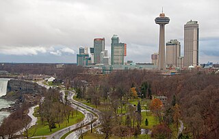
Niagara Falls is a city in Ontario, Canada, adjacent to, and named after, Niagara Falls. As of the 2021 census, the city had a population of 94,415. The city is located on the Niagara Peninsula along the western bank of the Niagara River, which forms part of the Canada–United States border, with the other side being the twin city of Niagara Falls, New York. Niagara Falls is within the Regional Municipality of Niagara and a part of the St. Catharines - Niagara Census Metropolitan Area (CMA).

The Battle of Lundy's Lane, also known as the Battle of Niagara or contemporarily as the Battle of Bridgewater, was fought on 25 July 1814, during the War of 1812, between an invading American army and a British and Canadian army near present-day Niagara Falls, Ontario. It was one of the bloodiest battles of the war, and one of the deadliest battles fought in Canada, with approximately 1,720 casualties including 258 killed.
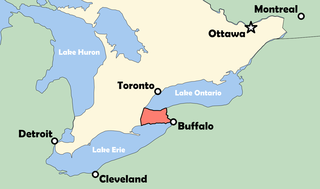
The Niagara Peninsula is an area of land lying between the southwestern shore of Lake Ontario and the northeastern shore of Lake Erie, in Ontario, Canada. Technically an isthmus rather than a peninsula, it stretches from the Niagara River in the east to Hamilton, Ontario, in the west. The peninsula is located in the Golden Horseshoe region of Southern Ontario, and has a population of roughly 1,000,000 residents. The region directly across the Niagara River and Lake Erie in New York State is known as the Niagara Frontier.
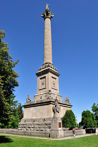
The Queenston Heights is a geographical feature of the Niagara Escarpment immediately above the village of Queenston, Ontario, Canada. Its geography is a promontory formed where the escarpment is divided by the Niagara River. The promontory forms a cliff face of approximately 100 m.

Queenston is a compact rural community and unincorporated place 5 kilometres (3.1 mi) north of Niagara Falls in the Town of Niagara-on-the-Lake, Ontario, Canada. It is bordered by Highway 405 to the south and the Niagara River to the east; its location at the eponymous Queenston Heights on the Niagara Escarpment led to the establishment of the Queenston Quarry in the area. Across the river and the Canada–US border is the village of Lewiston, New York. The Lewiston-Queenston Bridge links the two communities. This village is at the point where the Niagara River began eroding the Niagara Escarpment. During the ensuing 12,000 years the Falls cut an 11 kilometres (6.8 mi) long gorge in the Escarpment southward to its present-day position.
King's Highway 420, commonly referred to as Highway 420, is a 400-series highway in the Canadian province of Ontario that connects the Queen Elizabeth Way (QEW) with downtown Niagara Falls. It continues east as a limited-access expressway named Niagara Regional Road 420 to connect with the Rainbow Bridge international crossing between Canada and the United States over the Niagara River; this was part of Highway 420 until 1998. West of the QEW, the freeway ends at an at-grade intersection with Montrose Road. The highway has a speed limit of 80 kilometres per hour (50 mph), making it the only 400-series highway to have a speed limit less than 100 kilometres per hour (62 mph) for its entirety.
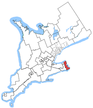
Niagara Falls is a federal electoral district in Ontario, Canada, that has been represented in the House of Commons of Canada since 1953.

Niagara Centre is a federal electoral district in the Niagara Region of Ontario that has been represented in the House of Commons of Canada from 1867 to 1988 and since 1997.

Ball's Falls, also known as Balls Mills, Louthe Mills and Glen Elgin, is a historical ghost town located in what is now a part of Jordan in the Niagara region, Ontario, Canada, which dates back to the early 19th century. It is now preserved as a conservation area operated by the Niagara Peninsula Conservation Authority.

The Niagara Falls Memorial Arena was an ice arena located in Niagara Falls, Ontario, Canada. Built in 1950, it served as the home of several junior ice hockey teams, including the Niagara Falls Flyers, Niagara Falls Thunder, and Niagara Falls Canucks. It was later purchased and converted into a museum, known as the Sand Sculpture Exibition. The arena was demolished in July 2024.
King's Highway 20, commonly referred to as Highway 20, is a provincially maintained highway in the Canadian province of Ontario. Presently, it is a short 1.9 km (1.2 mi) stub between Highway 58 and Niagara Regional Road 70 in the City of Thorold, but until 1997 it connected Hamilton to Niagara Falls, serving several towns atop the Niagara Escarpment en route.

Mackenzie House is a historic building and museum in Toronto, Ontario, Canada that was the last home of William Lyon Mackenzie, the city's first mayor. It is now a museum operated by the City of Toronto's Museum and Heritage Services.
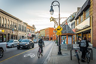
Downtown St. Catharines is the central business district of St. Catharines, Ontario, Canada. It is defined by the city as the area between Highway 406 on the west and south, Geneva Street on the east until it reaches St. Paul Street then Welland Avenue north until it meets Niagara Street.

Willoughby Township is the rural southern portion of Niagara Falls, Ontario, between the village of Chippawa and the boundary with Fort Erie. Included is historic Navy Island in the Niagara River and the site of the Battle of Chippawa, fought between British and American forces on July 5, 1814. In 1970, most of the township merged with the city of Niagara Falls with the creation of the Regional Municipality of Niagara, ending county government in Niagara.

The Rankine Generating Station is a former hydro-electric generating station along the Canadian side of the Niagara River in Niagara Falls, Ontario, slightly downstream from the older Toronto Power Generating Station. It was built in for the Canadian Niagara Power Company and named for company's founder William Birch Rankine, a New York City lawyer originally from Geneva, New York who died three days after the station opened in 1905 and renamed in 1927. Acquired by Niagara Mohawk Power Corporation in 1950 and in 2002, the station became a wholly owned subsidiary of FortisOntario. It was decommissioned in 2006.
The Niagara Falls Museum, in Niagara Falls, Ontario, was founded by Thomas Barnett in 1827. After a number of moves and varying fortunes it closed in 1998. The museum is known for housing the mummy of Ramesses I for 140 years before its return to Egypt in 2003.

Dufferin Islands are a group of artificial islands located 0.8 km from the Horseshoe Falls in Niagara Falls, Ontario. Before being renamed by the Niagara Parks Commission, they were known as Clarke Hill Islands and Cynthia Islands. The islands are decorated annually for the Winter Festival of Lights.

Stamford Township is a former incorporated and now geographic township in Upper Canada, later Ontario, on the Niagara Peninsula. In 1962 the township was amalgamated with the city of Niagara Falls, Ontario.
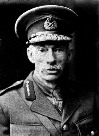
Ernest Alexander "E. A." Cruikshank, was a Canadian Brigadier General, a historian who specialized in military history and the first Chairman of the Historic Sites and Monuments Board of Canada.

Morningstar Mill is a 2.98-acre (1.21 ha) heritage site located in St. Catharines, Ontario, Canada. The site includes the Morningstar Mill, a sawmill, the home of the Morningstar family, a barn used for blacksmith demonstrations, and the Decew Falls gorge along the Niagara Escarpment. The site is operated by the volunteer group Friends of Morningstar Mill and owned by the City of St. Catharines. The gristmill was restored to working condition in 1992.


