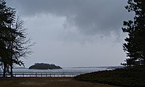
The Madawaska River is a river in the Saint Lawrence River drainage basin in Ontario, Canada. The river is 230 km (143 mi) long and drains an area of 8,470 km2 (3,270 sq mi). Its name comes from an Algonquian band of the region known as "Matouweskarini", meaning "people of the shallows".
The Brightsand River is a river in the James Bay drainage basin in Unorganized Thunder Bay District in northwestern Ontario, Canada.

Mississagi Provincial Park is a natural environment-class provincial park north of Elliot Lake, in Algoma District, Ontario, Canada. It lies on the Boland River, a tributary of the Little White River, which is itself a tributary of the Mississagi River. The park is accessed via Highway 639.

Awenda Provincial Park is a provincial park in Tiny Township, Simcoe County in Central Ontario, Canada, located on a peninsula jutting into Georgian Bay north of Penetanguishene. The park occupies an area of 2,915 hectares and was established in 1975. It is classified as a Natural Environment Park and therefore all land is protected.

Restoule Provincial Park is a provincial park in Parry Sound District in Central Ontario, Canada. It is located between Restoule Lake and Stormy Lake and extends along the banks of the Restoule River to its mouth at the French River in geographic Patterson Township and geographic Hardy Township. The park is located at the western terminus of Highway 534 northwest of Restoule, Ontario. The park offers three hiking trails and is home to coyotes, wolves, bears, otters, pine martens, moose and one of Ontario's largest white-tailed deer herds. It is also home to over 90 species of birds including the peregrine falcon and the heron. Camping areas include Bells Point, Putts Point and Kettle Point. Many hike the well-marked trail to the 100-foot (30 m) fire tower overlooking Stormy Lake. It is one of two provincial parks found in the Almaguin Highlands.
The Obabika River Provincial Park is a provincial park in Ontario, Canada, straddling across the boundaries of the Sudbury, Nipissing, and Timiskaming Districts. While it is named after and includes the Obabika River, the bulk of the park extends north of Obabika Lake to the eastern boundary of Lady Evelyn-Smoothwater Provincial Park.
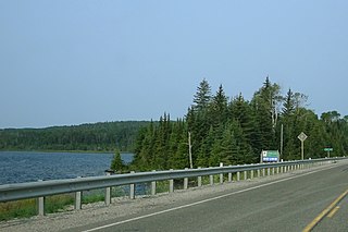
White Lake Provincial Park is a park in the Thunder Bay District of Northern Ontario, Canada, along Highway 17, north of Lake Superior.
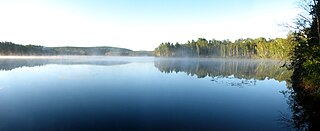
Lake St. Peter Provincial Park is a recreation-class provincial park in the municipality of Hastings Highlands, Hastings County, Ontario, Canada. It is operated by the Ontario Parks branch of the Ontario Ministry of Natural Resources and Forestry.
Blue Lake Provincial Park is a park in Kenora District, Ontario, Canada, located 10 kilometres (6 mi) northwest of the community of Vermilion Bay. It can be accessed via Ontario Highway 647.

Halfway Lake Provincial Park is a provincial park astride Ontario Highway 144 in Sudbury District in northeastern Ontario, Canada. It is operated by Ontario Parks and is named for Halfway Lake, which is entirely within the park grounds. The nearest settlement on Highway 144 is Cartier, about 25 kilometres (16 mi) to the south. The park contains more than a dozen lakes, including Antrim Lake, Bailey Lake, Benny Lake, Bittern Lake, Burnt Ridge Lake, Halfway Lake, Lodge Lake, Moosemuck Lake, Otter Lake, Raven Lake, Three Island Lake, Trapper Lake, and Two Narrows Lake. There are a mix of 221 electrical and non-electrical sites in the two campgrounds, 10 interior canoe-access sites located on Antrim Lake, Bailey Lake, and Trapper Lake, plus an additional five interior hike-access sites located along the Hawk Ridge Trail.

Woodland Caribou Provincial Park is a provincial park in Northwestern Ontario, Canada, west of the municipality of Red Lake. It borders Atikaki Provincial Park and Nopiming Provincial Park in eastern Manitoba, and is made up of Canadian Shield and boreal forest. Woodland Caribou Provincial Park is a wilderness park of 450,000 hectares, and it became part of the Pimachiowin Aki UNESCO World Heritage Site in 2018.

Murphys Point Provincial Park is a provincial park near Perth, Ontario, Canada. The 1,239-hectare (3,060-acre) park features natural areas prepared for hiking and skiing as well as access for day-use camping and water sports at Big Rideau Lake. Facilities include a park store, visitor centre and several "comfort centres", with flush toilets, showers and laundry facilities for the multi-day camper.

Ivanhoe Lake is a 25-kilometre (16 mi) long, narrow lake in the Unorganized North Part of Sudbury District in Northeastern Ontario, Canada. It is on the Ivanhoe River in the James Bay drainage basin and is located 8 kilometres (5 mi) southwest of Foleyet on Ontario Highway 101. The lake is substantially encompassed by Ivanhoe Lake Provincial Park, except for some private cottages at the northeast end of the lake. The lake is known as Pishkanogami in the Anishinaabe language, and was once the site of Pishkanogami Post, a Hudson's Bay Company trading post. It was renamed Ivanhoe Lake in 1960.
Porphyry Island Provincial Park is a remote, non-operating protected area in Unorganized Thunder Bay District in northwestern Ontario, Canada. It is located on Porphyry Island off the tip of the Black Bay Peninsula on the North Shore of Lake Superior. The park features boreal forest, wetlands, and rocky shores with arctic species like encrusted saxifrage, insectivorous butterwort and the sedge. The island is also one of the few locations of devil's club east of the Rocky Mountains.
The Ivanhoe River is a river in Cochrane District and Sudbury District in Northeastern Ontario, Canada. The river is in the James Bay drainage basin and is a left tributary of the Groundhog River.
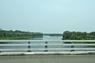
The Groundhog River is a river in Cochrane District and Sudbury District in Northeastern Ontario, Canada. The river is in the James Bay drainage basin and is a left tributary of the Mattagami River.

Sharbot Lake Provincial Park is a park under the auspices of Ontario Parks in the municipality of Central Frontenac, Frontenac County in Eastern Ontario, Canada. The park has an area of 80 hectares and was established in 1958.
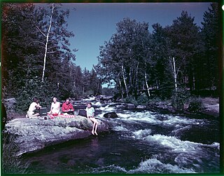
Rushing River Provincial Park is 20 kilometres (12 mi) southeast of Kenora, Ontario, Canada. It is a family campground at the mouth of the Rushing River where it enters Dogtooth Lake. It is a gateway to Eagle-Dogtooth Provincial Park, that borders on its east side.
René Brunelle Provincial Park is a provincial park in both the municipality of Moonbeam and the geographic Township of Gurney in Unorganized North Cochrane District, Cochrane District, in Northeastern Ontario, Canada. Established in 1957 and named in 1981 for René Brunelle, it is operated by Ontario Parks and has camping, hiking, swimming and other facilities on or near Remi Lake.

The Centennial Lake Provincial Nature Reserve is a provincial park located in the municipality of Greater Madawaska, Renfrew County, in Eastern Ontario, Canada. The 530-hectare (1,300-acre) reserve was created in 1989 and is managed by Ontario Parks.
