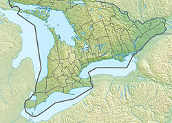
Fitzroy Provincial Park | |
---|---|
Location in Eastern Ontario | |
Location | Fitzroy Harbour, Ontario, Canada |
Nearest city | Ottawa, Ontario |
Coordinates | 45°28′57″N76°13′4″W / 45.48250°N 76.21778°W |
Area | 185 hectares (460 acres) |
Visitors | 112,980(in 2022 [2] ) |
Governing body | Ontario Parks |
Website | www |
Fitzroy Provincial Park is a provincial park on the Ottawa River in Ontario, Canada, designated as recreational-class by Ontario Parks. White pine covers much of the park. The park has century-old trees and a stand of 300-year-old bur oaks by the Carp River. There are two campgrounds within the park, both with comfort stations, a boat launch and park store. The main campgrounds have 235 campsites, 107 with electrical service, 205 with room for trailers, and a separate area with facilities for group camping and picnicking.
Cross-country skiing is available in the winter on trails maintained by the West Carleton Nordic Ski Club. [3]
Algonquin Provincial Park is an Ontario provincial park located between Georgian Bay and the Ottawa River, mostly within the Unorganized South Part of Nipissing District. Established in 1893, it is the oldest provincial park in Canada. Additions since its creation have increased the park to its current size of about 7,653 km2 (2,955 sq mi). The park is contiguous with several smaller, administratively separate provincial parks that protect important rivers in the area, resulting in a larger total protected area.
Achray is an unincorporated place and former railway point in geographic Stratton Township in the Unorganized South Part of Nipissing District in northeastern Ontario, Canada. It lies in northern Algonquin Provincial Park on the northern shore of Grand Lake, part of the Barron River system, and functions today as a campground site.
Lake Superior Provincial Park is one of the largest provincial parks in Ontario, covering about 1,550 square kilometres (600 sq mi) along the northeastern shores of Lake Superior between Sault Ste. Marie and Wawa in Algoma District in Northeastern Ontario, Canada. Ontario Highway 17 now runs through the park. When the park was established by Ontario in 1944, there was no road access.
Charleston Lake Provincial Park is located on Charleston Lake near Athens, Ontario, Canada, in the township of Leeds and the Thousand Islands.
Wheatley Provincial Park is a protected area in the municipality of Chatham–Kent in Southwestern Ontario, Canada. It is located on Lake Erie near the community of Wheatley and occupies an area of 241 hectares. Visitors to nearby Point Pelee National Park often camp at the park.
Garibaldi Provincial Park, also called Garibaldi Park, is a wilderness park located on the coastal mainland of British Columbia, Canada, 70 kilometres (43.5 mi) north of Vancouver. It was established in 1920 and named a Class A Provincial Park of British Columbia in 1927. The park is a popular destination for outdoor recreation, with over 30,000 overnight campers and over 106,000 day users in the 2017/2018 season.
Rock Point Provincial Park is a park located on the north shore of Lake Erie near the mouth of the Grand River in the Carolinian zone of southwestern Ontario. It occupies an area of 1.87 square kilometres (0.72 sq mi).
Bronte Creek Provincial Park is located in Oakville, Ontario, Canada, and is part of the Ontario Parks system.
Whiteshell Provincial Park is a provincial park in southeast Manitoba, approximately 120 kilometres (75 mi) east of the city of Winnipeg. The park is considered to be a Class II protected area under the IUCN protected area management categories. It is 275,210 hectares in size.
Tweedsmuir South Provincial Park is a provincial park covering parts of the eastern Kitimat Ranges, northern Pacific Ranges, and the Rainbow Range in British Columbia, Canada. It was established on May 21, 1938 in the western interior of the province, to protect its important natural features. The park hosts a variety of recreation activities for visitors. This park encompasses a range of diverse species in this park including bears, moose, and various fish. There are also a few at risk species in this park.
Lady Evelyn-Smoothwater Provincial Park is a remote wilderness park in northeastern Ontario, Canada, north of Lake Temagami. This operating park, requiring permits for all visitors, encompasses "rugged topography, clear lakes, stunning waterfalls, and rushing rivers".
Mactaquac Provincial Park is a Canadian provincial park with an area of 5.25 square kilometres (2.03 sq mi). It is located on the Saint John River 15 kilometres west of Fredericton, New Brunswick in the community of Mactaquac.
Rainbow Falls Provincial Park is a recreation-class provincial park within the Ontario Parks system. This 575-hectare (1,421-acre) park consists of two non-contiguous parts: Whitesand Lake campground in the main park, and the historic Rossport Campground, east of the fishing community of Rossport, Ontario, which provides campsites along the rough and rocky shorelines of Lake Superior.
Pinery Provincial Park is a provincial park located on Lake Huron near Grand Bend, Ontario. It occupies an area of 25.32 square kilometres. It is a natural environment-class Provincial Park created to help preserve oak savannah and the beach dune ecology. It has 1,275 sites of which 404 have electrical hookups. These include the yurt camping area and the group camping sites.
Sauble Falls Provincial Park is located in the town of South Bruce Peninsula, Bruce County in southwestern Ontario, Canada, 36 kilometres (22 mi) west of Owen Sound. It is in the lower drainage basin of the Sauble River, which flows into Lake Huron. The campground consists of two sections divided by County Road 13. The west section of the site is a quiet zone. Group camping is available in the east section. Many sites along the east portion of the park back up against the Sauble River. The park is also the downstream terminus of the Rankin River canoe route.
Murphys Point Provincial Park is a provincial park near Perth, Ontario, Canada. The 1,239-hectare (3,060-acre) park features natural areas prepared for hiking and skiing as well as access for day-use camping and water sports at Big Rideau Lake. Facilities include a park store, visitor centre and several "comfort centres", with flush toilets, showers and laundry facilities for the multi-day camper.
Voyageur Provincial Park is a provincial park located in eastern Ontario, Canada, opposite the once furious Long Sault rapids of the Ottawa River around which voyageurs portaged on their way upstream. Established in 1966, the park was formerly known as Carillon Provincial Park.
Sharbot Lake Provincial Park is a park under the auspices of Ontario Parks in the municipality of Central Frontenac, Frontenac County in Eastern Ontario, Canada. The park has an area of 80 hectares and was established in 1958.
Craigleith Provincial Park was established in 1967 by Ontario Parks. It is a recreation-class provincial park created to help preserve historic oil shale beach. Craigleith Provincial Park is a small park located between Collingwood and Thornbury on the southern shores of Georgian Bay.
Great Blue Heron Provincial Park is a recreational park in the central region of the Canadian province of Saskatchewan in the boreal forest ecozone of Canada. It is adjacent to the eastern boundary of Prince Albert National Park, about 50 kilometres (31 mi) north of the city of Prince Albert. The provincial park was established in 2013 from two pre-existing provincial recreation sites – Emma Lake and Anglin Lake Recreation Sites – and the addition of a large tract of Crown land.