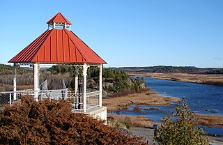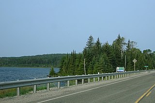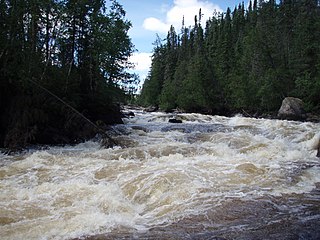
Algonquin Provincial Park is an Ontario provincial park located between Georgian Bay and the Ottawa River, mostly within the Unorganized South Part of Nipissing District. Established in 1893, it is the oldest provincial park in Canada. Additions since its creation have increased the park to its current size of about 7,653 km2 (2,955 sq mi). The park is contiguous with several smaller, administratively separate provincial parks that protect important rivers in the area, resulting in a larger total protected area.

The Spanish River is a river in Algoma District, Sudbury District and Greater Sudbury in Northeastern Ontario, Canada. It flows 338 kilometres (210 mi) in a southerly direction from its headwaters at Spanish Lake and Duke Lake to its mouth at the North Channel of Lake Huron just outside the community of Spanish.

The Goulais River is a river in northern Ontario, Canada, which rises in the Algoma highlands and empties into Goulais Bay on eastern Lake Superior near Sault Ste. Marie, Ontario. It is one of the largest tributaries on the eastern lake, draining an area of approximately 2,000 square kilometres (770 sq mi).

Quetico Provincial Park is a large wilderness park in Northwestern Ontario, Canada, known for its excellent canoeing and fishing. The 4,760 km2 (1,180,000-acre) park shares its southern border with Minnesota's Boundary Waters Canoe Area Wilderness, which is part of the larger Superior National Forest. These large wilderness parks are often collectively referred to as the Boundary Waters or the Quetico-Superior Country.

Mississagi Provincial Park is a natural environment-class provincial park north of Elliot Lake, in Algoma District, Ontario, Canada. It lies on the Boland River, a tributary of the Little White River, which is itself a tributary of the Mississagi River. The park is accessed via Highway 639.
The Pukaskwa River is a river in Thunder Bay District and Algoma District in Northern Ontario, Canada. It is in the Great Lakes Basin and is a tributary of Lake Superior, which it enters at the south end of Pukaskwa National Park. It is a remote, pristine, free-flowing, medium-sized Shield river, with lots of whitewater, best travelled in spring.
Spatsizi Plateau Wilderness Provincial Park is located in the northern portion of British Columbia, Canada, approximately 698, 659 hectares and encompasses the Spatsizi River and Gladys Lake Ecological Reserve. The park is a designated protected area that is intended for the conservation and research on caribou, grizzly bears, fish, and other wildlife species populations. Before the provincial park's establishment in 1975, the area was a historical hunting ground for local Indigenous communities like the Tahltan First Nations.It is the second largest provincial park in British Columbia.
The Obabika River Provincial Park is a provincial park in Ontario, Canada, straddling across the boundaries of the Sudbury, Nipissing, and Timiskaming Districts. While it is named after and includes the Obabika River, the bulk of the park extends north of Obabika Lake to the eastern boundary of Lady Evelyn-Smoothwater Provincial Park.

Lady Evelyn-Smoothwater Provincial Park is a remote wilderness park in northeastern Ontario, Canada, north of Lake Temagami. This operating park, requiring permits for all visitors, encompasses "rugged topography, clear lakes, stunning waterfalls, and rushing rivers".

White Lake Provincial Park is a park in the Thunder Bay District of Northern Ontario, Canada, along Highway 17, north of Lake Superior.
The Temagami River, formerly spelled as Timagami River, is a river in the Nipissing District of Ontario, Canada, in the Temagami region. Its source is Lake Temagami and flows through Cross Lake and Red Cedar Lake. It flows into the Sturgeon River at the community of River Valley.

The Chiniguchi Waterway Provincial Park consists of 9,368 ha (36.17 sq mi) of protected wilderness along the Chiniguchi River, Maskinonge Lake, Kukagami Lake, Wolf Lake and Matagamasi Lake in the Sudbury District of Ontario, that includes 336 hectares of Forest Reserve. The park is one of the several provincial parks located in the Sudbury area. It is managed by Ontario Parks. It contains the largest stand of old growth Red Pines.
The Makobe River is a river in northeastern Ontario, Canada. It is in the Saint Lawrence River drainage basin, and is a left tributary of the Montreal River.
Solace Provincial Park is a remote provincial park in Sudbury District, Ontario, Canada. It was established in 1985 and protects a series of lakes that provide backcountry canoeing opportunities. It is characterized by boreal forest, mostly jack pine conifer forest with mixed forest including white birch. The roadless park, with topography and scenery similar to the adjacent Lady Evelyn-Smoothwater Provincial Park, is considered as "one of the most isolated, wild places in Ontario."

The Kopka River is a river in northwestern Ontario, Canada. It forms at the height-of-land west of Lake Nipigon, flowing through rugged wilderness of Ontario's northern boreal forest, and drains into Wabinosh Lake.
St. Raphael Provincial Park is a provincial park in northern Ontario, Canada, roughly halfway between Sioux Lookout and Pickle Lake, straddling the boundary of Kenora and Thunder Bay Districts. It was established on May 22, 2003, and provides backcountry canoeing and camping opportunities.
The Turtle River–White Otter Lake Provincial Park is a large provincial park in Kenora and Rainy River Districts, roughly located between Ignace and Atikokan, Ontario, Canada. It has been recognized as a "natural area with unique biophysical, recreational, and cultural attributes."

The Aubinadong River is a river in Sudbury and Algoma Districts, Ontario, Canada. It is a right tributary of the Mississagi River.
The Aubinadong-Nushatogaini Rivers Provincial Park is a provincial park in Algoma District, Ontario, Canada. It protects a 85 kilometres (53 mi) network of rivers and lakes, in particular portions of the West Aubinadong and Nushatogaini Rivers, as well as a series of lakes extending south from the West Aubinadong-Nushatogaini confluence towards Ranger Lake, such as Saymo, Gong, Island, Mystery, and Friendly Lakes. As a waterway park, it includes a 200 metres (660 ft) strip of land along both banks of the rivers and along the shores of the lakes.

Nagagamisis Provincial Park is a provincial park in Algoma District, Ontario, Canada. It is located 32 kilometres (20 mi) north of Hornepayne, along Highway 631. It protects a large piece of land surrounding Nagagamisis Lake, as well as long linear sections along the Foch and Nagagami Rivers.


