
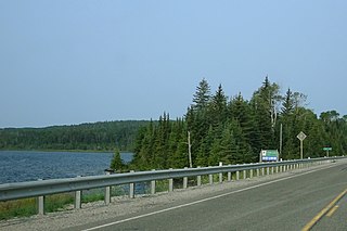
The Mattawa River is a river in central Ontario, Canada. It flows east from Trout Lake east of North Bay and enters the Ottawa River at the town of Mattawa. Counting from the head of Trout Lake, it is 76 kilometres (47 mi) long. The river's name comes from the Algonquin word for "meeting of waterways".

The Spanish River is a river in Algoma District, Sudbury District and Greater Sudbury in Northeastern Ontario, Canada. It flows 338 kilometres (210 mi) in a southerly direction from its headwaters at Spanish Lake and Duke Lake to its mouth at the North Channel of Lake Huron just outside the community of Spanish.

The Barron River is a river in the Saint Lawrence River drainage basin in Nipissing District and Renfrew County, Ontario, Canada. It flows from Clemow Lake in northern Algonquin Provincial Park and joins the Petawawa River, whose southern branch it forms, in the municipality of Laurentian Hills, near the municipality of Petawawa.
The Black Sturgeon River is a river in Thunder Bay District, Northwestern Ontario, Canada, located west of the Nipigon River, that flows to Lake Superior.
The Brightsand River is a river in the James Bay drainage basin in Unorganized Thunder Bay District in northwestern Ontario, Canada.

Mississagi Provincial Park is a natural environment-class provincial park north of Elliot Lake, in Algoma District, Ontario, Canada. It lies on the Boland River, a tributary of the Little White River, which is itself a tributary of the Mississagi River. The park is accessed via Highway 639.

The Steel River is a river in Thunder Bay District in northern Ontario, Canada. It empties into the north shore of Lake Superior east of Terrace Bay. Most of the river is protected in a provincial waterway park. It is a popular location for canoeing and fishing.
The Obabika River Provincial Park is a provincial park in Ontario, Canada, straddling across the boundaries of the Sudbury, Nipissing, and Timiskaming Districts. While it is named after and includes the Obabika River, the bulk of the park extends north of Obabika Lake to the eastern boundary of Lady Evelyn-Smoothwater Provincial Park.
White Lake Provincial Park is a park in the Thunder Bay District of Northern Ontario, Canada, along Highway 17, north of Lake Superior.
The Temagami River, formerly spelled as Timagami River, is a river in the Nipissing District of Ontario, Canada, in the Temagami region. Its source is Lake Temagami and flows through Cross Lake and Red Cedar Lake. It flows into the Sturgeon River at the community of River Valley.
Rushing River Provincial Park is 20 kilometres (12 mi) southeast of Kenora, Ontario, Canada. It is a family campground at the mouth of the Rushing River where it enters Dogtooth Lake. It is a gateway to Eagle-Dogtooth Provincial Park, that borders on its east side.
The Makobe River is a river in northeastern Ontario, Canada. It is in the Saint Lawrence River drainage basin, and is a left tributary of the Montreal River.
West English River Provincial Park is a provincial park in Kenora District, Ontario, Canada. It spans 65 kilometres (40 mi) along the English River from Barnston Lake to Tide Lake and also includes all the shores and waters of Wegg, Goose, Wilcox, Unexpected, Oak, and Maynard Lakes. The park's notable features include old growth red and white pine stands at the northern extent of their range, and migmatites that are provincially-significant examples of metatexitic and diatexitic metasedimentary rocks. It borders on Tide Lake and Maynard Lake Provincial Nature Reserves.
Abitibi-De-Troyes Provincial Park is in Cochrane District of Northern Ontario, Canada. It was established in 1985 and provides backcountry canoeing, camping, hunting, fishing and nature viewing activities. The park is named after Pierre de Troyes who may have portaged across Long Point during his Hudson Bay expedition in 1686.
The East English River Provincial Park is a linear waterway park in Kenora District, Ontario, Canada. It includes a 200 metres (660 ft) wide strip of land on both sides of the English River and its lakes, from the intersection of Highway 599 to Minnitaki Lake. It was established in 2003 to protect natural features, that are representative of the area, and high quality recreational canoe routes with over 30 sets of rapids. The park's notable features include white pine forest at the northern extent of its range, white elm and burr oak, caribou habitat and calving locations, fisheries, and archaeological sites.
Solace Provincial Park is a remote provincial park in Sudbury District, Ontario, Canada. It was established in 1985 and protects a series of lakes that provide backcountry canoeing opportunities. It is characterized by boreal forest, mostly jack pine conifer forest with mixed forest including white birch. The roadless park, with topography and scenery similar to the adjacent Lady Evelyn-Smoothwater Provincial Park, is considered as "one of the most isolated, wild places in Ontario."

The Kopka River is a river in northwestern Ontario, Canada. It forms at the height-of-land west of Lake Nipigon, flowing through rugged wilderness of Ontario's northern boreal forest, and drains into Wabinosh Lake.
St. Raphael Provincial Park is a provincial park in northern Ontario, Canada, roughly halfway between Sioux Lookout and Pickle Lake, straddling the boundary of Kenora and Thunder Bay Districts. It was established on May 22, 2003, and provides backcountry canoeing and camping opportunities.
The Turtle River–White Otter Lake Provincial Park is a large provincial park in Kenora and Rainy River Districts, roughly located between Ignace and Atikokan, Ontario, Canada. It has been recognized as a "natural area with unique biophysical, recreational, and cultural attributes."
The Algoma Headwaters Provincial Park is a large provincial park in Algoma and Sudbury Districts, Ontario, Canada. It is undeveloped remote wilderness located about 90 kilometres (56 mi) northeast of Sault Ste. Marie, with little road access.

