List of provincial parks of Central Ontario

Last updated

This is a list of provincial parks in Central Ontario . These provincial parks are maintained by Ontario Parks. For a list of other provincial parks in Ontario, see the List of provincial parks in Ontario.
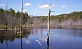
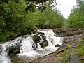
Contents

Dufferin County

NameEstablishedCommons categoryPictureCoordinates
Boyne Valley Provincial Park 1985 Boyne Valley Provincial Park
Boyne Valley Bridge.jpg
44°06′42″N80°06′34″W / 44.111666666667°N 80.109444444444°W / 44.111666666667; -80.109444444444
Hockley Valley Provincial Nature Reserve 1989 Hockley Valley Provincial Nature Reserve
Nottawasaga River tributary.jpg
43°59′06″N80°03′44″W / 43.985°N 80.0622°W / 43.985; -80.0622
Mono Cliffs Provincial Park 1985 Mono Cliffs Provincial Park
Mono Cliffs 10.jpg
44°02′48″N80°04′37″W / 44.0467°N 80.0769°W / 44.0467; -80.0769

Haliburton County

NameEstablishedPictureCoordinates
Dividing Lake Provincial Park 1985 45°24′13″N78°36′33″W / 45.403611111111°N 78.609166666667°W / 45.403611111111; -78.609166666667
Silent Lake Provincial Park 1977
SilentLake.jpg
44°55′15″N78°04′11″W / 44.9208°N 78.0697°W / 44.9208; -78.0697

Hastings County

NameEstablishedPictureCoordinates
Egan Chutes Provincial Nature Reserve 1989 45°04′49″N77°44′24″W / 45.080371°N 77.739862°W / 45.080371; -77.739862
Lake St. Peter Provincial Park 1971
Lake St. Peter.jpg
45°19′11″N78°01′17″W / 45.3197°N 78.0214°W / 45.3197; -78.0214
Menzel Centennial Provincial Nature Reserve 1997 44°21′30″N77°07′31″W / 44.358382°N 77.125391°W / 44.358382; -77.125391
Stoco Fen Provincial Nature Reserve 1985 44°27′43″N77°13′48″W / 44.4619445°N 77.23°W / 44.4619445; -77.23

Kawartha Lakes

NameEstablishedPictureCoordinates
Balsam Lake Provincial Park 1968
Balsam Lake Provincial Park at sunrise.jpg
44°37′58″N78°52′29″W / 44.6328°N 78.8746°W / 44.6328; -78.8746
Emily Provincial Park 1957 44°20′15″N78°32′06″W / 44.3375°N 78.535°W / 44.3375; -78.535
Indian Point Provincial Park 1989 44°38′04″N78°49′25″W / 44.634444444444°N 78.823611111111°W / 44.634444444444; -78.823611111111
Queen Elizabeth II Wildlands Provincial Park 2002
The Black River south of the Victoria Falls.JPG
44°50′00″N78°56′00″W / 44.8333°N 78.9333°W / 44.8333; -78.9333

Northumberland County

NameEstablishedCommons categoryPictureCoordinates
Ferris Provincial Park 1971 Ferris Provincial Park
Ferris Provincial Park and river from suspension bridge.jpg
44°17′31″N77°47′38″W / 44.291944444444°N 77.793888888889°W / 44.291944444444; -77.793888888889
Peter's Woods Provincial Nature Reserve 1976 44°07′43″N78°02′25″W / 44.1286111°N 78.0402778°W / 44.1286111; -78.0402778
Presqu'ile Provincial Park 1922 Presqu'ile Provincial Park
PresquileParkMarsh23.jpg
43°59′38″N77°42′47″W / 43.9939°N 77.7131°W / 43.9939; -77.7131

Muskoka District Municipality

NameEstablishedCommons categoryPictureCoordinates
Arrowhead Provincial Park 1971 Arrowhead Provincial Park
Arrowhead Lake.jpg
45°23′30″N79°11′55″W / 45.3917°N 79.1986°W / 45.3917; -79.1986
Big East River Provincial Park 2000 45°28′05″N79°04′58″W / 45.468055555556°N 79.082777777778°W / 45.468055555556; -79.082777777778
Bigwind Lake Provincial Park 1985 45°04′15″N79°01′26″W / 45.070833333333°N 79.023888888889°W / 45.070833333333; -79.023888888889
Gibson River Provincial Park 1968 44°56′24″N79°41′59″W / 44.93996°N 79.69985°W / 44.93996; -79.69985
Hardy Lake Provincial Park 1985 Hardy Lake Provincial Park
HardyLake1.jpg
45°00′40″N79°31′28″W / 45.011111111111°N 79.524444444444°W / 45.011111111111; -79.524444444444
J. Albert Bauer Provincial Park 1985 45°24′19″N79°01′11″W / 45.405277777778°N 79.019722222222°W / 45.405277777778; -79.019722222222
O'Donnell Point Provincial Nature Reserve 1985 45°04′54″N80°02′52″W / 45.08162°N 80.04767°W / 45.08162; -80.04767
Oxtongue River-Ragged Falls Provincial Park 1985 45°24′43″N78°53′40″W / 45.411944444444°N 78.894444444444°W / 45.411944444444; -78.894444444444
Six Mile Lake Provincial Park 1958 Six Mile Lake Provincial Park
Biberburg 2.jpg
44°53′56″N79°45′29″W / 44.899°N 79.758°W / 44.899; -79.758

Peterborough County

NameEstablishedCommons categoryPictureCoordinates
Kawartha Highlands Provincial Park 1989 Kawartha Highlands Provincial Park
CopperLake.jpg
44°45′N78°15′W / 44.75°N 78.25°W / 44.75; -78.25
Mark S. Burnham Provincial Park 1955 44°18′00″N78°16′09″W / 44.3°N 78.269166666667°W / 44.3; -78.269166666667
Petroglyphs Provincial Park 1981 Petroglyphs Provincial Park
Cast of boat.jpg
44°36′55″N78°02′27″W / 44.6152°N 78.0408°W / 44.6152; -78.0408
Quackenbush Provincial Park 1985 44°33′40″N78°00′07″W / 44.561111111111°N 78.001944444444°W / 44.561111111111; -78.001944444444
Serpent Mounds Provincial Park 1957
Serpent Mounds NHS.jpg
44°12′33″N78°09′17″W / 44.209166666667°N 78.154722222222°W / 44.209166666667; -78.154722222222
Wolf Island Provincial Park 1985 44°33′46″N78°15′02″W / 44.562777777778°N 78.250555555556°W / 44.562777777778; -78.250555555556

Prince Edward County

NameEstablishedPictureCoordinates
Lake on the Mountain Provincial Park 1957
Lake on the Mountain.JPG
44°02′02″N77°03′32″W / 44.034°N 77.059°W / 44.034; -77.059
North Beach Provincial Park 1970 43°57′28″N77°31′37″W / 43.957777777778°N 77.526944444444°W / 43.957777777778; -77.526944444444
Sandbanks Provincial Park 1990
Lake Ontario - Sandbanks Provincial Park 2001.jpg
43°54′00″N77°16′00″W / 43.9°N 77.2667°W / 43.9; -77.2667
Timber Island Provincial Nature Reserve 1985 43°57′25″N76°50′19″W / 43.956944444444°N 76.838611111111°W / 43.956944444444; -76.838611111111

Simcoe County

NameEstablishedCommons categoryPictureCoordinates
Awenda Provincial Park 1975 Awenda Provincial Park
Awenda - panoramio (1).jpg
44°50′30″N79°59′21″W / 44.8417°N 79.9891°W / 44.8417; -79.9891
Bass Lake Provincial Park 1957 44°36′16″N79°28′51″W / 44.604444444444°N 79.480833333333°W / 44.604444444444; -79.480833333333
Beattie Pinery Provincial Park 1997 Beattie Pinery Provincial Nature Reserve
Beattie Pinery Entrance.jpg
44°07′27″N79°51′34″W / 44.12405°N 79.859516°W / 44.12405; -79.859516
Devil's Glen Provincial Park 1965 44°21′38″N80°12′27″W / 44.360555555556°N 80.2075°W / 44.360555555556; -80.2075
Earl Rowe Provincial Park 1964 Earl Rowe Provincial Park
Earl Rowe Provincial Park view from beach, August 2020.jpg
44°09′28″N79°54′18″W / 44.157777777778°N 79.905°W / 44.157777777778; -79.905
Mara Provincial Park 1970 Mara Provincial Park
Lake Simcoe beach Mara Provincial Park.JPG
44°35′13″N79°21′36″W / 44.587°N 79.36°W / 44.587; -79.36
McRae Point Provincial Park 1971 44°34′17″N79°19′41″W / 44.571388888889°N 79.328055555556°W / 44.571388888889; -79.328055555556
Noisy River Provincial Nature Reserve 1989 Noisy River Provincial Nature Reserve
Noisy River.jpg
44°16′14″N80°11′30″W / 44.270605°N 80.191803°W / 44.270605; -80.191803
Nottawasaga Lookout Provincial Nature Reserve 1994 44°24′27″N80°15′02″W / 44.407598°N 80.250629°W / 44.407598; -80.250629
Springwater Provincial Park 1958 44°26′23″N79°45′41″W / 44.439722222222°N 79.761388888889°W / 44.439722222222; -79.761388888889
Wasaga Beach Provincial Park 1959
Wasaga Beach 3 db.jpg
44°29′38″N80°01′18″W / 44.493888888889°N 80.021666666667°W / 44.493888888889; -80.021666666667
Waubaushene Beaches Provincial Park 1969 44°44′53″N79°43′12″W / 44.74805°N 79.72004°W / 44.74805; -79.72004

Related Research Articles

Ontario Parks is the Ontario government agency in Ontario, Canada, that protects significant natural and cultural resources in a system of parks and protected areas that is sustainable and provides opportunities for inspiration, enjoyment and education. The Ontario Parks system covers over 78,000 square kilometres (30,000 sq mi), which is about 10 percent of the province's surface area or the equivalent of an area approximately equal to Nova Scotia. It falls under the responsibility and mandate of the province's Ministry of the Environment, Conservation and Parks. It was formerly under the mandate of the Ministry of Natural Resources and Forestry.

Polar Bear Provincial Park is an isolated wilderness park in the far north of Ontario, Canada. It lies on the western shore where James Bay joins Hudson Bay. The terrain is part of the Hudson Bay Lowlands and features unspoiled low-lying tundra in the Hudson Plains ecozone.

Tidewater Provincial Park

Tidewater Provincial Park is a provincial park located on five islands in the Moose River estuary between Moosonee and Moose Factory, Ontario, Canada:

Inverhuron Provincial Park

Inverhuron Provincial Park is a provincial park located on the shores of Lake Huron beside the small village of Inverhuron, Ontario, near Tiverton, Ontario, Canada. The Park opened in 1956.

Queen Elizabeth II Wildlands Provincial Park Provincial park in Ontario

The Queen Elizabeth II Wildlands Provincial Park is a provincial park in south-central Ontario, Canada, between Gravenhurst and Minden. The park, named for Elizabeth II, Queen of Canada, is 33,505 hectares in size, making it the second largest park south of Algonquin Park, but it has a fragmented shape as a result of many private lands within its boundary.

Foy Provincial Park

Foy Provincial Park is a provincial park on Round Lake, Ontario. Since it is non-operational, camping is prohibited, but day use activities such as swimming and hiking are permitted. The park property includes facilities used by the Ontario Ranger program of the Ministry of Natural Resources.

Upper Madawaska River Provincial Park

Upper Madawaska River Provincial Park is a waterway-class provincial park on the Madawaska River in the Municipality of South Algonquin in Nipissing District, Ontario, Canada. The park consists of a strip of land along both shores of the Madawaska River from the communities of Whitney to Madawaska. It is upstream and north of the Lower Madawaska River Provincial Park.

King's Highway 51, commonly referred to as Highway 51, was a provincially maintained highway in the Canadian province of Ontario that connected Highway 3 in Eatonville with Rondeau Provincial Park. An earlier designation existed south of Orangeville, connecting Highway 24 with Highway 10 in Caledon Village. This iteration was assumed in 1938, but later renumbered as Highway 24 In 1961. The more recent incarnation of the route number was assumed in 1970, but then decommissioned in 1997 and transferred to what is now the city of Chatham-Kent.

Woodland Caribou Provincial Park

Woodland Caribou Provincial Park is a provincial park in Northwestern Ontario, Canada, west of the municipality of Red Lake. It borders Atikaki Provincial Park and Nopiming Provincial Park in eastern Manitoba, and is made up of Canadian Shield and boreal forest. Woodland Caribou Provincial Park is a wilderness park of 450,000 hectares, and it became part of the Pimachiowin Aki UNESCO World Heritage Site in 2018.

Fitzroy Provincial Park

Fitzroy Provincial Park is a provincial park on the Ottawa River in Ontario, designated as recreational-class by Ontario Parks. White pine covers much of this park. The park has century-old trees and a stand of 300-year-old bur oaks by the Carp River. There are two campgrounds within the park, both with comfort stations, a boat launch and park store. The main campgrounds have 235 campsites, 107 with electrical service, 205 with room for trailers, and a separate area with facilities for group camping and picnicking.

Driftwood Provincial Park

Driftwood Provincial Park is a provincial park on the south shore of the Ottawa River, about 40 kilometres (25 mi) west of Deep River, Ontario. It is administered by Ontario Parks which classifies it as a recreation park.

Sharbot Lake Provincial Park

Sharbot Lake Provincial Park is a park under the auspices of Ontario Parks in the municipality of Central Frontenac, Frontenac County in Eastern Ontario, Canada. The park has an area of 80 hectares and was established in 1958.