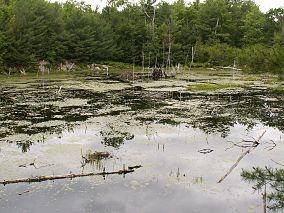
Ross Lake National Recreation Area is a US national recreation area in north central Washington just south of the Canada–US border. It is the most accessible part of the North Cascades National Park Complex which also includes North Cascades National Park and Lake Chelan National Recreation Area. Ross Lake NRA follows the Skagit River corridor from the Canada–US border to the western foothills of the Cascades. The NRA contains a portion of scenic Washington State Route 20, the North Cascades Highway, and includes three reservoirs: 12,000-acre (4,900 ha) Ross Lake, 910-acre (370 ha) Diablo Lake, and 210-acre (85 ha) Gorge Lake. These reservoirs make up the Skagit River Hydroelectric Project operated by Seattle City Light. Nestled in the "American Alps" the Ross Lake NRA bisects the north and south units of North Cascades National Park.
Six Mile Lake is in the Township of Georgian Bay, Muskoka, Ontario and has a Provincial Park.

Miquelon Lake Provincial Park is a provincial park in Alberta, Canada, about 65 kilometres southeast of the city of Edmonton. The park features several lakes, the largest of them being Miquelon Lake.

Killarney Provincial Park is a provincial park in central Ontario, Canada.

Canim Beach Provincial Park is a provincial park in British Columbia, Canada, located at the southwest end of Canim Lake in the Interlakes District of the South Cariboo region, adjacent to the Secwepemc Indian reserve community of Canim Lake, British Columbia just northeast of 100 Mile House. The park was established by Order-in-Council in 1956 and expanded by later legislation in 2000 and 2004 to total a current approximate of 8.2 hectares, 3.6 hectares of upland and 4.6 hectares of foreshore.
Cinnemousun Narrows Provincial Park is a provincial park in British Columbia, Canada, located on Shuswap Lake at the convergence of the lake's four arms.
Downing Provincial Park is a provincial park in British Columbia, Canada, created when Mr. and Mrs. Clair Downing donated their half-mile of lake frontage property on Kelly Lake. The park's size, including the 97 acres (0.39 km2) donated by the Downings, is 156 hectares. It is located adjacent to the British Columbia Railway line and the Pavilion Mountain Road about 30 km west of Clinton, at the junction with the road to Jesmond and Kostering.
Flat Lake Provincial Park is a provincial park in British Columbia, Canada. It features a number of interconnected lakes referred to as the "Davis Lake Chain" by locals. The park is located southwest of the municipalities of 100 Mile House and Lone Butte.
Green Lake Provincial Park is a provincial park in British Columbia, Canada, located around Green Lake in the South Cariboo-Interlakes district just east of 70 Mile House.
Kootenay Lake Provincial Park is a provincial park in British Columbia, Canada. It encompasses five widely dispersed parks around Kootenay Lake: Kootenay Lake Provincial Park, Kootenay Lake Provincial Park, Kootenay Lake Provincial Park, Kootenay Lake Provincial Park, and Kootenay Lake Provincial Park.
Kikomun Creek Provincial Park is a provincial park in British Columbia, Canada.

Klewnuggit Inlet Marine Provincial Park is a provincial park in British Columbia, Canada, located on the east side of Grenville Channel, 100 kilometres southeast of Prince Rupert, in the Range 4 Coast Land District.
Meziadin Lake Provincial Park is a provincial park in British Columbia, Canada. It sits 40 miles (64 km) east of Stewart, British Columbia.
Monkman Provincial Park is a provincial park in British Columbia, southwest of Tumbler Ridge and northeast of Hansard. Like Monkman Pass, Monkman Lake, Monkman Creek and Monkman Falls, it was named after Alexander Monkman.
Moose Valley Provincial Park is a provincial park in British Columbia, Canada, located in the South Cariboo region 31 km west of 100 Mile House.
Porcupine Meadows Provincial Park is a 2,704 hectare provincial park in British Columbia, Canada, located north of Tranquille Lake to the northwest of Kamloops. Its name is a direct translation of the Shuswap word for this area, "pisitsoolsia", named so for the numerous porcupine in the area.

Ross Lake Provincial Park is a provincial park in British Columbia, Canada. The park is located within the asserted traditional territory of the Gitxsan people, south of Nine Mile Mountain, just east of Hazelton in the Skeena Country.
Ruth Lake Provincial Park is a provincial park in British Columbia, Canada, located northeast of 100 Mile House.

Sugarbowl-Grizzly Den Provincial Park and Protected Area is a provincial park in British Columbia, Canada.

Ten Mile Lake Provincial Park is a provincial park in the Cariboo Land District of British Columbia, Canada, ten miles (16 km) north of the city of Quesnel. The park is situated within the Fraser Plateau and Basin complex, in a transition area between the wetter Quesnel Highland to the east, and the dry Chilcotin Plateau to the west.


