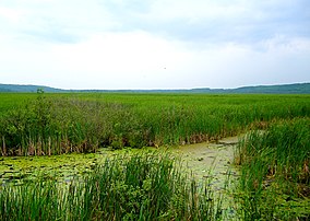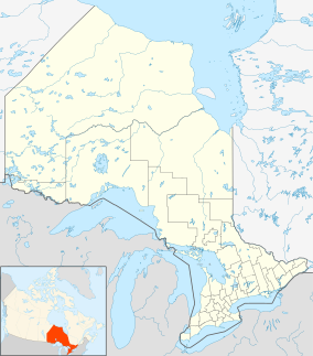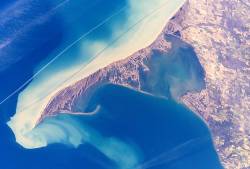
Long Point is a sand spit and medium-sized hamlet on the north shore of Lake Erie, part of Norfolk County in the province of Ontario, Canada.
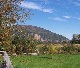
The Cap Tourmente National Wildlife Area is a National Wildlife Area (NWA) located on the north shore of the Saint Lawrence River in the National Provincial Capital Region of Quebec, established on 28 April 1978. It is one of the critical habitats for the greater snow goose during migration. Flocks of tens of thousands of these birds stop over to feed on the bullrushes in the spring and fall. The tidal marsh was recognized as a wetland of international significance per the Ramsar Convention in 1981, the first North American site to receive that distinction.

Midland is a town located on Georgian Bay in Simcoe County, Ontario, Canada. It is part of the Huronia/Wendat region of Central Ontario.

The trumpeter swan is a species of swan found in North America. The heaviest living bird native to North America, it is also the largest extant species of waterfowl, with a wingspan of 185 to 304.8 cm. It is the American counterpart and a close relative of the whooper swan of Eurasia, and even has been considered the same species by some authorities. By 1933, fewer than 70 wild trumpeters were known to exist, and extinction seemed imminent, until aerial surveys discovered a Pacific population of several thousand trumpeters around Alaska's Copper River. Careful reintroductions by wildlife agencies and the Trumpeter Swan Society gradually restored the North American wild population to over 46,000 birds by 2010.

The Tantramar Marshes, also known as the Tintamarre National Wildlife Area, is a tidal saltmarsh around the Bay of Fundy on the Isthmus of Chignecto. The area borders between Route 940, Route 16 and Route 2 near Sackville, New Brunswick. The government of Canada proposed the boundaries of the Tantramar Marshes in 1966 and was declared a National Wildlife Area in 1978.
The St. Clair National Wildlife Area is a nature reserve located in the southwestern part of the Canadian province of Ontario, on eastern Lake St. Clair, west of Chatham. It consists of two properties: St. Clair and Bear Creek, about 16 km apart.

The Tiny Marsh Provincial Wildlife Area, located in Simcoe County, Central Ontario, Canada, is Ontario’s first provincially owned and managed wetland and is one of approximately 1200 Important Bird Areas recognized in Canada. The marsh is situated near Elmvale, approximately three kilometres inland from Nottawasaga Bay. Open to visitors year-round, the area consists of 8.5 square kilometres (3.3 sq mi) of marshes, open water, bog, and upland forest. There are 25 kilometres (16 mi) of trails taking visitors to dikes, two observation towers, a marsh viewing mound, and a boardwalk. There is a nature centre, featuring displays of the marsh and its flora and fauna.
Grays Lake is a wetland in Idaho, United States. It lies in Bonneville County and Caribou County. Grays Lake National Wildlife Refuge was established in the area in 1965. Ranching is the predominant use of surrounding lands.

Oak Hammock Marsh is a marsh and a wildlife management area located 34 kilometres (21 mi) north of Winnipeg, Manitoba, Canada. The WMA is considered to be a Class IV protected area under the IUCN protected area management categories. The marsh is recognized as an Important Bird Area (IBA) for its globally significant numbers of waterfowl and shorebirds. It is a designated Ramsar site due to its international importance as a breeding and staging area for waterfowl and other migratory birds. It is 3,578.47 hectares in size.
Delta Marsh consists of an extensive open marsh located near the south shore of Lake Manitoba, approximately 24 km north of the town of Portage la Prairie, Manitoba. The marsh extends for nearly 30 km along the shore of the lake, and has a breadth of up to 4 km. The marsh consists of a network of interconnected shallow bays separated from Lake Manitoba by a wooded barrier dune ridge of 300m to 600m width.

Pointe Mouillee State Game Area (; pointmoo-yay or is a state game area in the U.S. state of Michigan. It encompasses 7,483 acres of hunting, recreational, and protected wildlife and wetland areas at the mouth of the Huron River at Lake Erie, as well as smaller outlying areas within the Detroit River. Pointe Mouillee State Game Area was established in 1945 and is administered by the Michigan Department of Natural Resources.
Banner Marsh State Fish and Wildlife Area is an Illinois state park covering 4,363 acres (1,766 ha) in Fulton County, Illinois, United States.
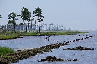
The Swanquarter National Wildlife Refuge is located in Hyde County, North Carolina near the village of Swan Quarter. The area is a federally protected land and home to many species of wildlife and waterfowl. The refuge is administered from the nearby Mattamuskeet National Wildlife Refuge. The refuge has a total area of 16,411 acres (66.41 km2).
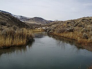
The Ana River is a short spring-fed river in south-central Oregon. It is on the northwestern edge of the Great Basin drainage. It flows 7 miles (11 km) from springs at the foot of Winter Ridge through high desert, range, and wetlands before emptying into Summer Lake. For most of its course, the Ana River flows through the Summer Lake Wildlife Area, which is maintained by the Oregon Department of Fish and Wildlife. The river provides habitat for many mammal and bird species, as well as several fish species, including the rare Summer Lake Tui chub. The largest hybrid striped bass ever caught in Oregon was taken from Ana Reservoir in 2009.

The Summer Lake Wildlife Area is a 29.6-square-mile (77 km2) wildlife refuge located on the northwestern edge of the Great Basin drainage in south-central Oregon. It is administered by the Oregon Department of Fish and Wildlife. The refuge is an important stop for waterfowl traveling along the Pacific Flyway during their spring and fall migrations. The Summer Lake Wildlife Area also provides habitat for shorebirds and other bird species as well as wide variety of mammals and several fish species. The Ana River supplies the water for the refuge wetlands.
Located in the southern part of British Columbia, Columbia National Wildlife Area was established to protect its wetlands and as a temporary home for migratory birds travelling to South America. The National Wildlife Area (NWA) is divided into four unit areas: Wilmer, Spillimacheen, Brisco and Harrogate, which are home to many diverse species of animals and plants which are significant in Canada.

Constitution Marsh is a 270-acre (110 ha) fresh water and brackish tidal marsh located between Constitution Island and the eastern shores of the Hudson River in Garrison, New York. Together with 80 acres (32 ha) of bordering woodlands, it forms the National Audubon Society's Constitution Marsh Audubon Center and Wildlife Sanctuary. Part of Hudson Highlands State Park, it is one of five major tidal marshes along the Hudson River. Constitution Marsh is an Audubon Important Bird Area, and has been listed as a New York State Bird Conservation Area since the early 2000s. It is also recognized by the New York State Department of State as both a Significant Coastal Fish and Wildlife Habitat and a Scenic Area of Statewide Significance.
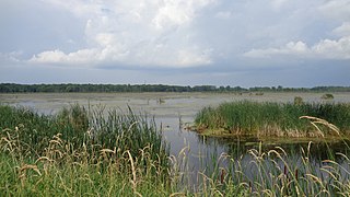
The Maple River State Game Area is a protected state game area in the U.S. state of Michigan. Located in the central region of the Lower Peninsula, it encompasses approximately 9,252 acres (3,744 ha) in segmented portions within Clinton, Gratiot, and Ionia counties. Governed by the Michigan Department of Natural Resources, the area is considered the state's longest contiguous wetland complex.

Foam Lake is a shallow lake in the aspen parkland ecoregion of the Canadian Province of Saskatchewan. It was named "Foam Lake" in 1882 by the Milligans because of the large amount of froth that forms on it. The lake and surrounding marsh are a protected area and important wildlife habitat. The primary inflows for the lake, Milligan Creek and Beckett Brook, originate to the south in the Touchwood Hills. From the north shore of the lake, Milligan Creek flows north-west into the salty Quill Lakes. The Quill Lakes are endorheic lakes as they have no outlet.

Magee Marsh Wildlife Area is a state wildlife area in Carroll Township, Ottawa County, Ohio, along the shore of Lake Erie. The marsh has a large seasonal population of waterfowl and other birds, making it a popular destination for birdwatching and hunting during migrations. It is managed by the Ohio Department of Natural Resources.
