The Nickel District Conservation Authority is a conservation authority in Greater Sudbury, Ontario. Formed in 1973 by the merger of two former conservation authorities in the region, the Junction Creek Conservation Authority in Sudbury and the Whitson Valley Conservation Authority in Valley East, the authority oversees the conservation, restoration, development and management of natural resources in the Sudbury area.

Sudbury, officially Greater Sudbury, is a city in Ontario, Canada. It is the largest city in Northern Ontario by population, with a population of 161,531 at the Canada 2016 Census. By land area, it is the largest in Ontario and the fifth largest in Canada. It is administratively a single-tier municipality, and thus not part of any district, county, or regional municipality.

Ontario is one of the 13 provinces and territories of Canada and is located in east-central Canada. It is Canada's most populous province accounting for 38.3 percent of the country's population, and is the second-largest province in total area. Ontario is fourth-largest jurisdiction in total area when the territories of the Northwest Territories and Nunavut are included. It is home to the nation's capital city, Ottawa, and the nation's most populous city, Toronto, which is also Ontario's provincial capital.
The NDCA has jurisdiction over an area of 7,576 square kilometres (2,925 sq mi), centred on the Wanapitei River, Vermilion River and Whitefish River watersheds. It also manages the Lake Laurentian Conservation Area in Sudbury.
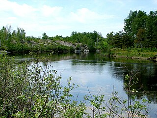
The Wanapitei River is a river in Northeastern Ontario, Canada. It is in the Great Lakes Basin and is a right tributary of the French River.

The Whitefish River is a river in Sudbury District in northeastern Ontario, Canada and a tributary of Lake Huron.

The Lake Laurentian Conservation Area is a 2,400 acres (970 ha) conservation area in Greater Sudbury, Ontario. Extending from the southeastern shore of Lake Ramsey to the Southeast Bypass, the park incorporates a large green space, several lakes, a self-guided nature trail, wetland areas, hiking trails, bird watching areas, and snowshoeing and cross-country ski trails in winter.
The authority is overseen by a seven-member board appointed by the City of Greater Sudbury.

Nickel Belt is one of two federal electoral districts serving the city of Greater Sudbury, Ontario, Canada. It has been represented in the House of Commons of Canada since 1953.

Sudbury is a federal electoral district in Ontario, Canada, that has been represented in the House of Commons of Canada since 1949. The district is one of two serving the city of Greater Sudbury, Ontario.

Valley East is a district of the city of Greater Sudbury, Ontario, Canada.

Nickel Centre was a town in Ontario, Canada, which existed from 1973 to 2000.
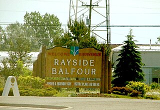
Rayside-Balfour was a town in Ontario, Canada, which existed from 1973 to 2000.

Onaping Falls was a town in the Canadian province of Ontario, which existed from 1973 to 2000. It was created as part of the Regional Municipality of Sudbury, and took its name from the waterfalls on the Onaping River.
Dynamic Earth is an interactive science museum in Greater Sudbury, Ontario, Canada. Owned and operated by Science North, Dynamic Earth is an earth sciences museum which builds on the city's mining heritage, focusing principally on geology and mining history exhibitions.
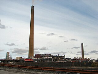
The Inco Superstack in Sudbury, Ontario, with a height of 380 metres (1,250 ft), is the tallest chimney in Canada and the Western hemisphere, and the second tallest freestanding chimney in the world after the GRES-2 Power Station in Kazakhstan. It is also the second tallest freestanding structure of any type in Canada, behind the CN Tower but ahead of First Canadian Place. It is the 40th tallest freestanding structure in the world. The Superstack is located on top of the largest nickel smelting operation in the world at Vale Inco's Copper Cliff processing facility in the city of Greater Sudbury.
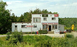
Wanup is a community in the Ontario city of Greater Sudbury. Formerly an unincorporated community in the geographic township of Dill, Wanup was annexed into Greater Sudbury on January 1, 2001 when that city was created by amalgamating the former Regional Municipality of Sudbury.
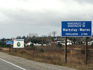
Markstay-Warren is a town in the Canadian province of Ontario, located in the Sudbury District. Highway 17, from the city limits of Greater Sudbury to the Sudbury District's border with Nipissing District, lies entirely within Markstay-Warren. The town had a population of 2,656 in the Canada 2016 Census.
Happy Valley is a ghost town in the city of Greater Sudbury, Ontario, Canada. The community was first inhabited in 1906 by workers from the nearby mine at Garson. Not wanting to live in a state of dependency in the company town, they built this smaller town of humble shacks with narrow streets.
Timiskaming—Cochrane was a federal electoral district in Ontario that was represented in the House of Commons of Canada from 1997 to 2003. It was located in the northeast part of Ontario. This riding was created in 1996 from parts of Cochrane—Superior, Nipissing, Timiskaming—French River and Timmins—Chapleau ridings.
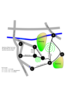
Cedar Hill is located in Northborough, Massachusetts. It is part of the larger Crane Swamp Conservation Area.

Nickel Belt is a provincial electoral district located in the Canadian province of Ontario. It elects one member to the Legislative Assembly of Ontario. The district is located in Northern Ontario and includes much of the eastern and southern parts of the District of Sudbury, as well as most of Greater Sudbury outside the city's urban core. Communities include Lively, Onaping, Levack, Dowling, Chelmsford, Naughton, Azilda, Coniston, Wahnapitae, Garson, Val Caron, Val Thérèse, Hanmer and Capreol.

Sudbury is a provincial electoral district in Ontario, Canada, that has been represented in the Legislative Assembly of Ontario since 1908. It is one of the two districts serving the city of Greater Sudbury.

The Greater Sudbury Museums are a network of four small community history museums in Greater Sudbury, Ontario. Three of the four are located on heritage properties in different neighbourhoods within the city, and the fourth is located in a library facility.

The Edison Building is a 1960s office building in Greater Sudbury, Ontario. Located at 5 Lindsley Street in the community of Falconbridge, the building was constructed in 1969 as the head office for Falconbridge Ltd.'s operations in the Sudbury area. The building was named after Thomas Edison, who was credited with the original ore discovery in the Falconbridge area.


