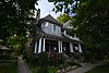
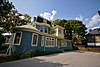
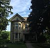
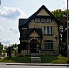
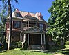
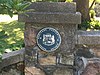
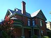
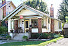
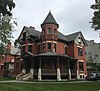
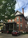
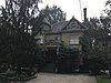
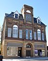
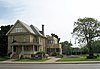
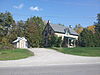
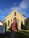
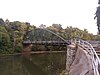
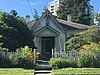
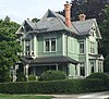
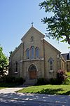
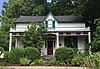
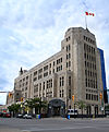
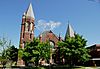
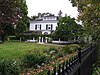
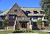
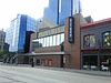
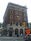
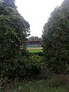
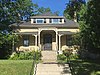
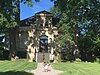
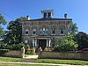
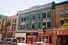
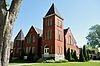
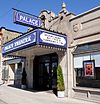
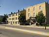
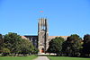
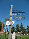
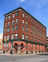
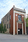
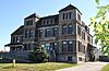
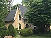
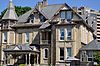
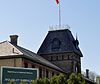
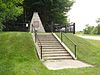
Name Address Coordinates Government recognition (CRHP № ) Image 37 Ridout Street South London ON 42°58′32″N 81°15′02″W / 42.9755°N 81.2506°W / 42.9755; -81.2506 (37 Ridout Street South ) London municipality (14087 ) More images 49 Ridout Street South London ON 42°58′29″N 81°15′00″W / 42.9748°N 81.25°W / 42.9748; -81.25 (49 Ridout Street South ) London municipality (14883 ) More images 64 Elmwood Avenue East London ON 42°58′14″N 81°15′29″W / 42.9705°N 81.2581°W / 42.9705; -81.2581 (64 Elmwood Avenue East ) London municipality (14284 ) 85 Albion Street London ON 42°59′19″N 81°15′42″W / 42.9886°N 81.2616°W / 42.9886; -81.2616 (85 Albion Street ) London municipality (14365 ) 165 Oxford Street East London ON 42°59′42″N 81°15′18″W / 42.995°N 81.255°W / 42.995; -81.255 (165 Oxford Street East ) London municipality (14046 ) 260 Sydenham Street London ON 42°59′50″N 81°15′06″W / 42.9972°N 81.2517°W / 42.9972; -81.2517 (260 Sydenham Street ) London municipality (14086 ) More images 308 Princess Avenue London ON 42°59′22″N 81°14′42″W / 42.9895°N 81.2451°W / 42.9895; -81.2451 (308 Princess Avenue ) London municipality (14864 ) 350 Talbot Street London ON 42°58′53″N 81°15′03″W / 42.9813°N 81.2509°W / 42.9813; -81.2509 (350 Talbot Street ) London municipality (14865 ) 379 Wortley Road London ON 42°57′46″N 81°14′51″W / 42.9627°N 81.2474°W / 42.9627; -81.2474 (379 Wortley Road ) London municipality (14871 ) 398 Piccadilly Street London ON 42°59′48″N 81°14′42″W / 42.9966°N 81.245°W / 42.9966; -81.245 (398 Piccadilly Street ) London municipality (14872 ) More images 437 Victoria Street London ON 43°00′23″N 81°14′52″W / 43.0063°N 81.2477°W / 43.0063; -81.2477 (437 Victoria Street ) London municipality (14089 ) 496 Waterloo Street London ON 42°59′23″N 81°14′40″W / 42.9896°N 81.2444°W / 42.9896; -81.2444 (496 Waterloo Street ) London municipality (14090 ) 501-503 Colborne Street London ON 42°59′18″N 81°14′28″W / 42.9883°N 81.2411°W / 42.9883; -81.2411 (501-503 Colborne Street ) London municipality (14884 ) 527 Princess Avenue London ON 42°59′31″N 81°14′11″W / 42.9919°N 81.2364°W / 42.9919; -81.2364 (527 Princess Avenue ) London municipality (14283 ) The Aeolian Hall London ON 42°59′27″N 81°13′30″W / 42.9907°N 81.2249°W / 42.9907; -81.2249 (The Aeolian Hall ) London municipality (4402 ) More images Banting House National Historic Site of Canada London ON 42°59′23″N 81°13′54″W / 42.9896°N 81.2318°W / 42.9896; -81.2318 (Banting House National Historic Site of Canada ) Federal (4021 ) More images Baty House London ON 42°56′40″N 81°11′37″W / 42.9444°N 81.1937°W / 42.9444; -81.1937 (Baty House ) London municipality (10781 ) Beth-Emmanuel British Methodist Episcopal Church London ON 42°58′48″N 81°14′06″W / 42.9799°N 81.2351°W / 42.9799; -81.2351 (Beth-Emmanuel British Methodist Episcopal Church ) London municipality (8429 ) More images Bishop Hellmuth Heritage Conservation District London ON 42°59′56″N 81°15′03″W / 42.9989°N 81.2508°W / 42.9989; -81.2508 (Bishop Hellmuth Heritage Conservation District ) London municipality (10788 ) Blackfriars Bridge London ON 42°59′20″N 81°15′26″W / 42.989°N 81.2573°W / 42.989; -81.2573 (Blackfriars Bridge ) London municipality (10079 ) More images Brick Street Cemetery London ON 42°57′19″N 81°16′50″W / 42.9554°N 81.2805°W / 42.9554; -81.2805 (Brick Street Cemetery ) London municipality (15190 ) Buchan House London ONLondon municipality (8569 ) More images Carfrae Cottage London ON 42°58′27″N 81°14′51″W / 42.9742°N 81.2474°W / 42.9742; -81.2474 (Carfrae Cottage ) London municipality (10811 ) Carling House London ON 42°59′58″N 81°15′21″W / 42.9995°N 81.2557°W / 42.9995; -81.2557 (Carling House ) London municipality (10814 ) Chestnut Hill London ON 42°57′37″N 81°15′53″W / 42.9602°N 81.2648°W / 42.9602; -81.2648 (Chestnut Hill ) London municipality (10904 ) More images Christ Anglican Church London ON 42°58′37″N 81°14′27″W / 42.977°N 81.2408°W / 42.977; -81.2408 (Christ Anglican Church ) London municipality (10183 ) More images Crooks Property London ON 42°59′23″N 81°14′11″W / 42.9897°N 81.2363°W / 42.9897; -81.2363 (Crooks Property ) London municipality (10910 ) Curnoe Property London ON 42°58′13″N 81°14′02″W / 42.9704°N 81.234°W / 42.9704; -81.234 (Curnoe Property ) London municipality (15305 ) Dominion Public Building London ON 42°59′06″N 81°15′04″W / 42.9851°N 81.2511°W / 42.9851; -81.2511 (Dominion Public Building ) Federal (3326 ), London municipality (10956 ) Dundas Centre United Church London ON 42°59′16″N 81°14′12″W / 42.9877°N 81.2367°W / 42.9877; -81.2367 (Dundas Centre United Church ) London municipality (10958 ) East Woodfield Heritage Conservation District London ON 42°59′28″N 81°14′10″W / 42.9912°N 81.2362°W / 42.9912; -81.2362 (East Woodfield Heritage Conservation District ) London municipality (10974 ) Upload Photo Eldon House London ON 42°59′05″N 81°15′19″W / 42.9846°N 81.2554°W / 42.9846; -81.2554 (Eldon House ) London municipality (8075 ) More images Elsie Perrin Williams Estate London ON 43°00′37″N 81°17′28″W / 43.0103°N 81.2912°W / 43.0103; -81.2912 (Elsie Perrin Williams Estate ) London municipality (11032 ) More images Elsie Perrin Williams Memorial Library London ON 42°59′11″N 81°14′39″W / 42.9863°N 81.2441°W / 42.9863; -81.2441 (Elsie Perrin Williams Memorial Library ) London municipality (11193 ) Fire Hall No. 5 London ON 42°58′52″N 81°13′43″W / 42.981°N 81.2285°W / 42.981; -81.2285 (Fire Hall No. 5 ) London municipality (11219 ) First Christian Reformed Church London ON 42°59′11″N 81°15′14″W / 42.9865°N 81.2539°W / 42.9865; -81.2539 (First Christian Reformed Church ) London municipality (11220 ) Flint Cottage and Flint Shelter London ON 42°57′26″N 81°19′21″W / 42.9571°N 81.3224°W / 42.9571; -81.3224 (Flint Cottage and Flint Shelter ) London municipality (11222 ) Forks of the Thames Interpretive Centre London ON 42°58′54″N 81°15′21″W / 42.9818°N 81.2559°W / 42.9818; -81.2559 (Forks of the Thames Interpretive Centre ) London municipality (11622 ) Goodholme London ON 43°00′41″N 81°15′26″W / 43.0113°N 81.2571°W / 43.0113; -81.2571 (Goodholme ) London municipality (10868 ) More images Grand Theatre London ON 42°59′09″N 81°15′03″W / 42.9859°N 81.2509°W / 42.9859; -81.2509 (Grand Theatre ) London municipality (13715 ) Grosvenor Lodge London ON 42°59′42″N 81°16′23″W / 42.9951°N 81.273°W / 42.9951; -81.273 (Grosvenor Lodge ) London municipality (10091 ) More images Hayman House London ON 42°59′36″N 81°13′20″W / 42.9933°N 81.2221°W / 42.9933; -81.2221 (Hayman House ) London municipality (11632 ) J. Allyn Taylor Building London ON 42°59′05″N 81°14′44″W / 42.9846°N 81.2455°W / 42.9846; -81.2455 (J. Allyn Taylor Building ) London municipality (13718 ) Labatt Memorial Park London ON 42°59′01″N 81°15′30″W / 42.9835°N 81.2584°W / 42.9835; -81.2584 (Labatt Memorial Park ) London municipality (10078 ) Lawson Site London ON 43°00′45″N 81°18′00″W / 43.0125°N 81.3°W / 43.0125; -81.3 (Lawson Site ) Ontario (1504 ) More images Loew's London Theatre London ON 42°59′03″N 81°14′54″W / 42.9842°N 81.2483°W / 42.9842; -81.2483 (Loew's London Theatre ) London municipality (14367 ) London and Western Trusts London ON 42°58′56″N 81°14′57″W / 42.9821°N 81.2491°W / 42.9821; -81.2491 (London and Western Trusts ) London municipality (11689 ) London Mechanics Institute Building London ON 42°59′03″N 81°14′49″W / 42.9843°N 81.2469°W / 42.9843; -81.2469 (London Mechanics Institute Building ) London municipality (11682 ) London Normal School London ON 42°58′14″N 81°15′04″W / 42.9706°N 81.2512°W / 42.9706; -81.2512 (London Normal School ) Ontario (8871 ) More images London Psychiatric Hospital London ON 43°00′14″N 81°12′16″W / 43.0038°N 81.2044°W / 43.0038; -81.2044 (London Psychiatric Hospital ) London municipality (11684 ) London Tower London ON 42°59′09″N 81°14′25″W / 42.9857°N 81.2404°W / 42.9857; -81.2404 (London Tower ) London municipality (11681 ) McClary Cottage (95 High Street) London ON 42°58′14″N 81°14′18″W / 42.9705°N 81.2384°W / 42.9705; -81.2384 (McClary Cottage (95 High Street) ) London municipality (14480 ) More images McClary Cottage (97 High Street) London ON 42°58′14″N 81°14′18″W / 42.9705°N 81.2384°W / 42.9705; -81.2384 (McClary Cottage (97 High Street) ) London municipality (14484 ) More images McClary House London ON 42°58′14″N 81°14′18″W / 42.9705°N 81.2384°W / 42.9705; -81.2384 (McClary House ) London municipality (14384 ) More images Middlesex County Court House London ON 42°58′56″N 81°15′15″W / 42.9821°N 81.2543°W / 42.9821; -81.2543 (Middlesex County Court House ) Federal (13537 ), 8873 ) More images New Brighton Housing Co-operative London ON 42°58′05″N 81°14′28″W / 42.968°N 81.2411°W / 42.968; -81.2411 (New Brighton Housing Co-operative ) London municipality (14443 ) More images Norton Attawandaron Site London ON 42°58′18″N 81°16′44″W / 42.9718°N 81.279°W / 42.9718; -81.279 (Norton Attawandaron Site ) London municipality (13721 ) ‘O’ Block, Wolseley Barracks London ON 43°00′00″N 81°14′00″W / 43°N 81.2333°W / 43; -81.2333 (‘O’ Block, Wolseley Barracks ) Federal (11281 ) Upload Photo Old East Heritage Conservation District London ON 42°59′38″N 81°13′35″W / 42.9939°N 81.2264°W / 42.9939; -81.2264 (Old East Heritage Conservation District ) London municipality (11863 ) Old Waterloo South Primary Public School London ON 42°58′45″N 81°14′19″W / 42.9791°N 81.2387°W / 42.9791; -81.2387 (Old Waterloo South Primary Public School ) London municipality (13724 ) Palace Theatre London ON 42°59′24″N 81°13′41″W / 42.9901°N 81.228°W / 42.9901; -81.228 (Palace Theatre ) London municipality (11868 ) Park Farm London ON 42°57′59″N 81°11′06″W / 42.9664°N 81.185°W / 42.9664; -81.185 (Park Farm ) London municipality (11881 ) Upload Photo Philip Aziz Property London ON 43°00′08″N 81°16′31″W / 43.0022°N 81.2752°W / 43.0022; -81.2752 (Philip Aziz Property ) London municipality (15471 ) More images Raleigh House London ON 42°59′31″N 81°15′22″W / 42.9919°N 81.2561°W / 42.9919; -81.2561 (Raleigh House ) London municipality (12428 ) Upload Photo Ridout Street Complex National Historic Site of Canada London ON 42°59′03″N 81°15′18″W / 42.9842°N 81.255°W / 42.9842; -81.255 (Ridout Street Complex National Historic Site of Canada ) Federal (12873 ) St. Paul's Cathedral London ON 42°59′09″N 81°14′59″W / 42.9857°N 81.2497°W / 42.9857; -81.2497 (St. Paul's Cathedral ) London municipality (15473 ) More images St. Peter's Seminary London ON 43°00′44″N 81°15′12″W / 43.0122°N 81.2534°W / 43.0122; -81.2534 (St. Peter's Seminary ) London municipality (8072 ) More images Scottsville Cemetery London ON 42°53′11″N 81°17′22″W / 42.8865°N 81.2895°W / 42.8865; -81.2895 (Scottsville Cemetery ) London municipality (13725 ) Sterling Place London ON 42°58′56″N 81°14′46″W / 42.9821°N 81.2461°W / 42.9821; -81.2461 (Sterling Place ) London municipality (13191 ) Substation No. 4 London ON 42°59′01″N 81°15′06″W / 42.9837°N 81.2516°W / 42.9837; -81.2516 (Substation No. 4 ) London municipality (13252 ) T Block London ON 42°59′50″N 81°13′56″W / 42.9971°N 81.2323°W / 42.9971; -81.2323 (T Block ) London municipality (14943 ) More images Thornwood London ON 42°59′59″N 81°15′28″W / 42.9998°N 81.2579°W / 42.9998; -81.2579 (Thornwood ) London municipality (13251 ) Victoria Park London ON 42°59′22″N 81°14′56″W / 42.9895°N 81.2490°W / 42.9895; -81.2490 (Victoria Park ) London municipality (10655 ) More images Waverly London ON 42°58′19″N 81°14′49″W / 42.9719°N 81.2469°W / 42.9719; -81.2469 (Waverly ) London municipality (10592 ) Wolseley Barracks London ON 42°59′55″N 81°13′59″W / 42.9986°N 81.2331°W / 42.9986; -81.2331 (Wolseley Barracks ) Federal (3310 ) Wolseley Barracks National Historic Site of Canada London ON 43°00′N 81°13′W / 43°N 81.21°W / 43; -81.21 (Wolseley Barracks National Historic Site of Canada ) Federal (14341 ) Parkhill National Historic Site of Canada Parkhill ON 43°12′05″N 81°45′00″W / 43.2014°N 81.7501°W / 43.2014; -81.7501 (Parkhill National Historic Site of Canada ) Federal (10619 ) Upload Photo Battle Hill National Historic Site of Canada Southwest Middlesex ON 42°41′39″N 81°42′20″W / 42.6941°N 81.7056°W / 42.6941; -81.7056 (Battle Hill National Historic Site of Canada ) Federal (13217 ) More images