Ecology
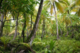
This sand spit, dune and wetland complex occurs on the south shore of the Ottawa River near the town of Westmeath. It is built from sand deposits laid down by the Ottawa River near the end of the last ice age, when larger areas of the Great Lakes drained east down the Ottawa River Valley. [2] Near Pembroke this ancient river entered the Champlain Sea, and deposited areas of sand and clay as its delta within the Champlain sea, which at that time flooded west up the Ottawa Valley. Hence these dunes partly reflect an ancient ocean shoreline. The dunes appear to be the best remaining example along the Ottawa River.
The park is home to 300 plant species, including 10 which are provincially or regionally rare, and a wide array of types of wetlands representative of the Ottawa River. There are six provincially significant plant species known, Bulbostylis capillaris, Danthonia compressa, Hudsonia tomentosa , Polygonella articulata and Stipa spartea. [3] There is also a substantial population of butternut trees.
The park has a rich diversity of wildlife, including 184 species of birds sighted, of which nearly half may breed in the park. Black terns may nest in Bellows Bay. Many other waterfowl use the park during migration. [4]
The Bellows Bay portion is home to the spiny softshell turtle and the map turtle. [5] This is the only known location on the Ottawa River for the spiny softshell, which is designated as "threatened" under the Canadian Species At Risk Act, [6] while the map turtle is designated as "Special Concern". [7]
One of the important functions of natural areas like Westmeath is to provide natural areas for the study of ecological principles that apply well beyond the boundaries of the park itself. Westmeath is an important natural study area, as it has some of the widest variation in wetland plant communities of any single location along the Ottawa River, from open sand beaches with reeds and sedges to densely vegetated bays with cattails. Hence, it has provided an important natural laboratory for the study of wetlands along the Ottawa River in particular, and in marsh ecology as a whole. During the 1980s, a team from the University of Ottawa used this outdoor laboratory as one source of data for a wetland classification system for the rest of the marshes along the Ottawa River. [8] The open sandy wetlands provided an important reference point in this classification system. Such areas have relatively low nutrient levels, particularly compared to most bays, and sites downstream from Ottawa-Hull. These open wetlands are dominated by partially evergreen and deeply rooted plants, that can tolerate the infertile conditions, damage by waves, and spring ice scouring. Another study used experimental transplants to measure the amount of above and below ground competition along the natural gradient from exposed sand shore to densely vegetated bay, showing that below ground competition was relatively constant across wetland types, but above ground competition increased with vegetation biomass. [9] This was the first study to provide such an important documentation of competition gradients in wetlands, and led to a general model for above and below ground competition in wetlands. Studies of plant diversity also showed that this area has enormously high plant diversity compared to other types of wetlands. [10] Table 1 in that paper refers to unusual shoreline vegetation, with plants including Ranunculus reptans and Eriocaulon septangulare (two evergreen species) and Drosera intermedia and Utricularia cornuta (two carnivorous species). Westmeath therefore provides an historical reference point for scientific papers in international journals, and these studies have even found its way into text books of wetland ecology. [11]
There are also extensive areas of silver maple swamp. These swamps depend upon the natural variation in the Ottawa River. High water periods drown terrestrial plants that would out-compete the maples, while lower water periods in mid-summer allow the maple trees to recover and grow. [12] Hence, spring floods are an important part of the ecology of these wetlands. [13]
Owing to their small stature and slow growth, shoreline plants such as Eriocaulon septangulare and Drosera intermedia are easily damaged by human traffic and all-terrain vehicles. Illegal all-terrain vehicle use in the park constitutes an ongoing threat to its ecosystem. [14]

Lake Ontario is one of the five Great Lakes of North America. It is bounded on the north, west, and southwest by the Canadian province of Ontario, and on the south and east by the U.S. state of New York. The Canada–United States border spans the centre of the lake.

The Ottawa River is a river in the Canadian provinces of Ontario and Quebec. It is named after the Algonquin word 'to trade', as it was the major trade route of Eastern Canada at the time. For most of its length, it defines the border between these two provinces. It is a major tributary of the St. Lawrence River and the longest river in Quebec.

A swamp is a forested wetland. Swamps are considered to be transition zones because both land and water play a role in creating this environment. Swamps vary in size and are located all around the world. The water of a swamp may be fresh water, brackish water, or seawater. Freshwater swamps form along large rivers or lakes where they are critically dependent upon rainwater and seasonal flooding to maintain natural water level fluctuations. Saltwater swamps are found along tropical and subtropical coastlines. Some swamps have hammocks, or dry-land protrusions, covered by aquatic vegetation, or vegetation that tolerates periodic inundation or soil saturation. The two main types of swamp are "true" or swamp forests and "transitional" or shrub swamps. In the boreal regions of Canada, the word swamp is colloquially used for what is more formally termed a bog, fen, or muskeg. Some of the world's largest swamps are found along major rivers such as the Amazon, the Mississippi, and the Congo.

The Thousand Islands – Frontenac Arch region or the Frontenac Axis is an exposed strip of Precambrian rock in Canada and the United States that links the Canadian Shield from Algonquin Park with the Adirondack Mountain region in New York, an extension of the Laurentian mountains of Québec. The Algonquin to Adirondacks region, which includes the Frontenac Axis or Arch, is a critical linkage for biodiversity and resilience, and one with important conservation potential. The axis separates the St. Lawrence Lowlands and the Great Lakes Lowlands. It has many distinctive plant and animal species. It is one of four ecoregions of the Mixedwood Plains.

The Mississippi River is a tributary of the Ottawa River in Eastern Ontario, Canada which has no relation with the Mississippi River in the United States. It is 200 kilometres (120 mi) in length from its source at Mackavoy Lake, has a drainage area of 4,450 square kilometres (1,720 sq mi), and has a mean discharge of 40 cubic metres per second (1,400 cu ft/s). There are more than 250 lakes in the watershed.

Lanark County is a county located in the Canadian province of Ontario. Its county seat is Perth, which was first settled in 1816 and was known as a social and political capital before being over shadowed by what we now know as Ottawa.

Drummond/North Elmsley is a township in eastern Ontario, Canada in Lanark County. It is situated on the north shore of the Rideau River between the town of Perth and the town of Smiths Falls. It is a predominantly rural municipality. The township offices are located in the hamlet of Port Elmsley.

Presqu'ile Provincial Park is a park in southeastern Northumberland County on the north shore of Lake Ontario near the town of Brighton in Ontario, Canada. The park occupies an area of 9.37 km2 (3.62 sq mi). The name of the park is the French word for peninsula, or literally "almost island", and was believed to be named by Samuel De Champlain on his second expedition. The peninsula was formed when a limestone island was connected to the mainland by a sand spit; this kind of formation is referred to as a tombolo.

Killbear Provincial Park is a provincial park located on Georgian Bay in the Parry Sound District of Ontario, near the town of Nobel. Killbear combines sandy beaches typical of the Great Lakes with the rock ridges and pines of the Canadian Shield. The park boundaries lie within the Georgian Bay Littoral UNESCO Biosphere Reserve.

Petrie Island is an island of parkland and recreational areas situated in the Ottawa River in the eastern part of the city of Ottawa, Ontario, Canada. The island has several nearby islands and the general collection of islands is also called Petrie Island.

The Shoalwater Bay Military Training Area is a heritage-listed military installation at Byfield Road, Byfield, Shire of Livingstone, Queensland, Australia. It is a large, relatively undisturbed and intact natural system with a wide variety of coastal landforms and a high level of biodiversity. It contains a diverse range of marine and coastal wetland landscapes, vegetation types and ecosystems. It was added to the Australian Commonwealth Heritage List on 22 June 2004.

The Hudson Bay Lowlands is a vast wetland located between the Canadian Shield and southern shores of Hudson Bay and James Bay. Most of the area lies within the province of Ontario, with smaller portions reaching into Manitoba and Quebec. Many wide and slow-moving rivers flow through this area toward the saltwater of Hudson Bay: these include the Churchill, Nelson and Hayes in Manitoba, Severn, Fawn, Winisk, Asheweig, Ekwan, Attawapiskat, and Albany in Ontario, and the Harricana, Rupert and Eastmain in Quebec. This is the largest wetland in Canada, and one of the largest in the world. The region can be subdivided into three bands running roughly northwest to southeast: the Coastal Hudson Bay Lowland, Hudson Bay Lowland, and James Bay Lowland.
Matchedash Bay is a bay and Ramsar wetland in Simcoe County in Central Ontario, Canada. It is the "final inland extension of Severn Sound" on Lake Huron's Georgian Bay, and is "situated at the interface between the Saint Lawrence Lowlands and the Canadian Shield ". It exhibits geologically unique features at the junction of the Canadian Shield and southern Ontario limestone. Wetland habitats in Matchedash Bay are varied, and include swamps, fens, cattail marshes, wet meadows and beaver ponds. Other features include "permanent freshwater lakes; upland hardwood forest, agricultural lands, native grass meadows and a unique, coniferous wetland forest".
Paul Anthony Keddy was a Canadian ecologist. He studied plant population ecology and community ecology in wetlands and many other habitats in eastern Canada and Louisiana, United States.
Mississippi Lake is a lake in Lanark County in Ontario, Canada, about 60 km southwest of Ottawa. It is a shallow and narrow lake, about 10 m deep at its deepest, 16 km in length, and less than one km wide in most places. Around the shoreline are over 1,000 homes, ranging from small cabins, to larger vacation homes, to full-time residences, many of them accessed by private roads. There are also several campground resorts, with RVs, waterfront condos, or rentals.
Plant ecology is a subdiscipline of ecology that studies the distribution and abundance of plants, the effects of environmental factors upon the abundance of plants, and the interactions among plants and between plants and other organisms. Examples of these are the distribution of temperate deciduous forests in North America, the effects of drought or flooding upon plant survival, and competition among desert plants for water, or effects of herds of grazing animals upon the composition of grasslands.

The White Lake fen is a small wetland on the shore of White Lake in Lanark County, Ontario in Canada. It has been designated both an Area of Natural and Scientific Interest and a Provincially Significant Wetland; it is also listed as a Special Place in Lanark County. Fens are a relatively rare wetland habitat in the region of Lanark County; they can occur on either marble or limestone bedrock. White lake has a granite dome along its north shore, while it spreads over marble bedrock to the south. A number of calcareous fens have developed along the south shore. The largest of these has developed in a long narrow arm of the lake, where it stretches for nearly two kilometers and covers 90 ha.

The Burnt Lands is an alvar between Almonte and Ottawa near Upper Huntley, Ontario, Canada. It probably obtained its name from one of the forest fires that swept the area during early European settlement.

The Mixedwood Plains Ecozone is the Canadian ecozone with the most southern extent, covering all of southwestern Ontario, and parts of central and northeastern Ontario and southern Quebec along the Saint Lawrence River. It was originally dominated by temperate deciduous forest growing mostly on limestone covered by glacial till. It is the smallest ecozone in Canada, but it includes the country's most productive industrial and commercial region, and is home to nearly half of Canada's population, including its two largest cities, Toronto, Ontario and Montreal, Quebec. Hence, little of the original forest cover remains, making protection of the remaining forests a high conservation priority. This ecozone includes two regions described by J.S. Rowe in his classic Forest Regions of Canada: the entire Deciduous Forest Region, and the southern portions of the Great Lakes-St. Lawrence Forest Region. In the province of Ontario, the Ontario Ministry of Natural Resources maps this area as Site Regions 6E and 7E.


