List of provincial parks of Southwestern Ontario

Last updated

This is a list of provincial parks in Southwestern Ontario . These provincial parks are maintained by Ontario Parks. For a list of other provincial parks in Ontario, see the List of provincial parks in Ontario.

Contents

Bruce County

NameEstablishedCommons categoryPictureCoordinates
Black Creek Provincial Park 1989 44°58′24″N81°21′49″W / 44.973333333333°N 81.363611111111°W / 44.973333333333; -81.363611111111
Cabot Head Provincial Nature Reserve 1985
Pano Fen Cabot Head Nature Preserve Ontario.jpg
45°12′35″N81°26′55″W / 45.209722222222°N 81.448611111111°W / 45.209722222222; -81.448611111111
Hope Bay Forest Provincial Nature Reserve 1985 44°55′23″N81°09′21″W / 44.92306°N 81.15572°W / 44.92306; -81.15572
Inverhuron Provincial Park 1967 Inverhuron Provincial Park
Inverhuron Park.jpg
44°17′59″N81°35′17″W / 44.2997°N 81.5881°W / 44.2997; -81.5881
Ira Lake Provincial Nature Reserve 1989 45°02′24″N81°21′54″W / 45.039995°N 81.364884°W / 45.039995; -81.364884
Johnston Harbour-Pine Tree Point Provincial Nature Reserve 1989 45°06′27″N81°30′52″W / 45.107537°N 81.514344°W / 45.107537; -81.514344
Lion's Head Provincial Park 1985
Lion's Head Provincial Park- Lion's Head Lookout-Ontario (2).jpg
44°59′49″N81°12′04″W / 44.997°N 81.201°W / 44.997; -81.201
Little Cove Provincial Nature Reserve 1985 45°14′50″N81°36′44″W / 45.247222222222°N 81.612222222222°W / 45.247222222222; -81.612222222222
MacGregor Point Provincial Park 1975 MacGregor Point Provincial Park
Observation Tower, MacGregor Point PP.jpg
44°24′31″N81°26′45″W / 44.4086°N 81.4458°W / 44.4086; -81.4458
Sauble Falls Provincial Park 1971
Sauble Falls Ontario (22291994871).jpg
44°40′32″N81°15′24″W / 44.6756°N 81.2567°W / 44.6756; -81.2567
Smokey Head/White Bluff Provincial Nature Reserve 1985 45°00′02″N81°13′13″W / 45.000555555556°N 81.220277777778°W / 45.000555555556; -81.220277777778

Chatham-Kent

NameEstablishedCommons categoryPictureCoordinates
Clear Creek Forest Provincial Park 2014 42°28′20″N81°43′24″W / 42.472314°N 81.723261°W / 42.472314; -81.723261
Rondeau Provincial Park 1894 Rondeau Provincial Park
2007-5-25- Rondeau Ontario - Provincial Park (47).JPG
42°17′00″N81°52′00″W / 42.2833°N 81.8667°W / 42.2833; -81.8667
Wheatley Provincial Park 1971 Wheatley Provincial Park
Wheatley Provincial Park - Beach.jpg
42°05′24″N82°26′50″W / 42.09°N 82.4472°W / 42.09; -82.4472

Elgin County

NameEstablishedCoordinates
John E. Pearce Provincial Park 1957 42°36′29″N81°26′48″W / 42.608055555556°N 81.446666666667°W / 42.608055555556; -81.446666666667
Port Bruce Provincial Park 1974 42°39′18″N81°00′48″W / 42.655°N 81.013333333333°W / 42.655; -81.013333333333
Port Burwell Provincial Park (formerly Iroquois Beach Provincial Park 1971-1986)1971 42°38′53″N80°48′58″W / 42.648055555556°N 80.816111111111°W / 42.648055555556; -80.816111111111

Essex County

NameEstablishedCoordinates
East Sister Island Provincial Nature Reserve 41°48′47″N82°51′21″W / 41.81317°N 82.85576°W / 41.81317; -82.85576
Fish Point Provincial Nature Reserve 1985 41°44′15″N82°40′17″W / 41.7376°N 82.67139°W / 41.7376; -82.67139
Lighthouse Point Provincial Nature Reserve 1985 41°49′32″N82°38′21″W / 41.8255°N 82.63928°W / 41.8255; -82.63928
Ojibway Prairie Provincial Nature Reserve 1977 42°15′56″N83°04′36″W / 42.2655556°N 83.0766666°W / 42.2655556; -83.0766666

Grey County

NameEstablishedCommons categoryPictureCoordinates
Bayview Escarpment Provincial Nature Reserve 1985 Bayview Escarpment Provincial Nature Reserve
Grey County, Ontario, Canada.jpg
44°38′12″N80°42′39″W / 44.636666666667°N 80.710833333333°W / 44.636666666667; -80.710833333333
Craigleith Provincial Park 1967 Craigleith Provincial Park
ON Craigleith tango7174.jpg
44°32′12″N80°20′55″W / 44.5367°N 80.3486°W / 44.5367; -80.3486
Duncan Escarpment Provincial Nature Reserve 1985
Cliff face in Duncan Escarpment.jpg
44°25′01″N80°27′58″W / 44.416944444444°N 80.466111111111°W / 44.416944444444; -80.466111111111
Pretty River Valley Provincial Park 1985 44°25′36″N80°17′25″W / 44.426666666667°N 80.290277777778°W / 44.426666666667; -80.290277777778

Haldimand County

NameEstablishedCommons categoryPictureCoordinates
James N. Allan Provincial Park 1989 42°50′58″N79°39′48″W / 42.84948°N 79.663466°W / 42.84948; -79.663466
Rock Point Provincial Park 1957 Rock Point Provincial Park
Shore, with Fossils.jpg
42°50′54″N79°33′09″W / 42.8482°N 79.5525°W / 42.8482; -79.5525
Selkirk Provincial Park 1967 42°48′50″N79°57′32″W / 42.813888888889°N 79.958888888889°W / 42.813888888889; -79.958888888889

Huron County

NameEstablishedCoordinates
Morris Tract Provincial Nature Reserve 1997 43°43′37″N81°38′36″W / 43.726944444444°N 81.643333333333°W / 43.726944444444; -81.643333333333
Point Farms Provincial Park 1970 43°48′18″N81°43′02″W / 43.805°N 81.717222222222°W / 43.805; -81.717222222222

Lambton County

NameEstablishedCommons categoryPictureCoordinates
The Pinery Provincial Park 1957 Pinery Provincial Park
Pinery beach.jpg
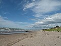
43°15′36″N81°49′40″W / 43.26°N 81.8278°W / 43.26; -81.8278

Middlesex County

NameEstablishedCommons categoryPictureCoordinates
Komoka Provincial Park 1989 Komoka Provincial Park
Thames River (48966075543).jpg
42°57′00″N81°23′51″W / 42.95°N 81.3975°W / 42.95; -81.3975

Norfolk County

NameEstablishedCommons categoryPictureCoordinates
Long Point Provincial Park 1921 Long Point Provincial Park
Long Point Marshes 2.jpg
42°34′48″N80°23′06″W / 42.58°N 80.385°W / 42.58; -80.385
Turkey Point Provincial Park 1959
Fort Norfolk NHS.jpg
42°42′17″N80°20′00″W / 42.7047°N 80.3333°W / 42.7047; -80.3333

Oxford County

NameEstablishedCoordinates
Trillium Woods Provincial Park 1969 43°03′50″N80°46′40″W / 43.06377°N 80.77787°W / 43.06377; -80.77787