Ishpatina Ridge is the highest point of land in the Canadian province of Ontario, at an estimated 693 m (2,274 ft) above sea level. Ishpatina Ridge rises approximately 300 m (984 ft) above the immediate area. It was only truly recognized as Ontario's highest point after topographical mapping by the Government of Canada revealed this fact in the 1970s. Before then, the more popular Maple Mountain was thought to be higher.

The Pigeon River forms part of the Canada–United States border between the state of Minnesota and the province of Ontario, west of Lake Superior. In pre-industrial times, the river was a waterway of great importance for transportation and the fur trade.

The Sudbury District is a district in Northeastern Ontario in the Canadian province of Ontario. It was created in 1894 from townships of eastern Algoma District and west Nipissing District.

The Mattawa River is a river in central Ontario, Canada. It flows east from Trout Lake east of North Bay and enters the Ottawa River at the town of Mattawa. Counting from the head of Trout Lake, it is 76 kilometres (47 mi) long. The river's name comes from the Algonquin word for "meeting of waterways".

The Sturgeon River is a river that springs near Lady Evelyn-Smoothwater Provincial Park in the Timiskaming District in Ontario, Canada. It flows 230 kilometres (140 mi) in a mostly south-easterly direction through Sudbury and Nipissing Districts before it empties into Lake Nipissing on the north shore. The town of Sturgeon Falls is located on the river about 3 kilometres (1.9 mi) north of its mouth.

Pinecone Burke Provincial Park is a provincial park in British Columbia, Canada. It extends from the southwest corner of Garibaldi Provincial Park, west of Pitt Lake and Pitt River to include Burke Mountain in the City of Coquitlam. Most of the park is unserviced wilderness with very rough trails such as the Fools Gold Trail in the Boise Valley. There is canoe access to Widgeon Slough and from there hiking trails that lead to Widgeon Lake, and a network of old logging roads, hiking and mountain biking trails on Burke Mountain. Visitors can also use the park for camping, backcountry skiing, and snowshoeing.
The Obabika River Provincial Park is a provincial park in Ontario, Canada, straddling across the boundaries of the Sudbury, Nipissing, and Timiskaming Districts. While it is named after and includes the Obabika River, the bulk of the park extends north of Obabika Lake to the eastern boundary of Lady Evelyn-Smoothwater Provincial Park.
The Obabika River is located in central Ontario, Canada. It is south of Lady Evelyn-Smoothwater Provincial Park and west of Lake Temagami, within Sudbury District. It flows from Obabika Lake in a south-westerly direction and drains into the Sturgeon River. The Obabika River is remote and surrounded by undeveloped wilderness.

Temagami, formerly spelled Timagami, is a municipality in northeastern Ontario, Canada, in the Nipissing District with Lake Temagami at its heart.
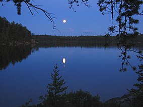
Maple Mountain is a mountain, located within Lady Evelyn-Smoothwater Provincial Park, Northeastern Ontario, Canada, estimated 642 m (2,106 ft) above mean sea level. It has a higher vertical rise over the surrounding landscape, 37 m (121 ft) higher than the Ishpatina Ridge, which is the highest point of land in Ontario rising over Scarecrow Lake. Maple Mountain rises over Tupper Lake and is considerably better known than Ishpatina Ridge. It ranks thirteenth, but when ranked by vertical rise it is the highest of the top 25 peaks in Ontario. The 30 m (100 ft) fire tower is also still intact and attracts many hikers. A 3.2-kilometre-long hiking trail leads to the abandoned fire tower.
The High Peaks Wilderness Area is the largest wilderness area of the Forest Preserve in the U.S. state of New York. It is located in three counties and six towns in the Adirondack Park: Harrietstown in Franklin County, North Elba, Keene, North Hudson and Newcomb in Essex County and Long Lake in Hamilton County.
The Temagami River, formerly spelled as Timagami River, is a river in the Nipissing District of Ontario, Canada, in the Temagami region. Its source is Lake Temagami and flows through Cross Lake and Red Cedar Lake. It flows into the Sturgeon River at the community of River Valley.

The Sturgeon River Provincial Park is a provincial park in northern Ontario, Canada, that protects about 70 kilometres (43 mi) long section of the Sturgeon River and its banks, from Woods Lake to the Sudbury-Nipissing District boundary. It was established in 1989 and expanded in 2005. It protects outstanding water routes that provide recreational canoe camping opportunities. Other activities include hunting and fishing.
Lady Evelyn Lake is a lake on the Lady Evelyn River in Timiskaming District, Northeastern Ontario, Canada. The highly irregularly shaped lake consists of two parts, about equal in size, separated by the Obisaga Narrows.

The eastern forest–boreal transition is a temperate broadleaf and mixed forests ecoregion of North America, mostly in eastern Canada. It is a transitional zone or region between the predominantly coniferous Boreal Forest and the mostly deciduous broadleaf forest region further south.

The Grand Portage State Forest is a state forest located near the community of Hovland in Cook County, in extreme northeastern Minnesota. The forest encloses Judge C. R. Magney State Park, Swamp River Wildlife Management Area, Hovland Woods Scientific and Natural Area, and Spring Beauty Hardwoods Scientific and Natural Area. It borders the Grand Portage Indian Reservation to the east, the Superior National Forest to the west, and Ontario to the north. The forest is named after the Grand Portage, a historic trade route between the Great Lakes and the Northwest.

The Western Great Lakes forests is a terrestrial ecoregion as defined by the World Wildlife Fund. It is within the temperate broadleaf and mixed forests biome of North America. It is found in northern areas of the United States' states of Michigan, Wisconsin and Minnesota, and in southern areas of the Canadian province of Manitoba and northwestern areas of the province of Ontario.
The Makobe River is a river in northeastern Ontario, Canada. It is in the Saint Lawrence River drainage basin, and is a left tributary of the Montreal River.
Solace Provincial Park is a remote provincial park in Sudbury District, Ontario, Canada. It was established in 1985 and protects a series of lakes that provide backcountry canoeing opportunities. It is characterized by boreal forest, mostly jack pine conifer forest with mixed forest including white birch. The roadless park, with topography and scenery similar to the adjacent Lady Evelyn-Smoothwater Provincial Park, is considered as "one of the most isolated, wild places in Ontario."

The Kopka River is a river in northwestern Ontario, Canada. It forms at the height-of-land west of Lake Nipigon, flowing through rugged wilderness of Ontario's northern boreal forest, and drains into Wabinosh Lake.