
Whitchurch-Stouffville is a town in the Greater Toronto Area of Ontario, Canada, approximately 50 km (31 mi) north of downtown Toronto, and 55 km (34 mi) north-east of Toronto Pearson International Airport. It is 206.22 km2 (79.62 sq mi) in area, and located in the mid-eastern area of the Regional Municipality of York on the ecologically-sensitive Oak Ridges Moraine. Its motto since 1993 is "country close to the city".

The Township of Woolwich is a rural township in Southwestern Ontario. The municipality is located in the northeastern part of Waterloo Region and is made up of 10 small communities, with Elmira, Ontario the largest and St. Jacobs, Ontario the second largest. The population at the time of the 2021 Census was 26,999, up from the 2016 population of 25,006. Waterloo Region is still home to the largest population of Old Order Mennonites in Canada, particularly in the areas around St Jacobs and Elmira. They are often seen on the local roads using their traditional horse and buggy transportation; many also use horses to pull the implements in their farm fields.

St. Jacobs is an unincorporated suburban community in the township of Woolwich in Waterloo Regional Municipality, Ontario, Canada. It is located north of the city of Waterloo. It is a popular location for tourism, due to its quaint appearance, retail focus, and Mennonite heritage. Waterloo Region is still home to the largest population of Old Order Mennonites in Canada, particularly in the areas around St Jacobs and Elmira. They are often seen on the local roads using their traditional horse and buggy transportation; many also use horses to pull the implements in their farm fields.

Nobleton is an unincorporated community in southwestern King, Ontario, Canada. It is the third-largest community in the township, after King City and Schomberg. Located south of the Oak Ridges Moraine, Nobleton is surrounded by hills and forests. Many horse farms are found on Nobleton's eastern periphery.

Laskay is an unincorporated rural community in King Township, York Regional Municipality, Ontario, Canada. It is west of King City and Highway 400, and south of the King Road—Weston Road intersection.
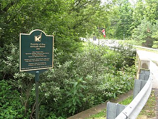
Kettleby is an unincorporated community in the northeastern part of King Township in Ontario, Canada. It is located about 1.5 kilometres (0.93 mi) east of Highway 400, 25 kilometres (16 mi) north of Toronto, about 40 kilometres (25 mi) south of Barrie, 6 kilometres (3.7 mi) west of Newmarket, and about 50 kilometres (31 mi) east of Orangeville.

Ball's Falls also known as Balls Mills, Louthe Mills and Glen Elgin, is a historical ghost town located in what is now a part of Jordan in the Niagara region, Ontario, Canada, which dates back to the early 19th century. It is now preserved as a conservation area operated by the Niagara Peninsula Conservation Authority.
The Toronto and Region Conservation Authority (TRCA) is a conservation authority in southern Ontario, Canada. It owns about 16,000 hectares of land in the Toronto region, and it employs more than 400 full-time employees and coordinates more than 3,000 volunteers each year. TRCA's area of jurisdiction is watershed-based and includes 3,467 square kilometres (1,339 sq mi) – 2,506 on land and 961 water-based in Lake Ontario. This area comprises nine watersheds from west to east – Etobicoke Creek, Mimico Creek, Humber River, Don River, Highland Creek, Petticoat Creek, Rouge River, Duffins Creek and Carruthers Creek.

Edgeley was a small rural community located in the city of Vaughan in York Region, Ontario, Canada, which today is the site of Vaughan's planned downtown core; Vaughan Metropolitan Centre. The first inhabitants of the Edgeley area immigrated from Somerset County, Pennsylvania, circa 1800. Early family names were Smith, Stong, Shunk, Hoover, Burkholder, Muskrat, Snider, Brown, and Dalziel. A Mennonite church, built of logs in 1824 on the northern portion of Lot #7, Concession #4, was one of the first churches built in Vaughan Township. A steam-powered shingle mill stood on the northwest corner of Highway 7 and Jane Street. A hotel was located on the northeast corner, with a general store on the southeast corner. The store contained the Edgeley post office from 1872 until 1960. Just south of the store, Samuel Snider operated a horse-powered cider mill. His son-in-law, Abraham Winger, and Abraham's brother Henry, later assumed the business, putting up a new steam-powered mill and producing apple cider, butter and jelly until the early 1900s.

Jordan is a community located on the eastern edge of the Town of Lincoln, in the Niagara Region. Jordan is bordered by the Twenty Mile Creek and Vineland to the west, Lake Ontario to the north, St. Catharines to the east, and Pelham to the south. Lying roughly 100 km from Toronto and 65 km from Buffalo by road, Jordan is located along a major transportation corridor between Canada and the United States. In January 2014, Jordan was brought to international attention when Al-Qaeda-directed terrorists were arrested for plotting to derail a passenger train traveling from Toronto to New York on a rail-bridge crossing the Jordan Harbour.

Doon Heritage Village, located at the Ken Seiling Waterloo Region Museum, is a picturesque 60 acre living history village that shows visitors what life was like in the Waterloo Region in the year 1914. It is located in the former Doon village, now part of Kitchener, Ontario, Canada, next to Homer Watson Park.
Dickson Hill is a small community in northeast Markham, Ontario, Canada, located near Highway 48 and 19th Avenue, on the border to Whitchurch-Stouffville.

Lang Pioneer Village Museum is a living history museum located in the hamlet of Lang in Peterborough County, Ontario. It was established in 1967 by the County of Peterborough. Lang Pioneer Village is situated on the shores of the historic Indian River. Lang Pioneer Village is an "outdoor museum" featuring more than 30 restored and furnished buildings, many of which were donated from the surrounding townships. The buildings, constructed between 1820 and 1910, are interpreted by costumed villagers portraying authentic 19th-century pioneer life. Since 2014 the Museum has been the site of the Aabnaabin Encampment, a pre-colonization representation of a Michi Saagiig camp where the story of the First Nations history and culture of the region is told by indigenous interpreters. Lang Pioneer Village Museum is owned and operated by the County of Peterborough.

Locust Hill is a historic community of Markham, Ontario centred on Hwy. 7 and the Canadian Pacific Railway and within the boundaries of the future national Rouge Park.
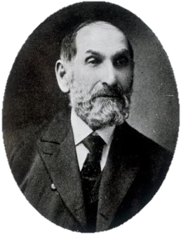
Jacob Yost Shantz was a Mennonite farmer, businessman, and industrialist from Ontario, Canada. He played a significant role in the urban development of Berlin, Ontario, where he held a succession of civic roles over a period of almost three decades, culminating in a term as mayor in 1882. Over the span of his life, Berlin was transformed from a rural agricultural settlement known as Ebytown into a bustling manufacturing centre; this was a change mirrored by Shantz, who began his adult life as a farmer and sawmiller, and ended it as a prominent local industrialist.

Fanshawe Pioneer Village is an open-air museum established in 1959 and located in the Fanshawe Conservation Area in London, Ontario. The village uses historical re-enactments to communicate the history of rural communities in the former townships of Westminster, London, North Dorchester, Delaware, West Nissouri and Lobo in Middlesex County from 1820 to 1920 and the founding and development of the City of London up to 1840.

Demorestville is a small village in Sophiasburgh Township in Prince Edward County, Ontario, Canada. It was named after Guilliame Demorest. Once much larger, it currently has a population of approximately one hundred. A formerly much larger creek which once powered mills fed by Fish Lake, flows through the center of town and has now been protected under the Demorestville Conservation Area.

Doon is a suburban community and former village which is now a part of the city of Kitchener, Ontario, Canada. Doon was settled around 1800 by German Mennonites from Pennsylvania, and after 1830 by Scottish immigrants. The area is located at the confluence of Schneider Creek and the Grand River. The post office was opened in 1845. A large flour mill, oatmeal mill, distillery and sawmill were built on the Doon River over the following years. The Perine brothers established extensive linen works and flax mills near the settlement. By 1870, there was a single church, Presbyterian, a variety of tradesmen and a population of 200.


