![]() | This article's tone or style may not reflect the encyclopedic tone used on Wikipedia.(July 2017) |
Govenlock | |
---|---|
Coordinates: 49°15′43″N109°48′32″W / 49.261845°N 109.80878°W | |
Country | Canada |
Province | Saskatchewan |
Region | Southwest Saskatchewan |
Census division | 4 |
Rural Municipality | Reno No. 51 |
Established | 1910 |
Incorporated (Village) | 1913-1976 |
Dissolved | January 1, 1976 |
Government | |
• Reeve | Brian McMillan |
• Administrator | Lacelle Kim |
• Governing body | Reno No. 51 |
• MP | Jeremy Patzer |
• MLA | Doug Steele |
Area | |
• Total | 0.00 km2 (0.00 sq mi) |
Population (2019) | |
• Total | 0 |
• Density | 0.0/km2 (0/sq mi) |
Postal code | S0N 2G0 |
Area code | 306 |
Highways | Highway 13 Highway 21 |
Railways | Former Canadian Pacific Railway |
[1] [2] [3] [4] |
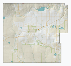
Govenlock is an unincorporated community within the Rural Municipality of Reno No. 51, Saskatchewan, Canada. It previously held the status of a village, with a peak population of 151 residents; its village status was dissolved on January 1, 1976. The former townsite of Govenlock is located on Highway 21 and Highway 13, also known as the historic Red Coat Trail, about 15 kilometres (9.3 mi) east of the Alberta-Saskatchewan border. Although many cement foundations and wooden sidewalks can still be found scattered around the town site, the only building that still stands as of 2010 is the old community hall and a commemorative plaque in remembrance of Govenlock's history.
In 1910, a Moose Jaw resident by the name of William Govenlock moved to the area with his family after applying for a homestead. They were one of the first pioneer families of Southwest Saskatchewan. In 1913, Govenlock negotiated a land deal with the Canadian Pacific Railway, starting a new town later named in his honour. That same year he established a post office for the area, with his wife Bessie as the first postmaster.
In 1914, pioneer John Linder built Govenlock's first hotel. The hotel stood two storeys tall with ten rooms. Three years later, James Gaff stopped at the hotel for a rest; after finding out that no rooms were available, Gaff immediately purchased the hotel for $4,500. [5]
In the early part of the 20th century, Govenlock had a Canadian Pacific Railway station, a section house, multiple grain elevators, and a chamber of commerce. Businesses included two general stores, blacksmith shops, a livery barn, two machine agencies, a pool room, a laundromat, a school, a meat shop, and a service station selling Model T Fords. Most of these businesses were connected by wooden sidewalks, a common feature in the pioneer prairie days. [6]
After Montana's prohibition declaration in 1919, large groups of Americans from that state frequently crossed the border by train to visit Govenlock to purchase booze.
Four liquor warehouses were established in the centre to serve the booming liquor trade. Gambling and parties became common, attracting not only thirsty people from across the border, but many bachelors from all parts of southwestern Saskatchewan who wanted to let loose. [6]
A pool room and two-storey dance hall building were built and owned by Henry Buss. These took advantage of American customers waiting for their liquor orders, offering a game of pool or high-stakes poker table to fill the time. Revelry and good times were staples in Govenlock during their early days.
To avoid legal problems, American bootleggers would have to obtain a tourist pass at Canada border entry points. They would come to the pioneer town with their car trunks weighed down with sand bags, in order to avoid suspicion later when they returned with a trunk full of heavy booze.
Canadian beer cost 12 cents per bottle and was said to be highly prized. Canadian whisky was more expensive and more lucrative. It was transported in barrels. Each barrel had three burlap sacks, with 24 four-quart bottles — wrapped in straw — in each sack. A barrel wholesaled for $24. When it reached the United States, it sold for $140. A carload of 14 barrels of beer and five cases of whisky could fetch a profit of $2,500.
The bootlegging trade was good business for several years and there were few legal hassles for the rumrunners. Mounties and provincial police intervened to ensure that the liquor went through the hands of locals before crossing the United States border. Even a few of the Govenlock residents tried their hand at bootlegging, but they soon found out that more of the liquor was stolen than sold.
In 1922, Govenlock's prosperity in the bootlegging business ended when the Government of Saskatchewan restricted liquor export houses to cities with 10,000 people or more. This started the slow end of the once promising pioneer town of Govenlock. Over the years and one by one, stores and shops soon closed and residents left. In 1962, the only grain elevator left in Govenlock was toppled and demolished. By 1990, rural municipality officials brought in the bulldozers and demolished all but one of the remaining buildings that stood in Govenlock, including the old Govenlock Hotel.
The only building left is the community hall, built in 1948. A commemorative plaque marks the area where Govenlock was located and honours the town's wilder pioneer days.
Prior to January 1, 1976, Govenlock was incorporated under village status, but was dissolved into an unincorporated community under the jurisdiction of the Rural Municipality of Reno No. 51 on that date. [7]
Govenlock, like many other small communities throughout Saskatchewan, struggled to maintain a sturdy population, causing it to become a completely abandoned "ghost town". By 2006, Govenlock had a population of 0 living in 0 dwellings, a 0% increase from 2001. The community had a land area of 0.00 km2 (0 sq mi) and a population density of 0.0/km2 (0/sq mi).
Rum-running, or bootlegging, is the illegal business of smuggling alcoholic beverages where such transportation is forbidden by law. The term rum-running is more commonly applied to smuggling over water; bootlegging is applied to smuggling over land.
Shaunavon is a town in southwest Saskatchewan. At the junction of Highways 37 and 13, it is 110 kilometres from Swift Current, 163 kilometres from the Alberta border, and 74 kilometres from the Montana border. Shaunavon was established in 1913 along the Canadian Pacific Railway line.
Kamsack, Saskatchewan, Canada, is a town in the Assiniboine River Valley, where the Whitesand River joins the Assiniboine River. It is 56 kilometres (35 mi) northeast of Yorkton. Highway 8 and Highway 5 intersect in the town.
Prohibition in Canada was a ban on alcoholic beverages that arose in various stages, from local municipal bans in the late 19th century, to provincial bans in the early 20th century, and national prohibition from 1918 to 1920. The relatively large and powerful beer and alcohol manufacturing sector, and the huge working class that purchased their products, failed to convince any of the governments to reverse their stance on prohibition. Most provinces repealed their bans in the 1920s, though alcohol was illegal in Prince Edward Island from 1901 to 1948. By comparison, the Ontario Temperance Act was in effect from 1916 to 1927.
Gainsborough is a village in the Canadian province of Saskatchewan within the Rural Municipality of Argyle No. 1 and Census Division No. 1. A farming community, the village is located on Highway 18 in the southeastern corner of Saskatchewan. Gainsborough is approximately 6 km (3.7 mi) from the Manitoba border, and 19 km (12 mi) from the North Dakota, United States border. The first post office was established on April 1, 1884 as the community of Antler. On September 1, 1885, the name of the community changed to Gainsborough, after Gainsborough, Lincolnshire in England, which was the former home of J. J. Sadler, an early settler.
Love is a village in the Canadian province of Saskatchewan within the Rural Municipality of Torch River No. 488 and Census Division No. 14. The village is northeast of the City of Prince Albert and about 48 km (30 mi) south of Prince Albert National Park boundaries and 16 km (9.9 mi) south of Torch River Provincial Forest.
Robsart is an unincorporated hamlet within the rural municipality of Reno No. 51, in the Canadian province of Saskatchewan. Robsart had a population of 20 at the 2016 Canada Census. Robsart previously incorporated an independent village since 1912 until it was dissolved into an unincorporated community on January 1, 2002 under the jurisdiction of the rural municipality of Reno No. 51. Robsart is located 48 km southwest of the town of Eastend at the junction of Highway 18 and Highway 13 approximately 170 km south-east of Medicine Hat, Alberta, 68 km south of the Town of Maple Creek.
Crichton is an unincorporated community within the Rural Municipality of Wise Creek No. 77, Saskatchewan, Canada. It is located between Admiral and Cadillac on the historic Red Coat Trail, also known as Highway 13. Like so many towns along the Red Coat Trail, Crichton has become a ghost town with only one family remaining and many empty buildings scattered throughout the town site.
Estuary is a hamlet in RM of Deer Forks No. 232 in the Canadian province of Saskatchewan. Very little remains of the former village of 800, other than a private residence and a pioneer cemetery on a small hill known as Cemetery Hill, overlooking the South Saskatchewan River.
Vidora is an unincorporated community within the Rural Municipality of Reno No. 51, Saskatchewan, Canada. The community once had a population of 200 people in 1940 and has since declined to 1 resident. It previously held village status until it was dissolved as an unincorporated community on January 1, 1952. The community is located between Robsart and Consul on highway 21 & highway 13 known as the Red Coat Trail. Very little remains of the former village, only one home that is also used as a post office still stands as of 2008. There are many cement foundations and sidewalks still found scattered around the town site, including the remnants of the old bank vault to the former Municipality Office that was moved to Consul.
The Rural Municipality of Reno No. 51 is a rural municipality (RM) in the Canadian province of Saskatchewan within Census Division No. 4 and SARM Division No. 3. Located in the southwest corner of the province, it is adjacent to the United States border to the south and the Alberta boundary to the west.
Neidpath, is a hamlet in Coulee Rural Municipality No. 136, Saskatchewan, Canada. The hamlet is located on Highway 363 and Highway 720 about 25 km east of the city of Swift Current.
Senate is an unincorporated community within the Rural Municipality of Reno No. 51, Saskatchewan, Canada. The village had a population of 63 around 1940 and has since declined to 0 residents. The townsite is located along Hwighway 21 and the historic Red Coat Trail, about 20 kilometres (12 mi) east of the Alberta-Saskatchewan border and is about 200 kilometres (120 mi) south-west of the city of Swift Current.
Raymore is a town in the Canadian province of Saskatchewan, about 110 km north of Regina.
Piapot is a hamlet within the Rural Municipality of Piapot No. 110, Saskatchewan, Canada. Listed as a designated place by Statistics Canada, the hamlet had a population of 50 in the Canada 2016 Census.
Harris is a village in the Canadian province of Saskatchewan within the Rural Municipality of Harris No. 316 and Census Division No. 12. It was the site of the Great Ruby Hoax in 1914. Harris was named for Richard Elford Harris, an early settler to the area.
Herschel is a special service area in the Canadian province of Saskatchewan. It is the seat of the Rural Municipality of Mountain View No. 318 and held village status prior to December 31, 2006. The population was 30 people in 2016. The community is located 37 km northwest of the town of Rosetown at the intersection of Highway 31 and Highway 656, along a now abandoned section of the Kerrobert-Rosetown Canadian Pacific Railway line. Herschel is the home of the Ancient Echoes Interpretive Centre. The Vancouver-based backpack manufacturer Herschel Supply Co., founded by Lyndon and Jamie Cormack in 2009, adopted the name of Herschel, the town where three generations of their family grew up.
Oxarat is an unincorporated community within Rural Municipality of Reno No. 51, Saskatchewan, Canada. The former town-site is located 15 km west of Highway 21, about 15 kilometres (9.3 mi) north of the village of Consul and Highway 13.
Instow is an unincorporated community within the Rural Municipality of Bone Creek No. 108, Saskatchewan, Canada. The community is on Highway 13 also known as the historic Red Coat Trail, about 10 kilometres (6.2 mi) northeast of the town of Shaunavon.
Bromhead is an unincorporated community and ghost town in Souris Valley Rural Municipality No. 7, Saskatchewan, Canada. The community is approximately 5 km (3.1 mi) north of Highway 18 and 45 km (28 mi) west of the City of Estevan.