Montreal Lake is a lake in the north-central part of Canadian province of Saskatchewan. It is the source of the Montreal River and is located between Highways 2 and 969. Prince Albert National Park is to the west and Clarence-Steepbank Lakes Provincial Park is to the east. Communities on the lake include Montreal Lake, Timber Bay, and Molanosa.
Peitahigan Lake is a lake in Meadow Lake Provincial Park in the Canadian Province of Saskatchewan in the boreal forest ecozone of Canada. The lake is one of six notable lakes in the Rusty Creek watershed. The other lakes include Rusty, First Mustus, Second Mustus, Third Mustus, and Fourth Mustus. Rusty Creek and the lakes are part of the Waterhen River drainage basin. The Waterhen River is a tributary of the Beaver River, which flows north into Lac Île-à-la-Crosse and the Churchill River, a major tributary in the Hudson Bay drainage basin.

Nipekamew River is a river in the Canadian province of Saskatchewan. The river's source is Nipekamew Lake at the north-western edge of the Cub Hills and its mouth is in Nipekamew Bay at the southern shore of Lac la Ronge. From the northern tip of Nipekamew Lake, the river travels from south to north through muskeg and boreal forest en route to Lac la Ronge. Lake la Ronge empties north into the Churchill River through Rapid River.
Nipekamew Lake is a lake in the Canadian province of Saskatchewan. The lake is north-east of Clarence-Steepbank Lakes Provincial Park and north-west of Narrow Hills Provincial Park and the Cub Hills. It is a long and narrow lake that runs in a north to south direction and is surrounded by boreal forest, rolling hills, and muskeg. The outflow, Nipekamew River, is at the northern end of the lake and at the southern end of the lake, neighbouring East Trout Lake flows directly into it through a short channel. Several other smaller rivers, such as Nipekamew Creek, also flow into the lake. The lake is part of the Churchill River watershed, which flows into the Hudson Bay.
White Gull Creek is a river in the Canadian province of Saskatchewan. The river's source is White Gull Lake, near the south-western boundary of Narrow Hills Provincial Park and near the southern slopes of the Cub Hills. The river travels through boreal forest and muskeg en route to its mouth at the Torch River. The Torch River is a tributary of the Saskatchewan River as it flows into one of North America's largest inland fresh water deltas, the Saskatchewan River Delta. There are no communities nor settlements along the river.
Summit Lake is a lake in the east-central part of the Canadian province of Saskatchewan in Narrow Hills Provincial Park. It is situated in a glacier-formed valley in the Cub Hills and the boreal forest ecozone of Canada. It is located north of Lost Echo Lake and is accessed from Highway 913. There are no communities or settlements on the lake.
Piprell Lake is a lake in the Canadian province of Saskatchewan in the boreal forest ecozone of Canada. The lake is located in the Northern Saskatchewan Administration District, just south of the geographical centre of Saskatchewan in the Cub Hills. It is west of the western boundary of Narrow Hills Provincial Park and south-east of Clarence-Steepbank Lakes Provincial Park Piprell Lake Recreation Site and Rainbow Lodge are situated at the northern end of the lake and its amenities are accessed from Highway 913.
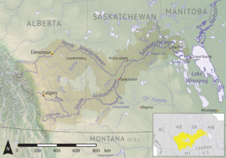
The Cub Hills are a hilly plateau located south-east of the geographical centre of the Canadian province of Saskatchewan. The hills are in the boreal forest ecozone of Canada and the landforms of the hills were shaped more than 10,000 years ago during last ice age. Throughout the Cub Hills, there are dozens of lakes and rivers and several parks. The Cubs Hills are 150 km (93 mi) north-east of Prince Albert and are in the Northern Saskatchewan Administration District and Census Division #18. Several highways criss-cross the plateau to provide access to the various parks and other amenities.

Piwei River is a river in the east-central part of the Canadian province of Saskatchewan in the boreal forest ecozone of Canada. It begins at the western end of the Porcupine Hills at Piwei Lakes and heads in an easterly direction through a glacier-formed valley and into the Etomami River, which is a tributary of the Red Deer River.
Woody River is a river in the Canadian provinces of Manitoba and Saskatchewan. The river's source is in the Porcupine Hills and Porcupine Provincial Forest of eastern Saskatchewan. From there it flows south through boreal forest and then east through Boreal Plains in the Parkland Region of Manitoba en route to Swan Lake. The river parallels the Swan River for much of its route as it travels through Swan River Valley between Duck Mountain and Porcupine Hills of the Manitoba Escarpment. Bowsman is the only notable community along the course of Woody River. Several highways cross it, including Saskatchewan's Highway 980, Manitoba's Roads 588, 587, 366, 268, and Manitoba's Highway 10.
Midnight Creek is a river in the Canadian province of Saskatchewan. The river begins in the heart of the Porcupine Hills and of the Manitoba Escarpment and heads in a generally south-east direction through the Porcupine Provincial Forest before emptying into Elbow Lake. A short river connects Elbow Lake to Woody Lake, which is the source for Woody River. Highway 980 follows the river for much of its course.
Townsend Lake is a lake in the Canadian province of Saskatchewan. It is located in the east-central part of the province in the Porcupine Hills and Porcupine Provincial Forest. The lake is in the Woody River Block of Porcupine Hills Provincial Park. Highway 980 provides access to the east side of the lake and its amenities. Several small creeks feed into the lake from the surrounding hills, lakes, and muskeg. The outflow is a short river at the eastern end of the lake that flows into the western end of Woody Lake.
Isbister Lake is a lake in the Canadian province of Saskatchewan. It is located in the east-central part of the province along the course of Midnight Creek in the Porcupine Hills and Porcupine Provincial Forest. The lake is in the Woody River Block of Porcupine Hills Provincial Park. Highway 980 provides access to the southern shore of the lake and its amenities. Isbister Lake is situated in boreal forest surrounded by hills, other small lakes, and muskeg.
Clarence-Steepbank Lakes Provincial Park is a remote wilderness park in the Canadian province of Saskatchewan. It is located in the boreal forest ecozone east of Prince Albert National Park and Montreal Lake, west of the Cub Hills and Narrow Hills Provincial Park, south of Nipekamew and East Trout Lakes, and north of Whiteswan Lakes and Candle Lake Provincial Park. The city of Prince Albert is approximately 150 kilometres (93 mi) to the south and access to the park is from Highway 927.
Clarence Lake is a lake in Clarence-Steepbank Lakes Provincial Park in the Canadian province of Saskatchewan. The lake is in a glacier-carved valley in the Boreal forest ecozone of Canada and is part of the Bow River chain of lakes at the headwaters of the Bow River, which is a tributary of Lac la Ronge in the Churchill River watershed.
Bow River is a river in the Northern Administration District of the Canadian province of Saskatchewan. The river begins at Ridge Lake of Bow River chain lakes in Clarence-Steepbank Lakes Provincial Park and flows in a northerly direction into Lac la Ronge and Lac La Ronge Provincial Park. Rapid River connects Lac la Ronge to the Churchill River. There are no communities nor settlements along the river's course.
Elaine Lake is a lake in the Canadian province of Saskatchewan. It is located north of Prince Albert National Park in the Thunder Hills of the Northern Saskatchewan Administration District.
Makwa Lake, which is Cree for Loon Lake, is a lake in the west-central region of the Canadian province of Saskatchewan in the transition zone between parkland and boreal forest. The Battle of Loon Lake, which was last battle of the North-West Rebellion, happened at Steele Narrows, a strait at the entrance to Sanderson Bay on Makwa Lake. The site is now part of Steele Narrows Provincial Park.
Beatty Lake is a lake in the Canadian province of Saskatchewan. The lake is set in rolling hills of Jack pine forest and muskeg in Saskatchewan's Northern Administration District. The lake is adjacent to Beaver River near where Beatty Creek flows into Beaver River. Access is from the Hanson Lake Road.

Boggy Creek is a river in the Canadian province of Saskatchewan. The river begins north-east of Balgonie and heads in a westerly direction towards Pilot Butte and Regina before turning north-west where it meets the Qu'Appelle River east of Lumsden. Along the river's course there is a reservoir and several tourist attractions including parks, golf courses, a race track, and a summer camp.

