Lake Winnipeg is a very large, relatively shallow 24,514-square-kilometre (9,465 sq mi) lake in North America, in the province of Manitoba, Canada. Its southern end is about 55 kilometres (34 mi) north of the city of Winnipeg. Lake Winnipeg is Canada's sixth-largest freshwater lake and the third-largest freshwater lake contained entirely within Canada, but it is relatively shallow excluding a narrow 36 m (118 ft) deep channel between the northern and southern basins. It is the eleventh-largest freshwater lake on Earth. The lake's east side has pristine boreal forests and rivers that were in 2018 inscribed as Pimachiowin Aki, a UNESCO World Heritage Site. The lake is 416 km (258 mi) from north to south, with remote sandy beaches, large limestone cliffs, and many bat caves in some areas. Manitoba Hydro uses the lake as one of the largest reservoirs in the world. There are many islands, most of them undeveloped.

Deloraine is an unincorporated urban community in the Municipality of Deloraine – Winchester within the Canadian province of Manitoba that held town status prior to January 1, 2015. It is situated near the Turtle Mountains in the southwestern corner of the province. Located in the Westman Region, the community is 100 km (62 mi) south of Brandon. Deloraine originally incorporated as a village in 1904 and then as a town in 1907. Its town status was relinquished in 2015 when it amalgamated with the Rural Municipality of Winchester.

Missisquoi National Wildlife Refuge is a National Wildlife Refuge located in the eastern shore of Lake Champlain in the U.S. state of Vermont. The refuge is in Franklin County in the northwest corner of the state near the International Boundary with Canada. It is the only National Wildlife Refuge located entirely in Vermont, and is administered by the United States Fish and Wildlife Service.

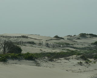
Pea Island National Wildlife Refuge is a national wildlife refuge located on North Carolina's Pea Island, a coastal barrier island and part of a chain of islands known as the Outer Banks, adjacent to Cape Hatteras National Seashore. The sanctuary is located 10 miles (16 km) south of Nags Head, North Carolina on NC 12.

The Erie National Wildlife Refuge is an 8,777-acre (3,552 ha) National Wildlife Refuge located in Crawford County, Pennsylvania. Named after the Erie tribe, it was established to provide waterfowl and other migratory birds with nesting, feeding, brooding, and resting habitat.

The Atlantic Flyway is a major north-south flyway for migratory birds in North America. The route generally starts in Greenland, then follows the Atlantic coast of Canada, then south down the Atlantic Coast of the United States to the tropical areas of South America and the Caribbean. Every year, migratory birds travel up and down this route following food sources, heading to breeding grounds, or traveling to overwintering sites.

Oak Hammock Marsh is a marsh and a wildlife management area located 34 kilometres (21 mi) north of Winnipeg, Manitoba, Canada. The WMA is considered to be a Class IV protected area under the IUCN protected area management categories. The marsh is recognized as an Important Bird Area (IBA) for its globally significant numbers of waterfowl and shorebirds. It is a designated Ramsar site due to its international importance as a breeding and staging area for waterfowl and other migratory birds. It is 3,578.47 hectares in size.
Delta Marsh consists of an extensive open marsh located near the south shore of Lake Manitoba, approximately 24 km north of the town of Portage la Prairie, Manitoba. The marsh extends for nearly 30 km along the shore of the lake, and has a breadth of up to 4 km. The marsh consists of a network of interconnected shallow bays separated from Lake Manitoba by a wooded barrier dune ridge of 300m to 600m width.

The Quill Lakes is a wetland complex in Saskatchewan, Canada that encompasses the endorheic basin of three distinct lake wetlands: Big Quill Lake, Middle Quill Lake, and Little Quill Lake. On May 27, 1987, it was designated a wetland of international importance via the Ramsar Convention. It was the first Canadian site in the North American Waterfowl Management Plan, is a site in the International Biological Programme and Saskatchewan Heritage Marsh Program, and was designated a Western Hemisphere Shorebird Reserve Network site of International significance in May, 1994. The site is an important staging and breeding area for spring and fall migration of shorebirds. The site qualifies as an Important Bird Area (IBA) of Canada for its globally and nationally significant migratory and breeding populations of more than a dozen species of birds. The IBA is designated as Quill Lakes .

The Creston Valley Wildlife Management Area is a Canadian river delta wetland and Wildlife Management Area near Creston in south-central British Columbia, on the floodplain of the Kootenay River at the south end of Kootenay Lake. Predominantly marshland, it was classified as a wetland of international importance on February 21, 1994, and is also a globally significant Important Bird Area. It is one of the "few significant agricultural areas of the province", and is in the Montane Cordillera. It stretches north along Kootenay Lake for approximately 20 km, and south to the United States border. It is both the only breeding site of the Forster's tern and the only site with leopard frogs in the province, as well as one of the few Canadian habitats for the Coeur D'Alene salamander. Creston Valley provides staging and nesting areas for migratory birds on the Pacific Flyway.

Breton National Wildlife Refuge is located in southeastern Louisiana in the offshore Breton Islands and Chandeleur Islands. It is located in the Gulf of Mexico and is accessible only by boat. The refuge was established in 1904 through executive order of President Theodore Roosevelt and is the second-oldest refuge in the National Wildlife Refuge System.

George C. Reifel Migratory Bird Sanctuary is a protected area in Delta, British Columbia, Canada, and is part of the Fraser River estuary, designated a site of Hemispheric Importance by the Western Hemisphere Shorebird Reserve Network.

The Sonny Bono Salton Sea National Wildlife Refuge is located in the Imperial Valley of California, 40 miles (64 km) north of the Mexican border. Situated at the southern end of the Salton Sea, the refuge protects one of the most important nesting sites and stopovers along the Pacific Flyway. Despite its location in the Colorado Desert, a subdivision of the larger Sonoran Desert, the refuge contains marine, freshwater, wetland, and agricultural habitats which provide sanctuary for hundreds of birds and wetland species, including several that have been listed as endangered or sensitive by the U.S. Fish and Wildlife Service.

Ottawa National Wildlife Refuge is a National Wildlife Refuge of the United States, which is located in the state of Ohio. This refuge was established in 1961, under the Migratory Bird Conservation Act, the purpose of the refuge being created was “… for use as an inviolate sanctuary, or for any other management purpose, for migratory birds.” 16 U.S.C. 715d. This refuge provides ideal habitat for a wide range for migratory birds and waterfowl, along with the native wildlife, and any endangered and threatened species. The property of the refuge was purchased from hunt clubs and farmlands with the Federal Duck Stamps.
Akyatan Lagoon is a 14700-hectare wetland ecosystem that is designated as Wetland of International Importance by Ramsar Convention. A major stop over for migrating birds, Akyatan is recognized as an Important Bird Area by BirdLife International. It is the single largest green turtle rookery at the Mediterranean, holding 43% of the Mediterranean nesting population.

The Summer Lake Wildlife Area is a 29.6-square-mile (77 km2) wildlife refuge located on the northwestern edge of the Great Basin drainage in south-central Oregon. It is administered by the Oregon Department of Fish and Wildlife. The refuge is an important stop for waterfowl traveling along the Pacific Flyway during their spring and fall migrations. The Summer Lake Wildlife Area also provides habitat for shorebirds and other bird species as well as wide variety of mammals and several fish species. The Ana River supplies the water for the refuge wetlands.

Frank Lake is a restored wetland located 6 km (3.7 mi) east of High River, Alberta, 50 km (31 mi) south of Calgary, near Blackie. The lake is controlled by Ducks Unlimited Canada for wildlife management purposes, and is an Important Bird Area and Key Biodiversity Area. It is one of four Alberta lakes with the same name.
Last Mountain Lake Bird Sanctuary is a National Historic Site of Canada, located in the rural municipality of Last Mountain Valley No. 250 in Saskatchewan. The migratory bird sanctuary was the first established in North America. The 47.36 km2 (18.29 sq mi) area is within the Last Mountain Lake National Wildlife Area, an International Biological Program site, and includes adjacent uplands.
Last Mountain Lake National Wildlife Area is a National Wildlife Area (NWA) in the Canadian province of Saskatchewan. The protected area is in the Prairie Pothole Region of North America, which extends throughout three Canadian provinces and five U.S. states. It is also within Palliser's Triangle and the Great Plains ecoregion. The site is an Important Bird Area (IBA) of Canada, designated as Last Mountain Lake NWA .

Thunder Creek is a river in the Canadian province of Saskatchewan. The watershed of Thunder Creek is within the semi-arid Palliser's Triangle in south-central Saskatchewan. It begins at small, man-made reservoir near Lake Diefenbaker and flows in a south-easterly direction towards the city of Moose Jaw and the Moose Jaw River. The Moose Jaw River is a major tributary of the Qu'Appelle River For most of its course, Thunder Creek follows a valley called the Thunder Creek meltwater channel that was formed over 10,000 years ago near the end of the last ice age.


