This article's lead sectionmay be too short to adequately summarize the key points. Please consider expanding the lead to provide an accessible overview of all important aspects of the article.(March 2021)
The Manitoba Watershed District Program is a provincial-municipal partnership directed to the conservation and management of water and soil resources. There are 14 watershed districts including more than 130 municipalities covering almost all of the agricultural areas of Manitoba, Canada. The Province provides substantial funding and general guidance but the programs are developed and administered locally. The districts spend more than $8 million each year on a wide variety of conservation programs.
The Whitemud Watershed District created in 1972 was the first district formed in Manitoba. The district covers about 2,450 square miles (6,350km2) in south central Manitoba. It includes all or portions of 15 rural municipalities and three towns. It includes all the area that drains into the Whitemud River. The district's goal is to promote soil and water stewardship and to facilitate agricultural land drainage on a watershed basis. The District is responsible for over 1,100 miles (1,800km) of drainage infrastructure and 1,200 crossings. Major activities include maintenance and replacement of infrastructure, as well as proactive soil and water conservation projects such as forage assistance, shelterbelts, grassed runways, water retention, shale traps, habitat preservation, conservation corridors, stream bank stabilization and riparian management.
West Lake Watershed District
The West Lake Watershed District was born in 1978 as the Alonsa Conservation District, in 2020 it expanded and the name was changed. It is on the west shore of Lake Manitoba. The beef cattle industry dominates the local economy as well as commercial fishing in the winter months. The District has been involved in soil and water management. Some of the major projects include channel construction, improvements and maintenance, water level and flood control, land drainage, forage seed assistance, waterfowl nesting grounds, waterfowl enhancement and school conservation education programs.
Northeast Red Watershed District
The Northeast Red Watershed District was started in 1979 as the Cooks Creek Conservation District in 2020 the name and boundaries were changed to watershed boundaries. The municipalities include Springfield, Tache, Ste. Anne, Brokenhead and Reynolds. Water management is the most important issue in the District. The District places emphasis on the maintenance and upgrading of agricultural drainage channels. Other initiatives include sealing abandoned wells, crossing replacements and repairs and public education.
Pembina Watershed District
The Pembina Waterhhed District was formed in 1989 as the Pembina Valley Conservation District. The name and boundaries were changed in 2020. The District includes portions of the Turtle Mountain, Pembina Valley, Tiger Hills, Red River Valley and Pembina Escarpment. municipalities included in the District are Killarney Turtle Mountain, Boissevaine-Morton, Lorne, Thompson, Cartwright-Roblin, Louise, Stanley and Pembina. Towns included are Killarney, Pilot Mound and Manitou, in addition to the Village of Crystal City. The District's priorities are conservation farming and water management.
Souris River Watershed District
The Souris River Watershed District was incorporated in 1995 as the West Souris Conservation District. The name and boundaries were changed in 2020 absorbing about half of the Turtle Mountain Conservation District. Is located in southwest corner of Manitoba. The municipalities included are Deloraine-winchester, Brenda-Waskada, Grassland, Boissevain-Morton, Two Borders, Pipestone, Sifton, Cameron and Wallace. Water and soil management programs are priorities of the District. Programs include water storage, sealing abandoned wells, well development, shelterbelt planting, riparian management, forage rotation, zero tillage and habitat conservation initiatives.
The district recognizes the important links between human health and watershed health. Through education, innovative leadership, community input and partnerships the district strives to manage the watershed as a complex sustainable system emphasizing prevention and protection programs. The District places a particular focus on public education.
Major streams found in the district include Gopher, Pipestone, Stoney, Jackson, Graham, Gainsborough, Antler, Medora and the Souris River. Major water bodies include Whitewater, Maple, Oak and Plum Lakes.
Assiniboine West Watershed District
This district, was created in 2020 combining the Lake of the Prairies, Upper Assiniboine and Little Saskatchewan River Conservation Districts
The district can be divided into three distinct landscapes: uplands, plains and river valleys. From the Newdale Plain to the border of Riding Mountain National Park, the undulating topography can vary over 200 meters. The dominant feature is the Assiniboine River meandering through the area. In places the valley is more than 1 mile (2km) wide and over 75 meters deep with steep slopes. The Assiniboine River Valley is one of the most scenic aspects but also presents a major resource management issue.
Inter-Mountain Watershed District
The Intermountain Conservation District was formed in 1997. In 2020, the Turtle River Watershed Conservation District, formed in 1975, was added and renamed the Inter-Mountain Watershed District. Riding Mountain National Park, Duck Mountain Provincial Forest, Crown Territory and Lakes Dauphin and Winnipegosis surround the District. The municipalities included in this District are Ste. Rose, McCreary, Dauphin, Ethelbert, Gilbert Plains, Grandview, Mossey River and Mountain. The Villages of McCreary, Ste Rose du lac , Winnipegosis and Ethelbert, the towns of Grandview and Gilbert Plains and the City of Dauphin are also included. Water management is the highest priority. Soil conservation and public education are priorities as well. IMWD is the only watershed district in the program with a responsibility to maintain waterway infrastructure (bridges/crossings and drains) in only some municipalities within the District.
Kelsey Watershed District
The Kelsey Conservation District was born in 1999 and the name was changed in 2020. It is located in the west-central Manitoba and includes the Pasquia hills and Carrot Riverdrainage basins. The District is most interested in developing programs that educate the public about prudent resource management, soil and water conservation practices and local decision-making as a means to maintain a healthy rural landscape. Some projects include off-site watering, exclusion fencing, forage assistance, abandoned well capping, well disinfecting, tree planting and wildlife habitat enhancement.
Central Assiniboine Watershed District
The Central Assiniboine District was formed in 2020. It covers 1,759 square miles (4,560km2). It includes the municipalities of Argyle, Victoria Manitoba|Victoria]], Glenwood, Cornwallis, Prairie Lakes and South Cypress and the Village of Glenboro and Wawanesa and the town of Souris. The board has stressed soil conservation, water management and conservation education programs.
Seine Rat Roseau Watershed District
The Seine Rat Roseau Watershed District is made up of three main watersheds; the Roseau River, the Seine River and the Rat River Watersheds. The five sub-watersheds that all drain into the Seine River Watershed are the Upper Seine River, the Lower Seine River, the Seine River Diversion, the Tourond Creek and the Manning Canal. The two sub-watersheds that contribute to the Rat River Watershed are the Upper Rat River and the Lower Rat River/Joubert Creek watersheds.
The district includes the municipalities of La Broquerie, Ste. Anne, Hanover, De Salaberry, Ritchot, Stuartburn, Reynolds, Montcalm, City of Steinbach, Town of Ste. Anne, the Village of t. Pierre-Jolys, Emerson-Franklin, the Town of Niverville, Piney, Springfield and Tache. The only outstanding municipalities are the City of Winnipeg and Morris, who have yet to join and complete the entire watershed as a unified voice of water management together over southeastern Manitoba. The district operates under the board of directors, made up of municipal appointed rate-payers and councilors who are all working together for the overall health of the watershed. Decision-making processes are based on watershed boundaries and local grassroots knowledge, with the leader of each sub-watershed taking a position on the main district board. All recommendations are made by the local sub-watershed committees and are brought before the main board for approval.
The Seine Rat Roseau Watershed District covers an area southeast of Winnipeg, over 7,000km2 and is home to approximately 68,000 people. The district offers a full line of water management programs with a particular focus on surface and groundwater management initiatives. One of the main objectives lies in creating water retention projects to hold back water during spring run-off to alleviate flooding downstream and provide greater aquifer recharge areas, as groundwater is a major drinking water supply to residents. Both objectives increase water quality on the surface and sub-surface overall. The district also provides funding to seal old and abandoned wells that present a point of contamination to groundwater; for livestock producers to purchase alternative watering systems & riparian fencing to keep livestock out of dugout, creeks and rivers; and to monitor well water in rural homes throughout the district are among the most popular programs. More information can be found at www.srrcd.ca
Redboine Watershed District
The Redboine Watershed District was established in 2020, formerly the LaSalle Redboine Conservation Districy. It includes all or parts of the municipalities of Dufferin, Grey, South Norfolk, Cartier and Victoria. It also includes Carman, St. Claude and Treherne. Their programs include grassed waterways, off channel watering systems, cover programs, rotational grazing systems and pasture pipelines.
East Interlake Watershed District
The East Interlake Watershed District was renamed in 2020, originally incorporated as East Interlake Conservation District in 2005. The district covers about 3,900 square miles (10,000km2) and is home to 55,000 residents. The District includes all or parts of the municipalities of Armstrong, Bifrost, Fisher, Gimli, St. Andrews, West St. Paul, Rockwood, Rosser, City of Selkirk, Towns of Arborg, Stonewall, Teulon and Winnipeg Beach, Villages of Riverton and Dunnottar. The district offers a wide range of programs, such as riparian management, well inventory, sealing abandoned wells, benthic invertebrate monitoring, culvert assessment and inventory, and water quality monitoring.
West Interlake Watershed District
The West Interlake Watershed District started in 2008 as a conservation district changed name to watershed district in 2020. The District covers 1,761 square miles (4,560km2) and is home to more than 6,500 people. The District is located along the eastern shores of Lake Manitoba. Municipalities include Armstrong, Coldwell, Eriksdale, Siglunes, St. Laurent, and Woodlands. The district develops and deliver programs to address priority land and water management issues and public education.
Swan Lake Watershed District
The Swan Lake Watershed District is the dedicated to regional land and water issues in a co-operative, long-term planning. It was formed in 2006, is about 1,630 square miles (4,220km2). The District is located in western Manitoba between the Duck Mountain Provincial Park and forest and Porcupine Provincial Forest. Municipal partners include the rural municipalities of Minitonas, Mountain and Swan River, the towns of Birch River, Minitonas and Swan River and the villages of Benito and Bowsman.
Related Research Articles
Lake Agassiz was a large proglacial lake that existed in central North America during the late Pleistocene, fed by meltwater from the retreating Laurentide Ice Sheet at the end of the last glacial period. At its peak, the lake's area was larger than all of the modern Great Lakes combined.
The Assiniboine River is a 1,070-kilometre (660 mi) river that runs through the prairies of Western Canada in Saskatchewan and Manitoba. It is a tributary of the Red River. The Assiniboine is a typical meandering river with a single main channel embanked within a flat, shallow valley in some places and a steep valley in others. Its main tributaries are the Qu'Appelle, Souris, and Whitesand Rivers. For early history and exploration see Assiniboine River fur trade.
The Souris River or Mouse River is a river in central North America. Approximately 435 miles (700 km) in length, it drains about 23,600 square miles (61,100 km2) in Canada and the United States.
The Pembina River is a tributary of the Red River of the North, approximately 319 miles (513 km) long, in southern Manitoba in Canada and northeastern North Dakota in the United States. It drains an area of the prairie country along the Canada–US border, threading the Manitoba-North Dakota border eastward to the Red River. Via the Red River, Lake Winnipeg and the Nelson River, it is part of the watershed of Hudson Bay.
The Qu'Appelle River is a river in the Canadian provinces of Saskatchewan and Manitoba that flows 430 kilometres (270 mi) east from Lake Diefenbaker in south-western Saskatchewan to join the Assiniboine River in Manitoba, just south of Lake of the Prairies, near the village of St. Lazare. It is in a region called the Prairie Pothole Region of North America, which extends throughout three Canadian provinces and five U.S. states. It is also within Palliser's Triangle and the Great Plains ecoregion.
Provincial Trunk Highway 5 is a provincial primary highway located in the Canadian province of Manitoba.
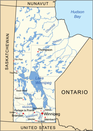
The geography of Manitoba addresses the easternmost of the three prairie Canadian provinces, located in the longitudinal centre of Canada. Manitoba borders on Saskatchewan to the west, Ontario to the east, Nunavut to the north, and the American states of North Dakota and Minnesota to the south. Although the border with Saskatchewan appears straight on large-scale maps, it actually has many right-angle corners that give the appearance of a slanted line. In elevation, Manitoba ranges from sea level on Hudson Bay to 2727 ft (831 m) on top of Baldy Mountain. The northern sixty percent of the province is on the Canadian Shield. The northernmost regions of Manitoba lie permafrost, and a section of tundra bordering Hudson Bay.
The Association of Manitoba Municipalities (AMM) is an organization of municipal governments in the province of Manitoba, Canada. All incorporated municipalities in Manitoba are members.
Duck Mountain Provincial Park is a 1,424 square kilometre provincial park in western Manitoba. The park is located within the larger and similarly named Duck Mountain Provincial Forest. Duck Mountain Provincial Park was designated a provincial park by the Government of Manitoba in 1961. and is considered to be a Class II protected area under the IUCN protected area management categories. The park is unincorporated, not lying within the borders of any of Manitoba's rural municipalities.
The Whitemud River is a small, highly meandering river in southwest Manitoba, Canada. It begins at the confluence of Stony Creek and Boggy Creek in Neepawa, and flows east to Arden, Gladstone, Westbourne, discharging into Lake Manitoba at Lynchs Point. Its total drainage area is 7,110 square kilometres (2,747 sq mi).
The Rat River is a tributary of the Red River of the North in southern Manitoba, Canada. It is part of the watershed of Hudson Bay.
The 2011 Assiniboine River flood was caused by above average precipitation in Western Manitoba and Saskatchewan. This was a 1 in 300 year flood that affected much of Western Manitoba. The flooding in Manitoba was expected to mostly involve the 2011 Red River Flood but instead the more severe flooding was found on the Assiniboine in the west.
The Prairie Mountain Health is the governing body responsible for healthcare delivery and regulation for the eponymous health region in southwest Manitoba.
Pipestone Creek is a river in the Souris River watershed. Its flow begins in southeastern Saskatchewan, just south of the town of Grenfell and travels in a southeastern direction into Manitoba in the Westman Region where it empties into Oak Lake through the Oak Lake Marsh.
Oak Lake is a lake in the south-western part of the Canadian province of Manitoba in a region called Westman. Oak Lake is a kettle lake and is an aquifer supplier for numerous nearby residential areas and farms. The lake is in the RM of Sifton and sits at an elevation of 426 metres above sea level. Provincial Road 254 provides access to the lake.
The Icelandic River is a river in the Interlake Region of Manitoba. The river has its headwaters near the Spruce Lakes system located by Manitoba Highway 68. The river is the source of an agricultural area in the north of the Interlake, flowing through and supporting the communities of Arborg, Manitoba and Riverton, Manitoba. The East Interlake Conservation Area has assessed that 81% of the land use of the Icelandic River watershed is used for an agricultural purpose.
This page is based on this Wikipedia article Text is available under the CC BY-SA 4.0 license; additional terms may apply. Images, videos and audio are available under their respective licenses.