Whitemud River

Last updated
Whitemud River
Whitemud westboune.jpg
Whitemud River in Westbourne
Canada Manitoba relief location map.jpg
Red pog.svg
Location
Canada
Province Manitoba
Physical characteristics
Mouth Lake Manitoba
  location
Lynchs Point
  coordinates
50°18′08″N98°35′15″W / 50.30222°N 98.58750°W / 50.30222; -98.58750
  elevation
247 m (810 ft)
Basin size7,110 km2 (2,747 sq mi) [1]
Discharge 
  location Westbourne
  average6.91 m3/s (244 cu ft/s) [2]
  minimum0.107 m3/s (3.8 cu ft/s) [2]
  maximum94.4 m3/s (3,330 cu ft/s) [2]

The Whitemud River is a small, highly meandering river in southwest Manitoba, Canada. [3] It begins at the confluence of Stony Creek and Boggy Creek in Neepawa, and flows east to Arden, Gladstone, Westbourne, discharging into Lake Manitoba at Lynchs Point. Its total drainage area is 7,110 square kilometres (2,747 sq mi). [1]

Contents

The fur trader Alexander Henry referred to it in 1799 as Riviere Terre Blanche, translated as "White Earth River" or "White Mud River", likely deriving its name from the colour of the clay and soil along its banks. This clay, also found on alkaline flats or the mud on the lower river, would become greyish-white when used for plastering the chinks of log houses. In addition to the two translated English names, other variations of the river's name included White River (1808) and Little Mud River (1885). In 1933, its name was spelled as one word. [4]

Geography

Other major streams feeding the river include the Big Grass River, Pine Creek, Squirrel Creek, Westbourne Drain and Rat Creek. [5]

The river's depth ranges from a few centimeters in the summer to several meters in flood events. Fish species known to inhabit the river include northern pike, white suckers, flathead minnows, emerald shiners, common carp and walleye.

Flows vary dramatically from year to year. The peak flow, measured at Westbourne in April 1979, was 310 cubic metres per second (11,100 cu ft/s), and zero flow has been measured on several occasions. Annual runoff volume has varied from 36,000,000 cubic metres (29,000  acre⋅ft ) in 1989 to 611,000,000 cubic metres (495,000 acre⋅ft) in 2001. The mean annual volume at Westbourne is 199,000,000 cubic metres (161,000 acre⋅ft). [6]

History

In the early 19th century, traders of the Hudson's Bay Company (HBC) would spend their winters at the mouth of the Whitemud River, along the shore of Lake Manitoba. In 1815, a winter fur-trade post was established there, called Big Point House or Manitoba Lake House. It was expanded in 1820, but abandoned by 1824. [7]

Big Point House was in operation again from 1862 until circa 1894. [7]

See also

Related Research Articles

<span class="mw-page-title-main">Lake Winnipeg</span> Large glacial lake in Manitoba, Canada

Lake Winnipeg is a very large, relatively shallow 24,514-square-kilometre (9,465 sq mi) lake in North America, in the province of Manitoba, Canada. Its southern end is about 55 kilometres (34 mi) north of the city of Winnipeg. Lake Winnipeg is Canada's sixth-largest freshwater lake and the third-largest freshwater lake contained entirely within Canada, but it is relatively shallow excluding a narrow 36 m (118 ft) deep channel between the northern and southern basins. It is the eleventh-largest freshwater lake on Earth. The lake's east side has pristine boreal forests and rivers that were in 2018 inscribed as Pimachiowin Aki, a UNESCO World Heritage Site. The lake is 416 km (258 mi) from north to south, with remote sandy beaches, large limestone cliffs, and many bat caves in some areas. Manitoba Hydro uses the lake as one of the largest reservoirs in the world. There are many islands, most of them undeveloped.

<span class="mw-page-title-main">Lake Manitoba</span> Lake in Manitoba, Canada

Lake Manitoba is the 14th largest lake in Canada and the 33rd largest lake in the world with a total area of 4,624 km2 (1,785 sq mi). It is located within the Canadian province of Manitoba about 75 km (47 mi) northwest of the province's capital, Winnipeg, at 50°59′N98°48′W.

<span class="mw-page-title-main">Assiniboine River</span> River in Western Canada

The Assiniboine River is a 1,070-kilometre (660 mi) river that runs through the prairies of Western Canada in Saskatchewan and Manitoba. It is a tributary of the Red River. The Assiniboine is a typical meandering river with a single main channel embanked within a flat, shallow valley in some places and a steep valley in others. Its main tributaries are the Qu'Appelle, Souris, and Whitesand Rivers. For early history and exploration see Assiniboine River fur trade.

<span class="mw-page-title-main">Souris River</span> River in Canada and the United States

The Souris River or Mouse River is a river in central North America. Approximately 435 miles (700 km) in length, it drains about 23,600 square miles (61,100 km2) in Canada and the United States.
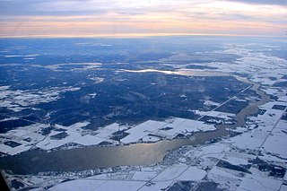
<span class="mw-page-title-main">Pembina River (Manitoba – North Dakota)</span> River in Canada, United States

The Pembina River is a tributary of the Red River of the North, approximately 319 miles (513 km) long, in southern Manitoba in Canada and northeastern North Dakota in the United States. It drains an area of the prairie country along the Canada–US border, threading the Manitoba-North Dakota border eastward to the Red River. Via the Red River, Lake Winnipeg and the Nelson River, it is part of the watershed of Hudson Bay.

<span class="mw-page-title-main">Qu'Appelle River</span> River in Western Canada

The Qu'Appelle River is a river in the Canadian provinces of Saskatchewan and Manitoba that flows 430 kilometres (270 mi) east from Lake Diefenbaker in south-western Saskatchewan to join the Assiniboine River in Manitoba, just south of Lake of the Prairies, near the village of St. Lazare. It is in a region called the Prairie Pothole Region of North America, which extends throughout three Canadian provinces and five U.S. states. It is also within Palliser's Triangle and the Great Plains ecoregion.

<span class="mw-page-title-main">Hayes River</span> River in Manitoba, Canada

The Hayes River is a river in Northern Manitoba, Canada, that flows from Molson Lake to Hudson Bay at York Factory. It was historically an important river in the development of Canada and is now a Canadian Heritage River and the longest naturally flowing river in Manitoba.

<span class="mw-page-title-main">Gladstone, Manitoba</span> Unincorporated community in Manitoba, Canada

Gladstone is an unincorporated urban community in the Municipality of WestLake – Gladstone within the Canadian province of Manitoba that held town status prior to January 1, 2015. It is located on the Yellowhead Highway at the intersection with Highway 34. The Gladstone railway station receives Via Rail service.

<span class="mw-page-title-main">Shellmouth Reservoir</span> Reservoir in Western Canada

The Shellmouth Reservoir is a man-made reservoir on the Assiniboine River in Manitoba and Saskatchewan, Canada.

<span class="mw-page-title-main">North Saskatchewan River</span> River in Western Canada

The North Saskatchewan River is a glacier-fed river that flows from the Canadian Rockies continental divide east to central Saskatchewan, where it joins with the South Saskatchewan River to make up the Saskatchewan River. Its water flows eventually into the Hudson Bay.

<span class="mw-page-title-main">Last Mountain Lake</span> Lake in Saskatchewan, Canada

Last Mountain Lake, also known as Long Lake, is a prairie lake formed from glaciation 11,000 years ago. It is located in south central Saskatchewan, Canada, about 40 kilometres (25 mi) north-west of the city of Regina. It flows into the Qu'Appelle River via Last Mountain Creek, which flows past Craven. It is approximately 93 km (58 mi) long, and 3 km (1.9 mi) wide at its widest point. It is the largest naturally occurring body of water in southern Saskatchewan. Only Lake Diefenbaker, which is man-made, is larger. The lake is a popular resort area for residents of south-eastern Saskatchewan.

<span class="mw-page-title-main">Carrot River (Saskatchewan)</span> River in Western Canada

Carrot River is a river in Western Canada in the north-eastern part Saskatchewan and the north-western part of Manitoba. The outlet of Wakaw Lake in Saskatchewan marks the beginning of the Carrot River and, from there, it flows north-east past several communities and Indian reserves until it joins the Saskatchewan River in the Cumberland Delta in Manitoba. The river's mouth is west and upstream of the Pasquia River and The Pas on the Saskatchewan River.

<span class="mw-page-title-main">South Fork Eel River</span> River in north-central California

The South Fork Eel River is the largest tributary of the Eel River in north-central California in the United States. The river flows 105 miles (169 km) north from Laytonville to Dyerville/Founders' Grove where it joins the Eel River. The South Fork drains a long and narrow portion of the Coast Range of California in parts of Mendocino and Humboldt counties. U.S. Route 101 follows the river for much of its length.

<span class="mw-page-title-main">Frenchman River</span> River in Saskatchewan and Montana

The Frenchman River,, also known locally as the Whitemud River, is a river in Saskatchewan, Canada and Montana, United States. It is a tributary of the Milk River, itself a tributary of the Missouri and in turn a part of the Mississippi River watershed that flows to the Gulf of Mexico.

The Cheslatta River is a tributary of the Nechako River, one of the main tributaries of the Fraser River, in the Canadian province of British Columbia. It flows through the Nechako Plateau. Before the construction of Kenney Dam in the early 1950s the Cheslatta was a minor tributary of the Nechako. Today the Nechako River is dry above the Cheslatta, which provides all its source water.

<span class="mw-page-title-main">Black River (York Region)</span> River in Ontario, Canada

The Black River is a river in the Regional Municipality of York and the Regional Municipality of Durham in Central Ontario, Canada. It is part of the Great Lakes Basin, and is a tributary of Lake Simcoe; the entire watershed is under the auspices of the Lake Simcoe Region Conservation Authority.

<span class="mw-page-title-main">Pipestone Creek (Saskatchewan)</span> River in central North America

Pipestone Creek is a river in the Souris River watershed. Its flow begins in southeastern Saskatchewan, just south of the town of Grenfell and travels in a southeastern direction into Manitoba in the Westman Region where it empties into Oak Lake through the Oak Lake Marsh.

<span class="mw-page-title-main">Last Mountain Creek</span> River in Saskatchewan, Canada

Last Mountain Creek is a river in south-central Saskatchewan. It is a tributary of the Qu'Appelle River in a region called the Prairie Pothole Region of North America, which extends throughout three Canadian provinces and five U.S. states. It is also within Palliser's Triangle and the Great Plains ecoregion.

Wood River is a river in the Canadian province of Saskatchewan. It has its source in the Wood Mountain Hills of south-western Saskatchewan and flows in a north-easterly direction to its mouth at Old Wives Lake. Old Wives Lake is a salt water lake with no outflow. As a result, the drainage basin of Wood River is an endorheic one. Along the course of the river, there are several parks, historical sites, and small towns.

<span class="mw-page-title-main">Icelandic River</span> River in Manitoba, Canada

The Icelandic River is a river in the Interlake Region of Manitoba. Its headwaters are near the Spruce Lakes system located by Manitoba Highway 68.

References

  1. 1 2 "Whitemud Watershed". whitemudwatershed.ca. Whitemud Watershed Conservation District. Retrieved 22 June 2023.
  2. 1 2 3 "Monthly Discharge Data for WHITEMUD RIVER AT WESTBOURNE (05LL002) [MB]". wateroffice.ec.gc.ca. Environment Canada. Retrieved 22 June 2023.
  3. "Whitemud River". Geographical Names Data Base . Natural Resources Canada . Retrieved 22 June 2023.
  4. "Geographical Names of Manitoba" (PDF). gov.mb.ca. Manitoba Geographical Names Program. Retrieved 22 June 2023.
  5. Agriculture and Agri-Food Canada - PFRA 2004. Summary of Resources and Land Use Issues Related to Riparian Areas in the Whitemud River Watershed.
  6. Archived data from Water Survey Canada
  7. 1 2 "Hudson's Bay Company: Big Point House". pam.minisisinc.com. Archives of Manitoba - Keystone Archives Descriptive Database. Retrieved 22 June 2023.

Commons-logo.svg Media related to Whitemud River at Wikimedia Commons