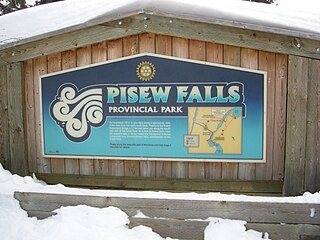
Pisew Falls Provincial Park is a provincial heritage park in the southwestern portion of Mystery Lake, Manitoba, Canada.

Northern Manitoba is a geographic and cultural region of the Canadian province of Manitoba. Originally encompassing a small square around the Red River Colony, the province was extended north to the 60th parallel in 1912. The region's specific boundaries vary, as "northern" communities are considered to share certain social and geographic characteristics, regardless of latitude.

Turtle Mountain Provincial Park is a provincial park located in the southwestern portion of the Canadian province of Manitoba. Within it are the Adam Lake and Max Lake campgrounds. The park is known for its bike trails, fishing, back country cabins and canoe routes. The park is very popular with families and outdoor enthusiasts.
Treherne is an unincorporated urban community in the Municipality of Norfolk Treherne within the Canadian province of Manitoba that held town status prior to January 1, 2015. It is halfway between Winnipeg and Brandon on Provincial Highway 2. Primarily a farming community, Treherne has a significant portion of the municipality's population, which is around 1750 people, and has two schools and a hospital. There is also a daycare facility, and in 2006 Treherne opened the Treherne Aquatic Centre next to a campground facility.

Hecla-Grindstone Provincial Park is a provincial park in Manitoba, Canada, which includes Hecla Island, Grindstone, Black Island and a number of other small islands in Lake Winnipeg, one of the largest freshwater lakes in the world. The park lies adjacent to the northeast side of the Municipality of Bifrost – Riverton in Manitoba.

Eastern Manitoba, or the Eastman Region, is an informal geographic region of the Canadian province of Manitoba. It is bounded on the north by the Winnipeg River and Lake Winnipeg, on the east by the Manitoba-Ontario border, on the south by the Canada–US border, and on the west by the Red River.

Grand Rapids is a town in Manitoba, Canada, on the northwestern shore of Lake Winnipeg where the Saskatchewan River enters the lake. As the name implies, the river had a significant drop at this point. In modern days, a large hydroelectric plant has been built there. Cedar Lake, a short distance upriver, provides a natural water source for the plant. Provincial Trunk Highway 6, the region's primary roadway, crosses the Saskatchewan River at the Grand Rapids Bridge.

Whiteshell Provincial Park is a provincial park in southeast Manitoba, approximately 120 kilometres (75 mi) east of the city of Winnipeg. The park is considered to be a Class II protected area under the IUCN protected area management categories. It is 275,210 hectares in size.

Hamber Provincial Park is a provincial park in British Columbia, Canada, located 130 kilometres (80.7 mi) north of Golden. Straddling the Great Divide on the provincial boundary with Alberta, the park is surrounded on three sides by Jasper National Park and protects the headwaters of the Wood River at Fortress Lake.
Duck Mountain Provincial Park is a provincial park, located in the Canadian province of Saskatchewan 14 km east of the town of Kamsack and stretches about 12 kilometres eastward to the Saskatchewan / Manitoba boundary. The park covers approximately 150 square kilometres. Road access to the park is via Highway 57, which connects Saskatchewan Highway 5 to Manitoba Highway 83.
Highway 49 and Provincial Trunk Highway 49 is a highway in the east central portion of the Canadian province of Saskatchewan and a very short highway in province of Manitoba. It runs from Saskatchewan Highway 35 between the communities of Fosston and Hendon to the Saskatchewan – Manitoba border, before ending at Provincial Trunk Highway 83 south of the community of Benito. The combined highway is about 166.4 km (103.4 mi) in length, 165.2 km (102.7 mi) is in Saskatchewan and 1.2 km (0.7 mi) is in Manitoba.

St. Ambroise Beach is a 46-hectare (110-acre) provincial park on the shore of Lake Manitoba in the Rural Municipality of Portage la Prairie of Canada. Established in 1961, the park lies in the Lake Manitoba Plain Ecoregion and is surrounded by marshland, which provides a habitat for waterfowl. The park is open to the public for recreational activities and birding. Piping plovers nest on the beach and warblers, geese and pelicans pass through the park during migration season. A boardwalk with a viewing tower extends into the marsh. St. Ambroise Beach is a stop on the international Pine to Prairie birding trail, which runs from Minnesota through Manitoba.

Meadow Lake Provincial Park is a northern boreal forest provincial recreational park along the Waterhen and Cold Rivers in the Canadian province of Saskatchewan. The park was founded on 10 March 1959, is the largest provincial park in Saskatchewan, and encompasses over 25 lakes in an area of 1,600 square kilometres. The park was named Meadow Lake after the city of Meadow Lake and Meadow Lake. The city and the lake are not in the park and are located about 40 kilometres (25 mi) south-east of the nearest park entrance, which is about 5 kilometres (3.1 mi) north of Dorintosh. The length of the park stretches about 113 kilometres (70 mi) from Cold Lake on the Saskatchewan / Alberta border in the west to the eastern shore of Waterhen Lake in the east.
Burgis Beach is a hamlet in the Canadian province of Saskatchewan.

Tobin Lake is a reservoir along the course of the Saskatchewan River in the Canadian province of Saskatchewan. Tobin Lake was formed by the building of the E.B. Campbell Dam on the Saskatchewan River in 1963. The dam was originally named Squaw Rapids Dam, but was renamed E.B. Campbell Dam in 1988 as the term squaw is derogatory. The town of Nipawin is near the western end of the lake and upstream from Nipawin along the Saskatchewan River is Codette Lake, which was formed by the construction of the Francois Finlay Dam in 1986. Situated between these two man-made lakes, Nipawin earned the nickname The Town of Two Lakes.
Narrow Hills Provincial Park is a northern boreal forest provincial recreational park in the Canadian province of Saskatchewan. It is located in a hilly plateau called the Cub Hills and contains several recreational facilities and over 25 accessible lakes within its boundaries. The geographical features of the park, including the lakes, valleys, and lowlands were formed over 10,000 years ago during the last ice age. The town of Smeaton is the closest community and it is located 70 kilometres (43 mi) to the south.

The Saskatchewan River Delta (SRD) is a large alluvial delta that straddles the border between the provinces of Saskatchewan and Manitoba in south-central Canada. Currently terminating at Cedar Lake, Manitoba, the delta is composed mainly of various types of wetlands, shallow lakes, and active and abandoned river channels bordered by forested natural levees. Sixty-five percent of the delta is occupied by vegetated wetlands, over one third of which comprise peat-forming fens and bogs. Geographically, the SRD consists of two parts---western and eastern---separated by a prominent moraine that was deposited by the Laurentide Ice Sheet during late stages of the Wisconsinan glacial epoch. These two components, commonly termed the "upper delta" and "lower delta", together occupy an area of approximately 10,000 square kilometres (3,900 sq mi) making the SRD one of the largest active inland delta in North America. The broad wetland tracts of the upper delta in Saskatchewan are sometimes referred to as the Cumberland Marshes. Approximately 5% of the delta surface has been drained for agricultural use following feasibility studies by the Prairie Farm Rehabilitation Administration in the 1950s.

Lundar Beach Provincial Park is a provincial park on the east shore of Lake Manitoba in Manitoba, Canada. It is located in the Rural Municipality of Coldwell, 18 kilometres west of Lundar, Manitoba.

Lac La Ronge Provincial Park is located in the boreal forest of the north central part of the Canadian province of Saskatchewan within the Canadian Shield. Situated in the Churchill River system, this provincial park has close to 100 lakes and more than 30 canoe routes, many of which follow old fur trade routes. Summer activities include camping, hiking, boating, fishing, and swimming. In the winter, there's cross-country skiing, snowmobiling, and ice fishing. Saskatchewan's highest waterfall is in the park. Nistowiak Falls are located north of Lac La Ronge along the Rapid River.
Porcupine Hills Provincial Park is the newest provincial park in the Canadian Province of Saskatchewan. It was created in 2018 through the amalgamation of five pre-existing provincial recreation sites south-east of the town of Hudson Bay. The park is in the Porcupine Provincial Forest in the Porcupine Hills, which is a geographical feature in eastern Saskatchewan and western Manitoba. The hills are part of a range of hills called the Manitoba Escarpment.
