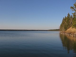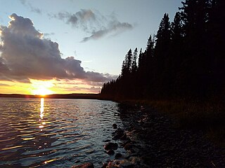
Turtle Mountain Provincial Park is a provincial park located in the southwestern portion of the Canadian province of Manitoba. Within it are the Adam Lake and Max Lake campgrounds. The park is known for its bike trails, fishing, back country cabins and canoe routes. The park is very popular with families and outdoor enthusiasts.

Riding Mountain National Park is a national park in Manitoba, Canada. The park is located within Treaty 2 Territory and sits atop the Manitoba Escarpment. Consisting of a protected area of 2,969 km2 (1,146 sq mi), the forested parkland stands in sharp contrast to the surrounding prairie farmland. It was designated a national park because it protects three different ecosystems that converge in the area; grasslands, upland boreal and eastern deciduous forests. It is most easily reached by Highway 10 which passes through the park. The south entrance is at the townsite of Wasagaming, which is the only commercial centre within the park boundaries.
Birds Hill Provincial Park is a provincial park in Manitoba, Canada located in the Boreal Plains ecozone. The park protects areas representative of Aspen/Oak parkland, as well as provides opportunities for recreation. It is located 24 kilometers north of Winnipeg on Highway 59, and covers approximately 8,300 acres or 35.1 km2.

Whiteshell Provincial Park is a provincial park in southeast Manitoba, approximately 120 kilometres (75 mi) east of the city of Winnipeg. The park is considered to be a Class II protected area under the IUCN protected area management categories. It is 275,210 hectares in size.

Golden Ears Provincial Park is a 555.9 square kilometres (214.6 sq mi) provincial park in British Columbia, Canada. It is named after the prominent twin peaks, which are commonly referred to as Golden Ears. The park was originally part of Garibaldi Provincial Park but was split off as a separate park in 1967. The area was logged extensively in the 1920s by the Lougheed and Abernathy Logging Company. Many recreational attractions are found within the park. Golden Ears Provincial Park is a protected area that contains many endangered species of flora and fauna.
Atikaki Provincial Park is a wilderness park in Manitoba, Canada, located east of Lake Winnipeg along the Ontario boundary in the Canadian Shield. The area of Atikaki Provincial Park is 3,981 square kilometres (1,537 sq mi). Atikaki Provincial Park is north of Nopiming Provincial Park and borders the Woodland Caribou Provincial Park in Ontario.
Spatsizi Plateau Wilderness Provincial Park is located in the northern portion of British Columbia, Canada, approximately 698, 659 hectares and encompasses the Spatsizi River and Gladys Lake Ecological Reserve. The park is a designated protected area that is intended for the conservation and research on caribou, grizzly bears, fish, and other wildlife species populations. Before the provincial park's establishment in 1975, the area was a historical hunting ground for local Indigenous communities like the Tahltan First Nations. It is the second largest provincial park in British Columbia.

Lady Evelyn-Smoothwater Provincial Park is a remote wilderness park in northeastern Ontario, Canada, north of Lake Temagami. This operating park, requiring permits for all visitors, encompasses "rugged topography, clear lakes, stunning waterfalls, and rushing rivers".

The Boreal Plains Ecozone, as defined by the Commission for Environmental Cooperation (CEC), is a terrestrial ecozone in the western Canadian provinces of Manitoba, Saskatchewan and Alberta. It also has minor extensions into northeastern British Columbia and south-central Northwest Territories. The region extends over 779,471 km2, of which 58,981 km2 is conserved.

Woodland Caribou Provincial Park is a provincial park in Northwestern Ontario, Canada, west of the municipality of Red Lake. It borders Atikaki Provincial Park and Nopiming Provincial Park in eastern Manitoba, and is made up of Canadian Shield and boreal forest. Woodland Caribou Provincial Park is a wilderness park of 450,000 hectares, and it became part of the Pimachiowin Aki UNESCO World Heritage Site in 2018.
Caribou River Provincial Wilderness Park is a provincial park in extreme north-central Manitoba, Canada. It is the northernmost provincial park in Manitoba, and borders the southern Nunavut border. It is known for its remote backcountry camping experience.

Narrow Hills Provincial Park is a northern boreal forest provincial recreational park in the Canadian province of Saskatchewan. It is located in a hilly plateau called the Cub Hills and contains several recreational facilities and over 25 accessible lakes within its boundaries. The geographical features of the park, including the lakes, valleys, and lowlands were formed over 10,000 years ago during the last ice age. The town of Smeaton is the closest community and it is located 70 kilometres (43 mi) to the south.

The Western Great Lakes forests is a terrestrial ecoregion as defined by the World Wildlife Fund. It is within the temperate broadleaf and mixed forests biome of North America. It is found in northern areas of the United States' states of Michigan, Wisconsin and Minnesota, and in southern areas of the Canadian province of Manitoba and northwestern areas of the province of Ontario.
Birch Island Provincial Park is a remote provincial park located on Lake Winnipegosis in Manitoba, Canada. The park is bordered on its western boundary by the Swan-Pelican Provincial Forest and on its eastern side by Chitek Lake Anishinaabe Provincial Park.
Colvin Lake Provincial Park is a provincial park in Manitoba, Canada, designated by the Government of Manitoba in 2010. The park is 1,630 km2 (630 sq mi) in size. It is considered a Class Ib protected area under the International Union for Conservation of Nature (IUCN) protected-area management categories.
Burge Lake Provincial Park was established in 1961 and is 6.12 ha in size. It is located on the west shore of the lake, about 10 km. north of Lynn Lake off PTR 394 The park has a small cottage subdivision, a campground, a boat launch and a beach with children's playground.
Zed Lake Provincial Park is a provincial park in Manitoba, Canada, established in 1961. It is 12.07 ha in size. The park is located on the east shore of the eponymous lake, about 27 kilometres (17 mi) north of Lynn Lake on PR 394. The park has 25 cottage lots, a campground, a boat launch and a beach.

Porcupine Hills Provincial Park is the newest provincial park in the Canadian Province of Saskatchewan. It was created in 2018 through the amalgamation of five pre-existing provincial recreation sites south-east of the town of Hudson Bay. The park is in the Porcupine Provincial Forest in the Porcupine Hills, which is a geographical feature in eastern Saskatchewan and western Manitoba. The hills are part of a range of hills called the Manitoba Escarpment.
Pasquia Hills are hills in the Canadian province of Saskatchewan. They are located in the east central part of the province in the RM of Hudson Bay No. 394 near the Manitoba border. The hills are the northern most in a series of hills called the Manitoba Escarpment. The Manitoba Escarpment marks the western edge of the pre-historical glacial Lake Agassiz. The other four hills include Porcupine Hills, Duck Mountain, and Riding Mountain.
Baldy Lake is a lake in the east-central part of the Canadian province of Saskatchewan in Narrow Hills Provincial Park. It is situated in the Cub Hills and the boreal forest ecozone of Canada.


