
Northern Manitoba is a geographic and cultural region of the Canadian province of Manitoba. Originally encompassing a small square around the Red River Colony, the province was extended north to the 60th parallel in 1912. The region's specific boundaries vary, as "northern" communities are considered to share certain social and geographic characteristics, regardless of latitude.
Provincial Trunk Highway 1 is Manitoba's section of the Trans-Canada Highway. It is a heavily used, 4-lane divided highway, with the exception of a short 18 km section in the southeastern corner of the province. It is the main link between southern Manitoba's largest cities, and also serves as the province's main transportation link to the neighbouring provinces of Saskatchewan and Ontario. The highway is the only major east-west divided highway in Manitoba, and carries a large majority of east-west traffic within and through the province. It has full freeway status sections at Portage la Prairie and Winnipeg. The total distance of the Trans-Canada Highway in Manitoba is approximately 490 km (300 mi).
Provincial Trunk Highway 59 is a major provincial highway in the Canadian province of Manitoba. It runs from the Lancaster-Tolstoi Border Crossing, through the city of Winnipeg, north to 8th Avenue in Victoria Beach on Lake Winnipeg.
Provincial Trunk Highway 4 is a provincial highway in the Canadian province of Manitoba. The highway connects the city of Selkirk to PTH 59, the main route to Grand Beach and cottage country on the east side of Lake Winnipeg.
Provincial Trunk Highway 6 is a provincial primary highway located in the Canadian province of Manitoba. It runs from the Perimeter Highway of Winnipeg to the Thompson south city limits. It is also the main highway connecting Winnipeg to northern Manitoba. The speed limit is 100 km/h. The route is also used to deliver nickel from the Thompson mine to the Royal Canadian Mint in Winnipeg. The section of highway between its southern terminus near Winnipeg and the second junction with PTH 68 near Eriksdale is part of the Northern Woods and Water Route. The portion of the highway between Ponton and Thompson was known as Highway 391 prior to 1986.
Birds Hill Provincial Park is a provincial park in Manitoba, Canada located in the Boreal Plains ecozone. The park protects areas representative of Aspen/Oak parkland, as well as provides opportunities for recreation. It is located 24 kilometers north of Winnipeg on Highway 59, and covers approximately 8,300 acres or 35.1 km2.
Provincial Trunk Highway 9 is a provincial primary highway located in the Canadian province of Manitoba. It runs from Winnipeg north to Gimli.
Provincial Trunk Highway 8 is a provincial primary highway located in the Canadian province of Manitoba. It runs from the north limit of the City of Winnipeg, where it meets with Route 180, north to Hecla-Grindstone Provincial Park. The highway between Winnipeg and PR 230 is known as McPhillips Street. At PR 230, McPhillips Street becomes McPhillips Road and continues along PR 230 to PTH 9. The route is a major road connecting Winnipeg with the communities of Winnipeg Beach and Gimli. The speed limit is 100 km/h (60 mph).
Provincial Trunk Highway 9A is a provincial primary highway located in the Canadian province of Manitoba. The route is an alternate route of PTH 9 through Selkirk, Manitoba for those that are travelling to and from or want to go through Selkirk itself, instead of taking the bypass. The length of this highway is 7.4 kilometres (4.6 mi).
Provincial Trunk Highway 32 is a provincial primary highway located in the Canadian province of Manitoba. It runs from PTH 14 at Winkler to the U.S. border, where it becomes North Dakota State Highway 32. Between its northern end and its intersection with PR 243, PTH 32 follows the Boundary Commission Trail.

Whiteshell Provincial Park is a provincial park in southeast Manitoba, approximately 120 kilometres (75 mi) east of the city of Winnipeg. The park is considered to be a Class II protected area under the IUCN protected area management categories. It is 275,210 hectares in size.
Highway 994 is a provincial highway in the far north region of the Canadian province of Saskatchewan. It is one of the province's shortest highways at about 1.1 kilometres (0.68 mi) long. The highway provides access to the isolated community of Kinoosao. Due to its geographic location, it is the only provincial highway in Saskatchewan that requires entering the neighbouring province of Manitoba to travel it. The route begins at the shores of Reindeer Lake in Kinoosao and heads east a short distance to the provincial line, where it continues eastward as Manitoba Provincial Road 394 towards Lynn Lake, Manitoba.

The Rural Municipality of Sifton is a rural municipality (RM) in the south-west portion of the Canadian province of Manitoba.
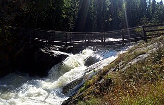
Wekusko Falls Provincial Park is a provincial park straddling the Grass River and Wekusko Lake, located in central Manitoba on Manitoba Provincial Road 392 near Snow Lake, Manitoba.
Highway 49 and Provincial Trunk Highway 49 is a provincial highway in the Canadian provinces of Saskatchewan and Manitoba. Most of the highway is in the east-central part of Saskatchewan and only a very short section is in Manitoba. It runs from Saskatchewan Highway 35 between the communities of Fosston and Hendon to the Saskatchewan — Manitoba border, before ending at Provincial Trunk Highway 83 south of the community of Benito. The combined highway is about 166.4 kilometres (103.4 mi) in length — 165.2 kilometres (102.7 mi) is in Saskatchewan and 1.2 kilometres (0.7 mi) is in Manitoba.
River Road Provincial Park is a provincial park in the Canadian province of Manitoba, designated by the Government of Manitoba in 1997. The park is .05 square kilometres (0.019 sq mi) in size, and is considered to be a Class V protected area under the IUCN protected area management categories.
Manitoba Transportation and Infrastructure is the provincial government department responsible for managing infrastructure in Manitoba. It is in charge of "the development of transportation policy and legislation, and [of] the management of the province’s vast infrastructure network."
Highway 57 and Provincial Trunk Highway 57 are two short highways in the Canadian provinces of Saskatchewan and Manitoba.

Provincial Road 238 (PR 238), also known as River Road, is a provincial road in the Canadian province of Manitoba, in the Rural Municipality of St. Andrews.
The La Vérendrye Trail is a series of highways in the Canadian province of Manitoba commemorating the oldest waterway fur-trading route in the province. It is named after Pierre Gaultier de Varennes, sieur de La Vérendrye, an explorer and fur-trader who is often credited as being the first European to visit what is now southern Manitoba.
