Manitoba Provincial Road 242

Last updated

Manitoba secondary 242.svg

Provincial Road 242

Route information
Maintained by Manitoba Infrastructure
Length157 km (98 mi)
Existed1966–present
Major junctions
North endLynchs Point on Lake Manitoba
Major intersectionsManitoba Highway 16.svg PTH 16 (TCH) at Westbourne
Manitoba Highway 1.svg PTH 1 (TCH) at Bagot
Manitoba Highway 2.svg PTH 2 near Treherne
Manitoba Highway 23.svg PTH 23 near Somerset
Manitoba Highway 3.svg PTH 3 at La Rivière
South endCR 13 jct.svg CR 13 at the Hannah–Snowflake Border Crossing
Location
Country Canada
Province Manitoba
Rural municipalities
Highway system
Manitoba secondary 241.svg PR 241 Manitoba secondary 243.svg PR 243

Provincial Road 242 (PR 242) is a north-south provincial road in the Pembina Valley and Central Plains Regions of Manitoba, Canada.

Contents

PR 242 begins at the Hannah–Snowflake Border Crossing on the Canada–United States border near Snowflake and terminates at Lynchs Point on the south shore of Lake Manitoba, in the Municipality of WestLake – Gladstone. It is a paved, two-lane road from the U.S. border to La Rivière (PTH 3) and from PTH 2 to the Trans-Canada Highway; the remainder is mostly gravel.

At the U.S. border, PR 242 connects with Cavalier County Road 13. [1]

Route description

PR 242 begins at the Hannah-Snowflake Border Crossing in the Municipality of Lorne, with the road continuing south to the town of Hannah, North Dakota as Cavalier County Road 13 (CR 13). The highway immediately goes through a switchback before heading north as a paved two-lane highway along the border between the Municipalities of Lorne and Pembina, passing through Snowflake to have a junction with PR 201. It has an intersection with PR 423 before fully entering the Municipality of Pembina as it winds it's way down into the Pembina River Valley, crossing the river to enter the town of La Rivière. The highway travels straight through the center of town along Broadway Street, where it becomes concurrent (overlapped) with PTH 3 (Boundary Commission Trail) and the two head west for a short distance to leave La Rivière. PR 242 now splits off as a gravel road and climbs its way out of the river valley before zigzagging between some sharp left and right turns for the next several kilometers.

After entering flat rural farmland, PR 242 crosses into the Municipality of Lorne, having a junction with PTH 23 before entering the hamlet of Somerset. The highway temporarily becomes paved and known as Third Street, traversing neighborhoods before passing through downtown, formerly crossing a railroad here. It passes through some neighborhoods before leaving town and becoming unpaved once again. PR 242 enters the Municipality of Norfolk Treherne during a short concurrency with PR 245. The highway travels along the eastern edge of the town of Treherne, where it becomes paved and has a short concurrency with PTH 2 (Red Coat Trail) before continuing due north through rural areas to cross the Assiniboine River.

Entering the Municipality of North Norfolk at an intersection with PR 350 (Former PR 461) just east of Lavenham, the highway makes a couple of sharp turns before passing straight through the center of Rosendale. The highway continues north through farmland for several more kilometers, passing through the hamlet of Bagot, where it crosses a railroad, PTH 1 (Trans-Canada Highway), and becomes unpaved once more.

PR 242 enters the Municipality of WestLake-Gladstone and makes a sharp right turn to begin following the Whitemud River. After having a short concurrency with PTH 16 (Yellowhead Highway), it bypasses the hamlet of Westbourne along its eastern side before becoming more narrow and winding for the next several kilometers, temporarily entering the Rural Municipality of Portage la Prairie and crossing a small creek. The highway begins following the coastline of southern Lake Manitoba shorty before coming to a dead end at the Lynchs Point Campground. The entire length of Provincial Road 242 is a two-lane highway. [2] [3]

Major intersections

DivisionLocationkmmiDestinationsNotes
Louise 0.00.0CR 13 jct.svg CR 13 Hannah Continuation into North Dakota
Canada–United States border at the Hannah-Snowflake Border Crossing
Louise / Pembina boundary Snowflake 6.13.8Manitoba secondary 201.svg PR 201 east Snowflake Western terminus of PR 201
15.99.9Manitoba secondary 423.svg PR 423 west Crystal City Eastern terminus of PR 423
Pembina La Rivière 27.4–
27.5
17.0–
17.1
Bridge over the Pembina River
28.417.6Manitoba Highway 3.svg PTH 3 east (Boundary Commission Trail) Manitou Southern end of PTH 3 concurrency
29.018.0Manitoba Highway 3.svg PTH 3 west (Boundary Commission Trail) Pilot Mound Northern end of PTH 3 concurrency; southern end of unpaved section
Lorne Somerset 49.330.6Manitoba Highway 23.svg PTH 23  Ninette, Morris
Lorne / Norfolk Treherne boundary64.139.8Manitoba secondary 245.svg PR 245 east Notre Dame de Lourdes Southern end of PR 245 concurrency
66.241.1Manitoba secondary 245.svg PR 245 west Holland Northern end of PR 245 concurrency
Norfolk Treherne Treherne 77.848.3Manitoba Highway 2.svg PTH 2 west (Red Coat Trail) Treherne Southern end of PTH 2 concurrency; northern end of unpaved section
81.250.5Manitoba Highway 2.svg PTH 2 east (Red Coat Trail) Rathwell Northern end of PTH 2 concurrency
94.3–
94.4
58.6–
58.7
Bridge over the Assiniboine River
Norfolk Treherne / North Norfolk boundary98.761.3Manitoba secondary 350.svg PR 350 north Lavenham Southern terminus of PR 350; former PR 461
North Norfolk Bagot 120.274.7Manitoba Highway 1.svg PTH 1 (TCH)  Brandon, Portage la Prairie Southern end of unpaved section
WestLake - Gladstone Westbourne 139.886.9Manitoba Highway 16.svgYellowhead Blank.svg PTH 16 (TCH) west / YH  Gladstone Southern end of PTH 16 concurrency
141.988.2Manitoba Highway 16.svgYellowhead Blank.svg PTH 16 (TCH) east / YH  Portage la Prairie Northern end of PTH 16 concurrency
144.289.6Main Street Westbourne Former PR 242
Portage la Prairie
No major junctions
WestLake - Gladstone Lynchs Point 15798Dead end at Lynchs Point Campground on Lake Manitoba Northern terminus; northern end of unpaved section
1.000 mi = 1.609 km; 1.000 km = 0.621 mi

Related Research Articles

Provincial Trunk Highway 6 is a provincial primary highway located in the Canadian province of Manitoba. It runs from the Perimeter Highway of Winnipeg to the Thompson south city limits. It is also the main highway connecting Winnipeg to northern Manitoba. The speed limit is 100 km/h. The route is also used to deliver nickel from the Thompson mine to the Royal Canadian Mint in Winnipeg. The section of highway between its southern terminus near Winnipeg and the second junction with PTH 68 near Eriksdale is part of the Northern Woods and Water Route. The portion of the highway between Ponton and Thompson was known as Highway 391 prior to 1986.

Provincial Trunk Highway 8 is a provincial primary highway located in the Canadian province of Manitoba. It runs from the north limit of the City of Winnipeg, where it meets with Route 180, north to Hecla-Grindstone Provincial Park. The highway between Winnipeg and PR 230 is known as McPhillips Street. At PR 230, McPhillips Street becomes McPhillips Road and continues along PR 230 to PTH 9. The route is a major road connecting Winnipeg with the communities of Winnipeg Beach and Gimli. The speed limit is 100 km/h (60 mph).

<span class="mw-page-title-main">Manitoba Highway 2</span> Highway in Manitoba, Canada

Provincial Trunk Highway 2 is a 315-kilometre (196-mile) highway in the Canadian province of Manitoba. It runs from Highway 13 at the Manitoba-Saskatchewan border to Winnipeg's Perimeter Highway near Oak Bluff.

Provincial Trunk Highway 3 is a major provincial highway located in the Canadian province of Manitoba. It runs from the Saskatchewan boundary to the southwest city limits of Winnipeg, where it continues as Winnipeg Route 155. Prior before to the implementation of Winnipeg's City Route System, it extended to Pembina Highway.

Provincial Trunk Highway 17 is a provincial highway in the Canadian province of Manitoba. It runs from a junction with PR 224 and PR 325 near Hodgson to a junction with PTH 9 near Winnipeg Beach.

Provincial Trunk Highway 11 is a provincial primary highway located in the Eastman Region of the Canadian province of Manitoba. It runs from an intersection with PTH 59 near Victoria Beach to an intersection with PTH 1.

Provincial Trunk Highway 32 is a provincial primary highway located in the Canadian province of Manitoba. It runs from PTH 14 at Winkler to the U.S. border, where it becomes North Dakota State Highway 32. Between its northern end and its intersection with PR 243, PTH 32 follows the Boundary Commission Trail.

Provincial Trunk Highway 5 is a provincial primary highway located in the Canadian province of Manitoba.

<span class="mw-page-title-main">Manitoba Highway 12</span> Highway in Manitoba

Provincial Trunk Highway 12 is a provincial primary highway located in the Canadian province of Manitoba. Lying entirely in the Eastman Region, it runs from the U.S. border to a dead end in Grand Beach. PTH 12 forms the Manitoba section of MOM's Way, a tourist route from Thunder Bay to Winnipeg. PTH 12 is primarily a two-lane highway except for two four-lane stretch between Steinbach and PTH 1 and a ten-kilometre concurrency with PTH 44.

Provincial Trunk Highway 23 is a major east-west provincial highway in the southern portion of the Canadian province of Manitoba. It runs from PTH 21 just south of Hartney to PTH 59 in La Rochelle. Along its route, PTH 23 passes through the communities of Elgin, Ninette, Baldur, Miami, Lowe Farm, and Morris.

Provincial Trunk Highway 44 is an east-west provincial highway in the Eastman Region of the Canadian province of Manitoba.

<span class="mw-page-title-main">Manitoba Highway 18</span> Provincial highway in Manitoba, Canada

Provincial Trunk Highway 18 is a provincial highway in the Canadian province of Manitoba. Located in the Westman Region, it is a north-south route, with the southern terminus at the St. John–Lena Border Crossing at the Canada–United States border and the northern terminus at PTH 2, 7.1 kilometres (4.4 mi) southeast of Wawanesa. The highway passes through the communities of Killarney and Ninette. It is designated as an RTAC route, meaning it is capable of handling RTAC vehicles such as a truck, a truck and pony trailer, a truck and full trailer, a truck tractor and semi-trailer, an A-train, a B-train, or a C-train.

Provincial Trunk Highway 21 is a provincial highway in the Canadian province of Manitoba. It runs from the U.S. border to PTH 45 and PR 577 in the village of Oakburn.

<span class="mw-page-title-main">Manitoba Highway 34</span> Provincial highway in Manitoba, Canada

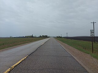
Provincial Trunk Highway 34 is a provincial primary highway located in the Canadian province of Manitoba. It runs from the U.S. border to PTH 16 at the town of Gladstone.

<span class="mw-page-title-main">Manitoba Provincial Road 201</span> Provincial road in Manitoba, Canada

Provincial Road 201 is an east–west provincial road in southern Manitoba, Canada. The road runs parallel to Manitoba's border with the United States for a distance of 218 kilometres (135 mi), nearly half the province's length.

<span class="mw-page-title-main">Manitoba Provincial Road 205</span> Provincial road in Manitoba, Canada

Provincial Road 205 is a 84.7-kilometre-long (52.6 mi) provincial road in the Canadian province of Manitoba. Spanning the Pembina Valley and Eastman regions in the south, it connects the communities of Sperling, Rosenort, Aubigny, St. Pierre-Jolys, and Grunthal with PTH 75, while also spanning the Red River.

<span class="mw-page-title-main">Manitoba Provincial Road 243</span> Provincial road in Manitoba, Canada

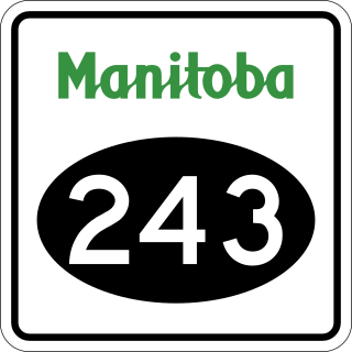
Provincial Road 243 is an east-west provincial road in the Pembina Valley Region of the Canadian province of Manitoba. It runs from PTH 75 near Emerson to PTH 32 near Friedensfeld West. Along the route, it passes north of Gretna using a small concurrence with PTH 30.

<span class="mw-page-title-main">Manitoba Provincial Road 240</span> Provincial road in Manitoba, Canada

Provincial Road 240 (PR 240) is a 122.8-kilometre-long (76.3 mi) north–south highway in the Pembina Valley and Central Plains regions of Manitoba, connecting the hamlets of Darlingford, Miami, Roseisle, and St. Claude with the city of Portage la Prairie, as well as providing the only road access to the hamlet of Delta Beach on Lake Manitoba.

<span class="mw-page-title-main">Manitoba Provincial Road 244</span> Provincial Road in Manitoba, Canada

Provincial Road 244 is a 46.2-kilometre-long (28.7 mi) north–south highway in the Pembina Valley and Central Plains regions of Manitoba. It serves as a connection between Manitou, Notre Dame de Lourdes, and Rathwell.

<span class="mw-page-title-main">Manitoba Provincial Road 245</span> Provincial Road in Manitoba, Canada

Provincial Road 245 is a 90.2-kilometre-long (56.0 mi) east-west highway in the Pembina Valley and Central Plains regions of Manitoba, Canada. It connects the communities of Bruxelles, Notre Dame de Lourdes, Roseisle, and Graysville with the town of Carman. PR 245 also provides access to Stephenfield Provincial Park.

References

  1. "11 Manitoba-U.S. border crossings under review | CBC News".
  2. Government of Manitoba. "Official Highway Map of Manitoba section 2" (PDF). Retrieved June 18, 2024.
  3. Google (June 18, 2024). "Map of Manitoba Provincial Road 242" (Map). Google Maps . Google. Retrieved June 18, 2024.