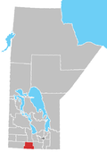
Gilbert Plains is an unincorporated urban community in the Gilbert Plains Municipality, Manitoba, Canada, that was classified as a town prior to January 1, 2015.
Birtle is an unincorporated urban community in the Prairie View Municipality within the Canadian province of Manitoba that held town status prior to 1 January 2015. It is located at the junction of Highways 83 and 42.

Clearwater is a district municipality in the North Thompson River valley in British Columbia, Canada, where the Clearwater River empties into the North Thompson River. It is located 124 km (77 mi) north of Kamloops. The District of Clearwater was established on December 3, 2007, making it one of the newest municipalities in British Columbia. It is near Wells Gray Provincial Park and is surrounded by the Trophy Mountains, Raft Mountain and Dunn Peak.
Emerson is an unincorporated community recognized as a local urban district in south central Manitoba, Canada, located within the Municipality of Emerson – Franklin. It has a population of 678 as of the 2016 Canada census.
Provincial Trunk Highway 3A is a provincial primary highway located in the Canadian province of Manitoba. It runs from PTH 3 to the same route concurrent with PTH 34. The highway continues as PR 423 from its eastern terminus.
Provincial Trunk Highway 3 is a major provincial highway located in the Canadian province of Manitoba. It runs from the Saskatchewan boundary to the southwest city limits of Winnipeg, where it continues as Winnipeg Route 155. Prior before to the implementation of Winnipeg's City Route System, it extended to Pembina Highway.

Baldur is an unincorporated community recognized as a local urban district in the Canadian province of Manitoba, located in the Rural Municipality of Argyle. Baldur is the largest community of the municipality, which is in southwestern Manitoba between Brandon and Portage la Prairie. The community is named after the Norse god Baldur.
Binscarth is an unincorporated urban community in the Municipality of Russell – Binscarth, Manitoba. It is located approximately 167 km (104 mi) northwest of Brandon, 16 km (9.9 mi) south from Russell, and 16 km (10 mi) east of the Saskatchewan border.
Cypress River is an unincorporated community recognized as a local urban district in the Rural Municipality of Victoria in the Canadian province of Manitoba. Originally, the community was known as "Littleton". On Neil Young's 2005 album Prairie Wind, he makes references to Cypress River in the title track.

Gladstone is an unincorporated urban community in the Municipality of WestLake – Gladstone within the Canadian province of Manitoba that held town status prior to January 1, 2015. It is located on the Yellowhead Highway at the intersection with Highway 34. The Gladstone railway station receives Via Rail service.

Lorette is a local urban district in the Rural Municipality of Taché, located 25 km southeast of Winnipeg, in the province of Manitoba, Canada.

Holland, Manitoba is an unincorporated community recognized as a local urban district in the Rural Municipality of Victoria, in Manitoba.
St. Malo is a local urban district located in the Rural Municipality of De Salaberry, approximately 70 km south of The Forks, Winnipeg, Manitoba. Most of the community's residents are bilingual francophone of Métis or Québécois heritage.
La Rivière is an unincorporated community recognized as a local urban district in Manitoba, Canada. It is located 11 km west of the town of Manitou on Highway 3. It is located in the Municipality of Pembina. La Riviere was founded 1886 by Metis Franco-Manitobans, however it is predominantly English speaking. It has a post office, credit union, a five-lift ski hill, a construction company, and a seasonal drive-in restaurant. It has a full service campground at the edge of the community that backs onto the Pembina River. La Riviere was previously home to Hamm-tone Guitars and Mandolins and the Pembina Valley Guitar Building Course.

Mather is an unincorporated community recognized as a local urban district in southwest Manitoba, Canada, and part of Cartwright – Roblin Municipality. The Mather area is known as Crocus Country.

Ninette is an unincorporated community recognized as a local urban district located in Manitoba, Canada at the north end of Pelican Lake. It is located in the Rural Municipality of Prairie Lakes. Ninette has many small businesses, and is known locally for its wide range of sports facilities. In the summer, activities such as boating, fishing, and hunting are offered, while snowmobiling and ice fishing are offered during the wintertime.

La Broquerie is a rural municipality in the province of Manitoba in Western Canada, located in the southeastern part of the province, just south and east of the city of Steinbach.


