Forest Lake, Minnesota | |
---|---|
Motto: As Good As It Sounds | |
Coordinates: 45°15′13″N92°57′30″W / 45.25361°N 92.95833°W | |
Country | United States |
State | Minnesota |
County | Washington |
Founded | March 11, 1874 |
Incorporated | 1896 |
Government | |
• Type | Mayor–council government |
• Mayor | Mara Bain (I) [1] [2] |
Area | |
• Total | 35.53 sq mi (92.01 km2) |
• Land | 30.54 sq mi (79.10 km2) |
• Water | 4.99 sq mi (12.92 km2) |
Elevation | 935 ft (285 m) |
Population | |
• Total | 20,611 |
• Estimate (2022) [6] | 20,857 |
• Density | 674.91/sq mi (260.58/km2) |
Time zone | UTC–6 (Central (CST)) |
• Summer (DST) | UTC–5 (CDT) |
ZIP code | 55025 |
Area code | 651 |
FIPS code | 27-21770 |
GNIS feature ID | 2394789 [4] |
Sales tax | 8.375% [7] |
Website | ci.forest-lake.mn.us |
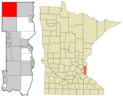
Forest Lake is a city in Washington County, Minnesota, United States, located 27 miles northeast of Saint Paul. The population was 20,611 at the 2020 census. [5]
Forest Lake began as a stop on the St. Paul and Duluth Railroad. The first train reached Forest Lake on December 23, 1868. The lake was so named for the abundant timber that lines its shores. [8] Forest Lake Township was organized on March 11, 1874. The first one-room school was built that year at the former location of city hall (220 N. Lake Street). The city of Forest Lake was incorporated on July 11, 1893 with 175 residents. In 2001, the city annexed the surrounding former Forest Lake Township. [9]
According to the United States Census Bureau, the city has a total area of 35.54 square miles (92.05 km2); 30.56 square miles (79.15 km2) is land and 4.98 square miles (12.90 km2) is water. [10]
Census | Pop. | Note | %± |
---|---|---|---|
1880 | 46 | — | |
1900 | 241 | — | |
1910 | 540 | 124.1% | |
1920 | 800 | 48.1% | |
1930 | 916 | 14.5% | |
1940 | 1,120 | 22.3% | |
1950 | 1,766 | 57.7% | |
1960 | 2,347 | 32.9% | |
1970 | 3,207 | 36.6% | |
1980 | 4,596 | 43.3% | |
1990 | 5,833 | 26.9% | |
2000 | 6,856 | 17.5% | |
2010 | 18,375 | 168.0% | |
2020 | 20,611 | 12.2% | |
2022 (est.) | 20,857 | [6] | 1.2% |
U.S. Decennial Census [11] 2020 Census [5] |
Median household income for 2017 was $76,904. Average household income was $93,296. Per capita income was $35,334.
As of the census of 2010, there were 18,375 people, 7,014 households, and 5,044 families residing in the city. The population density was 601.3 inhabitants per square mile (232.2/km2). There were 7,508 housing units at an average density of 245.7 per square mile (94.9/km2). The racial makeup of the city was 94.7% White, 1.1% African American, 0.4% Native American, 1.5% Asian, 0.1% Pacific Islander, 0.6% from other races, and 1.7% from two or more races. Hispanic or Latino of any race were 2.3% of the population.
There were 7,014 households, of which 36.8% had children under the age of 18 living with them, 56.2% were married couples living together, 10.7% had a female householder with no husband present, 5.1% had a male householder with no wife present, and 28.1% were non-families. 21.9% of all households were made up of individuals, and 7.6% had someone living alone who was 65 years of age or older. The average household size was 2.60 and the average family size was 3.04.
The median age in the city was 37.4 years. 26.3% of residents were under the age of 18; 7.6% were between the ages of 18 and 24; 27.1% were from 25 to 44; 27.7% were from 45 to 64; and 11.3% were 65 years of age or older. The gender makeup of the city was 49.7% male and 50.3% female.
Forest Lake is located in Minnesota's 8th congressional district.
The Forest Lake Area school system includes eight elementary sites, one middle school site, and one high school site. [13] There are also two independent districts, North Lakes Academy and Lakes International Language Academy.
The first newspaper, The Enterprise, was printed in 1903. It was changed in 1907 to The Forest Lake Advertiser and later to The Forest Lake Times, [14] in 1916, as it remains to this day. The Forest Lake Lowdown is another local paper. [15]
Andover is a city in Anoka County, Minnesota, United States. The population was 32,601 at the 2020 census.
Columbia Heights is a city in Anoka County, Minnesota, United States. The population was 21,973 at the 2020 census.
Ramsey is a suburban city 22 miles (35 km) north-northwest of downtown Minneapolis in Anoka County, Minnesota, United States. The population was 27,646 at the 2020 census. It is a northwest suburb of the Twin Cities.
Waconia is a city in Carver County, Minnesota, United States. Waconia attracts visitors to nearby Lake Waconia, a lake locally renowned for its fishing and recreation opportunities.
Lindström is a city in Chisago County, Minnesota, United States, located 35 miles northeast of the Twin Cities. The population was 4,888 at the 2020 census. Lindström's motto is America's Little [Sweden]. U.S. Highway 8 serves as a main route for the community.
Brooklyn Park is a suburban city on the west bank of the Mississippi River, upstream from downtown Minneapolis in northern Hennepin County. It is the sixth-largest city in the U.S. state of Minnesota. The population was 86,478 at the 2020 census. The city still has undeveloped land and farms, including the historic Eidem Homestead, a 1900s working farm that is a popular tourist attraction for families and school field trips. Brooklyn Park is considered both a second- and third-tier suburb of Minneapolis, because much of the land north of 85th Avenue was developed after 2000.
Eden Prairie is a city 12 miles (19 km) southwest of downtown Minneapolis in Hennepin County and the 16th-largest city in the State of Minnesota, United States. At the 2020 census, it had a population of 64,198. The city is adjacent to the north bank of the Minnesota River, upstream from its confluence with the Mississippi River.
Greenfield is a city in northwestern Hennepin County, Minnesota. It has a population of 2,903 residents, according to the 2020 United States Census, and is located 26.5 miles northwest of Minneapolis. It is part of the Twin Cities Metropolitan Statistical Area.
Minnetonka is a city in Hennepin County, Minnesota, United States. A western suburb of the Twin Cities, Minnetonka is located about 10 miles (16 km) west of downtown Minneapolis. At the 2020 census, the city's population was 53,781.
Finlayson is a city in Pine County, Minnesota, United States. The population was 315 at the 2010 census. The city's area was incorporated from Finlayson Township, the remainder of which is still adjacent to it. https://finlayson.municipalimpact.com/
Hills is a city in Rock County, Minnesota, United States. Located approximately four miles (6 km) from the South Dakota border and two miles (3 km) from the Iowa border, it is the southwesternmost city in Minnesota. The population was 686 at the 2020 census.
Prior Lake is an exurban city 20 miles (32 km) southwest of Minneapolis, next to Savage and Shakopee in Scott County in the state of Minnesota. Surrounding the shores of Lower and Upper Prior Lake, the city is south of the Minnesota River in an area known as RiverSouth and establishes the urban fringe of the south-southwest portion of Minneapolis-St. Paul, the 16th-largest metropolitan area in the United States. The population was 27,617 at the 2020 census.
Elk River is a city on the Mississippi River in Sherburne County, Minnesota, United States, approximately 34 miles northwest of Minneapolis. It is situated at the confluence of the Mississippi and Elk Rivers. The population was 25,835 at the 2020 census, making Elk River the second largest city with an area of 42.33 square miles in the Central Minnesota region after St. Cloud. It is the county seat. U.S. Highways 10 and 169 and State Highway 101 are three of the main routes in Elk River, and a station on the Northstar Commuter Rail line to downtown Minneapolis is located in the city. Elk River is located 33.2 miles northwest of Minneapolis and 37.4 miles southeast of St. Cloud.
Chisholm is a city in St. Louis County, Minnesota, United States. The population was 4,775 at the 2020 census. The city has been called "The Heart of the Iron Range" due to its location in the middle of the Mesabi Iron Range.
Mahtomedi is a city in Washington County, Minnesota, United States. The population was 7,676 at the 2010 census. Mahtomedi is a suburb of St. Paul and is located between St. Paul and Stillwater along the shores of White Bear Lake.
Woodbury is a city in Washington County, Minnesota, United States, eight miles east of Saint Paul along Interstate 94. It is part of the Minneapolis–Saint Paul metropolitan area. The population was 75,102 at the 2020 census, making it Minnesota's eighth most populous city.
Buffalo is a city in the U.S. state of Minnesota and the county seat of Wright County. It is in the Minneapolis–Saint Paul metropolitan area, about 42 miles northwest of Minneapolis on Buffalo Lake. Buffalo's population was 15,453 at the 2010 census and 18,168 at the 2020 census.
St. Michael is a city in eastern Wright County, northwest of the Minneapolis-St Paul "Twin Cities" Metropolitan Area. The population was 18,235 at the 2020 census, further growing to 21,034 by 2023.
Park Rapids is a city in and the county seat of Hubbard County, Minnesota, United States. It is near Itasca State Park, the source of the Mississippi River, as well as the beginning of the Heartland State Trail. The city was founded in 1890 near the Fish Hook River rapids and is along U.S. Highway 71 and Minnesota State Highway 34. The population was 4,142 at the 2020 census.
Chanhassen is a city in Carver County, Minnesota about 16 miles southwest of Minneapolis. A small portion extends into Hennepin County. Located in the southwest Minneapolis–Saint Paul suburbs, there is a mix of suburban residential neighborhoods and rural landscapes. The population was 25,947 at the 2020 census, with a 2024 estimate of 26,469.