Welcome, Minnesota | |
---|---|
Coordinates: 43°40′02″N94°37′08″W / 43.66722°N 94.61889°W | |
Country | United States |
State | Minnesota |
County | Martin |
Government | |
• City Council | Mayor Dan Schmidtke |
Area | |
• Total | 1.46 sq mi (3.77 km2) |
• Land | 1.46 sq mi (3.77 km2) |
• Water | 0.00 sq mi (0.00 km2) |
Elevation | 1,230 ft (370 m) |
Population | |
• Total | 710 |
• Density | 487.64/sq mi (188.33/km2) |
Time zone | UTC-6 (Central (CST)) |
• Summer (DST) | UTC-5 (CDT) |
ZIP code | 56181 |
Area code | 507 |
FIPS code | 27-69070 |
GNIS feature ID | 2397244 [2] |
Website | welcomemn |
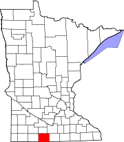
Welcome is a city in Martin County, Minnesota, United States. The population was 710 at the 2020 census. [3]
While a post office called "Welcome" has been in operation since 1881, [4] the city was not incorporated until 1890. Welcome was incorporated, first as a village, on May 7, 1890, and named after homesteader Alfred M. Welcome, who owned a farm on what became the city's southwest side. [5] [6]
A local newspaper, The Welcome Times, circulated in town from 1895 through 1969 before being merged with the Sherburn Advance-Standard. [7]
In 1988, Welcome combined with nearby Sherburn and Trimont schools to form the Martin County West School District. In 1999, Welcome combined its police department with nearby Sherburn to form the joint Sherburn/Welcome Police Department. [8]
Welcome is in central Martin County, between Fairmont, the county seat 8 miles (13 km) to the east, and Sherburn 6 miles (10 km) to the west. 120th Street, former U.S. Route 16, passes along the southern edge of Welcome and connects it with the two other cities. Interstate 90, also traveling east-west, passes just north of Welcome, with access from Exit 93. Minnesota State Highway 263 passes through the east side of Welcome as Guide Street, leading south 10 miles (16 km) to Ceylon.
According to the U.S. Census Bureau, Welcome has a total area of 1.46 square miles (3.78 km2), all land. [1] The original description of the site was "Section 1, Township 102, Range 32". [9]
Census | Pop. | Note | %± |
---|---|---|---|
1890 | 140 | — | |
1900 | 549 | 292.1% | |
1910 | 543 | −1.1% | |
1920 | 612 | 12.7% | |
1930 | 519 | −15.2% | |
1940 | 630 | 21.4% | |
1950 | 712 | 13.0% | |
1960 | 733 | 2.9% | |
1970 | 694 | −5.3% | |
1980 | 855 | 23.2% | |
1990 | 790 | −7.6% | |
2000 | 721 | −8.7% | |
2010 | 686 | −4.9% | |
2020 | 710 | 3.5% | |
U.S. Decennial Census [10] |
As of the census [11] of 2010, there were 686 people, 310 households, and 193 families living in the city. The population density was 466.7 inhabitants per square mile (180.2/km2). There were 341 housing units at an average density of 232.0 per square mile (89.6/km2). The racial makeup of the city was 99.9% White and 0.1% African American. Hispanic or Latino of any race were 2.9% of the population.
There were 310 households, of which 23.9% had children under the age of 18 living with them, 47.4% were married couples living together, 9.0% had a female householder with no husband present, 5.8% had a male householder with no wife present, and 37.7% were non-families. 32.6% of all households were made up of individuals, and 14.8% had someone living alone who was 65 years of age or older. The average household size was 2.21 and the average family size was 2.77.
The median age in the city was 44.3 years. 22% of residents were under the age of 18; 7% were between the ages of 18 and 24; 21.7% were from 25 to 44; 31% were from 45 to 64; and 18.4% were 65 years of age or older. The gender makeup of the city was 49.7% male and 50.3% female.
As of the census of 2000, there were 721 people, 310 households, and 200 families living in the city. The population density was 792.4 inhabitants per square mile (305.9/km2). There were 347 housing units at an average density of 381.3 per square mile (147.2/km2). The racial makeup of the city was 99.17% White, 0.14% from other races, and 0.69% from two or more races. Hispanic or Latino of any race were 0.97% of the population.
There were 310 households, out of which 28.7% had children under the age of 18 living with them, 54.8% were married couples living together, 6.5% had a female householder with no husband present, and 35.2% were non-families. 31.0% of all households were made up of individuals, and 16.1% had someone living alone who was 65 years of age or older. The average household size was 2.33 and the average family size was 2.90.
In the city, the population was spread out, with 25.4% under the age of 18, 6.2% from 18 to 24, 24.5% from 25 to 44, 24.1% from 45 to 64, and 19.7% who were 65 years of age or older. The median age was 41 years. For every 100 females, there were 107.2 males. For every 100 females age 18 and over, there were 99.3 males.
The median income for a household in the city was $32,125, and the median income for a family was $38,438. Males had a median income of $30,875 versus $20,536 for females. The per capita income for the city was $16,539. About 3.9% of families and 6.9% of the population were below the poverty line, including 7.4% of those under age 18 and 6.7% of those age 65 or over.
East Gull Lake is a city in Cass County, Minnesota, United States. The population was 986 at the 2020 census. The nearest semi-urban area is that of Brainerd and Baxter. It is part of the Brainerd Micropolitan Statistical Area. East Gull Lake is in Central Minnesota's Brainerd Lakes Area and takes its name from the largest lake within its borders, Gull Lake.
Lake Shore is a city in Cass County, Minnesota, United States. The population was 1,056 at the 2020 census. It is part of the Brainerd Micropolitan Statistical Area.
Ostrander is a city in Fillmore County, Minnesota, United States. The population was 254 at the 2010 census.
Kenyon is a city in southwestern Goodhue County, Minnesota, United States, located along the North Fork of the Zumbro River. It was founded in 1856 and named in honor of Kenyon College. It is known for the Boulevard of roses on main street, which is the namesake of the town festival "Rosefest" held every August. The population was 1,815 at the 2010 census.
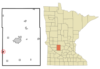
Raymond is a city in southwest Kandiyohi County, Minnesota, United States. The population was 764 at the 2010 census.
Ivanhoe is a city in Lincoln County, Minnesota, United States. The population was 559 at the 2010 census. Since 1902 it has been the county seat of Lincoln County and is now the least populous county seat in Minnesota.
Alvarado is a city situated along the Snake River in Marshall County in the State of Minnesota. The population was 388 at the 2020 census.
Dunnell is a city in Martin County, Minnesota, United States. The population was 133 at the 2020 census, down from 167 in 2010.
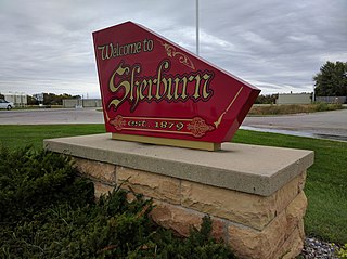
Sherburn is a city in Martin County, Minnesota, United States. The population was 1,058 at the 2020 census.
Trimont is a city in Martin County, Minnesota, United States. The population was 705 at the 2020 census. The small community is located in southern Minnesota between Sherburn and St. James on Minnesota State Highway 4.
Racine is a city in Racine Township, Mower County, Minnesota, United States. The population was 442 at the 2010 census.
Underwood is a city in Otter Tail County, Minnesota, United States. The population was 356 at the 2020 census.
Sturgeon Lake is a city in Pine County, Minnesota, United States. The population was 439 at the 2010 census.
Sanborn is a city in Redwood County, Minnesota, United States. The population was 339 at the 2010 census.
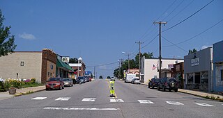
Kimball is a city in Stearns County, Minnesota, United States. The population was 799 at the 2020 census. It is part of the St. Cloud Metropolitan Statistical Area.
Lake Henry is a city in Stearns County, Minnesota, United States. The population was 103 at the 2010 census. It is part of the St. Cloud Metropolitan Statistical Area.
Hammond is a city in Wabasha County, Minnesota, United States. The population was 132 at the 2010 census.
Ortonville is a city in Big Stone County in the U.S. state of Minnesota at the southern tip of Big Stone Lake, along the border with South Dakota. The population was 2,021 at the 2020 census. It is the county seat of Big Stone County. Big Stone Lake State Park is nearby.
Minnesota Lake is a city in Blue Earth and Faribault counties in the State of Minnesota. The population was 661 at the 2020 census. The bulk of the city is in Faribault County; a small part extends into Blue Earth County.
Ormsby is a city in Martin and Watonwan counties in the U.S. state of Minnesota. The population was 131 at the 2010 census.