Dunnell, Minnesota

Last updated

Dunnell, Minnesota
Martin County Minnesota Incorporated and Unincorporated areas Dunnell Highlighted.svg
Location in Martin County and the state of Minnesota
Coordinates: 43°33′38″N94°46′31″W / 43.56056°N 94.77528°W / 43.56056; -94.77528
Country United States
State Minnesota
County Martin
Government
  MayorDan Nelson [ citation needed ]
Area
[1]
  Total0.15 sq mi (0.40 km2)
  Land0.15 sq mi (0.40 km2)
  Water0.00 sq mi (0.00 km2)
Elevation
[2]
1,319 ft (402 m)
Population
 (2020) [3]
  Total133
  Density869.28/sq mi (335.37/km2)
Time zone UTC-6 (Central (CST))
  Summer (DST) UTC-5 (CDT)
ZIP code
56127
Area code 507
FIPS code 27-17180 [4]
GNIS feature ID2394579 [2]
Dunnell sign DunnellMNstone2006-05-21.JPG
Dunnell sign

Dunnell is a city in Martin County, Minnesota, United States. The population was 133 at the 2020 census, [3] down from 167 in 2010. [5]

Contents

History

A post office called Dunnell has been in operation since 1873. [6] The city was named for Mark H. Dunnell, a member of the U.S. House of Representatives from Minnesota. [7]

Geography

The community is located in southwestern Martin County along Minnesota State Highway 4, which leads north 8 miles (13 km) to Sherburn and south 12 miles (19 km) to Estherville, Iowa. Interstate 90 is accessible from Sherburn.

According to the U.S. Census Bureau, the city has a total area of 0.15 square miles (0.39 km2), all land. [1]

Demographics

Historical population
CensusPop.Note
1910 170
1920 24745.3%
1930 237−4.0%
1940 2390.8%
1950 2421.3%
1960 2607.4%
1970 237−8.8%
1980 216−8.9%
1990 187−13.4%
2000 1975.3%
2010 167−15.2%
2020 133−20.4%
U.S. Decennial Census [8]

2010 census

As of the census [9] of 2010, there were 167 people, 80 households, and 50 families living in the city. The population density was 439.5 inhabitants per square mile (169.7/km2). There were 88 housing units at an average density of 231.6 per square mile (89.4/km2). The racial makeup of the city was 98.2% White and 1.8% Native American. Hispanic or Latino of any race were 1.8% of the population.

There were 80 households, of which 17.5% had children under the age of 18 living with them, 56.3% were married couples living together, 5.0% had a female householder with no husband present, 1.3% had a male householder with no wife present, and 37.5% were non-families. 30.0% of all households were made up of individuals, and 8.8% had someone living alone who was 65 years of age or older. The average household size was 2.09 and the average family size was 2.56.

The median age in the city was 51.8 years. 14.4% of residents were under the age of 18; 3% were between the ages of 18 and 24; 20.4% were from 25 to 44; 40.2% were from 45 to 64; and 22.2% were 65 years of age or older. The gender makeup of the city was 54.5% male and 45.5% female.

2000 census

As of the census [4] of 2000, there were 197 people, 83 households, and 52 families living in the city. The population density was 521.9 inhabitants per square mile (201.5/km2). There were 92 housing units at an average density of 243.7 per square mile (94.1/km2). The racial makeup of the city was 98.98% White, and 1.02% from two or more races.

There were 83 households, out of which 34.9% had children under the age of 18 living with them, 49.4% were married couples living together, 6.0% had a female householder with no husband present, and 37.3% were non-families. 34.9% of all households were made up of individuals, and 14.5% had someone living alone who was 65 years of age or older. The average household size was 2.37 and the average family size was 3.10.

In the city, the population was spread out, with 25.9% under the age of 18, 8.1% from 18 to 24, 27.4% from 25 to 44, 20.8% from 45 to 64, and 17.8% who were 65 years of age or older. The median age was 40 years. For every 100 females, there were 109.6 males. For every 100 females age 18 and over, there were 121.2 males.

Related Research Articles

<span class="mw-page-title-main">Backus, Minnesota</span> City in Minnesota, United States

Backus is a city in Cass County, Minnesota, United States. The population was 250 at the 2010 census. It is part of the Brainerd Micropolitan Statistical Area.

<span class="mw-page-title-main">Lake Shore, Minnesota</span> City in Minnesota, United States

Lake Shore is a city in Cass County, Minnesota, United States. The population was 1,056 at the 2020 census. It is part of the Brainerd Micropolitan Statistical Area.

<span class="mw-page-title-main">Sherburn, Minnesota</span> City in Minnesota, United States

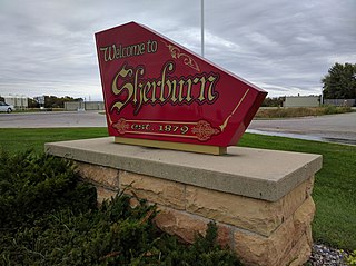
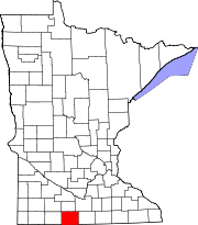
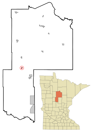
Sherburn is a city in Martin County, Minnesota, United States. The population was 1,137 at the 2010 census. The U.S. Census Bureau estimated the 2018 population as 1,093.

<span class="mw-page-title-main">Trimont, Minnesota</span> City in Minnesota, United States

Trimont is a city in Martin County, Minnesota, United States. The population was 747 at the 2010 census. The U.S. Census Bureau estimated 2018 population is 704. The small community is located in south central Minnesota between Sherburn and St. James on Minnesota State Highway 4. Interstate 90 is nearby.

<span class="mw-page-title-main">Welcome, Minnesota</span> City in Minnesota, United States

Welcome is a city in Martin County, Minnesota, United States. The population was 686 at the 2010 census. The U.S. Census Bureau estimated 2018 population is 649.

<span class="mw-page-title-main">Harding, Minnesota</span> City in Minnesota, United States

Harding is a city in Morrison County, Minnesota, United States, along the Platte River. The population was 123 at the 2020 census.

<span class="mw-page-title-main">Bluffton, Minnesota</span> City in Minnesota, United States

Bluffton is a city in Otter Tail County, Minnesota, United States, along the Leaf River. The population was 210 at the 2020 census.

<span class="mw-page-title-main">Deer Creek, Minnesota</span> City in Minnesota, United States

Deer Creek is a city in Otter Tail County, Minnesota, United States. The population was 330 at the 2020 census.

<span class="mw-page-title-main">Erhard, Minnesota</span> City in Minnesota, United States

Erhard is a city in Otter Tail County, Minnesota, United States. The population was 132 at the 2020 census.

<span class="mw-page-title-main">Henning, Minnesota</span> City in Minnesota, United States

Henning is a city in Otter Tail County, Minnesota, United States. The population was 854 at the 2020 census.

<span class="mw-page-title-main">Urbank, Minnesota</span> City in Minnesota, United States

Urbank is a city in Otter Tail County, Minnesota, United States. The population was 52 at the 2020 census.

<span class="mw-page-title-main">Maplewood, Minnesota</span> City in Minnesota, United States

Maplewood is a city in Ramsey County, Minnesota, United States. The population was 42,088 at the 2020 census. Maplewood is ten minutes' drive from downtown Saint Paul. It stretches along the northern and eastern borders of Saint Paul.

<span class="mw-page-title-main">Sanborn, Minnesota</span> City in Minnesota, United States

Sanborn is a city in Redwood County, Minnesota, United States. The population was 339 at the 2010 census.

<span class="mw-page-title-main">Winton, Minnesota</span> City in Minnesota, United States

Winton is a city in Saint Louis County, Minnesota, United States. The population was 172 at the 2010 census. The city is home to a small hydroelectric dam on the edge of Garden Lake, one of 11 stations owned by Minnesota Power.

<span class="mw-page-title-main">Grant, Minnesota</span> City in Minnesota, United States

Grant is a city in Washington County, Minnesota, and a suburb of St. Paul. The population was 4,096 at the time of the 2010 census.

<span class="mw-page-title-main">Minnesota City, Minnesota</span> City in Minnesota, United States

Minnesota City is a city in Winona County, Minnesota, United States. The population was 202 at the 2020 census.

<span class="mw-page-title-main">Federal Dam, Minnesota</span> City in Minnesota, United States

Federal Dam is a city in Cass County, Minnesota, United States, near Leech Lake. The population was 110 at the 2010 census. It is part of the Brainerd Micropolitan Statistical Area.

<span class="mw-page-title-main">Fifty Lakes, Minnesota</span> City in Minnesota, United States

Fifty Lakes is a city in Crow Wing County, Minnesota, United States. The population was 387 at the 2010 census. It is part of the Brainerd Micropolitan Statistical Area.

<span class="mw-page-title-main">Minnesota Lake, Minnesota</span> City in Minnesota, United States

Minnesota Lake is a city in Blue Earth and Faribault counties in the State of Minnesota. The population was 661 at the 2020 census. The bulk of the city is in Faribault County; a small part extends into Blue Earth County.

<span class="mw-page-title-main">Ormsby, Minnesota</span> City in Minnesota, United States

Ormsby is a city in Martin and Watonwan counties in the U.S. state of Minnesota. The population was 131 at the 2010 census.

References

  1. 1 2 "2023 U.S. Gazetteer Files: Minnesota". United States Census Bureau. Retrieved January 5, 2024.
  2. 1 2 U.S. Geological Survey Geographic Names Information System: Dunnell, Minnesota
  3. 1 2 "P1. Race – Dunnell city, Minnesota: 2020 DEC Redistricting Data (PL 94-171)". U.S. Census Bureau. Retrieved January 5, 2024.
  4. 1 2 "U.S. Census website". United States Census Bureau . Retrieved January 31, 2008.
  5. "2010 Census Redistricting Data (Public Law 94-171) Summary File". American FactFinder. United States Census Bureau . Retrieved April 27, 2011.[ dead link ]
  6. "Martin County". Jim Forte Postal History. Retrieved July 21, 2015.
  7. Upham, Warren (1920). Minnesota Geographic Names: Their Origin and Historic Significance. Minnesota Historical Society. p.  333.
  8. "Census of Population and Housing". Census.gov. Retrieved June 4, 2015.
  9. "U.S. Census website". United States Census Bureau . Retrieved November 13, 2012.