
Minnesota State Highway 55 is a state highway that runs 221 miles (356 km) across the central part of state taking a diagonal route from its western most at the North Dakota state line near Tenney to its easternmost point at the intersection with U.S. Highway 61 (US 61) in Hastings. In Minneapolis, portions of the route are also signed as Olson Memorial Highway.

Interstate 694 (I-694) is an east–west auxiliary Interstate Highway located in the Minneapolis–Saint Paul metropolitan area in the US state of Minnesota. The western terminus of the route is at its junction with I-94, I-494, and US Highway 52 (US 52) in Maple Grove. The eastern terminus of I-694 is at its junction with I-94 and I-494 at the Woodbury–Oakdale city line. I-694 comprises the northern and northeastern portions of a beltway around the Twin Cities, with I-494 forming the remainder of the beltway. The speed limit is 60 mph (97 km/h). Interstate Highways outside of the loop in Minnesota may be signed as high as 70 mph (110 km/h) but can only reach 60 mph (97 km/h) inside the loop.

Interstate 394 (I-394) is a short east–west auxiliary Interstate Highway in Hennepin County in the US state of Minnesota. It is also commonly referred to by its pre-1991 name, Wayzata Boulevard, and by its other designation for most of its route, US Highway 12 (US 12). It runs for 9.8 miles (15.8 km) from downtown Minneapolis to I-494 in the Minneapolis suburb of Minnetonka. At its western terminus, the roadway loses its Interstate designation but continues as US 12. I-394 serves as the most direct link for commuters and other drivers who are traveling between downtown Minneapolis and parts of the western Minneapolis–Saint Paul metropolitan area.
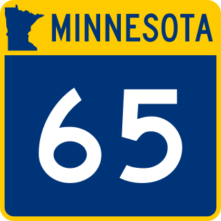
Minnesota State Highway 65 is a highway in the east–central and northeast parts of the U.S. state of Minnesota, which starts at its split from I-35W, skipping past the downtown Minneapolis core, only to resume at the intersection with Washington Avenue at the north end of downtown Minneapolis to continue north to its northern terminus at its intersection with U.S. Highway 71 (US 71) in Littlefork near International Falls.

Minnesota State Highway 7, or Trunk Highway 7, is a state highway in Minnesota, which runs from its intersection with MN 28 near Beardsley and continues east to its terminus with MN 100 and County Road 25 (CR 25) in St. Louis Park. The highway runs east–west for approximately 194.2 miles (312.5 km) through mostly rural farmland in the central part of the state. On its western end, it is part of the Minnesota River Valley Scenic Byway where it runs northwest–southeast along the Minnesota River and associated lakes near the border with the adjoining state of South Dakota. For roughly 24 miles (39 km) of its route, it runs concurrently with U.S. Highway 59 (US 59) between Appleton and Montevideo. In Montevideo, the highway turns to the east cutting across the state. It passes through several small towns before entering the Twin Cities metropolitan area. In the metro area, MN 7 follows an expressway through several suburbs before terminating in St. Louis Park. Two different segments have been listed on the National Highway System, system of roads considered important to the country.

Minnesota State Highway 100 is a state highway in the Twin Cities region of Minnesota, which runs from its interchange with Interstate 494 (I-494) in Bloomington and continues north to its northern terminus at its interchange with I-694 in Brooklyn Center. The southern end of MN 100 continues in Bloomington as Normandale Boulevard. At the north end, the main line of MN 100 merges with I-694 in Brooklyn Center. The route is 16 miles (26 km) in length.

Minnesota State Highway 23 (MN 23) is a state highway that stretches from southwestern to northeastern Minnesota. At 343.723 miles (553.169 km) in length, it is the second longest state route in Minnesota, after MN 1.

Minnesota State Highway 47 is a 126.872-mile-long (204.181 km) highway in east–central Minnesota, which runs from its intersection with Central Avenue in Minneapolis and continues north to its northern terminus at its intersection with U.S. Highway 169 in Aitkin.

Minnesota State Highway 610 (MN 610) is an east–west freeway in the Twin Cities region of Minnesota. The freeway connects Interstate 94 (I-94), County Road 81, and CR 130 in northern Hennepin County to U.S. Highway 10 (US 10) in southern Anoka County. MN 610 crosses the Mississippi River on the Richard P. Braun Bridge between suburban Brooklyn Park and Coon Rapids. The highway is 12.3 miles (19.8 km) long.

Minnesota State Highway 280 is a 3.710-mile-long (5.971 km) highway in the Twin Cities region of Minnesota that travels from its Interchange with Interstate 94/U.S.Route 12/US Route 52 (I-94/US 12/US 52) in Saint Paul to its interchange with I-35W in Roseville.

Minnesota State Highway 101 is a state highway in the U.S. state of Minnesota. The present day route currently has two separate segments. The roadway was a continuous route until 1988.

Interstate 94 (I-94) in the US state of Minnesota runs 259 miles (417 km) east–west through the central portion of the state. The highway connects the cities of Moorhead, Fergus Falls, Alexandria, St. Cloud, Minneapolis, and Saint Paul. Authorized in 1956, it was mostly constructed in the 1960s. For its whole length, it runs concurrently with either US Highway 52 (US 52) or US 12.

U.S. Highway 52 (US 52) enters the state of Minnesota at the unincorporated community of Prosper, north of the town of Burr Oak, Iowa. The route is marked north–south in Minnesota along its independent segment from the Iowa state line to downtown St. Paul. US 52 is not signed along the length of its concurrency with Interstate 94 (I-94) from downtown St. Paul to the North Dakota state line at Moorhead and Fargo.

County State-Aid Highway 81, also known as County Road 81, (County 81) is a county highway in Hennepin County, Minnesota, which runs from its interchange with Interstate 94 (I-94), CR 66, and CR 152 in the city of Minneapolis, and continues northwest to its terminus at Main Street in suburban Rogers. CR 81 is approximately 20 miles (32 km) long.

Hennepin County Road 122 (CR 122) or County State-Aid Highway 122 (CSAH 122) is an unsigned county state-aid highway within the city of Minneapolis, Hennepin County, Minnesota, United States, crossing the Mississippi River on the Washington Avenue Bridge.

U.S. Highway 169 (U.S. 169) is a major north–south highway in the U.S. state of Minnesota, connecting the Minnesota River valley with the Twin Cities and the Iron Range. Much of the route is built to expressway or freeway standards.

U.S. Highway 65 is a north-south United States Numbered Highway running from Clayton, Louisiana to Albert Lea, Minnesota. In the state of Minnesota, US 65 travels for 15 miles from the Iowa border to a partial interchange with Interstate 35 in Albert Lea. The length of US 65 in Minnesota is the shortest of the five states the route travels through.

U.S. Highway 212 (US 212) within the state of Minnesota travels from the South Dakota state line in the west, crosses the southwestern part of the state, to the Minneapolis–Saint Paul metropolitan area in the east and end at its interchange with US 169 and State Highway 62 (MN 62) in the Minneapolis suburb of Edina. US 212 in Minnesota has an official length of 161.8 miles (260.4 km). It is an urban freeway within the Minneapolis–Saint Paul area and is mostly a two-lane rural road elsewhere in the state.
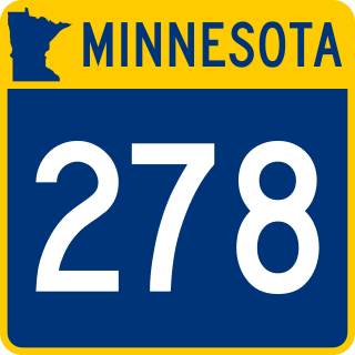
Minnesota State Highway 278 was a state highway in Minnesota, originally connecting MN 100 in Robbinsdale to MN 152 in Minneapolis. It existed entirely in Hennepin County. The route was decommissioned in 1982.

