Angora Township is a township in Saint Louis County, Minnesota, United States. The population was 249 at the 2010 census. Angora Township was named after Angora, in Turkey.
Brimson is an unincorporated community in Ault Township, Saint Louis County, Minnesota, United States.
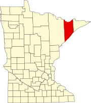
Rollins is an unincorporated community in Ault Township, Saint Louis County, Minnesota, United States.
Bowstring is an unincorporated community in Bowstring Township, Itasca County, Minnesota, United States.
Taft is an unincorporated community in Grand Lake Township, Saint Louis County, Minnesota, United States.
Four Corners is an unincorporated community in Saint Louis County, Minnesota, United States; located 10 miles northwest of the city of Duluth at the junction of U.S. Highway 53 and Saint Louis County Road 13.
Talmoon is an unincorporated community in Itasca County, Minnesota, United States.
Max is an unincorporated community in Max Township, Itasca County, Minnesota, United States; located within the Chippewa National Forest and the Leech Lake Indian Reservation.
Wirt is an unincorporated community in Wirt Township, Itasca County, Minnesota, United States; located within the Chippewa National Forest.
Mack is an unincorporated community in Itasca County, Minnesota, United States; located within the Chippewa National Forest. The community is located between Deer River and Talmoon; at the junction of State Highway 6 and Mac Road.
Alvwood is an unincorporated community in Alvwood Township, Itasca County, Minnesota, United States.
Bergville is an unincorporated community in Ardenhurst Township, Itasca County, Minnesota, United States; located within the Chippewa National Forest.
Silverdale is an unincorporated community in Koochiching County, Minnesota, United States; located in the southeast corner of the county.
Bass Lake is an unincorporated community in Wirt Township, Itasca County, Minnesota, United States; located within the Chippewa National Forest. The community is located between Wirt and Talmoon at the junction of Itasca County Roads 29 and 127.
Dora Lake is an unincorporated community in Kinghurst Township, Itasca County, Minnesota, United States; located within the Chippewa National Forest. The community is located near Wirt at the junction of Itasca County Roads 29 and 145.
Grattan is an unincorporated community in Grattan Township, Itasca County, Minnesota, United States.
Jessie Lake is an unincorporated community in Lake Jessie Township, Itasca County, Minnesota, United States; located within the Chippewa National Forest. The community is located between Wirt and Talmoon; along Itasca County Road 4.
Rosy is an unincorporated community in Third River Township, Itasca County, Minnesota, United States. The community is located northwest of Squaw Lake; near the junction of Itasca County Roads 32, 33, and 141.
Pomroy is an unincorporated community in Pomroy Township, Itasca County, Minnesota, United States.
Arthyde is an unincorporated community in Millward Township, Aitkin County, Minnesota, United States. The community is located northeast of McGrath, at the junction of Kestrel Avenue and 230th Lane. Aitkin County Road 2 is nearby.