Allendorf, Iowa

Last updated

Allendorf, Iowa
USA Iowa location map.svg
Red pog.svg
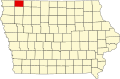
Allendorf, Iowa
Location of Allendorf, Iowa
Usa edcp location map.svg
Red pog.svg
Allendorf, Iowa
Allendorf, Iowa (the United States)
Coordinates: 43°24′53″N95°38′36″W / 43.4146902°N 95.6433454°W / 43.4146902; -95.6433454
Country Flag of the United States (23px).png  United States
State Flag of Iowa.svg  Iowa
County Osceola County
Elevation
487 m (1,598 ft)
Time zone UTC-6 (Central (CST))
  Summer (DST) UTC-5 (CDT)
Zip code
51354
Area code 712
GNIS feature ID454138

Allendorf is an unincorporated community in Osceola County, Iowa, United States. It is located on Highway 59, five miles east of Sibley, at 43.413270N, -95.64318W, [1] adjacent to the Johnson Wilderness Area.

History

Allendorf was founded in 1895, possibly named after a town named Allendorf in Germany; the town was originally named Oliver. [2] Allendorf's population was 13 in 1902, [3] and 35 in 1925. [4] The population was 60 in 1940. [5]

Related Research Articles

Dudley is a ghost town in Wapello County, Iowa, United States. Both 1908 and 1920 surveys of northwestern Wapello County show a post office at Dudley. A sign on the former edge of town reads: "Population 12 and God only knows how many dogs and cats."

Bladensburg is a small unincorporated community in Wapello County, Iowa, United States. It lies midway between Agency and Batavia at a distance of five miles (8 km) from each, and the largest nearby city is Ottumwa, seven miles (11 km) to the west-southwest.

Elvira is an unincorporated community in Clinton County, Iowa, United States. It falls within the Clinton zip code (52732).

Dewar is an unincorporated town in eastern Black Hawk County, Iowa, United States. It lies northeast of the city of Waterloo, the county seat of Black Hawk County. Its elevation is 889 feet (271 m). Although Dewar is unincorporated, it has a post office with the ZIP code of 50623, which opened on 25 October 1887.

Conroy is an unincorporated community and census-designated place (CDP) in central Iowa County, Iowa, United States. It lies along local roads southeast of the city of Marengo, the county seat of Iowa County. Its elevation is 879 feet (268 m). Conroy has a post office with the ZIP Code of 52220, which opened on 5 January 1885. As of the 2010 census the population was 259.

Folletts is an unincorporated community in Clinton County, Iowa, United States. It is located at the intersections of 292nd Street and County Highway Z36 on the north bank of the Wapsipinicon River. It is one mile west of Shaffton and three miles east of McCausland, at 41.750099N, -90.354990W.

Abingdon is an unincorporated community in Jefferson County, Iowa, United States. It is located at the intersection of County Road H33 and Cedar Avenue, near the west edge of Jefferson County, at 41.082036N, -92.138772W.

Bangor is an unincorporated community in Marshall County, Iowa, United States. It is located at the intersections of County Highway E18 and S62, five miles southwest of Liscomb and six miles south of Union. It is located near the west bank of the Iowa River, at 42.172838N, -93.089073W.

<span class="mw-page-title-main">Downey, Iowa</span> Unincorporated community in Iowa, United States

Downey is an unincorporated community in Cedar County, Iowa, United States.

Centerdale is an unincorporated community in Cedar County, Iowa, United States.

Plato is an unincorporated community in Cedar County, Iowa, United States. Plato is located at 41°44′17″N91°18′31″W.

Buchanan is an unincorporated community in Cedar County, Iowa, United States.

May City is an unincorporated community in Osceola County, Iowa, United States.

Quincy is an unincorporated community in Adams County, Iowa, United States.

Dean is an unincorporated community in Appanoose County, Iowa, United States.

Walnut City is an unincorporated community in Appanoose County, Iowa, United States.

<span class="mw-page-title-main">Edna, Iowa</span> Unincorporated community in Iowa, United States

Edna is an unincorporated town in Lyon County, Iowa, United States. Edna is located on the western border of Liberal Township in Lyon County. It is located 6 miles (10 km) southeast of Rock Rapids, the county seat.

Brainard is an unincorporated community in Fayette County, Iowa, United States. It is located at the junction of Echo Valley Road and F Avenue, four miles southwest of Elgin.

Douglas is an unincorporated community in Fayette County, Iowa, United States. It is located near the junction of County Road B44 and Maple Road, three miles southwest of Eldorado.

Kemling or Kemlingham is a ghost town in Pottawattamie County, in the U.S. state of Iowa.

References

  1. "US Gazetteer files: 2010, 2000, and 1990". United States Census Bureau. February 12, 2011. Retrieved April 23, 2011.
  2. Savage, Tom (2007). A Dictionary of Iowa Place-Names, p. 22. University Of Iowa Press. ISBN   1-58729-531-8.
  3. Cram's Modern Atlas: The New Unrivaled New Census Edition. J. R. Gray & Company. 1902. pp. 203–207.
  4. Premier Atlas of the World: Containing Maps of All Countries of the World, with the Most Recent Boundary Decisions, and Maps of All the States,territories, and Possessions of the United States with Population Figures from the Latest Official Census Reports, Also Data of Interest Concerning International and Domestic Political Questions. Rand McNally & Company. 1925. p. 190.
  5. The Attorneys List. United States Fidelity and Guaranty Company, Attorney List Department. 1940. p. 292.