Cloverdale, Iowa | |
|---|---|
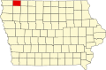
 Cloverdale, Iowa Location of Cloverdale, Iowa  Cloverdale, Iowa Cloverdale, Iowa (the United States) | |
| Coordinates: 43°20′49″N95°41′09″W / 43.3469151°N 95.6858470°W | |
| Country | USA |
| State | Iowa |
| County | Osceola County |
| Elevation | 466 m (1,529 ft) |
| Time zone | UTC-6 (Central (CST)) |
| • Summer (DST) | UTC-5 (CDT) |
| Zip code | 51249 |
| Area code | 712 |
| GNIS feature ID | 455489 [1] |
Cloverdale is an unincorporated community in Osceola County, Iowa, United States. [1] It is located 5 miles southeast of the county seat Sibley, and 10 miles from the Iowa-Minnesota border. [2]