
The Great River Road is a collection of state and local roads that follow the course of the Mississippi River through ten states of the United States. They are Minnesota, Wisconsin, Iowa, Illinois, Missouri, Kentucky, Tennessee, Arkansas, Mississippi and Louisiana. It formerly extended north into Canada, serving the provinces of Ontario and Manitoba. The road is designated as both a National Scenic Byway and an All-American Road in several states along the route.

U.S. Route 71 or U.S. Highway 71 is a major north–south United States highway that extends for over 1500 miles (2500 km) in the central United States. This original 1926 route has remained largely unchanged by encroaching Interstate highways. Currently, the highway's northern terminus is in International Falls, Minnesota at the Canada–US border, at the southern end of the Fort Frances-International Falls International Bridge to Fort Frances, Ontario. U.S. Route 53 also ends here. On the other side of the bridge, Trans-Canada Highway is an east–west route while Ontario Highway 71 is a north–south route. US 71's southern terminus is between Port Barre and Krotz Springs, Louisiana at an intersection with U.S. Route 190. For the entirety south of Kansas City, Missouri, US 71 runs parallel and concurrent with the existing and future Interstate 49. North of Kansas City, US 71 runs halfway between Interstate 29 and Interstate 35, which they split in the city at an interchange with Interstate 70.

U.S. Route 65 is a north–south United States highway in the southern and midwestern United States. The southern terminus of the route is at U.S. Route 425 in Clayton, Louisiana. The northern terminus is at Interstate 35 just south of Interstate 90 in Albert Lea, Minnesota. Parts of its modern route in Iowa and historic route in Minnesota follow the old Jefferson Highway.
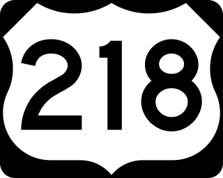
U.S. Highway 218 (US 218) is an original United States Highway that was created in 1926. Although technically a spur of US 18, US 218 neither begins nor ends at US 18, but overlaps US 18 for eight miles (13 km) near Charles City, Iowa. US 218 begins at U.S. 136 in downtown Keokuk and ends 319 miles (513 km) away at Interstate 35 (I-35) and US 14 at Owatonna, Minnesota. A large portion of US 218 in Iowa is part of the Avenue of the Saints, which connects St. Louis, Missouri, and Saint Paul, Minnesota.

State Route 18 is an east–west highway in northern Ohio. It is the sixth longest state route in the state. Its western terminus is at the Indiana state line near Hicksville, where the route continues in Indiana as State Road 8, and its eastern terminus is at State Route 91 in Akron.

Minnesota State Highway 371 (MN 371) is a 107.411-mile-long (172.861 km) highway in central and north-central Minnesota. The route connects Minnesota's northern lakes region with the central part of the state. It runs south–north from U.S. Highway 10 (US 10) in Little Falls to US 2 in Cass Lake. MN 371 has become a heavily traveled arterial route that was once a two-lane roadway over almost all of its length, but has been widened to four lanes across most of its southern half. Much of the traffic utilizing the route is Twin Cities-based traffic heading to their cabins on one of the many northern lakes.

State Highway 289, known for most of its length as Preston Road, is a north–south Texas state highway. It begins at the intersection of Preston Road and Loop 12/Northwest Highway in Dallas. The Preston Road designation comes from the fact that the highway generally follows the course of an older road known as the Preston Trail, which ran to the town of Preston [Bend]. Preston is now submerged by Lake Texoma. The road is known as Preston all the way north through the remainder of the Dallas-Fort Worth Metroplex to a junction with State Highway 56 west of Sherman, near the Oklahoma state line. Preston Road passes through many of the fast-growing northern Dallas suburbs, including Frisco and Plano, as well as Prosper and Celina, with many new housing developments being built along Preston.
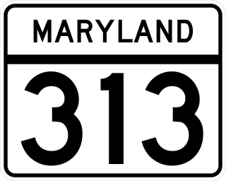
Maryland Route 313 (MD 313) is a state highway located on the Eastern Shore of Maryland in the United States. The 75.72-mile (121.86 km) route runs from U.S. Route 50 (US 50) in Mardela Springs, Wicomico County, north to MD 213 and MD 290 in Galena, Kent County. It is predominantly a rural two-lane undivided road that runs through agricultural areas a short distance west of the Delaware state line, with the exception of a four-lane divided bypass of Denton that is concurrent with MD 404. MD 313 serves many communities, including Sharptown, Eldorado, Federalsburg, Denton, Greensboro, Goldsboro, Barclay, Sudlersville, Millington, and Massey. The route intersects many major roads, including MD 54 in Mardela Springs, MD 404 in the Denton area, MD 302 in Barclay, MD 300 in Sudlersville, and US 301 near Massey.

New York State Route 354 (NY 354) is a state highway in New York in the United States. NY 354 is one of several highways radiating eastward from its western terminus in downtown Buffalo. The east terminus of NY 354 is in the village of Attica, where it ends at NY 98 and NY 238 as West Main Street. This highway runs through the center of Erie County to the northern county line of Wyoming County.
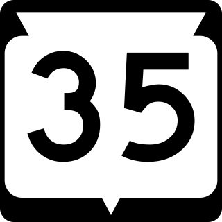
State Trunk Highway 35 is a Wisconsin state highway running north–south across western Wisconsin. It is 412.15 miles in length, and is the longest state highway in Wisconsin. Portions of WIS 35 are part of the Great River Road.

State Trunk Highway 64 (WIS 64) is a 275.65-mile-long (443.62 km) highway in Wisconsin, which runs from the St. Croix Crossing bridge as a continuation of Minnesota State Highway 36 (MN 36) near Stillwater, Minnesota, and continues east to its eastern terminus in downtown Marinette, where it terminates at US Highway 41 (US 41) at an intersection on the corner of Marinette and Hall Avenue. Along the way, Highway 64 runs east–west through eight counties across northern Wisconsin.
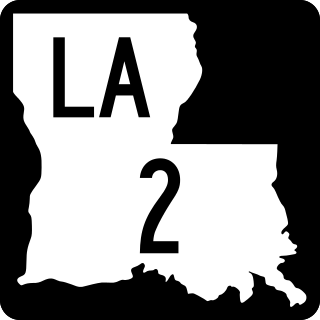
Louisiana Highway 2 (LA 2) is a state highway located in northern Louisiana. It runs 189.49 miles (304.95 km) in an east–west direction from the Texas state line southwest of Vivian to a junction with U.S. Highway 65 (US 65) near Lake Providence, just west of the Mississippi state line.

Pennsylvania Route 72 is a 37.8-mile-long (60.8 km) north–south state route located in southeast Pennsylvania. The southern terminus of the route is at U.S. Route 222 /PA 272 in Lancaster. The northern terminus is at PA 443 north of Lickdale in Union Township. PA 72 serves as a major road connecting Lancaster and Lebanon counties, serving East Petersburg, Manheim, Cornwall, Lebanon, and Jonestown. The route intersects several major roads including US 30 and PA 283 north of Lancaster, the Pennsylvania Turnpike south of Cornwall, US 322 along a concurrency on a freeway bypassing Cornwall, US 422 in Lebanon, US 22 near Jonestown, and I-81 via Fisher Avenue in Lickdale.
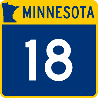
Minnesota State Highway 18 is a 78.207-mile-long (125.862 km) highway in east-central Minnesota, which runs from its intersection with State Highway 25 in Brainerd and continues east to its eastern terminus at its intersection with State Highway 23 in Finlayson Township near Askov and Sandstone. The eastern terminus of Highway 18 is less than 1/2 mile west of an interchange with Interstate Highway 35 along Highway 23.
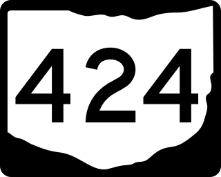
State Route 424 was an east–west state highway in the northwestern portion of the U.S. state of Ohio. The route was a former section of US 24 that ran parallel to the Maumee River and Miami and Erie Canal between the cities of Defiance and Napoleon. First designated in 1964, the western terminus of the route for most of its history was at an intersection with US 24 west of Defiance, though between 2008 and when the route was fully removed from the state highway system in 2012, it was at the Defiance County/Henry County line. Its eastern terminus was at a dead end near the US 6 / US 24 interchange east of Napoleon.

U.S. Route 322 is a spur of US 22, running from Cleveland, Ohio, east to Atlantic City, New Jersey. In the U.S. state of Pennsylvania, the route runs from the Ohio state line in West Shenango Township southeast to the Commodore Barry Bridge over the Delaware River in Chester, at which point the route crosses into New Jersey. The route passes near or through several cities, including Meadville, DuBois, State College, and Harrisburg. US 322 in Pennsylvania is named the 28th Division Highway in honor of the 28th Infantry Division.
U.S. Route 322 is a spur of U.S. Route 22, running from Cleveland, Ohio, east to Atlantic City, New Jersey. The easternmost segment of the route in New Jersey runs 62.64 miles (100.81 km) from the Commodore Barry Bridge over the Delaware River in Logan Township, Gloucester County, where it continues southeast to Atlantic Avenue and Pacific Avenue in Atlantic City, Atlantic County. The portion of the route between the Commodore Barry Bridge and Route 42 in Williamstown is mostly a two-lane undivided road that is concurrently signed with County Route 536 (CR 536), passing through Mullica Hill and Glassboro. From Williamstown, US 322 follows the Black Horse Pike, a four-lane road, southeast to Atlantic City. In Hamilton Township, Atlantic County, US 322 forms a concurrency with U.S. Route 40, continuing with that route all the way to Atlantic City. US 322 intersects several major roads including U.S. Route 130 and Interstate 295 (I-295) in Logan Township, the New Jersey Turnpike in Woolwich Township, Route 55 in Harrison Township, Route 42 in Williamstown, Route 50 and U.S. Route 40 in Hamilton Township, the Garden State Parkway in Egg Harbor Township, and U.S. Route 9 in Pleasantville.
U.S. Highway 71 is a U.S. highway that runs from Krotz Springs, LA to the Fort Frances–International Falls International Bridge at the Canadian border. In Arkansas, the highway runs from the Louisiana state line near Doddridge to the Missouri state line near Bella Vista. In Texarkana, the highway runs along State Line Avenue with US 59 and partially runs in Texas. Other areas served by the highway include Fort Smith and Northwest Arkansas.

