
Minnesota State Highway 219 is a 15.331-mile-long (24.673 km) highway in northwest Minnesota, which runs from its intersection with State Highway 1 near Goodridge and continues north to its northern terminus at its intersection with State Highway 89 near Grygla.

Minnesota State Highway 246 (MN 246) is a 18.221-mile-long (29.324 km) highway in southeast Minnesota, which runs from its intersection with State Highway 3 in the city of Northfield and continues south and east to its eastern terminus at its intersection with State Highway 56 in Holden Township near Kenyon.

Minnesota State Highway 247 (MN 247) is a 12.604-mile-long (20.284 km) highway in southeast Minnesota, which runs from its intersection with U.S. Highway 63 in Farmington Township, north of Rochester; and continues east to its eastern terminus at its intersection with State Highway 42 in the city of Plainview.
Minnesota State Highway 223 is a 7.643-mile-long (12.300 km) highway in northwest Minnesota, which runs from its intersection with State Highway 92 in Holst Township of Clearwater County and continues east to its eastern terminus at its intersection with Clearwater County State-Aid Highway 10 in Leonard. It is also signed as Leonard Road.

Minnesota State Highway 227 was a 10.680-mile-long (17.188 km) highway in north-central Minnesota, which ran from its intersection with U.S. Highway 71 and Wadena County Road 8 in Sebeka and continued east to its eastern terminus at its intersection with Wadena County Roads 12 and 14 in Nimrod near the Crow Wing River. The route was decommissioned in 2012 and it became an extension of Wadena County Road 12.

Minnesota State Highway 228 was a 7.785-mile-long (12.529 km) highway in west-central Minnesota, which ran from its intersection with Otter Tail County Roads 4 and 17 in Vergas and continued east to its eastern terminus at its intersection with U.S. Highway 10 in the unincorporated town of Luce in Gorman Township.

Minnesota State Highway 235 was a 10.027-mile-long (16.137 km) highway in west-central Minnesota, which ran from its intersection with Otter Tail County Road 59 in Urbank and continued east to its eastern terminus at its intersection with State Highway 29 in Parkers Prairie. In 2013, the route was removed from the state highway system. The route became an extension of Otter Tail County Road 38.

Minnesota State Highway 238 (MN 238) is a 34.709-mile-long (55.859 km) highway in central Minnesota, which runs from its interchange with Interstate 94 and Stearns County State-Aid Highway 10 in Albany and continues north to its northern terminus at its intersection with State Highways 27 / 28 near Little Falls.
Minnesota State Highway 254 was a 4.796-mile-long (7.718 km) highway in south-central Minnesota, which ran from its intersection with Faribault County Road 17 in the city of Frost and continued north to its northern terminus at its interchange with Interstate 90 in Emerald Township, 8 miles east of Blue Earth.

Minnesota State Highway 257 is a 3.991-mile-long (6.423 km) highway in southwest Minnesota, which runs from its intersection with Brown County State-Aid Highway 20 in the city of Hanska and continues east to its eastern terminus at its intersection with State Highway 15 in Linden Township, 6 miles north of Madelia.

Minnesota State Highway 271 is a 8.591-mile-long (13.826 km) highway in southwest Minnesota, which runs from its intersection with State Highway 19 in Hendricks Township and continues north and west to its terminus at the South Dakota state line, where the roadway becomes South Dakota Highway 28.

Minnesota State Highway 277 was a 11.025-mile-long (17.743 km) highway in west-central Minnesota. It ran from its intersection with State Highway 7 in Stoneham Township near Clara City and Maynard; and continued to its northern terminus at its intersection with State Highway 40 in Louriston Township, 20 miles west of Willmar.

Minnesota State Highway 282 (MN 282) is a 7.655-mile-long (12.320 km) highway in Minnesota, which runs from its intersection with U.S. Highway 169 in Jordan and continues east to its eastern terminus at its intersection with State Highway 13 in Spring Lake Township near Prior Lake.

Minnesota State Highway 287 (MN 287) is a 14.423-mile-long (23.212 km) highway in west-central Minnesota, which runs from its intersection with State Highway 28 in Grey Eagle and continues north to its northern terminus at its intersection with U.S. 71 / State Highway 27 in Long Prairie.
State Highway 261 was a 16.004-mile-long (25.756 km) highway in McLeod County, Minnesota. It ran from Winsted to U.S. Highway 212 east of Glencoe. It was turned back to McLeod County maintenance in 1996, becoming County State-aid Highway 1.

Minnesota State Highway 270 (MN 270) is a 7.659-mile-long (12.326 km) state highway in the southwest corner of Minnesota, which runs from its intersection with County State-Aid Highway 13 (CSAH 13) in the city of Hills, and continues east to its eastern terminus at its intersection with U.S. Highway 75 (US 75) in Clinton Township, eight miles (13 km) south of Luverne.
Minnesota State Highway 263 is a 11.226-mile-long (18.066 km) highway in southwest Minnesota, which runs from its intersection with Martin County State-Aid Highway 8 in Ceylon and continues north to its northern terminus at its interchange with Interstate 90 near Welcome, nine miles west of Fairmont.

Minnesota State Highway 264 is a 7.394-mile-long (11.899 km) highway in southwest Minnesota, which runs from its intersection with Nobles County State-Aid Highway 21 in Round Lake and continues north to its northern terminus at its interchange with Interstate 90 and Jackson County State-Aid Highway 1, six miles east of Worthington.
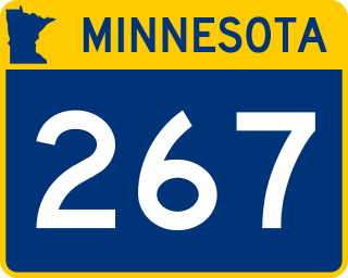
Minnesota State Highway 267 is a 5.353-mile-long (8.615 km) highway in southwest Minnesota, which runs from its intersection with Murray County State-Aid Highway 4 in Iona and continues north to its northern terminus at its intersection with State Highway 30, 1.5 miles west of Slayton.
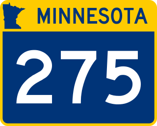
Minnesota State Highway 275 was a 6.519-mile-long (10.491 km) highway in southwest Minnesota, which ran from its intersection with Lac qui Parle County State-Aid Highway 2 in Boyd and continued north to its northern terminus at its intersection with U.S. Highway 212 in Baxter Township, 6 miles east of Dawson. It is now marked as Lac qui Parle County State-Aid Highway 29, and Lac qui Parle County Road 208 in the city limits of Boyd.

