Virginia began as a logging settlement and experienced significant growth when the iron ore industry expanded. Orrin Day Kinney, the original owner of the land, founded the town. The site was planned in 1892 and named Virginia in honor of the home state of many local lumber workers at that time.[8] A post office was established in Virginia in 1893.[9] The city was officially incorporated in 1895. As the mining industry developed, mines in the Virginia area became highly productive, consistently breaking records for ore output by the late 1890s. The city’s main population increase started after the construction of mining camps for prominent business figures such as Andrew Carnegie, Leonidas Merritt, Jay Cooke, John D. Rockefeller, William J. Olcott, and James J. Hill. Mining operations relied on diamond drills, mules, and a large workforce to extract millions of tons of ore each year. The ore was shipped from the Twin Ports of Duluth and Superior, as well as Two Harbors.
The commercial heart of Virginia endured two catastrophic fires in 1893 and 1900, with the latter event leading to the complete destruction of the downtown business area. In response, city ordinances were enacted mandating the use of brick for new commercial construction along Chestnut Street, which subsequently led to the establishment of a durable and fire-resistant downtown core. Many properties in this historic district were operated by early immigrant families from Finland, Sweden, Slovenia, and Croatia, along with other European countries who contributed to the city’s economic landscape. These groups, drawn by mining and industrial jobs, became major parts of the business community and established various enterprises in the city’s commercial district.[10][11]
The City of Franklin was consolidated into the City of Virginia.[12]
The Virginia Commercial Historic District is a designation applied to the historic downtown of Virginia, Minnesota, United States. It comprises 78 contributing properties built from 1900 to 1941.[13] It was listed as a historic district on the National Register of Historic Places in 1997 for its local significance in the theme of commerce.[14] It was nominated for representing an early-20th-century business district and Virginia's development as a mining boomtown and tourism gateway.[13]
Geography
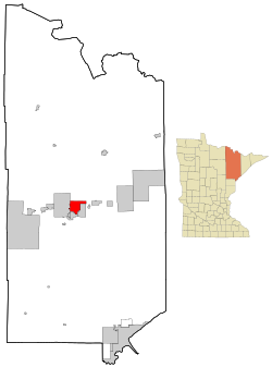
According to the United States Census Bureau, the city has an area of 19.18 square miles (49.68km2); 18.85 square miles (48.82km2) is land and 0.33 square miles (0.85km2) is water.[15] Lakes in Virginia include Silver Lake and Bailey Lake. An Ojibwe tribe originally named the area Qeechaquepagem, which roughly means "lake of the north birds".
The Köppen Climate Classification subtype for this climate is "Dfb" (Warm Summer Continental Climate). Summers are warm, sometimes hot, and winters are severely cold.
As of the census of 2010, there were 8,712 people, 4,242 households, and 2,019 families living in the city. The population density was 462.2 inhabitants per square mile (178.5/km2). There were 4,738 housing units at an average density of 251.4 per square mile (97.1/km2). The racial makeup of the city was 94.7% White, 0.6% African American, 1.0% Native American, 0.5% Asian, 0.3% from other races, and 2.9% from two or more races. Hispanic or Latino of any race were 1.5% of the population.
There were 4,242 households, of which 21.8% had children under the age of 18 living with them, 31.7% were married couples living together, 12.0% had a female householder with no husband present, 4.0% had a male householder with no wife present, and 52.4% were non-families. 46.3% of all households were made up of individuals, and 20% had someone living alone who was 65 years of age or older. The average household size was 1.95 and the average family size was 2.74.
The median age in the city was 44.9 years. 18.9% of residents were under the age of 18; 9.3% were between the ages of 18 and 24; 21.8% were from 25 to 44; 27.9% were from 45 to 64; and 22% were 65 years of age or older. The gender makeup of the city was 47.9% male and 52.1% female.
2000 census
As of the census of 2000, there were 9,157 people, 4,333 households, and 2,270 families living in the city. The population density was 486.1 inhabitants per square mile (187.7/km2). There were 4,692 housing units at an average density of 249.1 per square mile (96.2/km2). The racial makeup of the city was 95.17% White, 0.46% African American, 2.24% Native American, 0.55% Asian, 0.01% Pacific Islander, 0.17% from other races, and 1.40% from two or more races. Hispanic or Latino of any race were 0.80% of the population. 21.4% were of Finnish, 13.3% German, 9.9% Norwegian, 8.8% Italian, and 7.8% Swedish ancestry.
There were 4,333 households, out of which 22.5% had children under the age of 18 living with them, 38.4% were married couples living together, 10.7% had a female householder with no husband present, and 47.6% were non-families. 42.6% of all households were made up of individuals, and 19.6% had someone living alone who was 65 years of age or older. The average household size was 2.00 and the average family size was 2.73.
In the city, the population was spread out, with 19.0% under the age of 18, 9.4% from 18 to 24, 25.0% from 25 to 44, 23.3% from 45 to 64, and 23.2% who were 65 years of age or older. The median age was 43 years. For every 100 females, there were 88.4 males. For every 100 females age 18 and over, there were 85.9 males.
The median income for a household in the city was $28,873, and the median income for a family was $43,419. Males had a median income of $38,834 versus $22,473 for females. The per capita income for the city was $17,776. About 10.6% of families and 15.9% of the population were below the poverty line, including 16.6% of those under age 18 and 10.0% of those age 65 or over.
Virginia is situated on the Mesabi Range, part of northeastern Minnesota’s Iron Range, a region historically known for iron ore mining.[19] While mining remains important to the broader area, Virginia has diversified its local economy. The city serves as a commercial, healthcare, and service hub for nearby communities, aided by its location along U.S. Highway 53 and its proximity to other towns on the Range.[20][21] Retail plays a significant role in Virginia’s economy, with national chains like Target and Walmart operating alongside independent businesses in the downtown area and along the highway corridor.[22]
Healthcare is a major employer, with Essentia Health–Virginia providing medical services to much of the central Iron Range and standing as one of the city’s largest institutions.[23] Other economic sectors include transportation, warehousing, and companies supporting mining and industrial activities.[24] Tourism also contributes seasonally, as visitors come for outdoor recreation, nearby lakes, and events such as the annual Land of the Loon festival.[25] In 2023, Virginia strengthened its role as an educational center with the opening of a new consolidated high school campus under Rock Ridge Public Schools, serving students from multiple communities in the region.[26]
Virginia is home to several annual events that celebrate the community’s culture and traditions. Each June, the city hosts the Land of the Loon festival, which includes a parade, artisan market, food vendors, and cultural exhibitions that highlight the Iron Range’s immigrant heritage.[27] The Range Iron Pride Festival also takes place during August, focusing on LGBTQ+ pride and supporting diversity within the region.[28] Other major events include the Brewfest at Olcott Park, where regional craft breweries and live music are featured, the Virginia Food Truck Festival, which is held on Main Street.[29]
Points of interest
B'nai Abraham Synagogue: A restored early 20th-century synagogue now used as a cultural and historical interpretive site.[30]
Laurentian Divide: A geographical landmark just north of the city, representing a continental hydrological divide.
Lyric Center for the Arts: Located in the historic Lyric Opera House, this venue supports local performing arts and visual arts through shows, exhibits, and educational programs.[31]
Mesabi Trail: A paved recreational trail that passes through Virginia and connects communities across the Iron Range.[32]
Olcott Park Greenhouse: A city-operated public greenhouse featuring botanical displays and seasonal programming.[33]
The city is located roughly 60 miles north of Duluth, which anchors the Duluth–Superior metropolitan area. Virginia is officially included in the Duluth MN–WI Metropolitan Statistical Area, the second-largest metropolitan region in Minnesota by population.[35]
Parks and recreation
Looking across Silver Lake at former train depot
Virginia maintains a variety of public parks, trails, and recreational facilities that serve residents and visitors throughout the year.
Olcott Park, located near the center of the city, spans approximately 40 acres. It features open green space, a bandshell used for summer concerts, and a stone fountain originally built in 1937 through a Works Progress Administration (WPA) project. The fountain was restored and reactivated in 2019.[36][37] The park is also home to the Olcott Park Greenhouse, a city-operated botanical facility that features tropical and seasonal plants and is open to the public year-round.[38]
Silver Lake Park, located east of downtown, includes picnic shelters, a public boat launch, shoreline access, and paved trails. The adjacent Silver Lake Trail forms a walking and biking loop around the lake.[39]
Bridgeview Park, near the east end of Chestnut Street, offers elevated views of the Tom Rukavina Memorial Bridge, which spans the Rouchleau Mine Pit. The park features interpretive signage, benches, and access to the Mesabi Trail trailhead.[40]
Southside Park, located in the southern part of the city, includes athletic fields used for youth baseball, softball, and soccer programs.[41]
The Iron Trail Motors Event Center (ITMEC) opened in 2021. The 120,000 square foot facility includes two indoor ice arenas, a fitness center, a ballroom, and community meeting rooms. It serves as the home rink for Rock Ridge High School and hosts public skating, tournaments, and other events.[42]
The Virginia Indoor Tennis and Pickleball Club, formerly known as Tennis for All, is located at 1310 South 5th Avenue. The facility includes 12 acrylic courts—six indoor and six outdoor—with permanent lines, portable nets, restrooms, water, and lights.[43][44]
Virginia is also located along the Mesabi Trail, a paved multi-use trail that extends more than 135 miles across the Iron Range.[45]
Education
Tom Rukavina Engineering Center, Minnesota North College
Rock Ridge Public Schools (ISD 2909) serves the city with Rock Ridge High School (grades 7–12), North Star Elementary (grades 3–6), and Parkview Learning Center (Pre-K–2).[46]
Virginia is also the site of the Iron Range Engineering program, an ABET-accredited bachelor's degree in Integrated Engineering offered through Minnesota North College and Minnesota State University, Mankato. The program, based at Mesabi Range–Virginia, uses a cooperative education model with industry internships during the junior and senior years.[47][48]
The St. Louis County Schools (ISD 2142) district office is located in Virginia, though its schools serve surrounding towns such as Cherry and Tower–Soudan.[49]
Marquette Catholic School, affiliated with the Diocese of Duluth, offers private elementary education (K–6).[50]
The Virginia campus of Mesabi Range, part of Minnesota North College, provides two-year technical, career, and transfer programs.[51]
The Virginia Public Library offers media, resources, and programs for all ages.[52]
The Northland Learning Center, housed in the former James Madison Elementary School, serves students requiring alternative education under ISD 2909.[53]
Media
News media
The Mesabi Tribune, newspaper published in Virginia and Hibbing
Television
Stations serving Virginia are received from the Duluth television market:
Virginia is a regional transportation hub within the Mesabi Range. Major roadways include U.S. routes 53 and 169 (northern terminus) and State Highway 135 (MN 135). Other main routes include 2nd Avenue West, 9th Avenue West, 12th Avenue West, 13th Street South, 8th Street South, and 9th Street North. Downtown Virginia is centered along Chestnut Street. Arrowhead Transportation also allows for city bussing through the Virginia Metro area.
In 2017, the U.S. 53 Bridge was built. It is Minnesota's tallest bridge and the main bridge from the freeway from southern Minnesota to the north. In 2021, it was renamed the Thomas Rukavina Memorial Bridge.
Notable people
Actor Chris Pratt was born in Virginia, Minnesota.
This page is based on this Wikipedia article Text is available under the CC BY-SA 4.0 license; additional terms may apply. Images, videos and audio are available under their respective licenses.