Iron Junction, Minnesota

Last updated
Iron Junction
St. Louis County Minnesota Incorporated and Unincorporated areas Iron Junction Highlighted.svg
Location of the city of Iron Junction
within Saint Louis County, Minnesota
Coordinates: 47°25′1″N92°36′16″W / 47.41694°N 92.60444°W / 47.41694; -92.60444
Country United States
State Minnesota
County Saint Louis
Area
[1]
  Total0.81 sq mi (2.10 km2)
  Land0.81 sq mi (2.10 km2)
  Water0.00 sq mi (0.00 km2)
Elevation
1,388 ft (423 m)
Population
 (2020)
  Total110
  Density135.47/sq mi (52.33/km2)
Time zone UTC-6 (Central (CST))
  Summer (DST) UTC-5 (CDT)
ZIP codes
55751
Area code(s) 218
FIPS code 27-31238 [2]
GNIS feature ID0661552 [3]

Iron Junction is a city in Saint Louis County, Minnesota, United States. The population was 86 at the 2010 census. [4]

Contents

Saint Louis County Highway 7 and Iron Junction Road serve as main routes in the community. State Highway 37 (MN 37) is nearby.

The name Iron Junction, as a place of residence, is seldom used today by its residents. Those who reside in this community simply identify themselves as a resident of Iron. The road signs posted in the community also simply read "Iron".[ citation needed ]

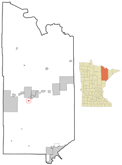
The city of Iron Junction is located within Clinton Township geographically but is a separate entity.

Geography

According to the United States Census Bureau, the city has a total area of 0.83 square miles (2.15 km2), all land. [5]

Demographics

Historical population
CensusPop.
1900 118
1910 76−35.6%
1920 9221.1%
1930 12839.1%
1940 107−16.4%
1950 12819.6%
1960 18746.1%
1970 150−19.8%
1980 134−10.7%
1990 133−0.7%
2000 93−30.1%
2010 86−7.5%
2020 11027.9%
U.S. Decennial Census [6]

2010 census

As of the census [7] of 2010, there were 86 people, 45 households, and 24 families living in the city. The population density was 103.6 inhabitants per square mile (40.0/km2). There were 47 housing units at an average density of 56.6 per square mile (21.9/km2). The racial makeup of the city was 96.5% White, 1.2% from other races, and 2.3% from two or more races. Hispanic or Latino of any race were 2.3% of the population.

There were 45 households, of which 15.6% had children under the age of 18 living with them, 42.2% were married couples living together, 2.2% had a female householder with no husband present, 8.9% had a male householder with no wife present, and 46.7% were non-families. 37.8% of all households were made up of individuals, and 11.1% had someone living alone who was 65 years of age or older. The average household size was 1.91 and the average family size was 2.42.

The median age in the city was 53.5 years. 12.8% of residents were under the age of 18; 4.6% were between the ages of 18 and 24; 16.3% were from 25 to 44; 45.4% were from 45 to 64; and 20.9% were 65 years of age or older. The gender makeup of the city was 54.7% male and 45.3% female.

2000 census

As of the census of 2000, [2] there were 93 people, 44 households, and 31 families living in the city. The population density was 119.3 people per square mile (46.0/km2). There were 44 housing units at an average density of 56.4 per square mile (21.8/km2). The racial makeup of the city was 100.00% White. 26.5% were of Norwegian, 14.7% Finnish, 13.2% German, 11.8% Swedish, 8.8% Slovene and 5.9% French Canadian ancestry.

There were 44 households, out of which 20.5% had children under the age of 18 living with them, 61.4% were married couples living together, 2.3% had a female householder with no husband present, and 29.5% were non-families. 25.0% of all households were made up of individuals, and 9.1% had someone living alone who was 65 years of age or older. The average household size was 2.11 and the average family size was 2.52.

In the city, the population was spread out, with 14.0% under the age of 18, 5.4% from 18 to 24, 26.9% from 25 to 44, 30.1% from 45 to 64, and 23.7% who were 65 years of age or older. The median age was 47 years. For every 100 females, there were 126.8 males. For every 100 females age 18 and over, there were 122.2 males.

The median income for a household in the city was $40,938, and the median income for a family was $45,625. Males had a median income of $39,375 versus $31,875 for females. The per capita income for the city was $21,751. None of the population and none of the families were below the poverty line.

Coordinates: 47°25′08″N92°36′13″W / 47.41889°N 92.60361°W / 47.41889; -92.60361

Related Research Articles

Atkinson, Illinois Town in Illinois, United States

Atkinson is an incorporated town in Henry County, Illinois, United States. The population was 965 at the 2020 census, down from 972 in 2010.

Woodland Hills, Kentucky City in Kentucky, United States

Woodland Hills is a home rule-class city in Jefferson County, Kentucky, United States. The population was 696 at the 2010 census.

Alna, Maine Place in Maine, United States

Alna is a town in Lincoln County, Maine, United States. The population was 710 at the 2020 census. Alna is home to the Wiscasset, Waterville and Farmington Railway Museum and is noted for its historic architecture, including the early mill village of Head Tide.

Topsfield is a town in Washington County, Maine, United States. The population was 179 at the 2020 census.

Trommald, Minnesota City in Minnesota, United States

Trommald is a city in Crow Wing County, Minnesota, United States. The population was 98 at the 2010 census. It is part of the Brainerd Micropolitan Statistical Area.

Coleraine, Minnesota City in Minnesota, United States

Coleraine is a city in Itasca County, Minnesota, United States. The population was 1,970 at the 2010 census. The community was named after Thomas F. Cole, President of the Oliver Iron Mining Company.

Marble, Minnesota City in Minnesota, United States

Marble is a city in Itasca County, Minnesota, United States. It is part of the chain of small mining towns known as the Iron Range. The population was 701 at the 2010 census.

Rose Creek, Minnesota City in Minnesota, United States

Rose Creek is a city in Windom Township, Mower County, Minnesota, United States. The population was 394 at the 2010 census.

Gilbert, Minnesota City in Minnesota, United States

Gilbert is a city in St. Louis County, Minnesota, United States. The population was 1,799 at the 2010 census. State Highway 37 and State Highway 135 are two of the main routes in Gilbert. Gilbert is part of the Quad Cities of Virginia, Eveleth, and Mountain Iron. The city gets its name from Giles Gilbert, who led the exploration of the McKinley mine property in the 1890s.

McKinley, St. Louis County, Minnesota City in Minnesota, United States

McKinley is a city in Saint Louis County, Minnesota, United States; located within the Iron Range region of Minnesota. The population was 128 at the 2010 census.

Mountain Iron, Minnesota City in Minnesota, United States

Mountain Iron is a city in Saint Louis County, Minnesota, United States; in the heart of the Mesabi Range. The population was 2,878 at the 2020 census.

Conception Junction, Missouri City in Missouri, United States

Conception Junction is a city in Nodaway County, Missouri, United States, near the Platte River. The population was 198 at the 2010 census, at which time it was a town.

Sutcliffe, Nevada CDP in Nevada, United States

Sutcliffe is a census-designated place (CDP) in Washoe County, Nevada, United States. The population was 253 at the 2010 census. It is part of the Reno–Sparks Metropolitan Statistical Area.

St. Louisville, Ohio Village in Ohio, United States

St. Louisville is a village in Licking County, Ohio, United States, along the North Fork of the Licking River. The population was 373 at the 2010 census.

Kirby, Ohio Village in Ohio, United States

Kirby is a village in Wyandot County, Ohio, United States. The population was 110 at 2019.

Oglesby, Texas City in Texas, United States

Oglesby is a city in Coryell County, Texas, United States. The population was 484 at the 2010 census. It is part of the Killeen–Temple–Fort Hood Metropolitan Statistical Area.

Hewitt, Marathon County, Wisconsin

Hewitt is a town in Marathon County, Wisconsin, United States. It is part of the Wausau, Wisconsin Metropolitan Statistical Area. The population was 606 at the 2010 census. The unincorporated community of Glandon is located in the town.

Worcester, Wisconsin Town in Wisconsin, United States

Worcester is a town in Price County, Wisconsin, United States. The population was 1,711 at the 2000 census. The unincorporated community of Cranberry Lake is located in the town.

Junction City, Louisiana Village in Louisiana, United States

Junction City is a village in Claiborne and Union parishes in Louisiana, United States, and is the twin city of neighboring Junction City, Arkansas. The population was 582 at the 2010 census.

Paden City, West Virginia City in West Virginia, United States

Paden City is a city in Tyler and Wetzel counties in the U.S. state of West Virginia, along the Ohio River. It was founded in 1902. The population was 2,550 at the 2020 census.

References

  1. "2020 U.S. Gazetteer Files". United States Census Bureau. Retrieved July 24, 2022.
  2. 1 2 "U.S. Census website". United States Census Bureau . Retrieved 2008-01-31.
  3. "US Board on Geographic Names". United States Geological Survey. 2007-10-25. Retrieved 2008-01-31.
  4. "2010 Census Redistricting Data (Public Law 94-171) Summary File". American FactFinder. U.S. Census Bureau, 2010 Census. Retrieved 23 April 2011.[ dead link ]
  5. "US Gazetteer files 2010". United States Census Bureau. Archived from the original on 2012-07-02. Retrieved 2012-11-13.
  6. "Census of Population and Housing". Census.gov. Retrieved June 4, 2015.
  7. "U.S. Census website". United States Census Bureau . Retrieved 2012-11-13.