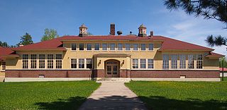
Linden Grove Township, St. Louis County, Minnesota

Last updated
Linden Grove Township, Minnesota
USA Minnesota location map.svg
Red pog.svg
Linden Grove Township, Minnesota
Location within the state of Minnesota
Usa edcp location map.svg
Red pog.svg
Linden Grove Township, Minnesota
Linden Grove Township, Minnesota (the United States)
Coordinates: 47°51′17″N92°53′5″W / 47.85472°N 92.88472°W / 47.85472; -92.88472 Coordinates: 47°51′17″N92°53′5″W / 47.85472°N 92.88472°W / 47.85472; -92.88472
Country United States
State Minnesota
County Saint Louis
Area
  Total35.4 sq mi (91.8 km2)
  Land35.4 sq mi (91.8 km2)
  Water0.0 sq mi (0.0 km2)
Elevation
1,302 ft (397 m)
Population
 (2010)
  Total145
  Density4.1/sq mi (1.6/km2)
Time zone UTC-6 (Central (CST))
  Summer (DST) UTC-5 (CDT)
FIPS code 27-37250 [1]
GNIS feature ID0664789 [2]

Linden Grove Township is a township in Saint Louis County, Minnesota, United States. The population was 145 at the 2010 census. [3]

Contents

State Highway 1 (MN 1) and State Highway 73 (MN 73) are two of the main routes in the township. Highway 1 runs east–west through the township. Highway 73 runs north–south through the township.

The unincorporated communities of Meadow Brook and Linden Grove are located within Linden Grove Township. Cook and Orr are both nearby.

Linden Grove Township was named for the groves of linden trees within its borders. [4]

Geography

According to the United States Census Bureau, Linden Grove Township has a total area of 35.4 square miles (92 km2), all land.

The unincorporated community of Linden Grove, within Linden Grove Township, is located 14 miles south of Orr, and eight miles west of Cook.

The Little Fork River flows through the northwest, central, and southeast portions of Linden Grove Township.

Beaver Creek flows through the northwest part of the township.

The west–central and southern portions of Linden Grove Township are located within the Sturgeon River State Forest.

Adjacent townships and communities

The following are adjacent to Linden Grove Township:

Unincorporated communities

Carpenter Road runs north–south along Linden Grove Township's eastern boundary line with adjacent Field Township.

Olson Road runs east–west along Linden Grove Township's northern boundary line with adjacent Willow Valley Township in the northwest and north–central part of Linden Grove Township.

Range Line Road–County Road 139 (CR 139) runs north–south along Linden Grove Township's western boundary line with adjacent Sturgeon River Unorganized Territory. The roadway is in two separate disjointed sections.

Leander Road runs east–west along Linden Grove Township's southern boundary line with adjacent Sturgeon Township in the southwest corner of Linden Grove Township.

Demographics

As of the census [1] of 2000, there were 141 people, 54 households, and 38 families residing in the township. The population density was 4.0 people per square mile (1.5/km2). There were 89 housing units at an average density of 2.5/sq mi (1.0/km2). The racial makeup of the township was 90.78% White, 3.55% Native American, 3.55% Asian, and 2.13% from two or more races.

There were 54 households, out of which 42.6% had children under the age of 18 living with them, 59.3% were married couples living together, 7.4% had a female householder with no husband present, and 29.6% were non-families. 24.1% of all households were made up of individuals, and 7.4% had someone living alone who was 65 years of age or older. The average household size was 2.61 and the average family size was 3.13.

In the township the population was spread out, with 32.6% under the age of 18, 2.8% from 18 to 24, 31.9% from 25 to 44, 22.0% from 45 to 64, and 10.6% who were 65 years of age or older. The median age was 39 years. For every 100 females, there were 113.6 males. For every 100 females age 18 and over, there were 106.5 males.

The median income for a household in the township was $38,500, and the median income for a family was $48,125. Males had a median income of $34,167 versus $23,125 for females. The per capita income for the township was $18,004. There were none of the families and 3.1% of the population living below the poverty line, including no under eighteens and none of those over 64.

Related Research Articles

Alango Township, St. Louis County, Minnesota Township in Minnesota, United States

Alango Township is a township in Saint Louis County, Minnesota, United States. The population was 258 at the 2010 census. Saint Louis County Roads 22 and 25 are two of the main routes in the township. Heino Road and Samuelson Road also pass through the township. Cook is nearby.

Angora Township, St. Louis County, Minnesota Township in Minnesota, United States

Angora Township is a township in Saint Louis County, Minnesota, United States. The population was 249 at the 2010 census. Angora Township was named after Angora, in Turkey.

Balkan Township, St. Louis County, Minnesota Township in Minnesota, United States

Balkan Township is a township in Saint Louis County, Minnesota, United States. The township was named after the Balkan Mountains. The population was 832 at the 2010 census.

Bassett Township, St. Louis County, Minnesota Township in Minnesota, United States

Bassett Township is a township in Saint Louis County, Minnesota, United States. The township was named for William Bassett, a businessperson in the lumber industry. The population was 41 at the 2010 census.

Biwabik Township, St. Louis County, Minnesota Township in Minnesota, United States

Biwabik Township is a township in Saint Louis County, Minnesota, United States. Biwabik is a name derived from the Ojibwe language meaning "iron". The population was 804 at the 2010 census.

Cedar Valley Township, St. Louis County, Minnesota Township in Minnesota, United States

Cedar Valley Township is a township in Saint Louis County, Minnesota, United States. Cedar Valley Township was named for the white cedar in the valley of the Floodwood River. The population was 195 at the 2010 census.

Colvin Township, St. Louis County, Minnesota Township in Minnesota, United States

Colvin Township is a township in Saint Louis County, Minnesota, United States. The population was 317 at the 2010 census.

Fairbanks Township, St. Louis County, Minnesota Township in Minnesota, United States

Fairbanks Township is a township in Saint Louis County, Minnesota, United States. The population was 63 at the 2010 census.

Field Township, St. Louis County, Minnesota Township in Minnesota, United States

Field Township is a township in Saint Louis County, Minnesota, United States. The population was 391 at the 2010 census.

French Township, St. Louis County, Minnesota Township in Minnesota, United States

French Township is a township in Saint Louis County, Minnesota, United States. The population was 567 at the 2010 census.

Grand Lake Township, St. Louis County, Minnesota Township in Minnesota, United States

Grand Lake Township is a township in Saint Louis County, Minnesota, United States. The population was 2,779 at the 2010 census.

Great Scott Township, St. Louis County, Minnesota Township in Minnesota, United States

Great Scott Township is a township in Saint Louis County, Minnesota, United States. The population was 561 at the 2010 census.

Lavell Township, St. Louis County, Minnesota Township in Minnesota, United States

Lavell Township is a township in Saint Louis County, Minnesota, United States. The population was 303 at the 2010 census.

Morcom Township, St. Louis County, Minnesota Township in Minnesota, United States

Morcom Township is a township in Saint Louis County, Minnesota, United States. The population was 94 at the 2010 census.

Owens Township, St. Louis County, Minnesota Township in Minnesota, United States

Owens Township is a township in Saint Louis County, Minnesota, United States. The population was 263 at the 2010 census.

Sandy Township, St. Louis County, Minnesota Township in Minnesota, United States

Sandy Township is a township in Saint Louis County, Minnesota, United States. The population was 356 at the 2010 census.

Solway Township, St. Louis County, Minnesota Township in Minnesota, United States

Solway Township is a township in Saint Louis County, Minnesota, United States. The population was 1,944 at the 2010 census. Solway Township was named after Solway Firth.

Sturgeon Township, St. Louis County, Minnesota Township in Minnesota, United States

Sturgeon Township is a township in Saint Louis County, Minnesota, United States. The population was 140 at the 2010 census.

White Township, St. Louis County, Minnesota Township in Minnesota, United States

White Township is an urban township in Saint Louis County, Minnesota, United States. The population was 3,229 at the 2010 census.

Willow Valley Township, St. Louis County, Minnesota Township in Minnesota, United States

Willow Valley Township is a township in Saint Louis County, Minnesota, United States. The population was 126 at the 2010 census.

References

  1. 1 2 "U.S. Census website". United States Census Bureau . Retrieved 2008-01-31.
  2. "US Board on Geographic Names". United States Geological Survey. 2007-10-25. Retrieved 2008-01-31.
  3. "Race, Hispanic or Latino, Age, and Housing Occupancy: 2010 Census Redistricting Data (Public Law 94-171) Summary File (QT-PL), Linden Grove township, St. Louis County, Minnesota". United States Census Bureau . Retrieved October 26, 2011.
  4. Upham, Warren (1920). Minnesota Geographic Names: Their Origin and Historic Significance. Minnesota Historical Society. p.  485.