Linden Grove Township is a township in Saint Louis County, Minnesota, United States. The population was 145 at the 2010 census.
Willow Valley Township is a township in Saint Louis County, Minnesota, United States. The population was 126 at the 2010 census.
Brimson is an unincorporated community in Ault Township, Saint Louis County, Minnesota, United States.
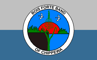
Bois Forte Indian Reservation is an Indian reservation formed for the Bois Forte Band of Chippewa.
Inger is an unincorporated community and census-designated place (CDP) in Itasca County, Minnesota, United States, along the Bowstring River of the Leech Lake Indian Reservation. As of the 2010 census, its population was 212.
Ash Lake is an unincorporated community in Saint Louis County, Minnesota, United States; located within the Kabetogama State Forest.
Crane Lake is an unincorporated community in Crane Lake Township, Saint Louis County, Minnesota, United States; located within the Kabetogama State Forest.
Angora is an unincorporated community in Angora Township, Saint Louis County, Minnesota, United States.
Skibo is an unincorporated community in Bassett Township, Saint Louis County, Minnesota, United States.
Celina is an unincorporated community in Saint Louis County, Minnesota, United States.
Bear River is an unincorporated community in Itasca and Saint Louis counties in the U.S. state of Minnesota.

Buyck is an unincorporated community in Portage Township, Saint Louis County, Minnesota, United States.
Glendale is an unincorporated community in Leiding Township, Saint Louis County, Minnesota, United States.

Sawyer is an unincorporated community in Carlton County, Minnesota, United States.
Ray is an unincorporated community in Koochiching County, Minnesota, United States.
Nett Lake is an unincorporated community and census-designated place (CDP) in Nett Lake Territory, Saint Louis County, Minnesota, United States; located on the shore of Nett Lake. As of the 2010 census, its population was 284.
Gheen is an unincorporated community in Gheen Territory, Saint Louis County, Minnesota, United States, one mile (1.6 km) east of Gheen Corner on Willow River Road.
Silverdale is an unincorporated community in Koochiching County, Minnesota, United States; located in the southeast corner of the county.
Rauch is an unincorporated community in Koochiching County, Minnesota, United States.
Bramble is an unincorporated community in Koochiching County, Minnesota, United States; located in the southeast corner of the county.


