Geography
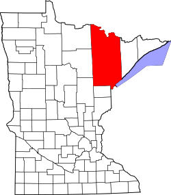
The area Britt covers begins at Highway 169 near Florenton, extending south towards Wouri Township. It also extends west past U.S. Highway 53 towards Sand Lake.
Saint Louis County Roads 65, 68, and 106 (Britt Bypass) are located within the Britt area. [3]
Britt is located within the Superior National Forest.
Natural lakes in the area include Lake Fourteen, Lake Leander, Lake Little Fourteen, Dark Lake, Arrowhead Lake, Sand Lake, Little Sand Lake, Sandy Lake, Little Sandy Lake, Moose Lake, Clear Lake, and a number of smaller lakes.
Britt Creek flows through the area.
History and culture
The original center of Britt was generally considered the intersection of Saint Louis County Road 68 and Jarvinen Road (County 662) in the southwest corner of Sandy Township.
Since the 1950s, a camp site has operated on Arrowhead Lake. [4] This site is currently known as Laurentian Environmental Center, operated by Mounds View Public Schools, a school district in the Twin Cities.
In 1976, Jim Mulligan created a documentary where he interviewed citizens of Britt on their actions against the Forestry Service to stop the organization's use of controversial herbicide 2-4-5T, a chemical that created health problems for local animals, people, and vegetation. [5]
Minntac Tailings Basin Cell One in Mountain Iron, Minnesota also lies partially in southern Britt.
This page is based on this
Wikipedia article Text is available under the
CC BY-SA 4.0 license; additional terms may apply.
Images, videos and audio are available under their respective licenses.


