Hoyt Lakes, Minnesota

Last updated
Hoyt Lakes
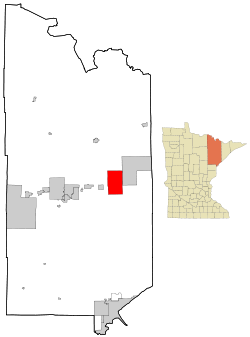
St. Louis County Minnesota Incorporated and Unincorporated areas Hoyt Lakes Highlighted.svg
Location of the city of Hoyt Lakes
within Saint Louis County, Minnesota
Coordinates: 47°31′17″N92°8′14″W / 47.52139°N 92.13722°W / 47.52139; -92.13722
Country United States
State Minnesota
County Saint Louis
Area
[1]
  Total57.59 sq mi (149.16 km2)
  Land55.91 sq mi (144.81 km2)
  Water1.68 sq mi (4.34 km2)
Elevation
[2]
1,473 ft (449 m)
Population
 (2020)
  Total2,020
  Density36.13/sq mi (13.95/km2)
Time zone UTC-6 (Central (CST))
  Summer (DST) UTC-5 (CDT)
ZIP codes
55750
Area code 218
FIPS code 27-30302 [3]
GNIS feature ID0661511 [2]
Website HoytLakes.com

Hoyt Lakes is a city in Saint Louis County, Minnesota. The population was 2,017 at the time of the 2010 census. [4]

Contents

Saint Louis County Highway 110 (CR 110) serves as a main route in Hoyt Lakes.

Geography

According to the United States Census Bureau, the city has a total area of 58.09 square miles (150.45 km2); 56.44 square miles (146.18 km2) is land and 1.65 square miles (4.27 km2) is water. [5] Water bodies in the community include Colby Lake and Whitewater Lake.

Demographics

Historical population
CensusPop.
1960 3,186
1970 3,63414.1%
1980 3,186−12.3%
1990 2,348−26.3%
2000 2,082−11.3%
2010 2,017−3.1%
2020 2,0200.1%
U.S. Decennial Census [6]

2010 census

As of the census [7] of 2010, there were 2,017 people, 885 households, and 602 families living in the city. The population density was 35.7 inhabitants per square mile (13.8/km2). There were 1,016 housing units at an average density of 18.0 per square mile (6.9/km2). The racial makeup of the city was 98.2% White, 0.5% Native American, and 1.3% from two or more races. Hispanic or Latino of any race were 0.3% of the population.

There were 885 households, of which 23.5% had children under the age of 18 living with them, 55.5% were married couples living together, 7.6% had a female householder with no husband present, 5.0% had a male householder with no wife present, and 32.0% were non-families. 26.8% of all households were made up of individuals, and 13.2% had someone living alone who was 65 years of age or older. The average household size was 2.27 and the average family size was 2.71.

The median age in the city was 49.3 years. 20.2% of residents were under the age of 18; 4% were between the ages of 18 and 24; 21.5% were from 25 to 44; 29.4% were from 45 to 64; and 25.1% were 65 years of age or older. The gender makeup of the city was 49.6% male and 50.4% female.

2000 census

As of the census of 2000, [3] there were 2,082 people, 916 households, and 649 families living in the city. The population density was 37.1 people per square mile (14.3/km2). There were 995 housing units at an average density of 17.8 per square mile (6.9/km2). The racial makeup of the city was 99.14% White, 0.29% African American, 0.19% Native American, 0.10% Asian, 0.05% from other races, and 0.24% from two or more races. Hispanic or Latino of any race were 0.19% of the population. 22.4% were of Norwegian, 18.6% German, 14.3% Finnish, 7.2% Irish, 6.1% Swedish and 5.2% English ancestry.

There were 916 households, out of which 24.1% had children under the age of 18 living with them, 61.6% were married couples living together, 7.3% had a female householder with no husband present, and 29.1% were non-families. 26.3% of all households were made up of individuals, and 13.3% had someone living alone who was 65 years of age or older. The average household size was 2.27 and the average family size was 2.71.

In the city, the population was spread out, with 19.8% under the age of 18, 6.6% from 18 to 24, 22.6% from 25 to 44, 29.6% from 45 to 64, and 21.3% who were 65 years of age or older. The median age was 46 years. For every 100 females, there were 99.6 males. For every 100 females age 18 and over, there were 96.4 males.

The median income for a household in the city was $39,493, and the median income for a family was $45,603. Males had a median income of $42,000 versus $24,052 for females. The per capita income for the city was $18,882. About 6.6% of families and 8.9% of the population were below the poverty line, including 19.5% of those under age 18 and 5.7% of those age 65 or over.
Related Research Articles

Lake View, Alabama City in Alabama, United States

Lake View is a city in Tuscaloosa County, Alabama, United States. At the 2010 census the population was 1,943, up from 1,357 in 2000. It is part of the Tuscaloosa, Alabama Metropolitan Statistical Area. It is located approximately halfway between Tuscaloosa and Birmingham via Interstates 20 and 59.

Ridgeway is a census-designated place (CDP) in Kenai Peninsula Borough, Alaska, United States. At the 2020 census the population was 2,136, up from 2,022 in 2010.

<span class="mw-page-title-main">Spirit Lake, Iowa</span> City in Iowa, United States

Spirit Lake is a city in Dickinson County, Iowa, United States. The population was 5,439 at the 2020 census. It is the county seat of Dickinson County.

<span class="mw-page-title-main">Crystal Lake, Iowa</span> City in Iowa, United States

Crystal Lake is a city in Hancock County, Iowa, United States. The population was 253 at the 2020 census.

<span class="mw-page-title-main">Portsmouth, Iowa</span> City in Iowa, United States

Portsmouth is a city in Shelby County, Iowa, United States. The population was 182 at the time of the 2020 census.

Hoyt, Kansas City in Jackson County, Kansas

Hoyt is a city in Jackson County, Kansas, United States. As of the 2020 census, the population of the city was 593.

<span class="mw-page-title-main">Portage Lake, Maine</span> Town in Maine, United States

Portage Lake is a town in Aroostook County, Maine, United States. The population was 359 at the 2020 census.

Beals is a town in Washington County, Maine, United States, located on an island opposite Jonesport. The town was named after Manwarren Beal, an early settler. The population was 443 at the 2020 census.

<span class="mw-page-title-main">Eagle Lake, Minnesota</span> Town in Minnesota, United States

Eagle Lake is in Blue Earth County, Minnesota, United States. The population was 3,278 at the 2020 census. It is part of the Mankato-North Mankato Metropolitan Statistical Area.

<span class="mw-page-title-main">Silver Bay, Minnesota</span> City in Minnesota, United States

Silver Bay is a city in Lake County, Minnesota, United States. The population was 1,857 at the time of the 2020 census. It is the largest population center in a natural tourism area which includes, Tettegouche State Park and the Split Rock Lighthouse. It is a port along Lake Superior for iron ore and has taconite mining facilities of its own.

Bassett Township is a township in Saint Louis County, Minnesota, United States. The township was named for William Bassett, a businessperson in the lumber industry. The population was 41 at the 2010 census.

<span class="mw-page-title-main">Embarrass Township, St. Louis County, Minnesota</span> Township in Minnesota, United States

Embarrass Township is a township in Saint Louis County, Minnesota, United States. The population was 607 at the 2010 census.

Waasa Township is a township in Saint Louis County, Minnesota, United States. The population was 249 at the 2010 census.

<span class="mw-page-title-main">Winton, Minnesota</span> City in Minnesota, United States

Winton is a city in Saint Louis County, Minnesota, United States. The population was 172 at the 2010 census. The city is home to a small hydroelectric dam on the edge of Garden Lake, one of 11 stations owned by Minnesota Power.

<span class="mw-page-title-main">Merriam Woods, Missouri</span> City in Missouri, United States

Merriam Woods is a city in Taney County, Missouri, United States. The population was 2,006 at the 2020 census. It is part of the Branson, Missouri Micropolitan Statistical Area.

<span class="mw-page-title-main">Fifty Lakes, Minnesota</span> City in Minnesota, United States

Fifty Lakes is a city in Crow Wing County, Minnesota, United States. The population was 387 at the 2010 census. It is part of the Brainerd Micropolitan Statistical Area.

<span class="mw-page-title-main">Lake Annette, Missouri</span> City in Missouri, United States

Lake Annette is a city in Cass County, Missouri, United States. The population was 100 at the 2010 census. It is part of the Kansas City metropolitan area.

<span class="mw-page-title-main">Clarkson Valley, Missouri</span> City in Missouri, United States

Clarkson Valley is a city in St. Louis County, Missouri, United States. The population was 2,609 at the 2020 census.

<span class="mw-page-title-main">Bloomburg, Texas</span> Town in Texas, United States

Bloomburg is a town in Cass County, Texas, United States. Bloomburg is 7 miles (11 km) east of Atlanta, Texas, and is home to the Cullen Baker Country Fair, held every year on the first Saturday in November. Despite it being named after an outlaw named Cullen Baker, it is a huge family event and has a parade, craft/food booths, a pageant, bouncy houses, and a rodeo. According to the 2020 U.S. census, Bloomburg had a population of 321.

<span class="mw-page-title-main">Schofield, Wisconsin</span> City in Wisconsin, United States

Schofield is a city in Marathon County, Wisconsin, United States. It is part of the Wausau, Wisconsin Metropolitan Statistical Area. The population was 2,169 at the 2010 census. The city was named for William Scholfield, who came to the area in the 1851 to open a sawmill. The city has since dropped the "L" from its name.

References

  1. "2020 U.S. Gazetteer Files". United States Census Bureau. Retrieved July 24, 2022.
  2. 1 2 U.S. Geological Survey Geographic Names Information System: Hoyt Lakes, Minnesota
  3. 1 2 "U.S. Census website". United States Census Bureau . Retrieved 2008-01-31.
  4. "2010 Census Redistricting Data (Public Law 94-171) Summary File". American FactFinder. U.S. Census Bureau, 2010 Census. Retrieved 23 April 2011.[ dead link ]
  5. "US Gazetteer files 2010". United States Census Bureau. Archived from the original on 2012-01-25. Retrieved 2012-11-13.
  6. "Census of Population and Housing". Census.gov. Retrieved June 4, 2015.
  7. "U.S. Census website". United States Census Bureau . Retrieved 2012-11-13.

Coordinates: 47°31′11″N92°08′19″W / 47.51972°N 92.13861°W / 47.51972; -92.13861