Culver Township, St. Louis County, Minnesota

Last updated

Culver Township, Minnesota
USA Minnesota location map.svg
Red pog.svg
Culver Township, Minnesota
Location within the state of Minnesota
Usa edcp location map.svg
Red pog.svg
Culver Township, Minnesota
Culver Township, Minnesota (the United States)
Coordinates: 46°53′42″N92°35′40″W / 46.89500°N 92.59444°W / 46.89500; -92.59444
Country United States
State Minnesota
County Saint Louis
Area
  Total35.1 sq mi (90.9 km2)
  Land34.6 sq mi (89.6 km2)
  Water0.5 sq mi (1.3 km2)
Elevation
1,299 ft (396 m)
Population
 (2010)
  Total294
  Density8.4/sq mi (3.2/km2)
Time zone UTC-6 (Central (CST))
  Summer (DST) UTC-5 (CDT)
Area code 218
FIPS code 27-14284 [1]
GNIS feature ID0663906 [2]

Culver Township is a township in Saint Louis County, Minnesota, United States. The population was 294 at the 2010 census. [3]

Contents

U.S. Highway 2 serves as a main route for the township. Highway 2 runs east–west along Culver Township's southern boundary line with adjacent Stoney Brook Township.

The unincorporated community of Culver, within Culver Township, is located 27 miles northwest of the city of Duluth at the junction of Saint Louis County Highway 7 (CR 7) and County Road 8 (CR 8).

The city of Brookston is located within Culver Township geographically but is a separate entity.

A portion of Culver Township is located within the Fond du Lac Indian Reservation.

History

Culver Township was named for Joshua B. Culver, first mayor of Duluth, Minnesota. [4]

Geography

According to the United States Census Bureau, the township has a total area of 35.1 square miles (91 km2); 34.6 square miles (90 km2) is land and 0.5 square miles (1.3 km2), or 1.45%, is water.

The Saint Louis River, the Cloquet River, and the Artichoke River all flow through Culver Township.

Adjacent townships

The following are adjacent to Culver Township :

Unincorporated communities

Demographics

At the 2000 census there were 285 people in 99 households, including 72 families, in the township. The population density was 8.2 people per square mile (3.2/km2). There were 118 housing units at an average density of 3.4/sq mi (1.3/km2). The racial makeup of the township was 92.28% White, 5.96% Native American, and 1.75% from two or more races. Hispanic or Latino of any race were 0.35%. [1]

Of the 99 households 36.4% had children under the age of 18 living with them, 61.6% were married couples living together, 8.1% had a female householder with no husband present, and 26.3% were non-families. 20.2% of households were one person and 10.1% were one person aged 65 or older. The average household size was 2.70 and the average family size was 3.05.

The age distribution was 29.5% under the age of 18, 6.0% from 18 to 24, 27.7% from 25 to 44, 21.4% from 45 to 64, and 15.4% 65 or older. The median age was 35 years. For every 100 females, there were 115.9 males. For every 100 females age 18 and over, there were 101.0 males.

The median household income was $38,333 and the median family income was $41,875. Males had a median income of $35,833 versus $16,705 for females. The per capita income for the township was $15,028. About 9.0% of families and 12.7% of the population were below the poverty line, including 13.4% of those under the age of eighteen and 18.4% of those sixty five or over.

Related Research Articles

<span class="mw-page-title-main">St. Louis County, Minnesota</span> County in Minnesota, United States

St. Louis County is a county located in the Arrowhead Region of the U.S. state of Minnesota. As of the 2020 census, the population was 200,231. Its county seat is Duluth. It is the largest county in Minnesota by land area, and the largest in the United States by total area east of the Mississippi River, ahead of Aroostook County, Maine.

Alborn Township is a township in Saint Louis County, Minnesota, United States. At the 2010 census, the population was 460.

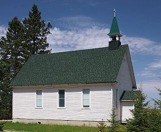
Arrowhead Township is a township in Saint Louis County, Minnesota, United States. The population was 223 at the 2010 census.

Brevator Township is a township in Saint Louis County, Minnesota, United States. The population was 1,269 at the 2010 census.

<span class="mw-page-title-main">Brookston, Minnesota</span> City in Minnesota, United States

Brookston is a city in Saint Louis County, Minnesota, United States; located along the Saint Louis River, opposite the mouth of the Artichoke River. The population was 118 at the 2020 census.

Cotton Township is a township in Saint Louis County, Minnesota, United States. The population was 445 at the 2010 census.

Duluth Township is a township in Saint Louis County, Minnesota, United States. The population was 1,941 at the 2010 census.

<span class="mw-page-title-main">Elmer Township, St. Louis County, Minnesota</span> Township in Minnesota, United States

Elmer Township is a township in Saint Louis County, Minnesota, United States. The population was 151 at the 2010 census.

<span class="mw-page-title-main">Embarrass Township, St. Louis County, Minnesota</span> Township in Minnesota, United States

Embarrass Township is a township in Saint Louis County, Minnesota, United States. The population was 607 at the 2010 census.

Floodwood Township is a township in Saint Louis County, Minnesota, United States. The population was 280 at the 2010 census. The township took its name from the Floodwood River.

Industrial Township is a township in Saint Louis County, Minnesota, United States. The population was 800 at the 2010 census.

Lavell Township is a township in Saint Louis County, Minnesota, United States. The population was 303 at the 2010 census.

<span class="mw-page-title-main">Meadowlands Township, St. Louis County, Minnesota</span> Township in Minnesota, United States

Meadowlands Township is a township in Saint Louis County, Minnesota, United States. The population was 304 at the 2010 census.

Midway Township is a township in Saint Louis County, Minnesota, United States. The population was 1,399 at the 2010 census.

Ness Township is a township in Saint Louis County, Minnesota, United States. The population was 62 at the 2010 census.

New Independence Township is a township in Saint Louis County, Minnesota, United States. The population was 299 at the 2010 census.

Northland Township is a township in Saint Louis County, Minnesota, United States. The population was 169 at the 2010 census.

Stoney Brook Township is a township in Saint Louis County, Minnesota, United States. The population was 332 at the 2010 census.

Van Buren Township is a township in Saint Louis County, Minnesota, United States. It was named for Martin Van Buren, the eighth President of the United States. The population was 189 at the 2010 census.

Waasa Township is a township in Saint Louis County, Minnesota, United States. The population was 249 at the 2010 census.

References

  1. 1 2 "U.S. Census website". United States Census Bureau . Retrieved January 31, 2008.
  2. "US Board on Geographic Names". United States Geological Survey. October 25, 2007. Retrieved January 31, 2008.
  3. "Race, Hispanic or Latino, Age, and Housing Occupancy: 2010 Census Redistricting Data (Public Law 94-171) Summary File (QT-PL), Culver township, St. Louis County, Minnesota". United States Census Bureau . Retrieved August 25, 2011.
  4. Upham, Warren (1920). Minnesota Geographic Names: Their Origin and Historic Significance. Minnesota Historical Society. p.  480.