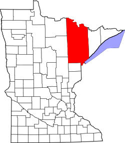
Burntside, Minnesota

Last updated

Burntside
USA Minnesota location map.svg
Red pog.svg
Burntside
Location of the community of Burntside
within Morse Township, Saint Louis County
Usa edcp location map.svg
Red pog.svg
Burntside
Burntside (the United States)
Coordinates: 47°53′40″N91°55′44″W / 47.89444°N 91.92889°W / 47.89444; -91.92889
Country United States
State Minnesota
County Saint Louis
Township Morse Township
Elevation
1,391 ft (424 m)
Time zone UTC-6 (Central (CST))
  Summer (DST) UTC-5 (CDT)
ZIP code
55731
Area code 218
GNIS feature ID660917 [1]

Burntside is an unincorporated community in Morse Township, Saint Louis County, Minnesota, United States.

The community is located three miles west of Ely, near the junction of State Highway 169 (MN 169) / State Highway 1 (MN 1), and Saint Louis County Road 88 (Grant–McMahan Boulevard).

Burntside Lake and Shagawa Lake are in the vicinity.

Related Research Articles

<span class="mw-page-title-main">St. Louis County, Minnesota</span> County in Minnesota, United States

St. Louis County is a county located in the Arrowhead Region of the U.S. state of Minnesota. As of the 2020 census, the population was 200,231. Its county seat is Duluth. It is the largest county in Minnesota by land area, and the largest in the United States by total area east of the Mississippi River, ahead of Aroostook County, Maine.

Breitung Township is a township in Saint Louis County, Minnesota, United States. The population was 605 at the 2010 census.

<span class="mw-page-title-main">Ely, Minnesota</span> City in Minnesota, United States

Ely is a city in Saint Louis County, Minnesota, United States. The population was 3,268 at the 2020 census.

Morse Township is a township in Saint Louis County, Minnesota, United States. The population was 1,213 at the 2010 census.

<span class="mw-page-title-main">Pike Township, St. Louis County, Minnesota</span> Township in Minnesota, United States

Pike Township is a township in Saint Louis County, Minnesota, United States. The population was 417 at the 2010 census.

Vermilion Lake Township is a township in Saint Louis County, Minnesota, United States. The population was 278 at the 2010 census.

<span class="mw-page-title-main">Duluth MN-WI Metropolitan Area</span> Place in Minnesota and Wisconsin, United States

<span class="mw-page-title-main">Minnesota State Highway 1</span>

Minnesota State Highway 1 is a state highway across northern Minnesota, United States, which runs from North Dakota Highway 54 (ND 54) at the North Dakota state line and continues east to its eastern terminus at MN 61 at the unincorporated community of Illgen City in Beaver Bay Township on the North Shore of Lake Superior. At 346 miles (557 km) in length, MN 1 is the longest state route in Minnesota.

Twig is an unincorporated community in Grand Lake Township, Saint Louis County, Minnesota, United States.

Saginaw is an unincorporated area in Saint Louis County, Minnesota, United States. Although unincorporated, Saginaw has a post office with the ZIP code 55779.

Britt is an unincorporated area in Saint Louis County, Minnesota, United States.

Island Lake is an unincorporated community in Saint Louis County, Minnesota, United States.

Bear River is an unincorporated community in Itasca and Saint Louis counties in the U.S. state of Minnesota.

Florenton is an unincorporated community in Wuori Township, Saint Louis County, Minnesota, United States; located near Britt.

Four Corners is an unincorporated community in Saint Louis County, Minnesota, United States; located 10 miles northwest of the city of Duluth at the junction of U.S. Highway 53 and Saint Louis County Road 13.

Peyla is an unincorporated community in Vermilion Lake Township, Saint Louis County, Minnesota, United States.

Robinson is an unincorporated community in Morse Township, Saint Louis County, Minnesota, United States.

McComber is an unincorporated community in Eagles Nest Township, Saint Louis County, Minnesota, United States.

Wahlsten is an unincorporated community in Kugler Township, Saint Louis County, Minnesota, United States.

References

  1. "Burntside, Minnesota". Geographic Names Information System . United States Geological Survey, United States Department of the Interior.