South Aroostook is an unorganized territory in Aroostook County, Maine, United States. The population was 579 at the 2020 census.
East Hancock is an unorganized territory in Hancock County, Maine, United States. The population was 85 at the 2020 census.
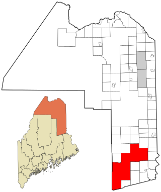
Kingman is an unorganized territory (township) in Penobscot County, Maine, United States. The population was 137 at the 2020 census.
Brook Lake is an unorganized territory in Beltrami County, Minnesota, United States. The population was 200 at the 2000 census.

North Cass is an unorganized territory in Cass County, Minnesota, United States. The population was 282 at the 2020 census. It is part of the Brainerd Micropolitan Statistical Area.
North Central Cass is an unorganized territory in Cass County, Minnesota, United States. The population was 24 at the 2000 census. It is part of the Brainerd Micropolitan Statistical Area.
Northwest Roseau is an unorganized territory in Roseau County, Minnesota, United States. The population was 18 at the 2000 census.
Southeast Roseau is an unorganized territory in Roseau County, Minnesota, United States. The population was 215 at the 2020 census.
Camp A Lake is an unorganized territory in Saint Louis County, Minnesota, United States. The population was 16 at the 2000 census.
Crab Lake is an unorganized territory in Saint Louis County, Minnesota, United States, located north of Eagles Nest Township, and west of Morse Township. The population was 11 at the 2000 census.
Heikkala Lake is an unorganized territory in Saint Louis County, Minnesota, United States. The population was 322 at the 2000 census.
Leander Lake is an unorganized territory in Saint Louis County, Minnesota, United States, located near Britt and Great Scott Township. The population was 119 at the 2000 census.
Linwood Lake is an unorganized territory in Saint Louis County, Minnesota, United States. The population was 54 at the 2000 census.
McCormack is an unorganized territory in Saint Louis County, Minnesota, United States, located near Hibbing and Balkan Township. The population was 237 at the 2000 census.
Mud Hen Lake is an unorganized territory in Saint Louis County, Minnesota, United States. The population was 320 at the 2000 census.
Northwest St. Louis is an unorganized territory in Saint Louis County, Minnesota, United States. The population was 306 at the 2000 census.
Slim Lake is an unorganized territory in Saint Louis County, Minnesota, United States, located north of Ely and Morse Township. The population was 75 at the 2000 census.
Nett Lake is an unorganized territory in Koochiching County, Minnesota, United States. The population was 56 at the 2000 census.
Nett Lake is an unorganized territory in Saint Louis County, Minnesota, United States. The population was 272 at the 2000 census.
Effie is an unorganized territory in Itasca County, Minnesota, United States. The population was 203 at the 2010 census.

